Page 1 of 2

Mineral King Photos, 7/13-7/16

Posted: Wed Jul 26, 2006 12:47 am
by mountaineer
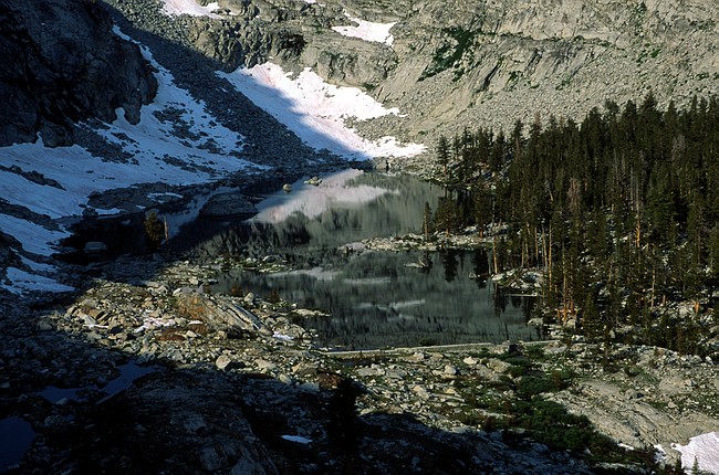
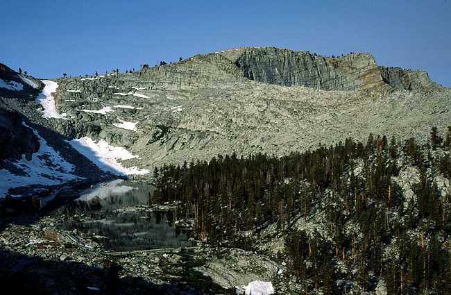
Awesome headwall above Upper Mosquito Lake...
Image

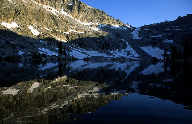
Eagle Lake looking NE back across towards Sawtooth Peak and the Mineral King Valley. The Kaweah Peaks are on the distant skyline...
Image

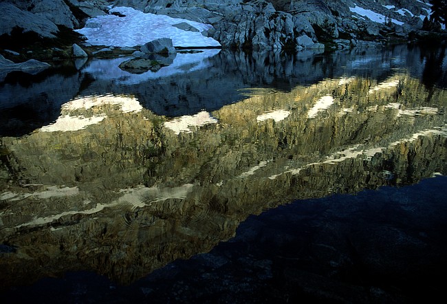
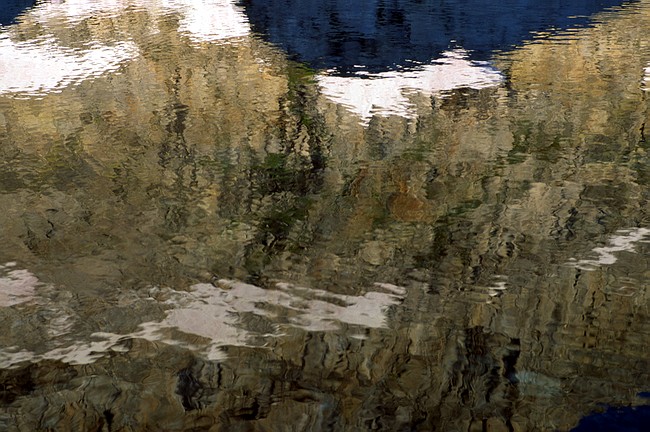
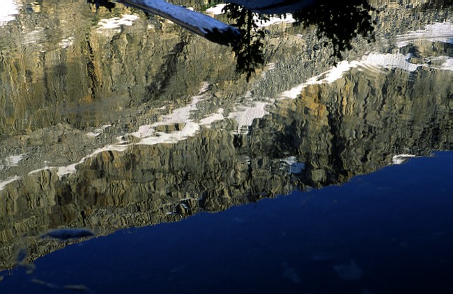
The next few are reflections in Eagle Lake...
Image
Image
Image
Image
Image

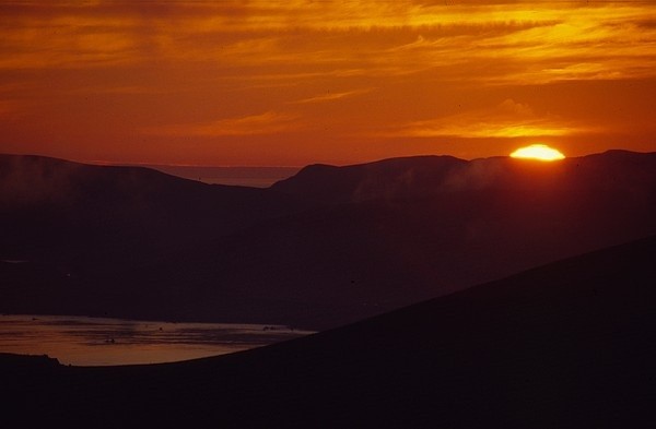
Juniper snags on the ridge between Eagle Lake and White Chief Canyon. Got up there in time to watch the sun rise. Incredible experience...
Image
Image
Image

Looking across Mineral King Valley from the ridge...
Image

Eagle Lake from the ridge, looking SW. My camp was in the trees on the right side of the lake...
Image
Image

The obligatory flower photo. This was what an Indian Paint Brush and unknown other flower. These were in an incredible flower field along the trail to Timber Gap...
Image

Looking back across Mineral King Valley from Timber Gap. The ridge above Eagle Lake where I took the Juniper photos is at the top of the dark red rock near the upper middle of the photo. The headwall above Mosquito Lake is to the right of that...
Image

Posted: Wed Jul 26, 2006 6:44 am
by Randonnee
Nice shots mountaineer.

Looks like you had a great trip! Was this a weekend trip or a longer excursion?

H

Posted: Wed Jul 26, 2006 7:15 am
by krudler
Great shots! :nod:

Posted: Wed Jul 26, 2006 9:04 am
by mountaineer
It was just a short trip. Went up from sea level on Thursday evening and hiked up to 10,000+ feet. Surprised I din't get sick. Went home Sunday afternoon.

Posted: Wed Jul 26, 2006 10:42 am
by SSSdave
Thanks for sharing the pics Mountaineer. Impressive headwall cliff. Nice shot with the moon. I've backpacked up in the White Chief Creek area but not Mosquito Lakes. I'm probably going to be going over Sawtooth Pass on a 5-day solo trip within a week unless I decide on something else. Your pictures give me confidence conditions in the high areas are now about prime. There are lots of sierra juniper up to about 10k around the Mineral King valley however snags on the upper ridge lines are likely foxtail pines. ...David

Posted: Wed Jul 26, 2006 11:22 am
by mountaineer
Yes, foxtail is probably right. Some of the snags were just downright gorgeous. When I was there, there were some people that said the backside of Glacier Pass(much more preferable over Sawtooth IMO) and Sawtooth were still pretty snowed in. Not sure how the descent on Sawtooth is in those conditions but Glacier Pass is doable without crampons. If I were to go back to Lost Canyon I would go over Glacier Pass and stop for a night at Spring Lake and then x-country up by Cyclaman and Columbine to reach Lost Canyon. People that purposely take Sawtooth are asking for severe punishment.

Posted: Wed Jul 26, 2006 11:27 am
by Shawn
Hey Mountaineer -

Great photos! Sorry I missed you up there and now your photos make me want to make a trip to check out the White Chief area even more.

Looks like you had a good time in MK.

Posted: Wed Jul 26, 2006 3:05 pm
by SSSdave
Sawtooth is likely to have a snowfield right at the top though the steep section is brief. Since it faces the east southeast, the current heat wave is likely to be eating through whatever remains. Also since I'm going to likely be lugging about 75 pounds, there is no way I'm going to be going over the first day and don't want to anyway because I want to get a shot of Mineral Peak late afternoon from a ridge so will camp in the Monarch area. The next morning will rise at dawn then slog up the gruss. NWS now forecasting the monsoonal flow is going to move east after this weekend so maybe that will be the time for some fair skies.

http://www.topozone.com/map.asp?lat=36. ... -118.56167

Posted: Wed Jul 26, 2006 5:57 pm
by mikehike
How is the fishing in Mineral King?

Posted: Mon Aug 07, 2006 3:11 pm
by copeg
Great shots Mountaineer. Looks like a fantastic trip. I don't know that area well, and you definitely got me to pull out the topos :)