Page 1 of 1
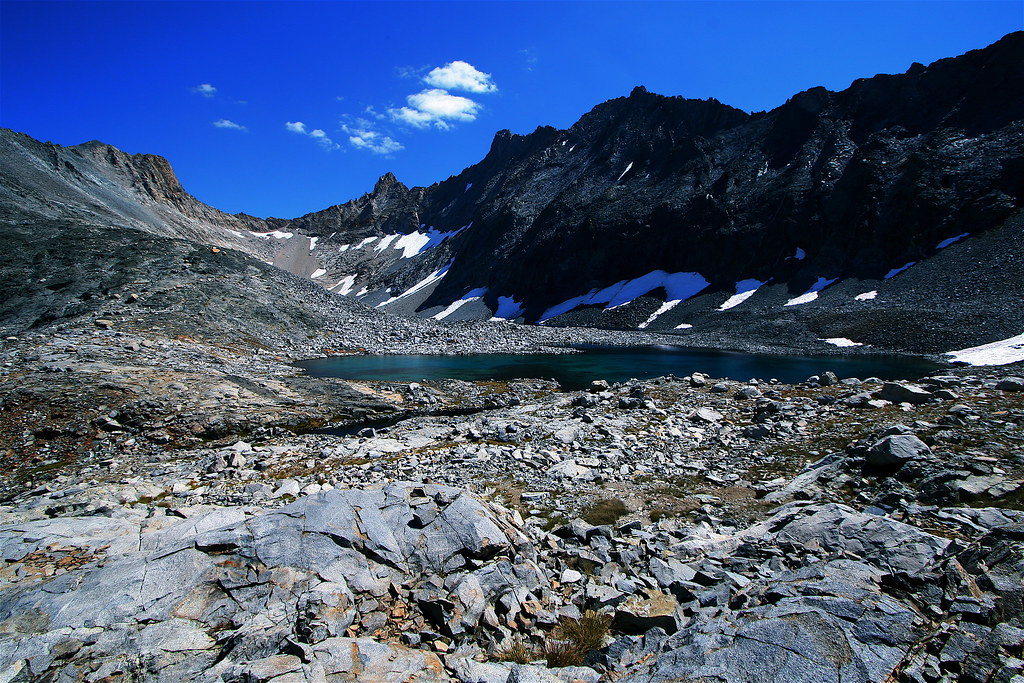
Western View of Pyra Queen Col
Posted: Fri Dec 29, 2006 4:41 pm
by maverick
Posted: Fri Dec 29, 2006 6:51 pm
by copeg
I recognize that awesome view. Just an amazing one. A lot more snow when I was there. Man, Black Kaweah just towers over those lakes...cool shot.
Posted: Tue Jan 02, 2007 4:12 pm
by maverick
There was alot more snow the first time I went over back in
the 70s.
The approach did seem longer this time around !
Have you been over Pants Pass ? Its more of a rush because of the
steepness on both sides of the pass, but the eastern side of Pyra into
Kaweah Basin is prettier than Pants Passes eastern side to me.
Posted: Wed Jan 03, 2007 9:09 pm
by copeg
maverick wrote:There was alot more snow the first time I went over back in
the 70s.
The approach did seem longer this time around !
Have you been over Pants Pass ? Its more of a rush because of the
steepness on both sides of the pass, but the eastern side of Pyra into
Kaweah Basin is prettier than Pants Passes eastern side to me.
In going back to my photos, there wasn't too much snow on it...but in tennis shoes and solo, enough for a conservative dude like myself to turn back

I tried what I thought was pants pass, snow covered on the other side so I turned back...it turned out to be pass 11775. It was steep and slippery to say the least

I normally plan trips at the last minute, but this summer I'm gonna set aside at least a week for Kaweah Basin....most likely heading in from over Colby Pass to Gallets Lake into Kaweah (although, the mosquitos in that area sucked!)
Posted: Thu Jan 04, 2007 12:59 pm
by maverick
You can climb up to Picket Lake from Kern-Kaweah River across
from Kern Point. I descended following the path of the large foxtails
on the opposite side of the ridge which leads to the approx point
where you go over at the top.
It is not difficult just a little steep.
I would not recommend ascending the creek from Rockslide to
Kaweah Basin unless you want to do some bushwacking and then
do some climbing but if you dont mind then start 300-400 yards off trail
from Rockslide Lake and the northern side of the creek. Before you
get to the fork go over to the southern side and follow it up staying
close to the creek.
If the water is low then ascend up the creek when possible to the
first lake.
Stay on the same side and head for the falls from the lake and start
going to the left of the falls so you end up above the lake with the island
in it.
If you going to the Red Spur area then climb up and over the shoulder at
about the 11000ft level and then down to the small lake and follow the
creek or whats left of it to the next lake.