Dusy and Palisade Basins, July 6th - 8th, 2012
Posted: Tue Jan 15, 2013 5:52 pm
*** David Here - this is a cross post of a report my wife just submitted to nwhikers.net - this forum was a great help to us when we were doing research. ****
I’m going to make a bold statement here and say that the area we visited on this report was my favorite area of all during our 16 day trip to the Sierras. That is pretty high praise because I REALLY like the Thousand Island Lake area as well.
Once we stepped off the trail on the far side of Bishop Pass we only saw one party walk past us in the distance during the 3 whole days, we had complete solitude.
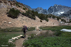
The trailhead leaves from the scenic South Lake, west of Bishop California. Did I mention it is at 9750 ft? Bring your extra lung! This trail passes by many scenic lakes that will keep your attention and cool you off on a hot day.
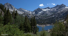
First up is Long Lake.
Then a turnoff to Ruwau Lake, Spearhead Lake, Timberline Tarns, Saddlerock Lake (home to the largest cloud of squeeters I’ve ever seen on trail) and finally Bishop Lake.
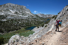
Then the fun begins, the ascent to the pass. By this time in the trip our bodies had acclimatized fairly well, however we were consistently noticing the elevation at around 11,500 ft.
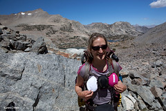
We attained the pass at 11,972ft.
Surprisingly the view towards Dusy Basin was not that great. You couldn’t see any lakes and the pass itself was quite long and flat.
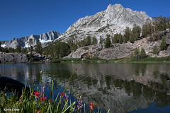
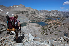
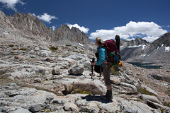
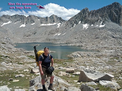
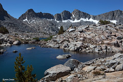
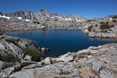
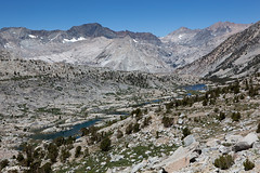
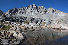
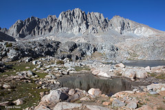
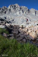
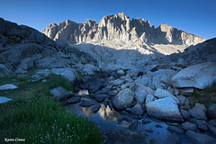
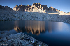
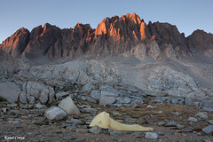
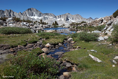
We dropped just over the pass and with a quick check of the map and altimeter, our boots left the trail and we headed cross-country towards our camp for the night, Lake 11,393.
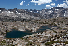
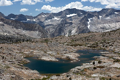
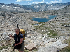
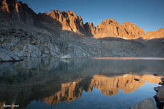
This is the largest lake in Dusy Basin and the one I decided was the best place for a photographer to spend the night based on internet forum discussions, the topo map and Google Earth (my favourite tool for trip planning – see my video under my Limestone Lakes trip report from last summer if you don’t believe me!).
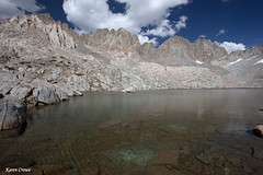
We sidehilled our way across in attempt to stay above the lake. What surprised me the most was looking at the map, everything seems relatively flat. I could not believe we could not see the lake until we were almost on top of it.
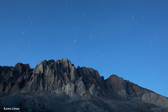
What a glorious place this is! If you ever want to feel small and insignificant, this is a good place to be!
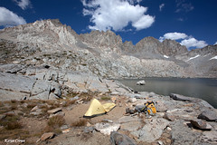
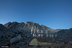
So we setup camp for the night and I went for a VERY short and frigid dip.
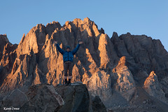
We did the usual wander around camp and engaged in some dancing for my 2012 Hiking Year in Review video. We didn’t do much, as after busting out a couple moves we felt drunk from the lack of oxygen.
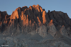
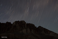
Sunset proved to be fairly boring with little drama in a clear blue sky.
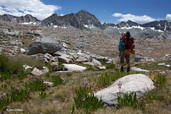
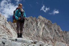
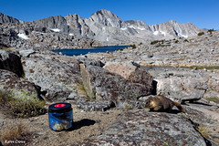
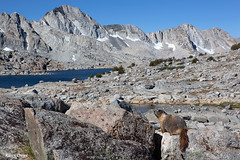
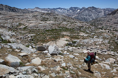
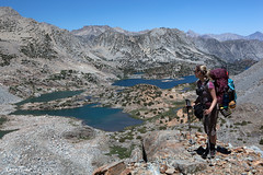
The next morning after playing with the friendly marmots we packed up and headed towards Knapsack Pass.
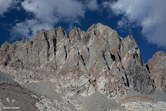
We had also considered Thunderbolt Pass however we knew it was more difficult and with a full pack opted for the easier route. While there are portions of boot beaten path through the boulders and ankle twisting rocks, we lost and found it many times. The route was not as easy as I had thought it would be, it took a lot of concentration and was tiring with the full pack.
Once we got to the pass we refueled and debated our best route down as the far side was pretty steep.
Here is where we made the mistake. The boot beaten path appeared to be going up and we wanted to go down. So down we went and it was challenging and awkward. On the way back out the next day we picked up the climbers path and indeed we should have followed the tread upwards.
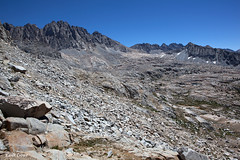
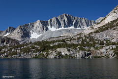
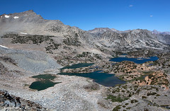
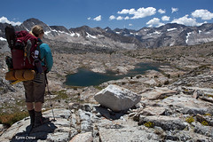
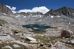
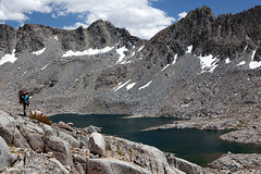
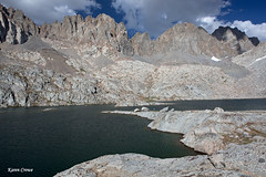
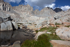
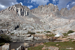
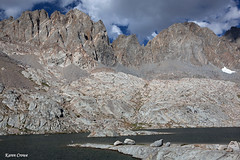
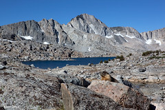
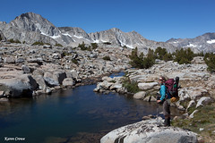
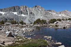
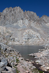
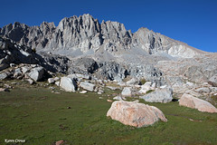
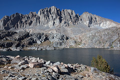
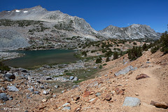
Again I surprised that from the high vantage of the pass, we could not see our destination of lake 11,523. Once on more level ground we made quick work of the basin and arrived at our destination for the night.
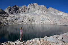
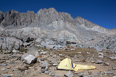
It was still early, but man it was flipping hot! There was a little rock formation built up, obviously made as a stove shelter, but it was large enough that we used it as “our fridge”. There was literally no shade whatsoever in this place and we crammed all our food and water into the fridge to try to keep it at least lukewarm instead of boiling.
We wandered around a bit, but once again I was the party pooper and elected not to travel over to Potluck Pass because the heat was killing me and we still had many hard days ahead of us.
After a comfortable night we got up, packed up and headed back up Knapsack Pass. Traveling from the pass back to the trail by the first Dusy Basin Lake seemed to take forever.
We were relieved to be out of the crummy rock and back onto dusty trail.
The hike out was long and very hot, we were melting. By the time we got back to the car and down into Owen’s Valley the car thermometer said it was 104 dF. Yikes! I think I consumed my smoothie from Schats Bakery (best yummys in Bishop!) in one gulp!
I’m going to make a bold statement here and say that the area we visited on this report was my favorite area of all during our 16 day trip to the Sierras. That is pretty high praise because I REALLY like the Thousand Island Lake area as well.
Once we stepped off the trail on the far side of Bishop Pass we only saw one party walk past us in the distance during the 3 whole days, we had complete solitude.
The trailhead leaves from the scenic South Lake, west of Bishop California. Did I mention it is at 9750 ft? Bring your extra lung! This trail passes by many scenic lakes that will keep your attention and cool you off on a hot day.
First up is Long Lake.
Then a turnoff to Ruwau Lake, Spearhead Lake, Timberline Tarns, Saddlerock Lake (home to the largest cloud of squeeters I’ve ever seen on trail) and finally Bishop Lake.
Then the fun begins, the ascent to the pass. By this time in the trip our bodies had acclimatized fairly well, however we were consistently noticing the elevation at around 11,500 ft.
We attained the pass at 11,972ft.
Surprisingly the view towards Dusy Basin was not that great. You couldn’t see any lakes and the pass itself was quite long and flat.
We dropped just over the pass and with a quick check of the map and altimeter, our boots left the trail and we headed cross-country towards our camp for the night, Lake 11,393.
This is the largest lake in Dusy Basin and the one I decided was the best place for a photographer to spend the night based on internet forum discussions, the topo map and Google Earth (my favourite tool for trip planning – see my video under my Limestone Lakes trip report from last summer if you don’t believe me!).
We sidehilled our way across in attempt to stay above the lake. What surprised me the most was looking at the map, everything seems relatively flat. I could not believe we could not see the lake until we were almost on top of it.
What a glorious place this is! If you ever want to feel small and insignificant, this is a good place to be!
So we setup camp for the night and I went for a VERY short and frigid dip.
We did the usual wander around camp and engaged in some dancing for my 2012 Hiking Year in Review video. We didn’t do much, as after busting out a couple moves we felt drunk from the lack of oxygen.
Sunset proved to be fairly boring with little drama in a clear blue sky.
The next morning after playing with the friendly marmots we packed up and headed towards Knapsack Pass.
We had also considered Thunderbolt Pass however we knew it was more difficult and with a full pack opted for the easier route. While there are portions of boot beaten path through the boulders and ankle twisting rocks, we lost and found it many times. The route was not as easy as I had thought it would be, it took a lot of concentration and was tiring with the full pack.
Once we got to the pass we refueled and debated our best route down as the far side was pretty steep.
Here is where we made the mistake. The boot beaten path appeared to be going up and we wanted to go down. So down we went and it was challenging and awkward. On the way back out the next day we picked up the climbers path and indeed we should have followed the tread upwards.
Again I surprised that from the high vantage of the pass, we could not see our destination of lake 11,523. Once on more level ground we made quick work of the basin and arrived at our destination for the night.
It was still early, but man it was flipping hot! There was a little rock formation built up, obviously made as a stove shelter, but it was large enough that we used it as “our fridge”. There was literally no shade whatsoever in this place and we crammed all our food and water into the fridge to try to keep it at least lukewarm instead of boiling.
We wandered around a bit, but once again I was the party pooper and elected not to travel over to Potluck Pass because the heat was killing me and we still had many hard days ahead of us.
After a comfortable night we got up, packed up and headed back up Knapsack Pass. Traveling from the pass back to the trail by the first Dusy Basin Lake seemed to take forever.
We were relieved to be out of the crummy rock and back onto dusty trail.
The hike out was long and very hot, we were melting. By the time we got back to the car and down into Owen’s Valley the car thermometer said it was 104 dF. Yikes! I think I consumed my smoothie from Schats Bakery (best yummys in Bishop!) in one gulp!