Regarding some rare routes and regions
Posted: Fri Nov 16, 2012 4:40 pm
Hey, all. Got a couple questions about some very- to semi-obscure routes I’m hoping someone can shed some light on.
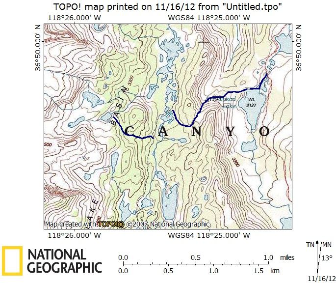
The first involves a possible route across the upper regions of Dike Creek and Slide Creek below the Minarets. Here’s a rough idea of what I’m talking about:
Has anyone been on any of this terrain or done anything like this before? Obviously the main idea is a high traverse from the Upper Iron Creek Basin area over to the Upper North Fork San Joaquin area. From the 7.5’ quad it looks doable. Adventurous, but doable. On a related note, how difficult is travel in the Slide/Dike drainages?
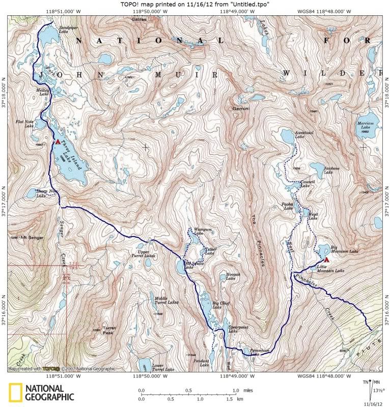
Next up: A ramble over Pass 11,840/“Senger Pass” from Three Island Lake and down Senger Creek, maybe throwing in a detour over to the Turret Lakes. I’ve been able to find a bunch of stuff on the general area but not Senger Creek drainage itself, the upper reaches in particular. Seems pretty average but thought I’d throw it at the wall.
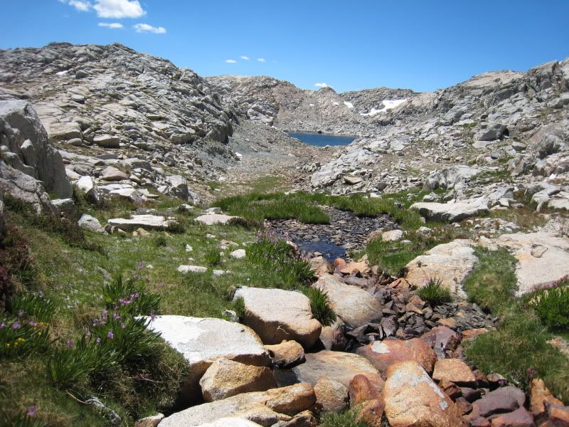
Another thing I’ve found some good stuff about but haven’t really been able to get clear on is the crossing from Bench Lake over to Woods Creek. The QOTM (question of the moment) is: which drainage is the best descent route, Window Creek or White Fork Creek? It seems like taking Whitefork Pass and heading down WF creek would be the most straightforward option. On the other hand, Explorer Pass to Window Creek seems nice and rugged and maybe more scenic. And of course the saddle between the drainages provides extra options. I’m sure everyone knows what I’m talking about but just to be clear here’s the general idea:
Moving south: I haven’t really been able to find anything on Rae Col. Seems like a pretty simple hop over the ridge from 60 Lakes. I’ve been curious about it since scoping out the area from Glen Pass. Anyone been over this pass?
Last but not least, I’m wondering about the area around the lake basins at the west end of the Silver Divide (Margaret Lakes, Rainbow lake, etc). This area seems very much off the beaten path. Different maps show different trails, it’s not at all clear which are maintained and which aren’t, and there don’t seem to be any (named) cross-country passes connecting this area with the lakes on the other side of the divide (Beetlebug, Anne, Olive, etc), although there seem to be several viable options. Has anyone been to this area? Is the trail from Fish Valley maintained? Or the two from Lake Edison? Are there any known cross-country routes across the divide?
Muchas gracias for any and all input, folks.
The first involves a possible route across the upper regions of Dike Creek and Slide Creek below the Minarets. Here’s a rough idea of what I’m talking about:
Has anyone been on any of this terrain or done anything like this before? Obviously the main idea is a high traverse from the Upper Iron Creek Basin area over to the Upper North Fork San Joaquin area. From the 7.5’ quad it looks doable. Adventurous, but doable. On a related note, how difficult is travel in the Slide/Dike drainages?
Next up: A ramble over Pass 11,840/“Senger Pass” from Three Island Lake and down Senger Creek, maybe throwing in a detour over to the Turret Lakes. I’ve been able to find a bunch of stuff on the general area but not Senger Creek drainage itself, the upper reaches in particular. Seems pretty average but thought I’d throw it at the wall.
Another thing I’ve found some good stuff about but haven’t really been able to get clear on is the crossing from Bench Lake over to Woods Creek. The QOTM (question of the moment) is: which drainage is the best descent route, Window Creek or White Fork Creek? It seems like taking Whitefork Pass and heading down WF creek would be the most straightforward option. On the other hand, Explorer Pass to Window Creek seems nice and rugged and maybe more scenic. And of course the saddle between the drainages provides extra options. I’m sure everyone knows what I’m talking about but just to be clear here’s the general idea:
Moving south: I haven’t really been able to find anything on Rae Col. Seems like a pretty simple hop over the ridge from 60 Lakes. I’ve been curious about it since scoping out the area from Glen Pass. Anyone been over this pass?
Last but not least, I’m wondering about the area around the lake basins at the west end of the Silver Divide (Margaret Lakes, Rainbow lake, etc). This area seems very much off the beaten path. Different maps show different trails, it’s not at all clear which are maintained and which aren’t, and there don’t seem to be any (named) cross-country passes connecting this area with the lakes on the other side of the divide (Beetlebug, Anne, Olive, etc), although there seem to be several viable options. Has anyone been to this area? Is the trail from Fish Valley maintained? Or the two from Lake Edison? Are there any known cross-country routes across the divide?
Muchas gracias for any and all input, folks.