Hey, all. Got a couple questions about some very- to semi-obscure routes I’m hoping someone can shed some light on.
The first involves a possible route across the upper regions of Dike Creek and Slide Creek below the Minarets. Here’s a rough idea of what I’m talking about:
Has anyone been on any of this terrain or done anything like this before? Obviously the main idea is a high traverse from the Upper Iron Creek Basin area over to the Upper North Fork San Joaquin area. From the 7.5’ quad it looks doable. Adventurous, but doable. On a related note, how difficult is travel in the Slide/Dike drainages?
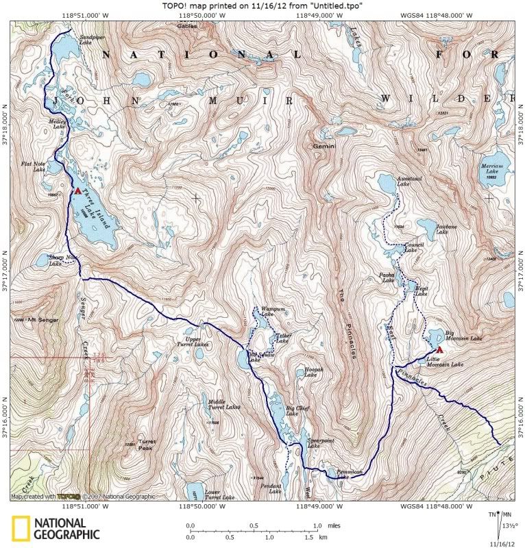
Next up: A ramble over Pass 11,840/“Senger Pass” from Three Island Lake and down Senger Creek, maybe throwing in a detour over to the Turret Lakes. I’ve been able to find a bunch of stuff on the general area but not Senger Creek drainage itself, the upper reaches in particular. Seems pretty average but thought I’d throw it at the wall.
Another thing I’ve found some good stuff about but haven’t really been able to get clear on is the crossing from Bench Lake over to Woods Creek. The QOTM (question of the moment) is: which drainage is the best descent route, Window Creek or White Fork Creek? It seems like taking Whitefork Pass and heading down WF creek would be the most straightforward option. On the other hand, Explorer Pass to Window Creek seems nice and rugged and maybe more scenic. And of course the saddle between the drainages provides extra options. I’m sure everyone knows what I’m talking about but just to be clear here’s the general idea:
Moving south: I haven’t really been able to find anything on Rae Col. Seems like a pretty simple hop over the ridge from 60 Lakes. I’ve been curious about it since scoping out the area from Glen Pass. Anyone been over this pass?
Last but not least, I’m wondering about the area around the lake basins at the west end of the Silver Divide (Margaret Lakes, Rainbow lake, etc). This area seems very much off the beaten path. Different maps show different trails, it’s not at all clear which are maintained and which aren’t, and there don’t seem to be any (named) cross-country passes connecting this area with the lakes on the other side of the divide (Beetlebug, Anne, Olive, etc), although there seem to be several viable options. Has anyone been to this area? Is the trail from Fish Valley maintained? Or the two from Lake Edison? Are there any known cross-country routes across the divide?
Muchas gracias for any and all input, folks.
Regarding some rare routes and regions
-
SandStorm

- Topix Acquainted
- Posts: 60
- Joined: Mon Feb 20, 2012 3:58 pm
- Experience: N/A
Regarding some rare routes and regions
You do not have the required permissions to view the files attached to this post.
-
RoguePhotonic

- Topix Fanatic
- Posts: 1693
- Joined: Thu Mar 24, 2011 9:52 am
- Experience: Level 4 Explorer
- Location: Bakersfield CA
- Contact:
Re: Regarding some rare routes and regions
I didn't make it across Mcdonald Pass like I had planned this year but I also couldn't find information on it while I did my planning. The U Notch leading over to it was listed as needing an ice axe. When I finally saw it I would not have even wanted to attempt going down it without crampons. That is of course if your considering that as a jump over point to your route.
I can't compare the Window Peak drainage to the White Fork because I haven't done White Fork but in general the Window Peak drainage is very easy. Only once your getting close to Woods Creek will you have to pick your way through a few granite shelves. I haven't done Explorer Pass though.
The trail leaving the Onion Spring OHV road should be maintained. Two employees at VVR told me they hiked up to the ridge East of Arch Rock to some very nice views.
I think the trail going into Fish Creek is not maintained. It is however there to some extent as I could see some of it while I climbed out of Fish Creek heading for Reds Meadow.
As for routes across the divide the only thing I have heard is a man at VVR told me he liked taking a route up past Devil's Bathtub on to the ridge and down to Beetlebug Lake. But I don't recall any specific details.
If I plan another hike next year I had my eye on that area myself so hopefully we can get some information.
-
Wandering Daisy
- Topix Docent
- Posts: 6689
- Joined: Sun Jan 24, 2010 8:19 pm
- Experience: N/A
- Location: Fair Oaks CA (Sacramento area)
- Contact:
Re: Regarding some rare routes and regions
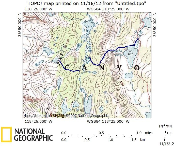
Sixty Lks to Arrowhead Lake - use trail on west side. I think there also is a use trail on east side but I came in from the north and missed it and intersected the trail a bit down off the pass. I am not sure this is the pass you are talking about.
View northwest from top of pass
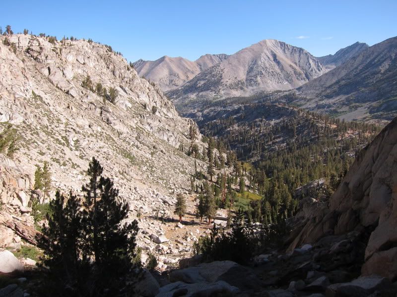
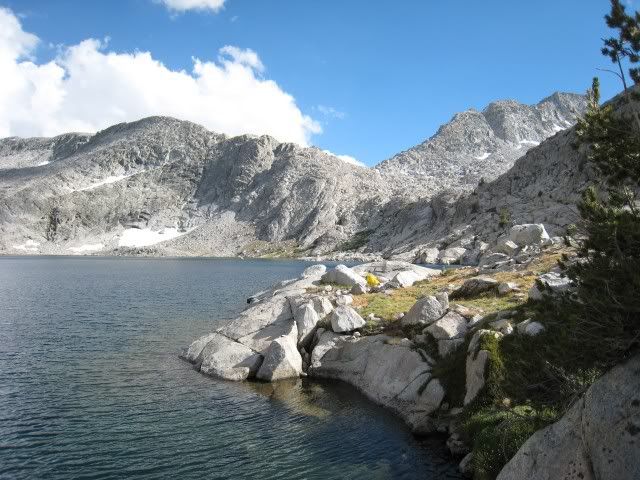
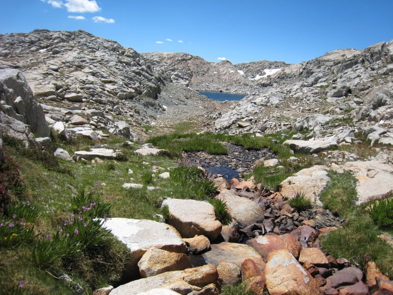
Three Island Lake to Turrett Lakes- Map of my route shown - I did not go down Sanger Creek. From Sanger Creek to Turrett Lakes - lots of steep slabs - the route I took probably was not the best way to go.
View towards Pass from Three Island Lake
View back towards Three Island Lake

Turrett LAkes

View northwest from top of pass
Three Island Lake to Turrett Lakes- Map of my route shown - I did not go down Sanger Creek. From Sanger Creek to Turrett Lakes - lots of steep slabs - the route I took probably was not the best way to go.
View towards Pass from Three Island Lake
View back towards Three Island Lake
Turrett LAkes
-
Wandering Daisy
- Topix Docent
- Posts: 6689
- Joined: Sun Jan 24, 2010 8:19 pm
- Experience: N/A
- Location: Fair Oaks CA (Sacramento area)
- Contact:
Re: Regarding some rare routes and regions
Fish valley to Olive Lake - trail all the way, but Olive Lake trail leaves the main trail and is faint, hard to follow. You can then follow an even fainter use trail around Olive Lake and climb up near the outlet to a beautiful bench valley. - go north to Anna Lake or south to BettleBug Lake. I have not gone south (I think Rogue did this). The climb up out of Olive Lake is steep and you have to do some route finding, but not bad. I too have been curious of going over the ridge to Margaret Lake. It looks to me like you would be best to do it from Bettle Bug Lake. But, then, I have not done it.
Also, the Fish Creek Trail crosses the river to get onto the trail to Olive Lake. It is not used much and was quite grown over when we were there 2 yrs ago. There is a large packer camp on the west side. Trail is quite distinct on the west side. The river crossing goes through a meadow and gets lost in the grass.
Also, the Fish Creek Trail crosses the river to get onto the trail to Olive Lake. It is not used much and was quite grown over when we were there 2 yrs ago. There is a large packer camp on the west side. Trail is quite distinct on the west side. The river crossing goes through a meadow and gets lost in the grass.
-
Wandering Daisy
- Topix Docent
- Posts: 6689
- Joined: Sun Jan 24, 2010 8:19 pm
- Experience: N/A
- Location: Fair Oaks CA (Sacramento area)
- Contact:
Re: Regarding some rare routes and regions
Sorry - meant to say climb up near the INLET stream of Olive Lake.
-
SandStorm
- Topix Acquainted
- Posts: 60
- Joined: Mon Feb 20, 2012 3:58 pm
- Experience: N/A
Re: Regarding some rare routes and regions
Great stuff. Thanks, guys.
@Rogue: I'll be coming from the south-east, probably over Beck Lakes Pass to get to McDonald. (Won't be taking South Notch, which I assume is the "U Notch" you mentioned.) As far as Window vs Whitefork goes I think they're probably pretty similar. At this point though, unless I get some more data on White Fork, I'll plan to go through the Window. Thanks for the tips on that, and also for passing along the scuttlebutt on the far west Silver area. That's gonna be cool to explore.
(As an aside, I believe Window Creek drainage was the one Randy Morgenson was traveling through when he (apparently) fell through a snow bridge over the creek. I seem to remember that from The Last Season but it's been quite a while since I read it. Can anyone confirm or deny?)
@Wandering Daisy: Thanks for the pictures. Very helpful. Pretty much what I thought, too. If I'm not mistaken, the pass you went through is Basin Notch. The plan is to enter 60 Lakes Basin through that Notch from the north, head down through the Basin and cross Rae Col, then hit the JMT and cross Glen. Here's what I've got in mind:
I was thinking about heading west across 60 Lakes Col and exploring Gadiner Basin but I don't think I'll have time.
I must admit, I'm really intrigued by the area on the west end of the Silver Divide. That's definitely a go. I think you may be right, Daisy, about jumping over from one of the eastside lakes. That would probably be the easiest way to go. But, we'll see what happens.
Thanks again, Rogue & Daisy. Really appreciate the input.
You do not have the required permissions to view the files attached to this post.
-
RoguePhotonic
- Topix Fanatic
- Posts: 1693
- Joined: Thu Mar 24, 2011 9:52 am
- Experience: Level 4 Explorer
- Location: Bakersfield CA
- Contact:
Re: Regarding some rare routes and regions
Yeah South Notch is the name. Just had one of those brain malfunctions!
And yes the Window Peak drainage is where Randy died.
And yes the Window Peak drainage is where Randy died.
-
Wandering Daisy
- Topix Docent
- Posts: 6689
- Joined: Sun Jan 24, 2010 8:19 pm
- Experience: N/A
- Location: Fair Oaks CA (Sacramento area)
- Contact:
Re: Regarding some rare routes and regions
The small basin of lakes on the bench above 60Lakes, beneath Mt Clarence King are very nice and offer a great day-hike (I camped up there) from the northern 60 Lakes. I did not see any fish up there but that does not mean there are none. You may want to consider this instead of going to Gardiner Lakes as an addition to your trip. Gardiner Lakes are fantastic and you would regret not having enough time to really enjoy and explore. 60 Lks Col is slow - the Gardiner side has a LOT of talus - not difficult but tedious; there really are no ways to do a "quick" trip into Gariner Basin.
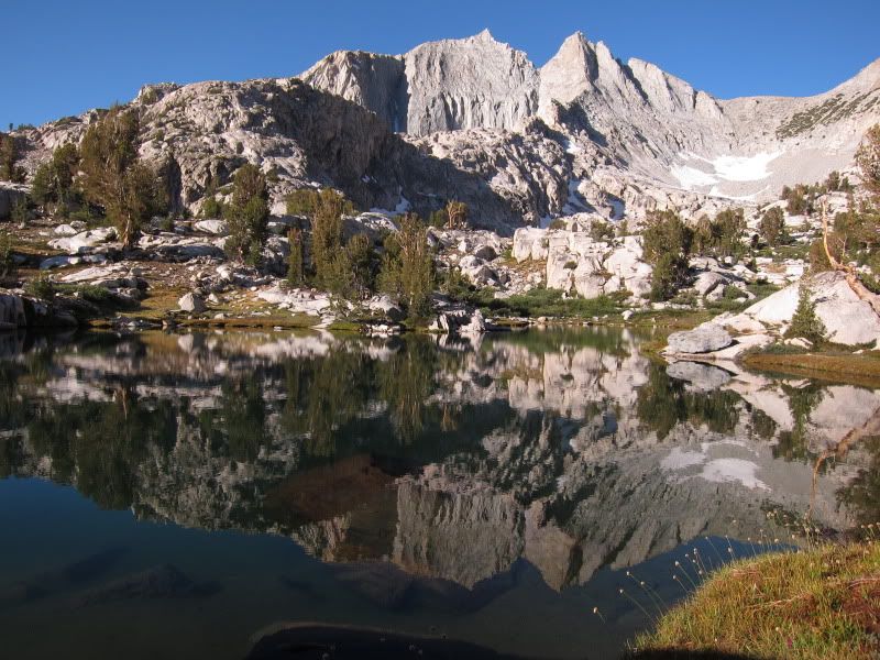
photo shot from the unnamed lake below Clarence King, just northwest of the "S" in BASIN on the 7.5 minute map
photo shot from the unnamed lake below Clarence King, just northwest of the "S" in BASIN on the 7.5 minute map
-
SandStorm
- Topix Acquainted
- Posts: 60
- Joined: Mon Feb 20, 2012 3:58 pm
- Experience: N/A
Re: Regarding some rare routes and regions
Grâce amis.
-
John Dittli

- Topix Expert
- Posts: 479
- Joined: Thu Sep 03, 2009 10:38 am
- Experience: N/A
- Location: Crooked Creek
- Contact:
Re: Regarding some rare routes and regions
The White Fork is vastly different from Window Creek. If you like to fish- Window Creek. If you want to see something very unique- White Fork. In low water White Fork is straight forward all the way down to the JMT. Window Peak LakeSandStorm wrote:Great stuff. Thanks, guys.
As far as Window vs Whitefork goes I think they're probably pretty similar. At this point though, unless I get some more data on White Fork, I'll plan to go through the Window.
White Fork Lake
White Fork
I've come in to WF from the top from Bench over the pass south of Ickes (White Fork Pass) as well as a loop up Window Creek and across the saddle between upper Window Creek lakes and White Fork Lakes.
BTW, if you plan on heading down Window Creek into Woods Creek, it is not as straight forward- the best route (for me) is to stay well east of the creek (easier to see on the way up).
You do not have the required permissions to view the files attached to this post.
Walk the Sky: Following the John Muir Trail

Who is online
Users browsing this forum: Dirtnbrews, Google Adsense [Bot], iluka, muleaaron and 79 guests