Here's the full trip report:
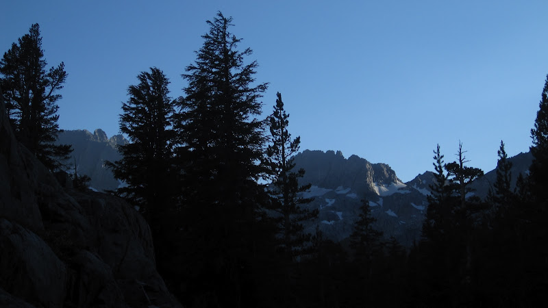
Our trip left the eastern side of the Sierra, on the Rush Creek trailhead near Silver lake along the June Lake loop south of Yosemite and Tioga Pass. That's the view of from the Silver Lake campground above.
Since we were leaving Rush Creek trailhead, and it’s a steep climb, we wanted to make sure we got an early start. But that was not to be. Our permit was not waiting for us in the night drop box of the Mono Lake Visitor Center. We thought about hiking without a permit, but decided against it. So we were eating breakfast and waiting for them to open at 8 a.m. It turned out that a problem with the phones the day before had prevented the main office in Bishop from getting them the message about out late arrival. At any rate, by 8 :30 we were back at the trailhead, and hiking uphill.
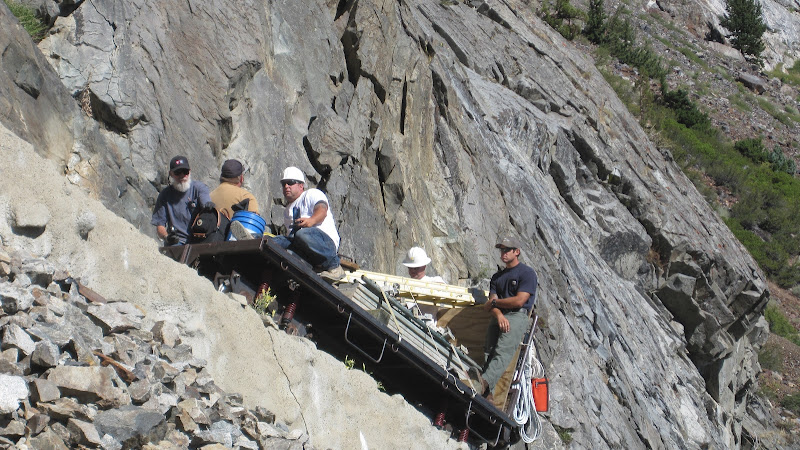
This is a long, warm climb, and we were treated to a view of the little tram with a work party slowly and majestically passing us on the way to Agnew Lake.
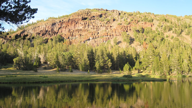
The water level here was VERY low, because they were working on the dam. From there it was another warm steep mile to Gem Lake, and we ate lunch at a shady spot near the western end of Gem Lake. Another 3-4 miles got us to our first campsite, at Waugh Lake—a climb of about 2,000 feet in six miles on the first day. The water was about fifteen feet low here as well, but that left us with a nice beach in front of our campsite, as you can see below. (the campsite probably would not have been legal if the water lever had been normal.

It felt good to be back on the trail, but we were surprised at how out of practice we were. We found ourselves dealing with lots of little things that we normally don’t have to think about. Did you bring this? Where is that? Over the next day or so these got ironed out, and we fell happily back into our normal routine. There were no fish rising at Waugh Lake, by the way, and I didn't even break out my fishing rod here.
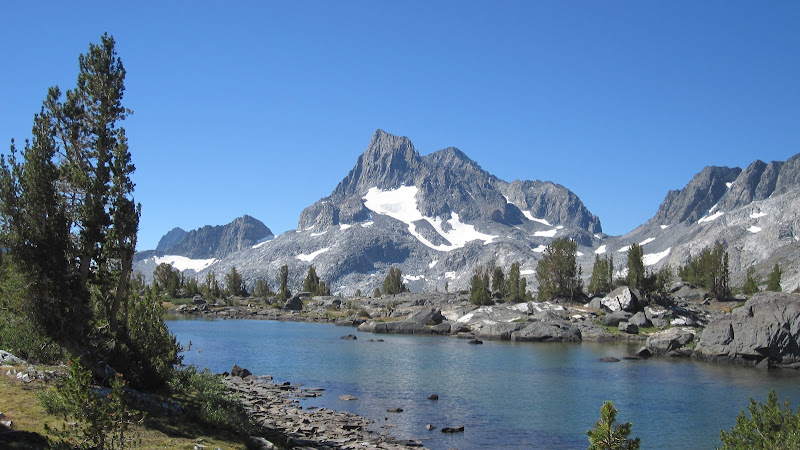
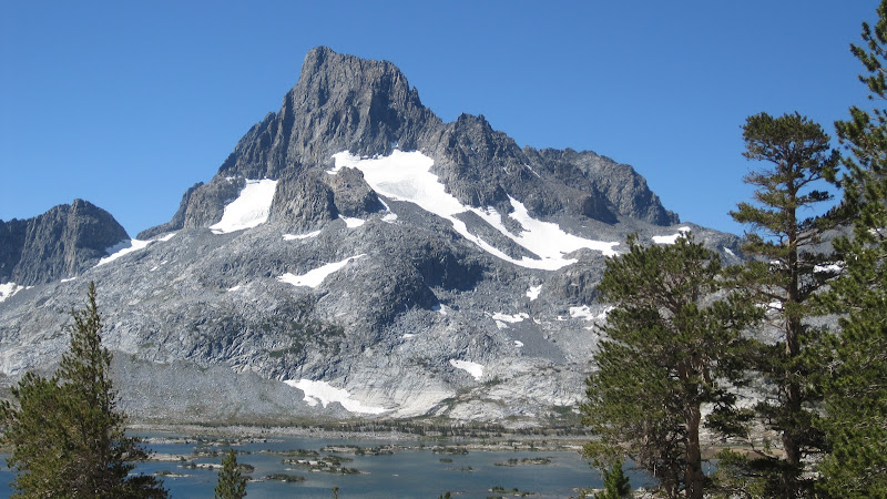
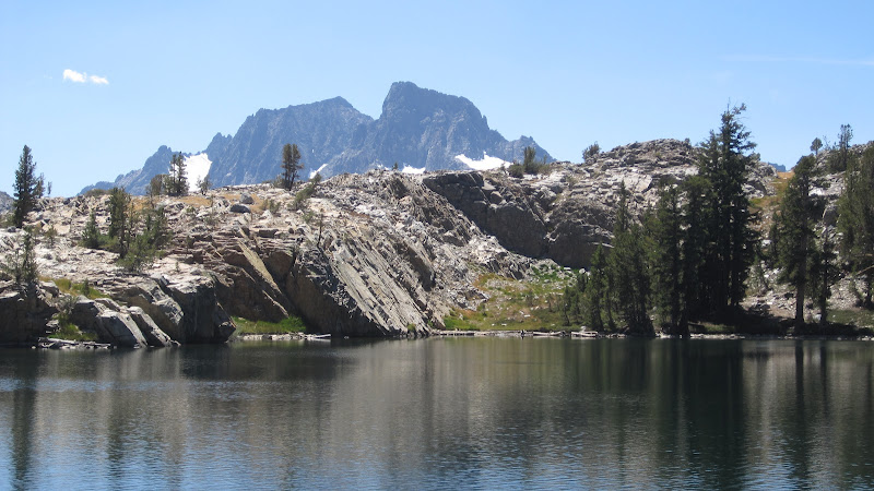
The next day we hiked up to the John Muir Trail and then over Island Pass. The top of this pass is gorgeous, with lovely alpine scenery, and the peaks of Banner and Ritter looming over it all. This is the very best part of the JMT, and it just got better as we descended to Thousand Island Lake. Compared to our normal routes, there were plenty of people on these trails. That's Thousand Island Lake below.
From there we continued south past the two charming intermediate lakes: Emerald and Ruby. We ate lunch at Ruby Lake, and made a note to stop back here again--maybe even camp here--sometime. And then we were over the ridge, and down into Garnet Lake, where we thought we’d be camping. But there were so many people and so few nice campsites that we resisted…there must be a better choice.
After consulting both maps and our inner resources, we eventually found nearby Altha Lake on a spur trail off the use trail down to the river trail. Steep? Class III for part of this descent. The photo below is M working her way down one of the steeper sections.
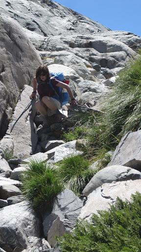
Did I marry the right woman or what?
So we wandered up the canyon until we found the trail to Altha Lake…but when we got there, we were charmed. It was our own private High Sierra Lake, with nice fishing and nobody else. Beware---there is only one really good campsite at this lake, so it won’t be fun to share it. But I spent a very fun couple of hours catching nice trout, and the views over the San Joaquin from our campsite were great.
On our way out, we met a family that was dayhiking to this lake, and remembered it fondly from many years past.
The next morning we were scrambling back up the Class III use trail to Garnet, and then hiking over the pass towards Shadow Creek. A long hot descent led us to the junction with the Ediza Lake trail, and we climbed up along Shadow Creek. We had lunch at Ediza, but again found too many people there for our taste. Plus the wind was really howling. We backtracked down Shadow Creek until we found a place to wade across it, and then camped on the far side in heavenly privacy. We saw our first mosquitoes here---about five of them in all. The views through the trees allowed us to see the peaks of the Ritter Range and the Minarets, and there were lots of 6-10 inch brook and rainbow trout.
The next morning we were climbing back over the hill to Garnet Lake, then scrambling down the use trail to the River Trail.
And from there, instead of heading up canyon, we bushwhacked down the west side of the San Joaquin to the junction with the trail to Clark Lakes—not recommended unless you really like bushwhacking. It would have been better to cross over and take the River trail. Another legitimate climb took us back up from the River Trail to Agnew Pass, and we had lunch on the shores of Summit Lake.
This is a beautiful spot with some great views, and just as we were leaving we met a young couple who were planning to camp there. Good choice!
But we were headed further down to Clark Lakes. The trail runs along the eastern shore of the largest of the Clark Lakes, and we were not impressed with the grassy shoreline and bug potential. Once we scoped out the campsite options, we decided to press on to Upper Clark Lake. After all, how far could it be?
It could be about a half mile up a steep climb. And it was grassier and buggier looking than the lower lake. (The next morning, we did notice some nice trout in this upper lake.) So we went back down, after admiring the views of Banner and Ritter from the western end of the lake. And we made the best of the campsite we found at lower Clark Lake.
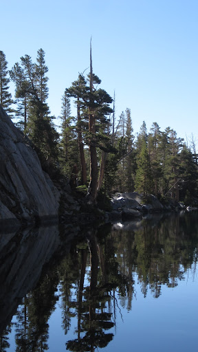
Happily, Lower Clark lake turned out to be a great place to camp, and we saw more wildlife there than we had in the whole rest of the trip—deer, ducks, osprey, bats—it was a lovely place to watch night fall.
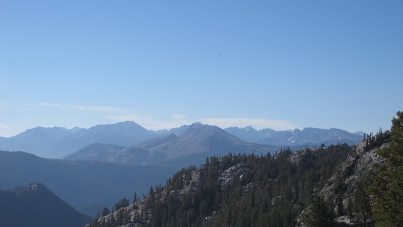
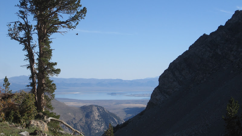
Our last day was a lesson in down-climbing. Once over the ridge to Spooky Meadow, it was about five miles of descending 2500 vertical feet through talus, rock and sand. Luckily we were early, and much of this part of the hike was in shade. There were some nice views of Mono Lake in the distance, and good shots of Agnew and Gem Lakes…but all in all, this was work more than pleasure.
Still, we made it down to the trailhead by 11:30, packed up the car, and were at the Mobil station in Lee Vining in time for lunch. And from there, another couple of hours got us back to our cabin for warm water, soft beds, and civilization.