Page 2 of 3
Re: High Sierra Trail Out and Back to Sequoia
Posted: Thu Feb 02, 2012 6:52 am
by RoguePhotonic
If I recall right it's only 15 dollars for the shuttle to Sequoia also so it's a good price.
Re: High Sierra Trail Out and Back to Sequoia
Posted: Thu Feb 02, 2012 4:23 pm
by sparky
Im an electrician and we had a small 2 week job in modesto. I took my gear and was dropped off in Visalia on the way back to Riverside. Stayed in a motel and caught the shuttle into the park the next AM. Started from Lodgepole around 11am. Returned to lodgepole and caught the shuttle out, and bus/trains back home. It's totally doable without a car.
There's options for making loops/semi loops. Get your maps! I like Tom Harrison maps. Get the mt Whitney high country map
Re: High Sierra Trail Out and Back to Sequoia
Posted: Thu Feb 02, 2012 5:05 pm
by mattherrington
Crossing the Kaweahs is pretty crappy. We had planned to go over Pyra Queen last summer but it was packed with snow mid-Aug so we went for the lower Pants Pass. Mav gave me fair warning that it was going to be crappy and it really was. I'm pretty comfortable in class 3-4 situations and Pants gave me some serious pucker factor going W-E.
Nothing is worse than being commited at 11AM half way up and seeing a 48L cooler size boulder loosen up, tumble, accelerate to 50 mph, and explode into an outcropping 300 yds away. For the last 500 ft of elevation with a 35 lb pack everytime I took a step EVERYTHING for 6 feet in every direction (up, down, in, L,R) started down the mtn. Not pea gravel, volleyballs.
Never again. Next time I'll take some scotch and enjoy the hot springs. And I'm 6' 185, 35.
That's just my two cents though!
Re: High Sierra Trail Out and Back to Sequoia
Posted: Thu Feb 02, 2012 7:35 pm
by Wandering Daisy
There is a trick to going over Pants Pass. I did it from Kern Keweah to Keweah Gap and although some rocks scrambling was required, it was generally safe. The descent was cruddy scree, but not the worst scree I have been on. The way I went, you first go to the left (false) pass, then traverse almost at the top of the ridge to the real pass. There is a bit of down climbing to get to the real pass. The route straight up the real pass from the Kern-Keweah side is full of loose stuff. Pyra Queen is more difficult and I had to cut some steps down a band of ice on the west side. On the east side, I avoided much talus by angeling in up high. Both these passes are considered mountaineering passes. Not for the general backpacking public. You do not want to do these passes with a heavy pack so doing them on the return is preferable. As with all mountaineering passes, micro-routefinding is critical to keep to the easiest path. Perhaps I have a warped sense of pleasure; for example I actually enjoyed the north side of Alpine Col and hopping the boulders around Goethe Lake. Most backpackers probably would not like it. And I really did not mind Pants Pass. It all went quickly. Pyra Queen definitely streched my definition of "tolerable". If you have not experienced a lot of Sierra Class 2-3 passes, you should instead go over Colby Pass and Elizabeth Pass where there are trails.
Re: High Sierra Trail Out and Back to Sequoia
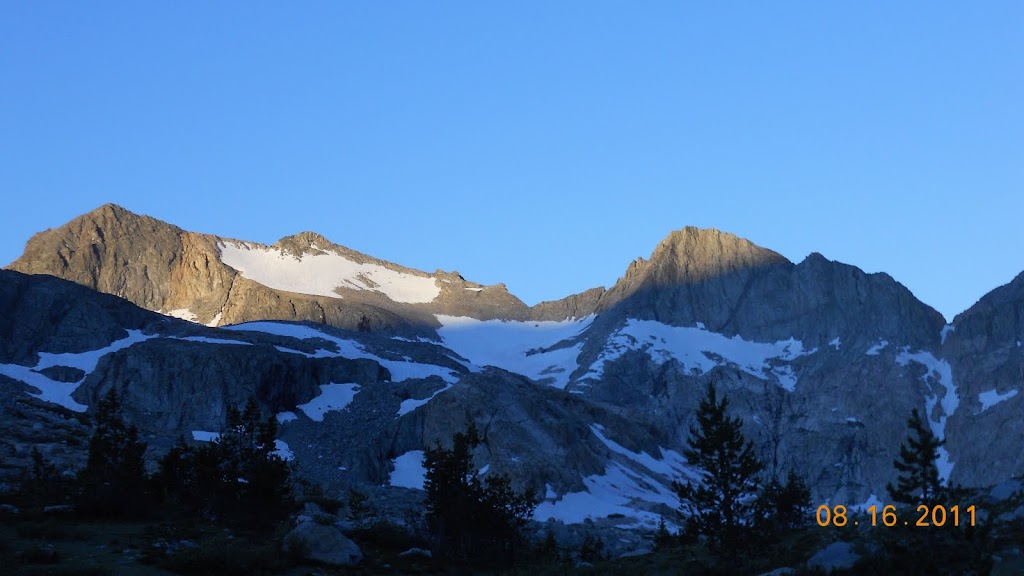
Posted: Fri Feb 03, 2012 9:36 am
by Wandering Daisy
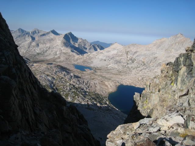
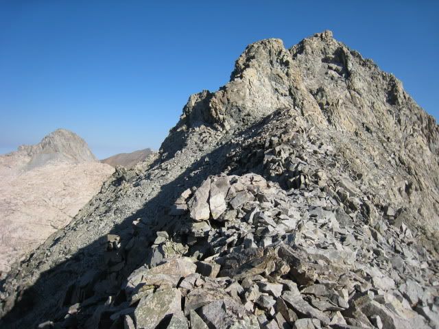
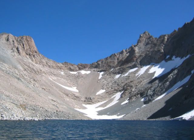
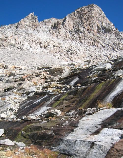
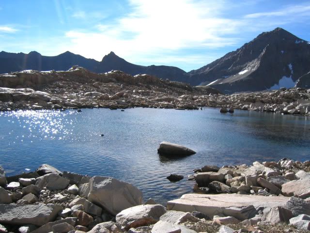
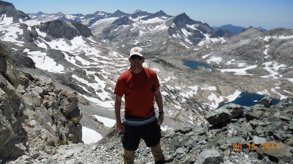
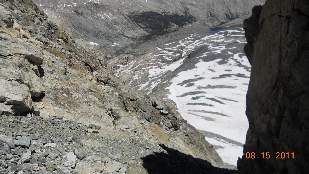
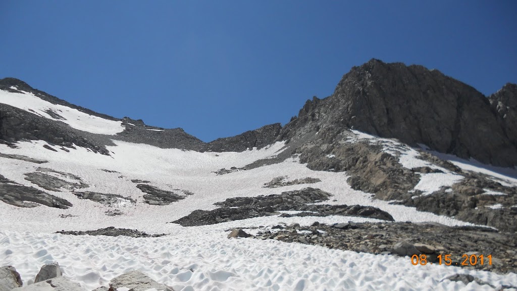
Some photos. As you can see these are not easy passes.
top of "False" Pants Pass (left notch from Kern Keweah side)
Pants Pass (traverse at top to the real pass)
Pants Pass from Nine Lakes Basin. From this direction the "real pass" is on the left and the false pass is on the right. The pass is a dual pass. Nine Lakes Basin-Real pass/ traverse/Kern Keweah-"false pass"

Prya Queen from Nine Lakes Basin
Looking down pass into Nine Lakes Basin

Slabs on Nine Lakes Basin side.
One of the ponds you pass on Keweah Basin side of the pass. If you make a point of heading for these ponds you will stay out of the talus gully.
Re: High Sierra Trail Out and Back to Sequoia
Posted: Fri Feb 03, 2012 10:50 am
by mattherrington
To Daisy's point it's not that bad; I recant my "never again" statement. I would do it again going from E-W dropping into 9 Lakes Basin/Kaweah Gap. I will never ascend that W side again. I had heard about the traverse at the top too but after we got up to the N notch it was a 100 yd chute down to a snow field so I put board shorts over my hiking pants and did it on my butt.
Seems like the E side would have been easier regardless but it was a snow field in Aug last yr. Deceptively snowy on the E side compared to the W approach.
From 9 Lakes Basin

From N notch looking back W to Kaweah Gap
From N notch looking down E side chute
Looking back at both notches from the E
Next AM (lower notch is dead center)
I'm way off topic reliving glory since passed. To bring it full circle this is one of the most direct and (arguably) easiet ways to cut some mileage out and or return a differnt route. It was really dicey with a not UL setup and it didn't even save us any time. I left my toothbrush on a stump at our camp in Kaweah Gap and the friends we made returned it to me on the trail roughly 36 hours later when we were both at Junction Meadow and they had stayed on the trail.
Re: High Sierra Trail Out and Back to Sequoia
Posted: Fri Feb 03, 2012 11:59 am
by Wandering Daisy
Oh yes. You went the hard way! I was warned about going that direction. Amazing how much difference in snowpack! My pack was 25-pounds when I did it. Either way, it is not a pass for a newbie off-trail traveler.
Re: High Sierra Trail Out and Back to Sequoia
Posted: Fri Feb 03, 2012 12:35 pm
by mattherrington
Next time I do it I'd like to leave Crescent Mdw, do the unabridged HST, return via Forester/Bubbs Creek to Road's End w maybe a side trip to Lake S. America. You 'd get into another major drainage, cross Forester which IMHO is awesome, and Bubbs Creek is a stroll going down. From Guitar Lake three 12-mile days will get you out and two of them are pretty easy.
I've hitched from Road's End before and it's easy, particulary with the Rae Lakes fans and Mist Falls day hikers. Everybody is going your way (hence Road's End) as far as Grant Grove and then half of them are going towards Lodgepole/Crescent Mdw.
Re: High Sierra Trail Out and Back to Sequoia
Posted: Tue Feb 07, 2012 11:05 am
by WandererWade
After reading the 'directions', here goes.
Backpacking level of experience: Level 3 (not much x-country travel but comfortable with the it just so long as I'm not doing a Bear Grylls)
Terrain Comfort: I'd say Class 2 mainly due to the 13 yo
Interests: Lakes, big scenery
Trip: Late July starting at Crescent Meadow and follow HST to Whitney, then return to West side either as yo-yo or another route (most preferable). I do not have permits yet as the SEKI site says March 1 is the earliest date to apply. I am traveling from Atlanta Ga with 20 yo son and now the 13 yo is dying to come as well. We are all suitably equipped and follow the UL spirit of backpacking. Both boys are very experienced in backpacking and are in great shape. We have been on many trips in the east as well as the Rockies. Yes I know altitude kicks butt for several days. We are not interested in taking excessive risks but would be open to x-country if not too risky. We do have a GPS and orienteering knowledge. Some of the photos on this thread and the prospect of washing machine size bolders flying around may be too risky for us and especially the 13 yo.
Matterrington had a good suggestion of a return to west side return via Forester/Bubbs Creek to Road's End. Has anyone done this trip? Looks pretty good on Google Earth. Is this more scenic than the yo-yo??I searched but cannot find transportation from Roads End back to Crescent Meadow other than hitchhiking. Probably would be tough with 3 people and packs. Apparently the shuttle bus does not go to Roads End. Any other transportation suggestions?? I would like to leave the car at Roads End so I dont have to worry about transporation at the end of the trip.
We have plenty of time to do this route. We will not resupply but our food is typically light weight fare and should not be too bad to carry. Plus the load lightens each day.
Thanks for everyones help and suggestions. Thus far the Sierras are my favorite destination.
Re: High Sierra Trail Out and Back to Sequoia
Posted: Tue Feb 07, 2012 1:39 pm
by Mike M.
Wade, I like the idea of looping back via another route -- either that, or doing an incomplete loop, like the one you are considering over Forester Pass and down Bubb's Creek to Road's End.
There are many options. For a loop, a nice option would be to double back to the Kern via the JMT and the Wallace Creek trail, then hook up with the Colby Pass trail, go over Colby Pass and circle around to Elizabeth Pass and then back to your starting point. The view from Elizabeth Pass is one of the best in the Sierra and this area is generally lightly traveled. All this is Class 1 trail.
Regarding getting around the park from Road's End: hitch-hiking is a great option. Always do it alone -- it is too hard for most potential rides to fit more than one person (with gear) in a car. What we do is leave the rest of the group with the packs and one of us (usually me) hitches (always with my pack) alone. I'm usually able to get a ride by asking around at the trailhead, as people come and go. If you do have to thumb it, having your pack with you instantly gives you credibility (you look like a backpacker! -- and not some dirty, smelly bum no one in their right mind would want to let into their car).
I wouldn't try to plan trips using Google Maps. You need topo maps for sure -- I favor the old U.S. Geological Survey 15 minute maps (no longer manufactured -- 80 feet elevation per contour line) over the 7.5 minute maps (40 feet per contour line). HST has a link to an on-line database of these maps for the entire Sierra.
Mike