Moose Lake TR
Posted: Wed Aug 31, 2011 2:53 pm
I took a small group of folks up into Sequoia NP to visit the tablelands. It's a bit long for an overnight given the cross country factor, but it worked.
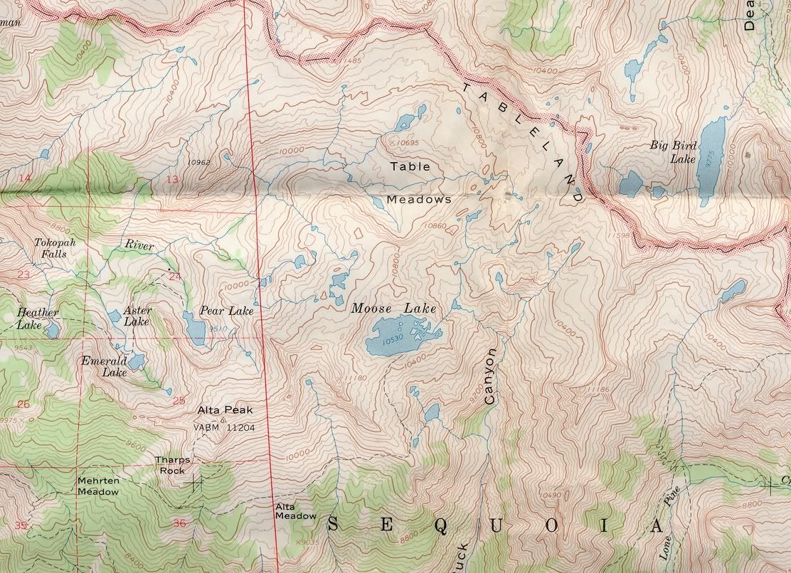
When you get to the end of the trail at Alta Meadow, you can traverse or just start marching upward, and I've been told that the best way is to just traverse over to the old trail. A friend gave me a 1956 USGS topo with the old trail clearly marked. We found the old trail, all right. We marched uphill too steeply and met it in the saddle where the trail pops up over the edge of the tablelands. Lots of brush that way. Not too bad, just a hindrance.

Looking out at the Sierra from somewhere in Alta Meadow
Moose Lake is at about 10,000 feet. It's got a lot of brook trout in it. I caught a few, kept none. They bite nearly every cast at dusk. We saw tons of them as we made our way around the lake to flat spots - we still had to navigate snowfields too.

I set up my nonfreestanding tent with 50 lbs of rocks on each corner. Of course, because I went to all the trouble, there was no wind whatsoever, unlike the times I've used 20 lbs of rocks and nearly lost a tarp. But the Tarptent Sublite kept the bugs from chewing on me in the night. Mosquitos were making themselves known until pretty late.
One of our group vomited instead of eating dinner. I suspect that due to having only one water bottle and not stopping a lot at the many water sources along the way, he was dehydrated and thus feeling the elevation more than the rest of us did. Case in point about making sure you get enough water.

Moose at sunset
We had interesting times on the way to Pear Lake, where we were rejoining the trail to get back to the car. Given the nature of the group we spent a little time eyeballing the terrain and the map and went the scenic route - longer but less steep.
Of course, it's the tablelands - the scenery is sort of slabby.

With the occasional tarn or small lake.

And the columbines were everywhere - my favorite flower, other than the tiger lily.

We came down north of Pear and traversed around the final ridge, arriving at the solar outhouse around lunchtime. The ranger at Pear Lake got there when we did, and checked our wilderness permit. After all the talus hopping and slab traversing, we soaked our feet for a while before beating it for the parking lot. We stopped again at the Watchtower and a few contemplated going out to look over the edge, but onward we marched, lured by the promise of pizza.
Bear Mountain Pizza in Squaw Valley - three thumbs up!
When you get to the end of the trail at Alta Meadow, you can traverse or just start marching upward, and I've been told that the best way is to just traverse over to the old trail. A friend gave me a 1956 USGS topo with the old trail clearly marked. We found the old trail, all right. We marched uphill too steeply and met it in the saddle where the trail pops up over the edge of the tablelands. Lots of brush that way. Not too bad, just a hindrance.
Looking out at the Sierra from somewhere in Alta Meadow
Moose Lake is at about 10,000 feet. It's got a lot of brook trout in it. I caught a few, kept none. They bite nearly every cast at dusk. We saw tons of them as we made our way around the lake to flat spots - we still had to navigate snowfields too.
I set up my nonfreestanding tent with 50 lbs of rocks on each corner. Of course, because I went to all the trouble, there was no wind whatsoever, unlike the times I've used 20 lbs of rocks and nearly lost a tarp. But the Tarptent Sublite kept the bugs from chewing on me in the night. Mosquitos were making themselves known until pretty late.
One of our group vomited instead of eating dinner. I suspect that due to having only one water bottle and not stopping a lot at the many water sources along the way, he was dehydrated and thus feeling the elevation more than the rest of us did. Case in point about making sure you get enough water.
Moose at sunset
We had interesting times on the way to Pear Lake, where we were rejoining the trail to get back to the car. Given the nature of the group we spent a little time eyeballing the terrain and the map and went the scenic route - longer but less steep.
Of course, it's the tablelands - the scenery is sort of slabby.
With the occasional tarn or small lake.
And the columbines were everywhere - my favorite flower, other than the tiger lily.
We came down north of Pear and traversed around the final ridge, arriving at the solar outhouse around lunchtime. The ranger at Pear Lake got there when we did, and checked our wilderness permit. After all the talus hopping and slab traversing, we soaked our feet for a while before beating it for the parking lot. We stopped again at the Watchtower and a few contemplated going out to look over the edge, but onward we marched, lured by the promise of pizza.
Bear Mountain Pizza in Squaw Valley - three thumbs up!