Ansel Adams Dayhike (Eastside)
Posted: Tue Aug 30, 2011 9:37 am
While car camping with the family @ Silver lake last week, I had a chance to get a day off to do some exploring. While I had previously hiked up to Agnew/Gem, this time around I wanted to go a little further to check out some other possible fishing opportunities.
What follows is a brief log of some of my impressions of a loop hike I made to Gem, Clark & Summit lakes (via Agnew Pass), and a return through Spooky Meadow. Here's a brief recap:
o Total distance was a little over 13 miles;
o Elevation gain from Silver (7,200') to Agnew (8,500') was 1,300', followed by another 1,450' to Clark #1 @ 9,950' (Agnew/Summit is 9,900') for a total of 2,750';
o I left @ 6:30am to avoid getting stuck behind packers from the Frontier station that leave for Gem around 8am;
o I returned @ 3:30pm, for a total of 9hrs, 2 of which were spent fishing, for a net of 7 hrs hiking - a little under 2 mph;
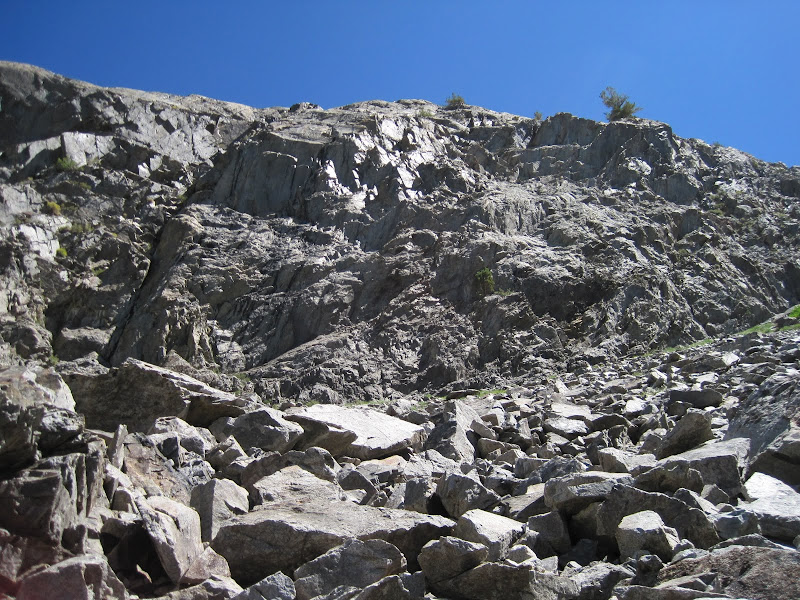
o Unlike the PCT highway, about 95% of the trail requires paying attention to where you step. In other words, it's very rocky, hence the slower than usual time.
o For those of you getting in touch with your 'inner hermit', you may be interested to note that I saw a total of 8 people during the entire trip, until the final descent back to Silver:
- The first person was an overnighter @ Geam near the Crest creek inlet. He was around 100 yrds away and we both waved as I continued on around the bend;
- The next 3 were way across Gem who were being dropped off on shore from a small boat. They looked like were part of a maintenance crew;
- The final 4 was a group of BPers I saw from across Clark #2, presumably on their way to TI lake.
All in all, I'd have to give this day hike a 10. Big scenery (see following pics), moderate-strenuous exertion, no people, great fishing. If one lived @ or was visiting the Mammoth area, it would be easy to shoot up for the day for the loop, or just catch the YARTS bus and walk back home via the PCT high trail to Agnew/Reds Mdw and/or Devil PP. Or, alternatively, do a quick 1 nighter to TI/Garnet and back.
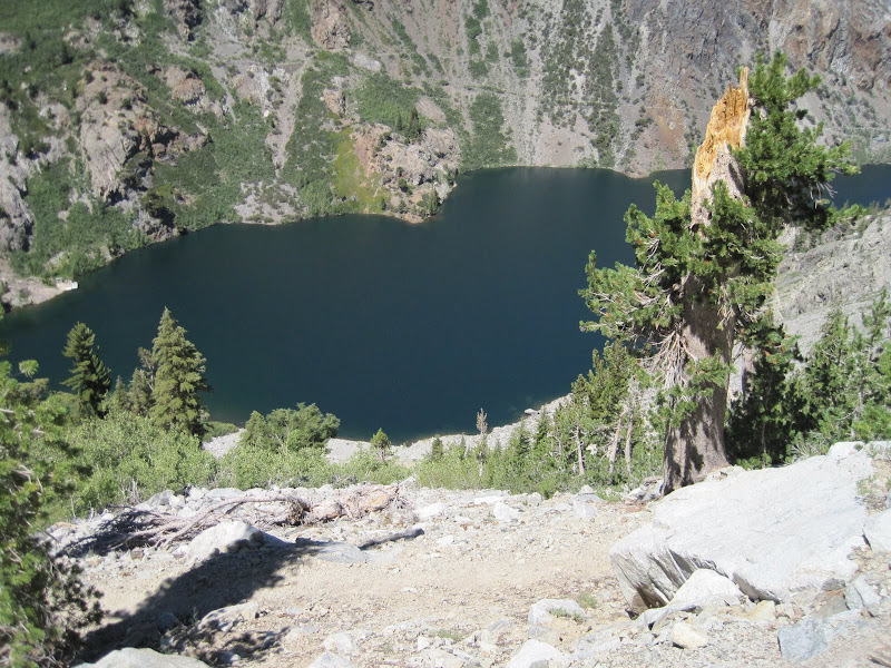
Ok, on with some pics. First one, the requisite look back towards Agnew (with Gull/June behind the shoulder) from the climb up to Gem:
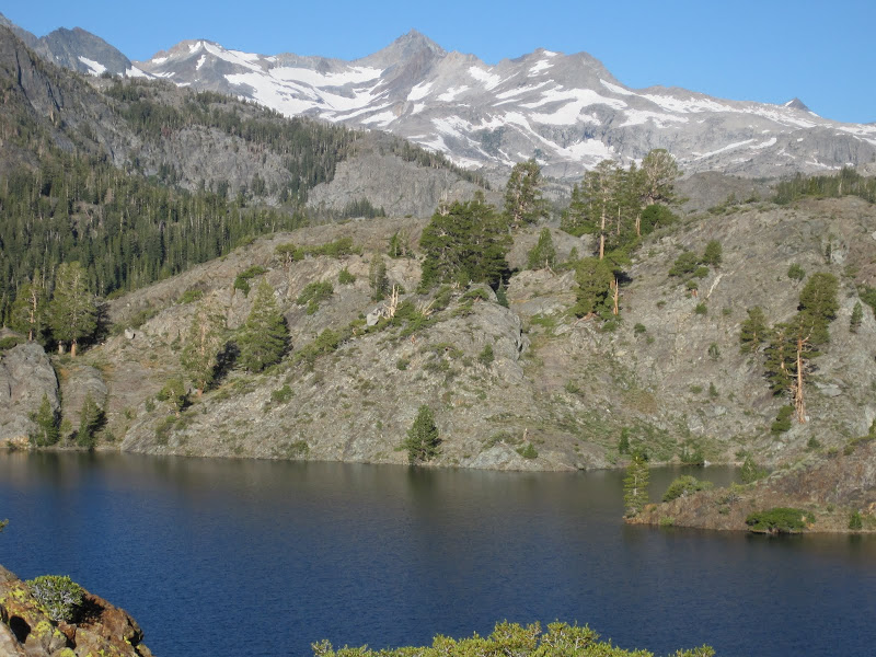
Mt Lyell from Gem:
One of the Clark lakes - these proved to be the proverbial 'cast & catch' kinds of Brook char lakes:

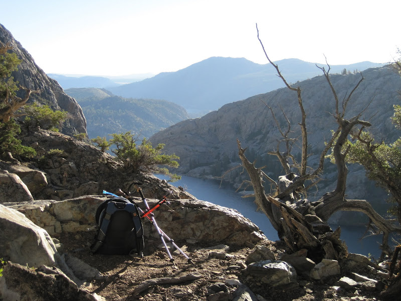
After getting bored of catching a fish on every cast, I decided to mosey on up the trail over Agnew pass to Summit lake (Minarets in the background):

Funny story - I thought for sure all my lures were crimped/filed, but I had one that I had neglected to fix. So there I am struggling to get the hook out, apologizing to the fish, while cursing myself for being so forgetful. I finally decide to switch out lures, but then the fish stopped biting! So I went back to my killer while trying not to injure the fish.
I did have my fly rod with me, but as usual, the fish were way out in the middle of the lake(s), necessitating big heaves. The upper part of Rush creek that drops into Gem was prime stream/fly fishing, but I was a little apprehensive about time & making the entire loop, as you will soon see, so I stuck to spin fishing a few spots before heading back.
What follows is a brief log of some of my impressions of a loop hike I made to Gem, Clark & Summit lakes (via Agnew Pass), and a return through Spooky Meadow. Here's a brief recap:
o Total distance was a little over 13 miles;
o Elevation gain from Silver (7,200') to Agnew (8,500') was 1,300', followed by another 1,450' to Clark #1 @ 9,950' (Agnew/Summit is 9,900') for a total of 2,750';
o I left @ 6:30am to avoid getting stuck behind packers from the Frontier station that leave for Gem around 8am;
o I returned @ 3:30pm, for a total of 9hrs, 2 of which were spent fishing, for a net of 7 hrs hiking - a little under 2 mph;
o Unlike the PCT highway, about 95% of the trail requires paying attention to where you step. In other words, it's very rocky, hence the slower than usual time.
o For those of you getting in touch with your 'inner hermit', you may be interested to note that I saw a total of 8 people during the entire trip, until the final descent back to Silver:
- The first person was an overnighter @ Geam near the Crest creek inlet. He was around 100 yrds away and we both waved as I continued on around the bend;
- The next 3 were way across Gem who were being dropped off on shore from a small boat. They looked like were part of a maintenance crew;
- The final 4 was a group of BPers I saw from across Clark #2, presumably on their way to TI lake.
All in all, I'd have to give this day hike a 10. Big scenery (see following pics), moderate-strenuous exertion, no people, great fishing. If one lived @ or was visiting the Mammoth area, it would be easy to shoot up for the day for the loop, or just catch the YARTS bus and walk back home via the PCT high trail to Agnew/Reds Mdw and/or Devil PP. Or, alternatively, do a quick 1 nighter to TI/Garnet and back.
Ok, on with some pics. First one, the requisite look back towards Agnew (with Gull/June behind the shoulder) from the climb up to Gem:
Mt Lyell from Gem:
One of the Clark lakes - these proved to be the proverbial 'cast & catch' kinds of Brook char lakes:
After getting bored of catching a fish on every cast, I decided to mosey on up the trail over Agnew pass to Summit lake (Minarets in the background):
Funny story - I thought for sure all my lures were crimped/filed, but I had one that I had neglected to fix. So there I am struggling to get the hook out, apologizing to the fish, while cursing myself for being so forgetful. I finally decide to switch out lures, but then the fish stopped biting! So I went back to my killer while trying not to injure the fish.
I did have my fly rod with me, but as usual, the fish were way out in the middle of the lake(s), necessitating big heaves. The upper part of Rush creek that drops into Gem was prime stream/fly fishing, but I was a little apprehensive about time & making the entire loop, as you will soon see, so I stuck to spin fishing a few spots before heading back.