Page 1 of 1
Need info
Posted: Wed May 11, 2011 4:08 pm
by brnbear51
I need to know if it is possible to backpack from Red and White Lake to Grinnell Lake. The col between the two looks passable. Does anyone have any info or pictures on this? Thanks

Re: Need info
Posted: Wed May 11, 2011 4:12 pm
by maverick
Welcome Brnbear51 to HST!
Please take time to read the "SUGGESTIONS FOR REQUESTING TRIP ADVICE" section in the "Announcements" section above, before asking for advice on a route, thanks.
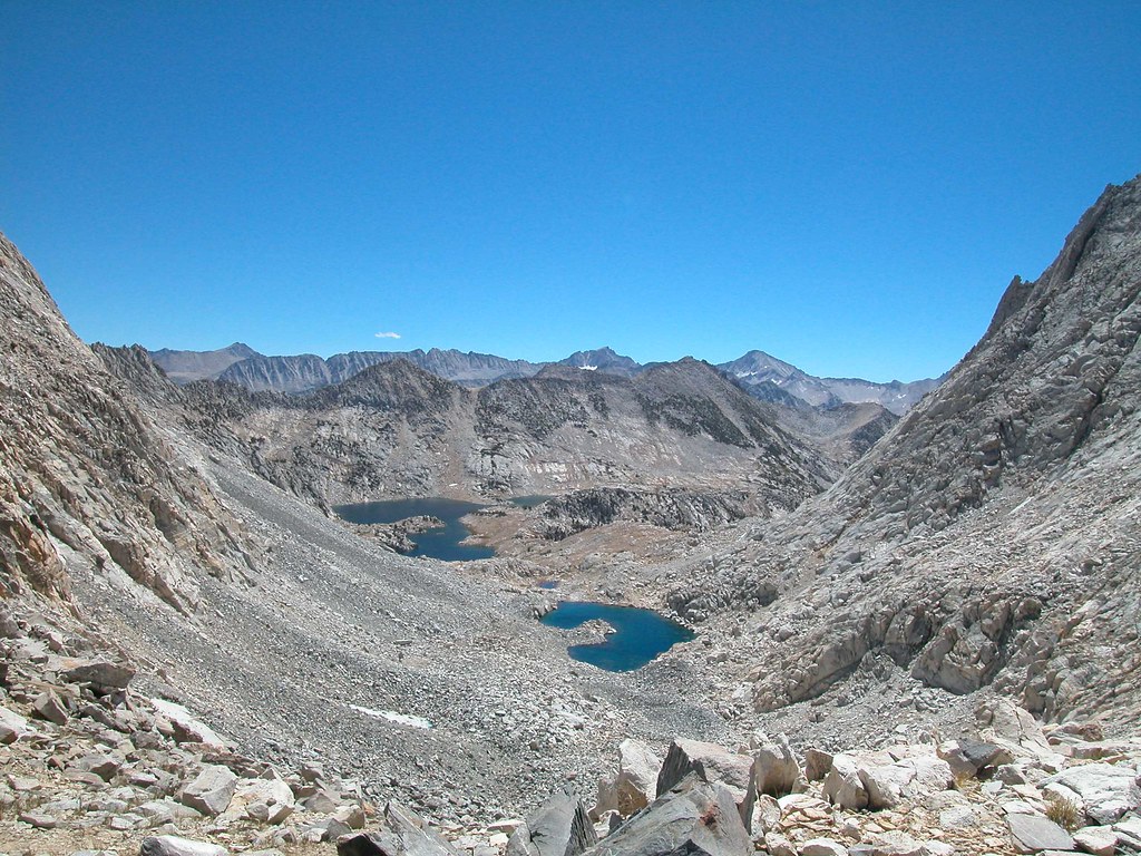
Re: Need info
Posted: Wed May 11, 2011 5:06 pm
by RoguePhotonic
What your looking at is called "Pace Col". That may help in your research. I have never been over it and have only seen it from Grinnell Lake. It's rated as class 2.
I found this image on flickr from the top of the Col but it doesn't help much.
Re: Need info
Posted: Wed May 11, 2011 5:55 pm
by maverick
Let's wait till the OP gives us some info about himself please. Thanks
Re: Need info
Posted: Wed May 11, 2011 7:50 pm
by SSSdave
Have been to Red and White Lake on several trips and Grinnel Lake once. From the former looked up at the north side route choices. Although rated as a class 2 route, there is considerable class 3 on both sides of Red and White Lake one could easily wander into. Did not like the possible choice above the east shores because some was steep metamorphic talus and scree off of Red and White Mountain. Such geology tends to be rather unstable and unpleasant. Above the west shores are some steep ledges one might work past the cliff areas. There are always some narrow bands of snow to negotiate and if firm as in the morning would not be pleasant. Falling on either side of the lake could result in a slide into the cold steep shored talus lake. Uncertain one could see that route coming down from above. Was a reason 16 years ago we carrying big packs instead chose to cross via Bighorn Pass and Shout of Relief Pass even though that is longer and a bit more up and down. Note that route is all class 2 though tedious in parts. I have some Kodachrome slides zoomed into the route areas.