Fishmonger, Thanks for sharing those Excellent Photo's. How Awesome it must be to have your kids enjoy the trails with you. A few years back I took my daughter (15 at the time) with her Uncles for a loop hike in this area. Unfortunately, the trials were a little to much for her, however, she loved all those evenings around the campfires and Peter Pande Lake might just give her reason to return someday. I've been going to this area since I first started backpacking at 16. At 46 I still can't seem to get enough of it.
Wondering Daisy. To get to Peter Pande & Olive Lake, I've always taken the Edison Lake route. Once through the devils bathtub area, 3 times through Graveyard Lakes over Silver Fox Pass, and 2.5 times up through the north fork of Mono Creek.
However, coming from Reds Meadow is a route worth considering. Although a little steep, Fish creek isn't to far off. It would also be a lot easier on the vehicle, and avoiding VVR might even save a few bucks depending on how you look at it. I've had good and bad experiences there, but thats another story. I have yet to make it to Wilber May Lake or over to Beetle Bug lake, so I just might try it out this coming summer.
Silver Divide
-
intrek38

- Topix Acquainted
- Posts: 55
- Joined: Mon May 07, 2007 6:40 pm
- Experience: N/A
- Location: Hesperia, Calif
-
intrek38
- Topix Acquainted
- Posts: 55
- Joined: Mon May 07, 2007 6:40 pm
- Experience: N/A
- Location: Hesperia, Calif
Re: Silver Divide
But then again, wouldn't coming through Mammoth and Duck lake be shorter... Thankfully there's still too many choices.... Have a great hike...
-
Wandering Daisy
- Topix Docent
- Posts: 6689
- Joined: Sun Jan 24, 2010 8:19 pm
- Experience: N/A
- Location: Fair Oaks CA (Sacramento area)
- Contact:
Re: Silver Divide
Each entry point has its plus and minus aspects. I do not mind a bit extra distance or a bit more cost. What I do not like is extra distance through non-scenic country or in areas over-used by horse packers. Does Margaret Lake get a lot of packer use? Is the route from Devils Postpile scenic enough or has good enough fishing to justify the extra distance? I came down from Mammoth Pass through the burned area to Reds Meadows this summer and I would not want to walk many miles through that burn. Heading to Fish Creek do you get out of the burn quickly? I do not have any problem with Vermillion Ranch - it is just a long slow drive on the road - a few hours more than driving to Mammoth.
Thanks everyone for all the good information!
Thanks everyone for all the good information!
-
intrek38
- Topix Acquainted
- Posts: 55
- Joined: Mon May 07, 2007 6:40 pm
- Experience: N/A
- Location: Hesperia, Calif
Re: Silver Divide
I have yet to visit Margaret Lake area, but I always seem to manage to run into horses no matter where I go. They even run into the Olive Lakes area which shouldn't be aloud. Fish Creek is probably the same. I guess calling one of the outfitters in the area to find out couldn't hurt.
We hiked south from Reds last year on the JMT through the burn area, fortunately it was a little cool in the morning and didn't seem to bother me as much, however, it didn't take long to heat up before we made it through. Better a burnt area then a clear cut. I tried searching for a map of the burn area but couldn't find one. On a good note, they have a 10' – 17' snow base already with more to come.
We hiked south from Reds last year on the JMT through the burn area, fortunately it was a little cool in the morning and didn't seem to bother me as much, however, it didn't take long to heat up before we made it through. Better a burnt area then a clear cut. I tried searching for a map of the burn area but couldn't find one. On a good note, they have a 10' – 17' snow base already with more to come.
-
DoyleWDonehoo
- Founding Member
- Posts: 480
- Joined: Wed Dec 14, 2005 2:06 pm
- Experience: N/A
- Location: San Jose, CA
- Contact:
Re: Silver Divide
I think if you have already looked at my story about this trip (http://www.doylewdonehoo.com/sliver/stcoverv1n11.htm" onclick="window.open(this.href);return false;), it would answer the question about the scenic part. I would add that on my trip I had the trail pretty much to myself except around the Indian named lakes near Silver Pass; the trails around Graveyard Meadows were wild enough to require a map; and a shortcut to Peter Panda would be over the Graveyard Lakes Pass. The times I have been in the Graveyard area I had to myself, even Arrowhead Lake, an unmapped packer destination. Then there is always the food, showers and pie to look forward to among our own people (backpackers) at the end of the trip.I do not mind a bit extra distance or a bit more cost. What I do not like is extra distance through non-scenic country or in areas over-used by horse packers.
I think if I was going from Mammoth, the most direct route would be over Duck Pass and hang a right at the Purple Lake cutoff downward towards Peter Panda (if you can find it: I didn't see it passing through). But you wanted a less impacted area, and the JMT/PCT is not that. A hot, burned, longer wild way would be from Reds Meadow, but it does have some nice hot springs along the way, and would be a good bet for early season. Stream crossings may be a concern, in particular early season.
Doyle W. Donehoo
Sierra Trails:
http://www.doylewdonehoo.com" onclick="window.open(this.href);return false;
Sierra Trails:
http://www.doylewdonehoo.com" onclick="window.open(this.href);return false;
-
richapple

- Topix Acquainted
- Posts: 50
- Joined: Wed Aug 04, 2010 12:30 pm
- Experience: N/A
- Location: Santa Cruz, CA
Re: Silver Divide
Wandering Daisy, I did just post a Trip Report from a long September trip from Edison to Peter Pande and back, so some further photos of the Silver Divide area west of Chief Lake are there. Twice hiking by doing the JMT we were intrigued by that sign for the turn-off to Lake of the Lone Indian, so figured we'd give the area a real good look-see.
viewtopic.php?f=1&t=5766
I'm no help for fishing info, but can attest to someone else's comment about how few people seem to venture into this area compared to other areas. We enjoyed 8 days without seeing any people.
You asked about off-trail from Peter Pande to Graveyard Lakes, and while I just updated that post that maverick sent with lots of talk about it, you being climbers and all - you'd scamper over easily. We chose to meander out the way we came in 'cuz we're not huge fans of hiking on the big talus blocks sort of stuff. I added a good photo of the X-Country route to that post.
If you you do wander in from Duck, might you consider taking the high route through gorgeous Lake Virginia and up toward Silver Pass but then heading west to Lake of the Lone Indian? I guess it could be that the fishing is better coming up the big canyons... And those Iva Bell hot springs have always sounded worth a stop.
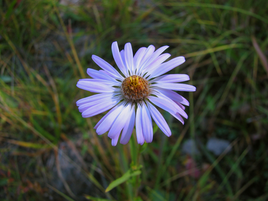
This is a Purple Aster, but it is kind of Wandering Daisyish:
viewtopic.php?f=1&t=5766
I'm no help for fishing info, but can attest to someone else's comment about how few people seem to venture into this area compared to other areas. We enjoyed 8 days without seeing any people.
You asked about off-trail from Peter Pande to Graveyard Lakes, and while I just updated that post that maverick sent with lots of talk about it, you being climbers and all - you'd scamper over easily. We chose to meander out the way we came in 'cuz we're not huge fans of hiking on the big talus blocks sort of stuff. I added a good photo of the X-Country route to that post.
If you you do wander in from Duck, might you consider taking the high route through gorgeous Lake Virginia and up toward Silver Pass but then heading west to Lake of the Lone Indian? I guess it could be that the fishing is better coming up the big canyons... And those Iva Bell hot springs have always sounded worth a stop.
This is a Purple Aster, but it is kind of Wandering Daisyish:
richapple
Who is online
Users browsing this forum: BarkingSpider, bobby49, Google Adsense [Bot], MRrogers and 318 guests