Page 1 of 1
High Sierra Trail - Early July
Posted: Sun Jun 13, 2010 9:26 am
by Ranboze
Im joining some friends on the HST beginning July 3. Ive stood atop Whitney recently and seen firsthand the amount of snow in the backcountry. Im unfamiliar w/ the HST, and although I don't anticipate snow travel to be an issue, Im a bit more curious about stream crossings, and not being able to cross.
Anyone have any thoughts on this... and/or... who/what would be a good resource to check on stream crossings, especially on the east side of Kaweah gap?
Re: High Sierra Trail - Early July
Posted: Sun Jun 13, 2010 7:35 pm
by sashe
When we did the trip there was a snow gully just beyond the tunnel above Hamilton Lake. And the creek crossings in Kern Canyon were a challenge for some, but everyone made it. You'll also find snow at Kaweah Gap and just before Trail Crest.
Re: High Sierra Trail - Early July
Posted: Sun Jun 13, 2010 9:34 pm
by Mike M.
Expect very high water this year.
I don't know for sure (can't remember) but I think there is a bridge across the Kern along the HST -- I know there was a bridge there back in the 70s. Be sure to check at the ranger station for information about this crossing.
For the tributary streams, just be careful. There are ways to deal with high water. First, water levels are usually lower in the mornings than the afternoons. Second, if water is high and raging and you are uncomfortable, look for a better place to cross regardless of where the trail might be. A broad, open area like you would see in a meadow often works. Water there might be deep, but it won't be a raging torrent. Yet another option is to walk miles upstream until the water levels are manageable. Unless you're really into bushwhacking, this approach is problematic!
Mike
Re: High Sierra Trail - Early July
Posted: Sun Jun 13, 2010 9:49 pm
by stevet
You might find the Mehrton Creek crossing at bit unsettling. With high water you'll wade it knowing that a slip could take you on a long ride down the canyon wall. Never had a problem had a problem other than being on high alert though.
Wet but not a problem; the section around Precipice Lake,
Whitney Creek and Wallace Creek crossing in the Kern Canyon will likely be knee deep or higher. Wallace Creek is a long crossing and you likely won't see the trail on the opposite side. Just walk straight across.
When climbing out of the Kern Canyon, Wright Creek flows fast and likely knee deep. I've had to search for better crossings above the trail. And finally Wallace Creek one last time whle heading south on the JMT. Knee deep, but good fording right at the trail crossing.
Re: High Sierra Trail - Early July
Posted: Mon Jun 14, 2010 11:04 am
by Wandering Daisy
First, I find crossings difficult. So take this with a grain of salt. On several early season trips to Hamilton Lakes, I found the crossing just below Hamilton Lakes difficult. We got there late in the day at peak snowmelt. I suspect the depths vary up to a foot from morning to afternoon. Even though creeks will be high, the south-facing rocky trail from the large bridge to the creek from Hamilton Lake is an afternoon is really hot and dry . Note that if you need water, you cannot get it at the bridge (it is too high over the water). Either fill up at Bearpaw or you have to take a use-trail upstream west of the bridge to access the creek.
I usually go from Wolverton, over Panther Gap simply to avoid the crossings you have to do if you start at Crescent Meadow. By the time you add up all the small ups along the trail from Crescent meadow, it is not that much more to do one up over Panther Gap. The only down side is that you would not be on the entire High Sierra Trail, if you are a purist.
Also, from Moraine Lake to the Kern River the area has burned and is not very pretty. I made the mistake of not stopping at Moraine Lake thinking I would camp a bit further.
I did the trail in 2008, and I am not sure what you are talking about regarding crossing Kern River. WHen I did it, there was a huge bridge across. The trail has been re-routed from what is shown on the topo map. I just followed the trail and took the bridge. The place with no bridge is at Junction Meadow so if you come down from Colby Pass then you do have to cross.
Re: High Sierra Trail - Early July
Posted: Mon Jun 14, 2010 11:27 am
by Wandering Daisy
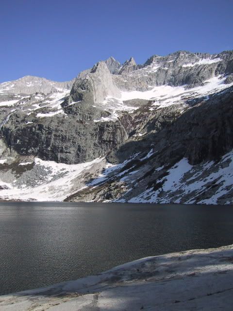
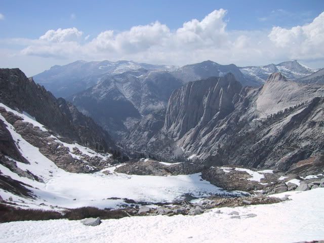
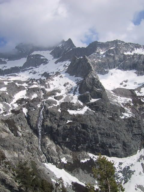
Here are a few photos of a trip I did on 4th July weekend I believe in 2003. We went in to climb Hamilton Dome (no success) so hiked up to Keweah Gap to take photos.
Hamilton Lake
Frozen lake below Precipice Lake
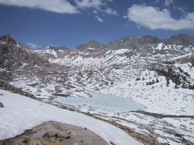
Nine Lakes Basin from Keweah Gap
View from High Sierra Trail (on way to Precipice Lake)
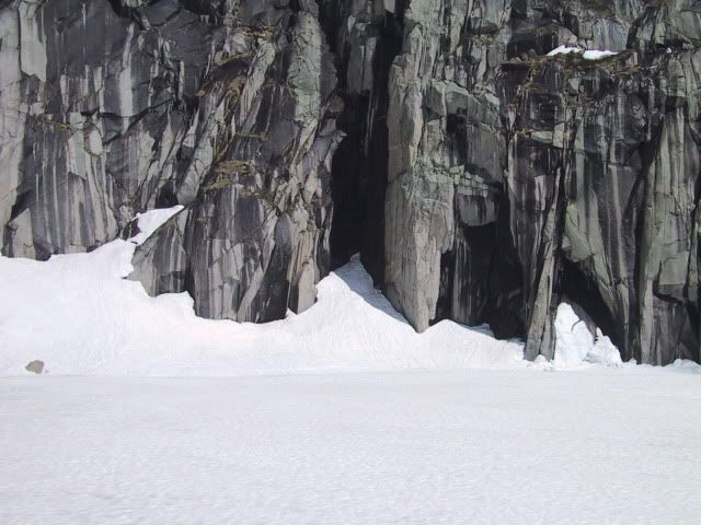
Precipice Lake (same place of famous Ansel Adams photo)
Re: High Sierra Trail - Early July
Posted: Tue Jun 22, 2010 5:05 am
by Cloudy
Nice photos! It's great to see what the area looks like with more snow cover than I usually see. It's funny but I saw a copy of the Ansel Adams photo of Precipice Lake at an exhibition in Fresno a number of years back and I had never seen it before but immediately recognized where it was taken even though the location wasn't specified... It's truly beautiful to behold when there's still a little bit of ice and snow around to set off the turquoise of the shallows and the pitch black at the back.
Alan
Re: High Sierra Trail - Early July
Posted: Wed Jun 23, 2010 6:35 pm
by SPeacock
Rangers report Mehrten Creek to be a possible problem (last week info). They suggest going up stream to find a better crossing if the trail crossing is bothersome. Lots of people up there, so guessing most are making it with little problem.
Re: High Sierra Trail - Early July
Posted: Wed Jun 30, 2010 11:58 am
by Phil R
The Mineral King Ranger station told us on 6/29: "From ½ mile above Hamilton Lk. the trail is covered and route finding skills are needed. The Tunnel Chute is full of snow. AND Precipice Lk. is still covered by snow."
Planning to hike that section on July 15. Not sure there will be enough snow melt for our group....we are not snow people.