Page 1 of 1
Cartridge Creek Trail
Posted: Wed May 26, 2010 12:59 pm
by js hill
Has anyone hiked from the South Fork of the Kings River up over Cartridge Creek Pass and down to the Middle Fork of the Kings? As I understand, this used to be the original John Muir Trail before the trail was rerouted over Mather Pass. I've looked at this route many times over the years and would like to hear first-hand from someone that has hiked it. Any information you could give me would be appreciated.
Re: Cartridge Creek Trail
Posted: Wed May 26, 2010 1:57 pm
by DoyleWDonehoo
I have seen the bottom part by North Fork (clear for a ways), and the upper section beyond Marion Lake. I have talked to people who have done the section from NF to Marion Lake, and, well, if you like a lot of nasty bush, knock yourself out.

I want no part of it. The upper basin to Cartridge Pass is great, and well worth the visit, and the best way to get there is via the Roper Route. You can read about it here:
http://www.sierra-trails.com/ctcc/stcoverv1n4.htm" onclick="window.open(this.href);return false;
And if you want to know more about the upper basin, see this (click 23 or 24)):
http://www.sierra-trails.com/ctcc/ctccmap2.htm" onclick="window.open(this.href);return false;
Re: Cartridge Creek Trail
Posted: Wed May 26, 2010 3:05 pm
by Mike M.
It' a classic bushwhack!
See this link:
viewtopic.php?f=1&t=4775" onclick="window.open(this.href);return false;
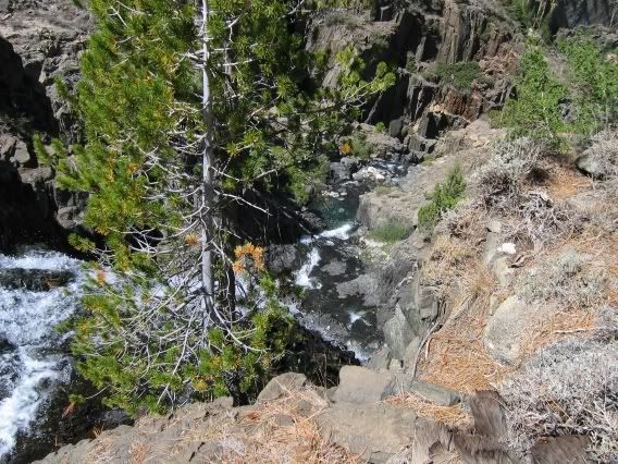
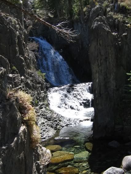
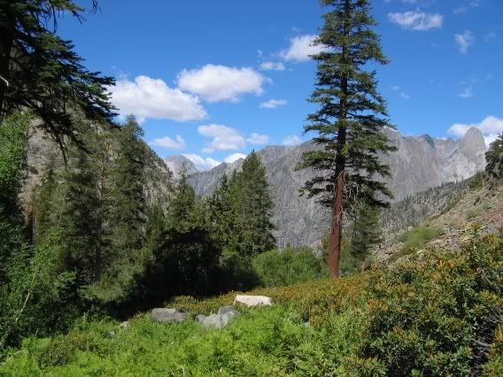
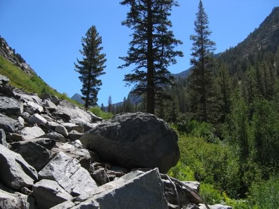
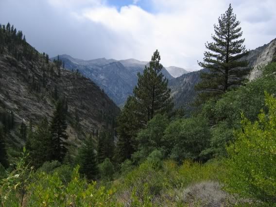
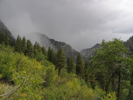
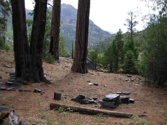
The hardest part by far is the three miles of bushwhack from where you leave the Simpson Meadow trail until you get to Triple Falls. There is a fine campsite just up from the Simpson Meadow trail, next to Cartridge Creek. If you are lucky and patient, you might find the old Cartridge Creek trail near this campsite. The trail is located on the north side of the creek, and climbs high above the creek through thick underbrush, then makes its way towards Triple Falls. (A few years ago, going south to north, I found traces of the trail below Triple Falls and was able to follow it almost all the way to the above mentioned camp, before losing it.) Once to Triple Falls, it is fairly easy going. You'll see an obvious path near the base of the falls, which takes you to the top of the falls. From here, hiking is pretty easy. Once into the Cartridge Lakes basin, you'll find traces of the old Muir Trail. The switchbacks leading up to the pass are still serviceable (with washouts). The trail leading down to the South Fork of the King's River should be easy to follow all the way from the pass. There is sizable bench below the pass, with a nice lake, and below this is a classic, no-nonsense old Sierra trail that shoots straight down to the river -- this is not a trail built for horses! Once near the river, the trail disappears.
A glutton for punishment, I have done this route at least five times, but only once from the south. The first time was hardest -- I fought my way through high and dense cottonwood for many hours before finally reaching Triple Falls. The second time I had success using the creekbed when the bushes got too thick.
Bottom line, it's a nasty challenge but worth the effort.
Mike
Re: Cartridge Creek Trail
Posted: Thu May 27, 2010 12:12 pm
by js hill
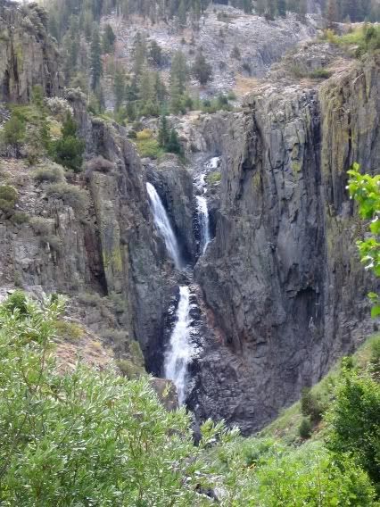
Thanks guys for the info. Years ago I met a fellow hiking up the Taboose Creek Trail. He was heading into Cartridge Creek Basin to do some fishing. I've always been curious about this area but have never ventured into it. Does anyone have a picture of Triple Falls? If so could you post it? Thanks again. JS Hill
Re: Cartridge Creek Trail
Posted: Thu May 27, 2010 12:31 pm
by DoyleWDonehoo
js hill wrote: Does anyone have a picture of Triple Falls? If so could you post it? Thanks again. JS Hill
See Mike M.'s link in the post above: his trip report has a picture of Triple Falls, at least I believe it is.
Re: Cartridge Creek Trail
Posted: Thu May 27, 2010 5:57 pm
by Mike M.
Re: Cartridge Creek Trail
Posted: Fri May 28, 2010 8:43 am
by ndwoods
I've hiked into Lake Basin and gone over the pass and out the current JMT...lovely area.
Re: Cartridge Creek Trail
Posted: Fri May 28, 2010 3:02 pm
by DoyleWDonehoo
Here is a birds eye view of the falls in Google Maps:
http://maps.google.com/?ie=UTF8&ll=36.9 ... 5&t=h&z=17" onclick="window.open(this.href);return false;
Re: Cartridge Creek Trail
Posted: Sun May 30, 2010 10:03 am
by stevet
Bushwhack indeed! I last hiked the Cartridge Creek trail 40 summers ago as a Boy Scout. It was a bushwhack then. I can hardly imagine what it would be like now.
Re: Cartridge Creek Trail
Posted: Wed Jun 02, 2010 1:22 pm
by maverick
As others have mention it is a bushwhack not to be attempted by anyone without
cross country, and rough class 2 experience.
It is pretty country, but using the SHR is a much easier way to access this area unless
your looking for a challenge.
I preferred my route coming around Mt. Shakspere to the lakes below Observation
Peak so to access Dumbbell Lakes Basin, prettier views especially towards the Devil's
Craig, and beyond, with rarely visited gorgeous lakes.