I would rate my level of experience between a 3 and a 4 and am very conferrable with class 3 terrain.
My ideal trips include great views and solitude with the most important being good fishing.
Is there a route that will take you from the Humphrey's Basin to Evolution Valley?
Humphrey Basin To Evolution Valley
-
SkagetMuir

- Topix Acquainted
- Posts: 33
- Joined: Tue Jun 10, 2008 6:05 pm
- Experience: N/A
- Location: Rincon Valley California
Humphrey Basin To Evolution Valley
"Everyone is different, likes doing different things, but we all go to the back country for a reason, it's what we do with that reason that counts."
-
maverick

- Forums Moderator

- Posts: 11835
- Joined: Thu Apr 06, 2006 5:54 pm
- Experience: Level 4 Explorer
Re: Humphrey Basin To Evolution Valley
There are several routes, easiest being Lobe Pass, Packsaddle Pass, and Alpine Col, all
class 2, which I would recommend over the next 2.
Snow Tongue a class 2-3, and The Keyhole class 3 are only recommended if you like
torturing yourself with loose rock and very steep talus.
http://sierrabackpacker.com/GlacierDivideEast.htm" onclick="window.open(this.href);return false;
"The High Sierra Peaks, Passes, and Trails", book by R.J. Secor gives you descriptions
of the routes and there are numerous TR's with pictures on-line to give you a flavor
of most of the routes.
-
TehipiteTom
- Founding Member
- Posts: 953
- Joined: Thu Aug 24, 2006 8:42 am
- Experience: Level 4 Explorer
Re: Humphrey Basin To Evolution Valley
Cgundersen did a route that looks very appealing to me, traversing around the end of the Glacier Divide via Ramona Lake and the unnamed lakes north of Pavilion Dome. Report and follow-up questions in this thread.
-
giantbrookie

- Founding Member & Forums Moderator
- Posts: 3582
- Joined: Wed Dec 28, 2005 10:22 am
- Experience: N/A
- Location: Fresno
- Contact:
Re: Humphrey Basin To Evolution Valley
In 1997 we crossed over the Glacier Divide sort of in reverse of of the CGunderson route having pretty much contoured all the way over from Darwin Bench before going over; the pass is the westernmost class 2 pass that crosses the Glacier Divide. We dropped straight down to Piute instead of to Ramona. If we had to do it over again we would have certainly traversed to Ramona instead--a much more interesting route. The drawback to this route over the more direct passes mentioned by Maverick is that west end crossing is a bit out of the way. The passes mentioned by Maverick may shave a day off of the transit time getting from Humphreys Basin to Evolution compared to the interesting but longer western crossing.
Since my fishing (etc.) website is still down, you can be distracted by geology stuff at: http://www.fresnostate.edu/csm/ees/facu ... ayshi.html" onclick="window.open(this.href);return false;
-
mokelumnekid

- Topix Expert
- Posts: 475
- Joined: Mon Sep 22, 2008 4:45 pm
- Experience: N/A
- Location: Seattle
- Contact:
Re: Humphrey Basin To Evolution Valley
I've been over Packsaddle, from n-s. If there is snow at the top it can get a bit iffy as it steepens just before the top. Easy walk down the south side tho.
-
Wandering Daisy
- Topix Docent
- Posts: 6689
- Joined: Sun Jan 24, 2010 8:19 pm
- Experience: N/A
- Location: Fair Oaks CA (Sacramento area)
- Contact:
Re: Humphrey Basin To Evolution Valley
I have been over Snow Tongue Pass and Alpine Col. (in 2008) Alpine Col may be Class 2 but there is a LOT of talus on both sides. The ugly on Snow Toungue is short but loose and potentially dangerous on the north side. I got over once without a crushed foot or worse and do not care to do it again. It is not so much that it is class 3, but that it is very loose. The south side is easy. If you traverse to Darwin bench on the south side, it can be tricky getting off the ledges. I ended up nearly getting stuck! The south side bench is really beautiful - was full of wildflowers when I was there.
-
Mike M.
- Topix Expert
- Posts: 647
- Joined: Fri May 25, 2007 10:50 pm
- Experience: Level 4 Explorer
- Location: Portland, Oregon
Re: Humphrey Basin To Evolution Valley
I would think your best bets are either The Keyhole or Alpine Col.
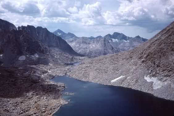
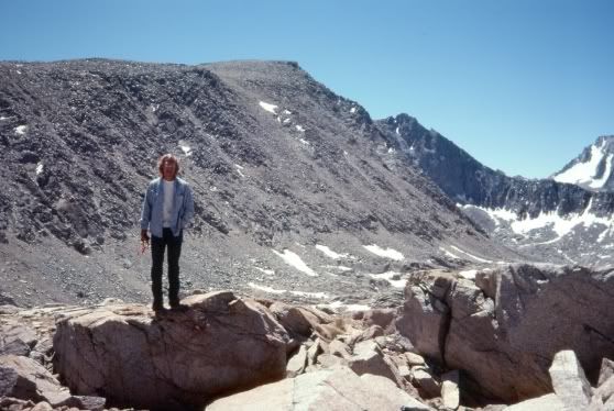
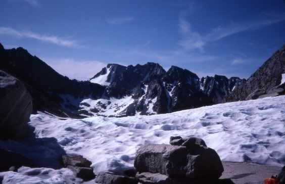
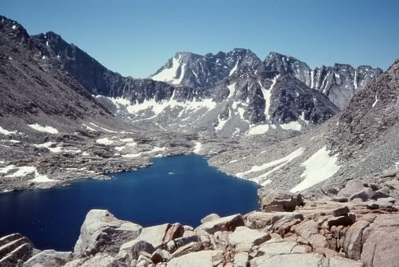
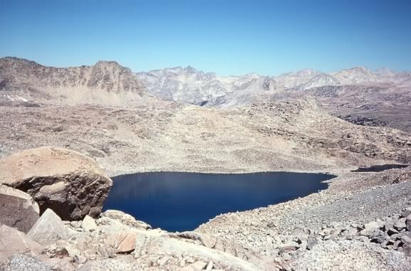
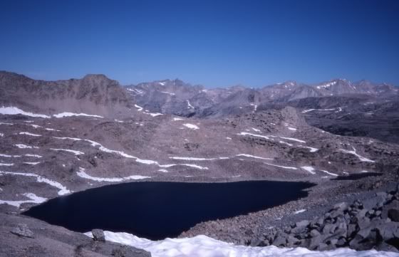
The Keyhole is listed as class 3, but really isn't in my opinion -- there is no exposure to speak of. Route finding is the main challenge. The pass is actually a hole in the ridgecrest. There is a short steep section where you will need to hand your pack down (coming from the Humphrey's Basin side) through the hole in the ridge. At that point, it is a steep but quite manageable hike through talus and scree to the highest of the Darwin Basin lakes. I have been over this pass several times, once with 12 days food on my back. It is a terrific route, with excellent views looking back at Mt. Humphreys .
Alpine Col is easier in terms of route finding, but there is a field of huge boulders you must make your way through as you head up to the pass from Goethe Lake. The reverse hike is harder -- It is easier to go up this field of boulders than go down.
Looking down The Keyhole
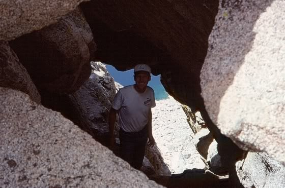
Looking up The Keyhole
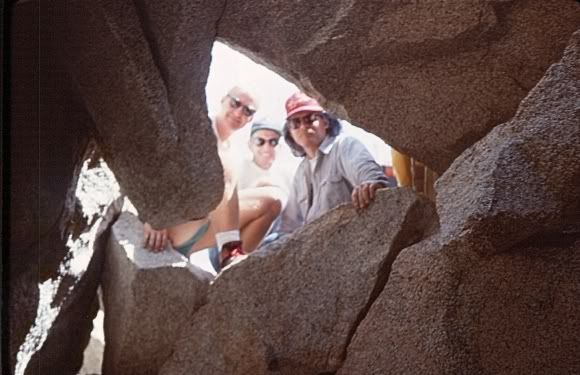
Mt. Humphreys from The Keyhole
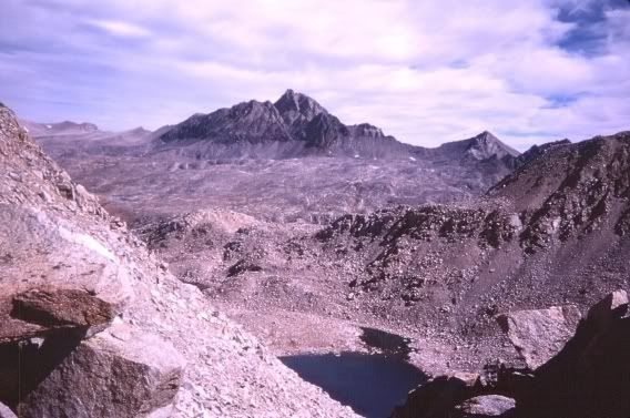
Darwin Basin from The Keyhole
Alpine Col 1976
Alpine Col 1982
Darwin Basin from Alpine Col 1976
Goethe Lake from Alpine Col 1976
Goethe Lake from Alpine Col 1982
The Keyhole is listed as class 3, but really isn't in my opinion -- there is no exposure to speak of. Route finding is the main challenge. The pass is actually a hole in the ridgecrest. There is a short steep section where you will need to hand your pack down (coming from the Humphrey's Basin side) through the hole in the ridge. At that point, it is a steep but quite manageable hike through talus and scree to the highest of the Darwin Basin lakes. I have been over this pass several times, once with 12 days food on my back. It is a terrific route, with excellent views looking back at Mt. Humphreys .
Alpine Col is easier in terms of route finding, but there is a field of huge boulders you must make your way through as you head up to the pass from Goethe Lake. The reverse hike is harder -- It is easier to go up this field of boulders than go down.
Looking down The Keyhole
Looking up The Keyhole
Mt. Humphreys from The Keyhole
Darwin Basin from The Keyhole
Alpine Col 1976
Alpine Col 1982
Darwin Basin from Alpine Col 1976
Goethe Lake from Alpine Col 1976
Goethe Lake from Alpine Col 1982
-
SkagetMuir
- Topix Acquainted
- Posts: 33
- Joined: Tue Jun 10, 2008 6:05 pm
- Experience: N/A
- Location: Rincon Valley California
Re: Humphrey Basin To Evolution Valley
WOW  Havent had much of a chance to respond to all your great suggestions. Seems like I have a bunch of great options. Luckily, I'm planning for a bunch of time so it seems like exploring will be a very pleasant experience. I've been obsessively looking through google earth anytime I have a chance and cant get by the number of lakes that can be visited in the matter of a few days. Just setting up a base camp and day hiking looks as though it can be very rewarding.
I still kick myself in the butt for passing right through here and not stopping a few years back. I left out of North Lake in an attempt to hike the 60 mile loop back to South Lake VIA the JMT knowing nothing at the time about the GOLD MINE I hiked right through. Unfortunately the first day I underestimated the sun and combined with only 2 hours of sleep and a 6 hour drive ended up with a sprained hip and a minor case of heat exhaustion. In short my buddy and I ( I hobbling down to the San Jauquen) ended up camping for a few days near the confluence of Piute creek where we did well fishing giving my hip some time to rest. We ended up catching and releasing a couple of browns in the three pound class and a mixture of Rainbows, Brookies and Goldens in the 1-2 pound range. Now though I am ready to get back up there to find the golden of all goldens and some great scenery to boot.
BTW Great pictures Mike M I think I've even seen a few of them on google earth. I look forward to seeing it all this summer.
"Everyone is different, likes doing different things, but we all go to the back country for a reason, it's what we do with that reason that counts."
Who is online
Users browsing this forum: Google [Bot], JosiahSpurr and 246 guests