Page 1 of 1
Pants Pass
Posted: Mon Jun 15, 2009 9:25 am
by pvalovich
I'm planning a 16-day mid-July solo loop out of either Horseshoe Meadows or Shepherd Pass. Would like to see Nine Lakes Basin and the Kern-Kaweah River via Pants Pass. Undecided as to whether to do it east to west via Colby Pass Trail, or west to east via the High Sierra Trail from the Chagoopa Plateau.
Anyone have an opinion?
Re: Pants Pass
Posted: Mon Jun 15, 2009 11:48 am
by maverick
Which ever side you decide to go over make sure you go over the higher/northern
notch because the lower/southern notch is even steeper on its western side.
I like going from west to east because once you descend the sandy steep portion
at the top you can ski/slalom down the scree.
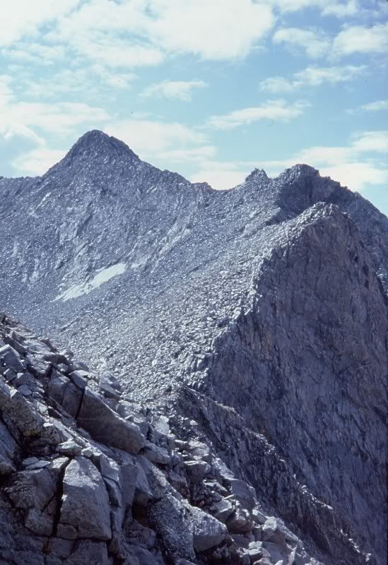
Make sure you go over the correct pass, the notch to the north of Pants looks
like the obvious pass and gets people in trouble because of the steep cliffs on the
eastern side.
Secor's book has a good picture of the correct pass.
Re: Pants Pass
Posted: Mon Jun 15, 2009 1:04 pm
by giantbrookie
I'd agree that west to east is slightly better for the reasons given above, but its not too much of a difference, provided the correct notch is used.
Re: Pants Pass
Posted: Mon Jun 15, 2009 2:53 pm
by copeg
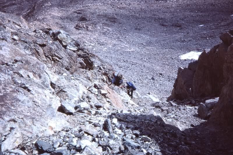
As the others mentioned, make sure you have the correct 'notch' for Pants pass. When I was in the area a few years ago I had known about the pass, but failed to do my homework before I left. I chose what looked like the most obvious pass which was wrong. I scrambled up a very steep chute on the west, to find an even steeper chute on the east side with a long icefield halfway down. There were footprints so I thought I was on the correct pass, but it wasn't. Good views from the top though.
Re: Pants Pass
Posted: Tue Jun 16, 2009 8:10 am
by cgundersen
Hi Pvalovich,
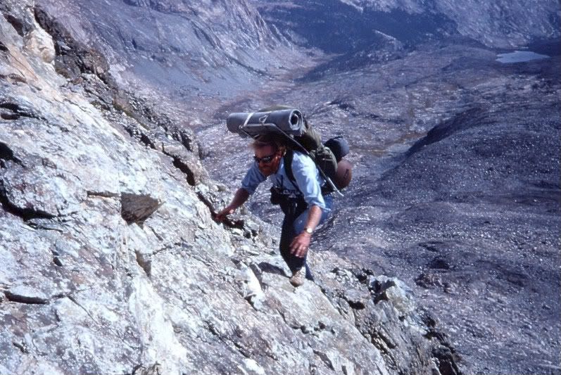
My wife and I just returned from a loop to the backside of the Kaweahs. We did what we figured was Pants Pass from West to East. At this time of year, we had the advantage that the approach was very compliant snow till the last ~200 ft of scree scrambling. The descent on the East side could have been 100% on snow. To get down the first ~150 ft, I had to do a backward ladder routine to kick toeholds for my wife, but then we hit some exposed rock to the side of the chute for about 100 ft and from there reached snow that was perfect for glissading. I'm guessing that the snow made it easier than boulder/scree hopping on the way down. Regardless, I'll try to get a trip report and a photo link posted within the week. As others noted, the views will at least knock your socks off (if not your Pants)
CG
Re: Pants Pass
Posted: Tue Jun 16, 2009 8:24 am
by markorr
cgundersen wrote:Hi Pvalovich,
My wife and I just returned from a loop to the backside of the Kaweahs. We did what we figured was Pants Pass from West to East.
CG
What were the snow levels out there on various aspects?
Re: Pants Pass
Posted: Thu Jun 18, 2009 1:30 pm
by cgundersen
Hi Pvalovich,
OK, photos are up on the TR I posted today. If you'd like more photos of Pants, let me know, because the 17 I put on Flickr were from 170 my wife shot, and there were several more of and from Pants.
Cg
Re: Pants Pass
Posted: Thu Jun 18, 2009 4:19 pm
by Mike M.
Re: Pants Pass
Posted: Thu Jun 18, 2009 4:47 pm
by cgundersen
Hey Mike,
From those shots, I'm pretty convinced that our glissading beat the stuffing out of the hardrock you got to climb. Nice job and fun to see the contrast!
CG