Posted: Wed Aug 01, 2007 3:02 pm
Hi Giantbrookie,
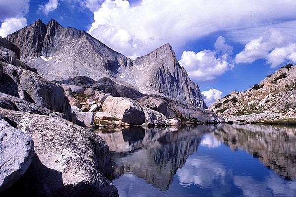
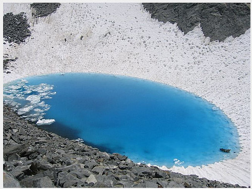
Turns out I'm in agreement again; the trip earlier this year that my wife thought was a killer (and got us back to Blue Lakes) was a "high loop" around Lyell in which we visited virtually all of the drainages that run off the flanks of Lyell, MacLure, Simmons, Rodgers etc. It was something I'd longed to do for a while, because I figured that the lakes/valleys in those areas were likely to be pretty underutilized, even though most of them run out to trails. Turns out it was a good guess, because we did not see another soul for 8 of the 11 days we were out. (However, there was one set of footprints from someone who'd been at Blue and went over to the Lyell Fork Lakes). Anyway, both the Hutchings Creek drainage and the Lyell fork of the Merced (and that great series of azure steppingstone lakes on its East side) were absolutely spectacular. However, the wildest visuals on the whole trip came from a pothole lake at the end of the basin a little south and east of Simmons peak. With ice trapped below a layer of melt, it was among the most intoxicating blues I've seen in the Sierras (and all the more incongruous, because it was barricaded by dark rock and snow). Anyway, once I figure out how to get photos posted, I'll illustrate. The only downside is that by the time we reached Blue Lakes, the early July fires that were sweeping the Owens valley had kicked up enough smoke that those stunning views to the south that you were waxing eloquent about were partially obscured. Still, I think the take home message is that it's hard to go wrong on either side of the Minarets/Ritter/Banner......
cgundersen
