Page 1 of 1
Question about Spiller Creek Cross-Country route
Posted: Tue Jul 14, 2020 10:18 pm
by Flamingo
Hi All,
I'm looking at a loop trek in Yosemite this weekend that would involve walking cross-country from the PCT, up Spiller Creek to Horse Creek Pass. It looks straightforward on Google Earth, but---oddly---I can't find much online about this x-country route, except a couple random trip reports. Is there anything special I should know? Which side of Spiller Creek is the best route?
Thanks!
Re: Question about Spiller Creek Cross-Country route
Posted: Wed Jul 15, 2020 5:10 pm
by Sierraholic2
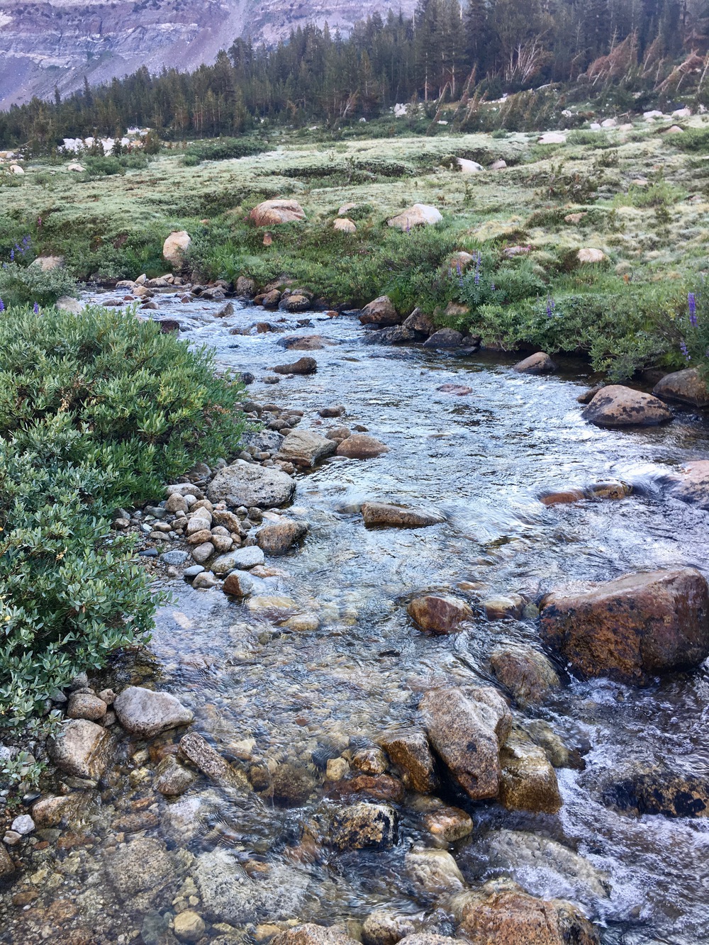
My wife and I did a loop over Horse Creek Pass, down Spiller Canyon, north on PCT, up to Burro and Crown Passes, then back to Twin Lakes several years ago. If you coming from the PCT from the south heading north up Spiller Canyon, this is the way we did it (in reverse from you) and it seemed relatively easy and not too much bushwhacking down near the PCT. Written from your perspective, at the junction of the PCT with Spiller Creek, follow the use trail up the creek in a northwestern direction. You will see an impressive 20 foot waterfall and then some cool rock tubs in the creek that are great for bathing or chilling out in. There is a great campsite just up the hill from the rock tubs with awesome views of Virginia Canyon and Sky Pilot Col. Not too far past this, cross the creek to the westside and meander a little uphill through trees. After a few hundred yards, you should hit the avalanche zone with lots of downed trees to scramble around and over. Not too far after the avalanche zone, cross back over to the eastside of the creek, and from there it is an easy open trek up to the obvious pass and lakelet at Horse Creek Pass. The views and overall scenery in Spiller Canyon are some of the finest in the Sierra. Enjoy your trip!
Re: Question about Spiller Creek Cross-Country route
Posted: Thu Jul 16, 2020 1:00 pm
by stephen_sd
In 2019 I went over Burro Pass (north to south) and spent a night on the south ridge of Whorl Mountain at about 10350' with a great sunset and views. The next day I descended into Spiller Canyon and went south to the PCT. So I've done the lower half of your route from PCT to Horse Creek Pass.
I stayed on the west side of the creek but only because that was the sided I started on. It was straightforward travel mostly through open forest. Things were still pretty wet from snowmelt that trip so I stayed a bit higher than the creek meadows in most places. As you get closer to the PCT there are some use trails. I don't remember any major obstacles or challenges on that part of the route. That section of the trip from Sawtooth Ridge to Mount Conness was scenic and other than a few miles on the PCT I didn't see anyone.
Re: Question about Spiller Creek Cross-Country route
Posted: Thu Jul 16, 2020 2:19 pm
by stephen_sd
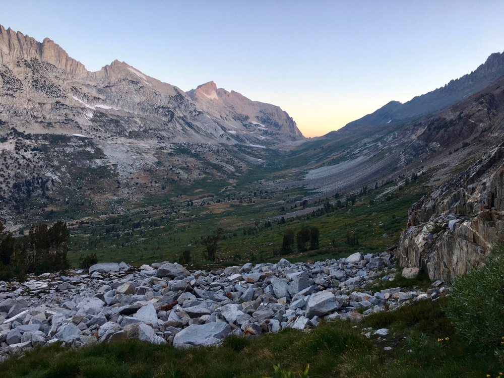
Found a couple pictures for you. The first is late in the day and the next is at sunrise so the canyon is in the shade but here they are:
1) Looking north - up Spiller Creek with Virgina and Stanton Peaks

2) Looking south the next morning - down Spiller Creek with views of Sheep Peak and Mount Conness to the southwest.

Re: Question about Spiller Creek Cross-Country route
Posted: Thu Jul 16, 2020 3:00 pm
by maiathebee
Ha! I just posted asking about Spiller canyon before I saw this. If you're back in time to give me beta on Horse Creek / Spiller I'd love that fresh info as I'm headed up Horse Creek over the pass to Spiller on Tuesday.

Re: Question about Spiller Creek Cross-Country route
Posted: Thu Jul 16, 2020 4:14 pm
by LMBSGV
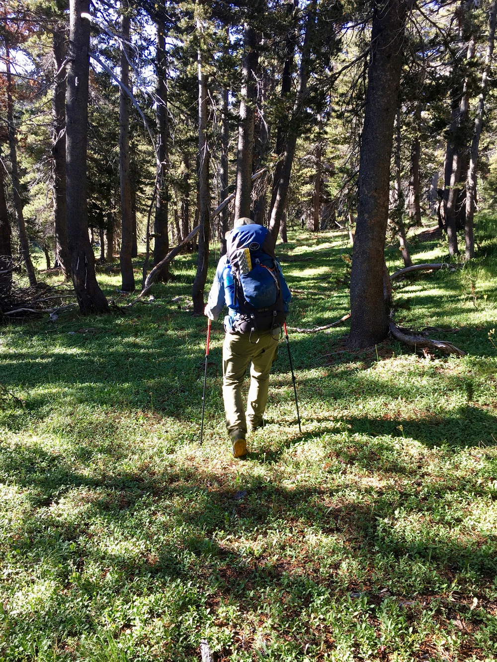
Last year, I found the hike up Spiller Creek Canyon to be spectacular and pretty straightforward. There is one point where you need to go up around away from the creek to avoid bushwhacking. Above that section, the numerous downed trees are annoying, but easy to get through. I crossed over to the west side above the section with the downed trees since the walking was easier on that side.
The trip report is here with the Spiller Creek Canyon section are pages 9-13.
http://laurencebrauer.com/Images/TripRe ... 19-map.pdf
Re: Question about Spiller Creek Cross-Country route
Posted: Thu Jul 16, 2020 5:15 pm
by jimmyjamhikes
Spiller Canyon is some of the most gorgeous and easy cross-country I have ever done. You will love it!
https://jimmyjamhikingclub.com/2017/09/ ... er-canyon/
Gloriously easy cross-country
Spiller Creek
Upper Spiller Creek and Dead Horse Pass