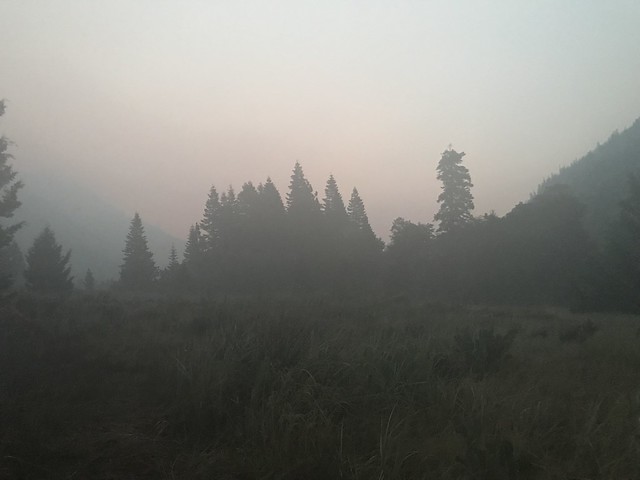
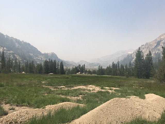
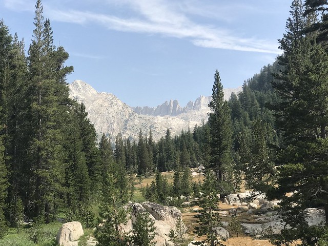
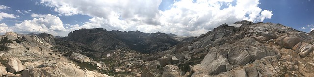
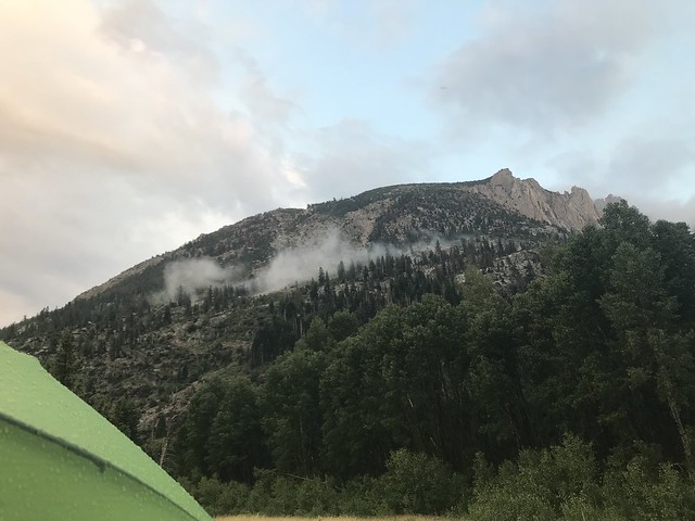
Left the Santa Cruz area around 7:30am. Stopped in Davis to pick up BIL and nephew. Left Davis at 12:15 to head over to Bridgeport to get permit. We made it just in time, arrived at 4:15, office closes at 4:30 during the summer. Grabbed a quick bite at the Jolly Kone (excellent soft serve ice cream), and then headed to the trailhead. The trailhead is at Arnett’s Mono Village. Parking is $10. Check in at the kiosk. They are informative as to where to park and how to get to the trailhead. To get to the official trailhead, one must wander through the RV campgrounds (look for the yellow rectangles placed on the trees), approximately ½ - ¾ mile from the backcountry parking area. It’s a gradual climb for the first 3 – 3.25 miles through sagebrush, aspens, and some conifers. The canyon is amazing. Sawtooths high on your left, and steep canyon walls (with remnants of many rock slides) on your right. As we got on the trail at 5:30 pm, we camped a few miles in. Our campsite was at the mouth of Little Slide Canyon, just shy of the aspen and conifer grove with Robinson Creek flowing a short distance away.
July 15 – Robinson Creek Canyon at Little Slide Canyon Campsite (7,622 feet) to Crown Lake (9,456 feet), approximately 6 miles
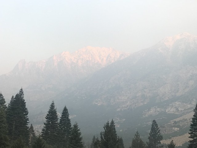
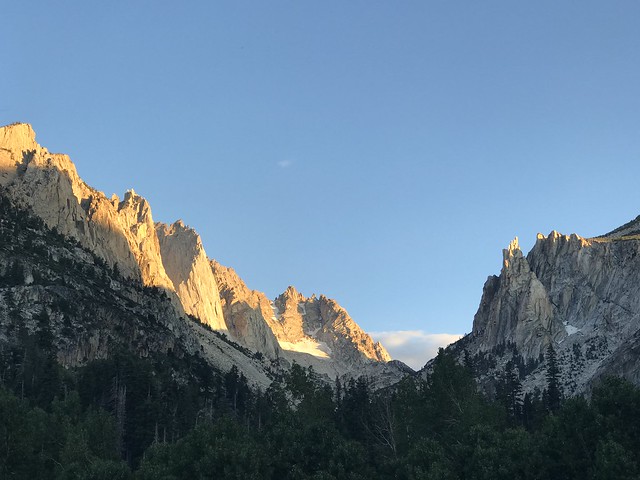
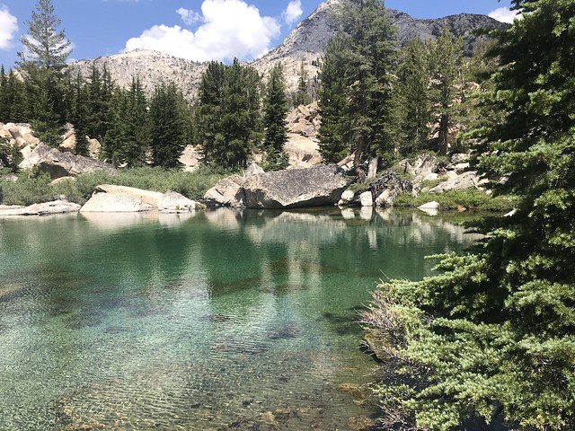
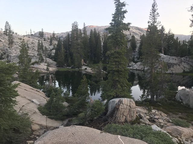
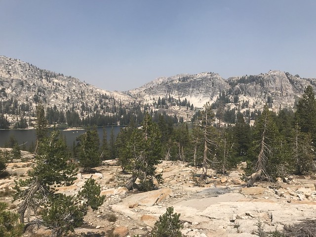
This was going to be a big climb day. Crown Lake was the destination, 6 miles and 1,800 feet above us. We started before 8 and noticed a haze as we reached Barney Lake. Little did we know, but the Ferguson Fire was getting cranked up on the Highway 140 corridor to Yosemite’s west. The early start helped with temps and air quality. Barney Lake is nice, however, it is a popular day hiking destination, so impacts are noticeable. As you leave Barney Lake, you pass by marshy (probably mosquito-infested) area where Robinson Creek feeds into Barney Lake. Luckily, the trail is far above this area. Aspens gave way to more conifers as we climbed higher up Robinson Creek. Eventually, at a confluence of Robinson Creek and a creek that is fed from Peeler Lake, the switchbacks started. As switchbacks go, these weren’t bad. At times, they were long, gentle grades with short climbs interspersed. We hit the junction to Peeler Lake, and we saw the hiker population drop dramatically. I was looking for a little more seclusion on this trip. We climbed further and reached the Robinson Lake group. The first pond has a rich aquamarine color and makes for a nice lunch spot. The other two are nice for fishing (so says my nephew). More climbing after the Robinson Lakes to get to Crown Lake (about a mile from Robinson Lakes). Got to Crown Lake and headed to the east side of the lake, opposite of the trail. Campsites looked better from the aerial research, and there are small use trails that lead to the campsites. Crown Lake is snow/glacier fed, so it is cold, but the scenery is incredible with Crown Point and Slide Mountain hanging above the lake.
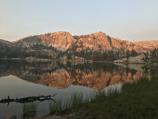
July 16 – Crown Lake (9,456 feet) to Seavey Pass (8,982 feet) approximately 11 miles with side trip to Arndt Lake
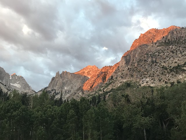
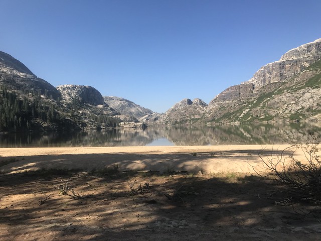
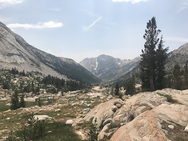
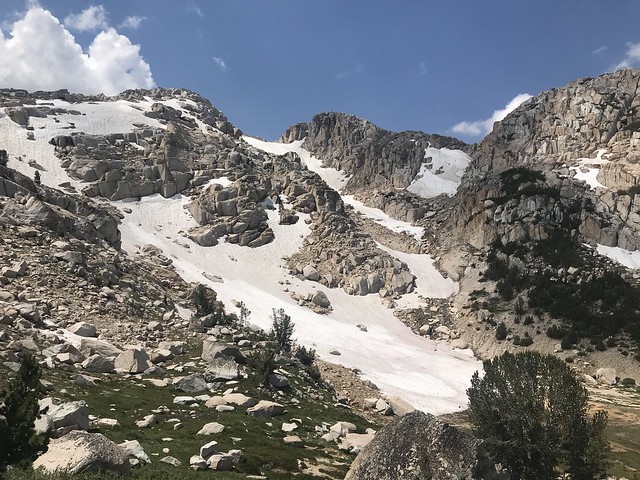
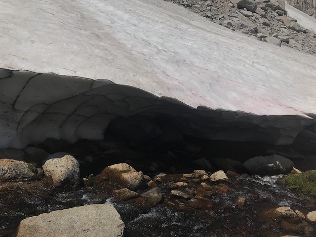
Today’s journey included our first of four 10,000+ foot passes. We started with switchbacks leaving Crown Lake. The switchbacks were in decent shape. Some were long and gentle, some were short and steep. There was some evidence of erosion, likely from a strong rainstorm on the afternoon of the 14th that we heard about from passing groups of hikers. We passed the junction to Mule Pass (whose sign is in desperate need of repair) and saw where we would be coming down later in the week. It looked like an intense drop with some snow fields mixed in. We eventually reached Snow Lake, just shy of Rock Island Pass. Snow Lake sits in a bowl whose outlet drops steeply down Robinson Canyon. It was interesting to see one of the main headwaters of Robinson Creek, the other being a glacier on the descent from Mule Pass. The trail from Rock Island Pass to Kerrick Canyon is not frequently travelled. We saw no one between our departure from Crown Lake to just before we got to the junction with Kerrick Canyon. Several trees blocked the trail, and at times the trail was rutted from run-off. The fascinating part was the distinctive tree-line. Small scrubby conifers at the pass gave way to larger conifers just a few hundred feet down in elevation. Upper Kerrick Canyon resembles a larger Jack Main Canyon. It is wider and has less tree cover. Rancheria Creek meanders through the upper canyon before it takes its steeper drop. We took a side trip to Arndt Lake for lunch. Arndt Lake deserved more exploration, but smoke from the Ferguson Fire was thick, so energy was conserved. Heading back to the trail, I took a spill into Rancheria Creek. It was a stupid mistake that I learned from – when using trekking poles crossing a creek, never make a straight line with the poles and your feet. Always try to make a triangle, balance is a million times better. Ended up with a whopping bruise on my knee, but luckily that was it. We finally reached Seavey Pass. Going through at the end of the day, it seemed to never end, as was expressed to us by a PCT hiker that looked as tired as we were. Our goal was to shoot for the funny shaped pond east of the large southern pond, however, we found a campsite on the east side of the large southern pond that didn’t involve climbing down 100-200 feet. Mysteriously, the mosquitos were absent for much of our evening, however, once the sun went down, they came out in full force. It was bedtime anyway, so into the tent we went.
July 17 – Seavey Pass (8,982 feet) to Smedberg Lake (9,229 feet) approximately 7 miles with side trip to Benson Lake
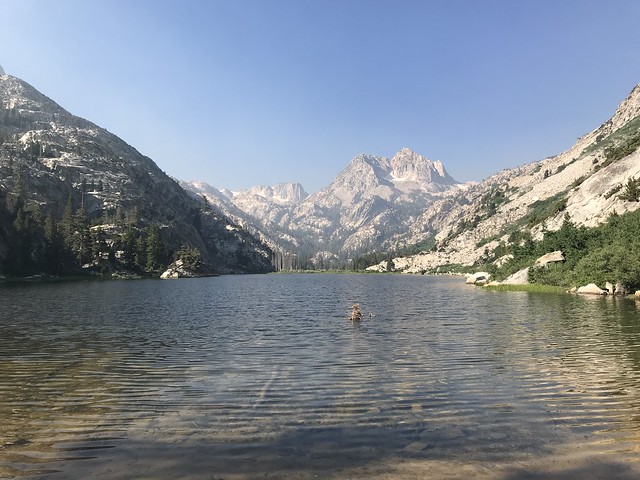
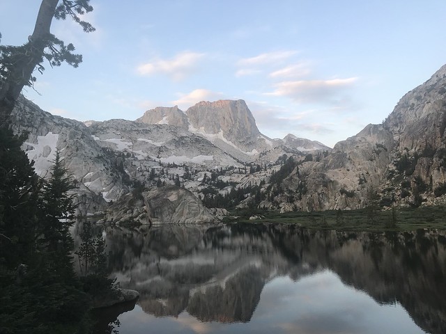
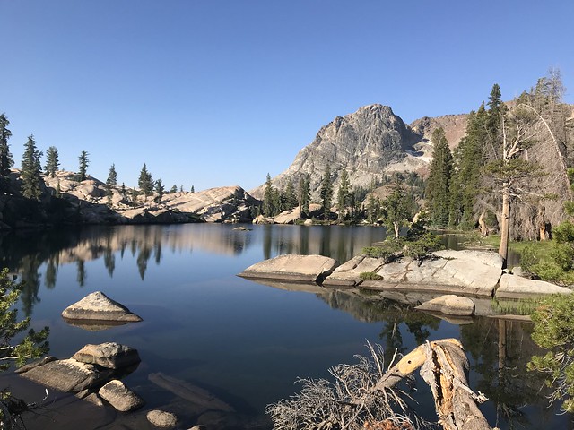
Today was going to be a hard day. Slightly limping from my Rancheria Creek tumble, the drop from Seavey Pass to Benson Lake was a little painful. Fortunately, we started early, so we got to Benson Lake after everyone had left. On the way down, we passed several PCT hikers going up. We also met Ranger PJ on her way up. She asked to see our permit and about our bear canisters, as well as how our trip was going. She also asked about the trail conditions from Rock Island Pass. We reported to her about our observations, and she said that a trail crew was expected to head in that direction in the coming days/weeks. It was a nice snack spot and it provided my nephew some of the largest fish he landed for the entire trip. His report was that the mouth of Piute Creek was where to catch them. It would be nice to spend more time there, perhaps on a future trip. After getting back to the main trail, we began our climb up to Smedberg Lake. This year was different from last year when we made this climb. Last year we had a thundershower shield us from the sun and higher temps, not so this year. We had smoky sunshine and temps in the mid-70s. We had lunch at the last creek crossing before starting up the final set of switchbacks. During that lunch break, a German PCT hiker happened by. He was a pleasant man. He was 71 and hiking the PCT alone. After returning from the trip, I saw that the PCT Facebook page had posted that he was missing at some point in time (He later checked in with his family and was listed as found), but it was shocking to see that post and know that we had lunch with him. I still called the Sheriff’s Office to say when and where I had contact with him on the off chance that he was still lost. Switchbacks finally behind us, we arrived at Smedberg Lake. After a nice swim and some relaxation, it was dinner, watch the sun set, and bed.
July 18 – Smedberg Lake (9,229 feet) to Matterhorn Creek/PCT Junction (8,255 feet) approximately 6 miles
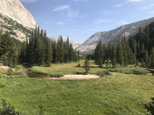
Slower start today. Hit the trail at 8:30. The climb from Benson Lake was tough. I awoke to what I thought was fog on Smedberg Lake only to find out (and smell) that it was heavy smoke. The day was looking ominous. I was worried that the climb to Benson Pass was going to be rough due to the smoke, but as we got on the trail, the air started to mix, and the smoke lifted. It was still visible, but it wasn’t a blanket. Benson Pass was our second 10,000+ foot pass to cross. We met a PCT hiker by the name of Country Gold who was taking a break. He was going to bow out once he got to the Sonora Pass. The descent down to Wilson Canyon was uneventful. We had lunch in Wilson Canyon beside some refreshing pools (at least according to my BIL). Further down the canyon and then dropping into Matterhorn Canyon, we passed a group of Girl Scouts on their way up to Benson Pass. They were on the exposed granite at the mouth of Wilson Canyon, and looked beat. I couldn’t blame them, it was hot. I took pity on the hikers going up to Benson Pass. That must be a tough climb from Matterhorn Canyon. After cruising up Matterhorn Canyon, we arrived at a campsite near the junction of Matterhorn Creek and the PCT. It’s a relaxing campsite that we have used before, and it was nice to arrive with plenty of time to relax and soak in the surroundings.
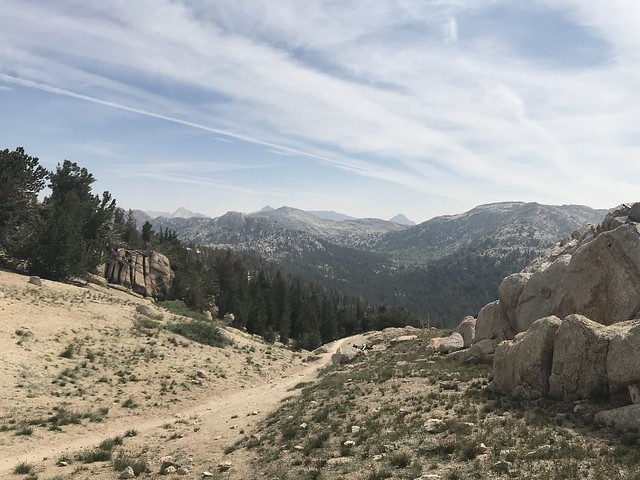

July 19 – Matterhorn Creek/PCT Junction (8,255 feet) to lakes below Burro Pass (10,304 feet) approximately 7 miles
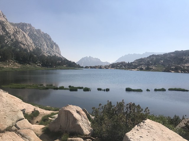
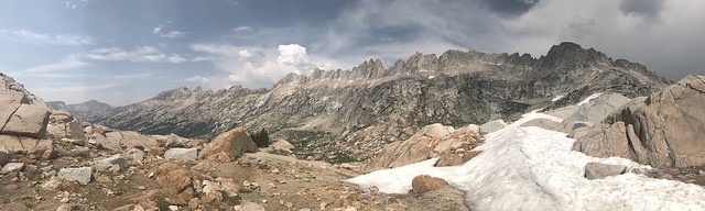
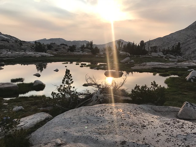
Seeing new territory is exciting. Of all the portions of this trip, this was the day I was looking forward to the most. I had a feeling that we were about to go to a place where people were scarce, and I was right! From 8:30 on the morning of the 19th to around 2:30 in the afternoon of the 20th, we saw no one. On top of the experience of climbing our highest 10,000+ foot pass, Burro Pass, we had the jagged Sawtooth Range to look at for most of our climb. The climb, for the most part, was steady. It wasn’t until we got closer to Burro Pass that the trail got steeper. There were a few switchbacks, and they were short and steep. The views, however were worth the effort. The long view back down Matterhorn Canyon, Whorl Mountain, Matterhorn Peak, the Finger Peaks, the headwaters of Matterhorn Creek, it was so worth the effort. The smoke was cooperating with us, and the skies spawned thundershowers. Our time on Burro Pass was limited due to an approaching storm, so we hustled down to the lakes (tarns, more like it) below Burrow Pass. We saw some lightning, heard some thunder, and had a brief rain shower. Then, the skies cleared and gave us a wonderful afternoon/evening. Strangely, the mosquitos were smaller at this lake and were much more persistent. We were chased into the tent by the ferocious beasts. It was time to sleep anyway.

July 20 – Lakes below Burro Pass (10,304 feet) to Robinson Canyon Campsite at the mouth of Little Slide Canyon from July 14 (7,622 feet) approximately 11 miles
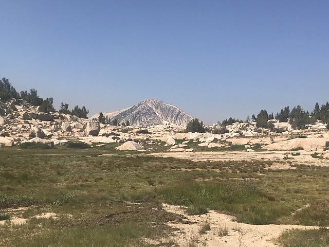
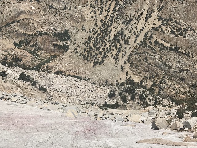
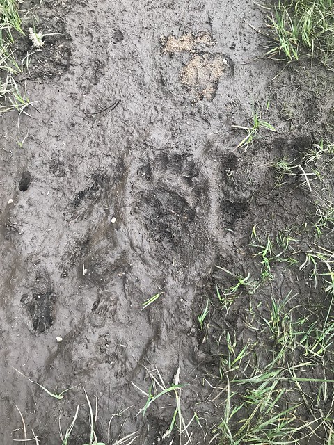
Before drifting off to sleep the night before, my companions and I reviewed the map about the possibility of setting up for an early exit the next day. Originally, I had planned to end at Crown Lake on this day, but we were ready to be home. We tossed around the idea of going from our current destination (below Burro Pass), a distance of about 13 miles. When we started thinking that we still had a four-hour drive back to my BIL’s, we thought better and decided to try for our campsite from the first night. After all, we still had our last 10,000+ foot pass to cross and a 3,000 foot descent to get to that campsite. In actuality, we had an 800 foot descent to get to the base of the Mule Pass climb, a 1,000 foot climb to Mule Pass, and then a 3,000 foot descent. The first descent was fun. We followed Piute Creek as it gathered steam from all directions. We caught a glimpse of “The Slide” down Slide Canyon, and we were treated to some interesting avalanche remains (broken trees). The avalanche remains were similar to what we saw as we travelled up Matterhorn Canyon. With the steep canyon walls and heavy snowfall, I can only imagine what an avalanche would be like in these canyons. The climb to Mule Pass wasn’t too bad. At times there felt to be some false summits. I think that hitting two big passes less than 24 hours apart also played a part in my impatience to reach the top, but once at the top, wow! One is treated to a long view of Piute Canyon, the top of Little Slide Canyon, Slide Canyon, the Sawtooths, the Finger Peaks, and Matterhorn Peak. It was probably one of my favorite views. Coming down from the pass, we were in one of the headwaters to Robinson Creek. We saw what could potentially be the remnants of a glacier off to the left of Slide Mountain feeding the creek. A small lake sits above Robinson Canyon before it drops down into it. Steep, rocky switchbacks together with some small snowfield crossings led us down to the junction we saw several days previous on our way up to Snow Lake and Rock Island Pass. We were now back in somewhat familiar territory. Crown Lake lay below us and it wasn’t even 12:00 yet. Our plan to push on seemed reasonable. We passed Crown Lake and dropped down to the Robinson Lake group. We ate lunch between the large lake the middle lake. A rain shower passed and the drops on the lake were soothing. After eating, we dropped past the junction to Peeler Lake and descended down the switchbacks that eventually led us back to Barney Lake. We rallied at Barney Lake for the remaining mile or so to get us back to our planned campsite. We pulled in as a rain shower started. We cooked and ate quickly during the shower and then headed for shelter – just in time. The skies opened, and we were treated to a heavy rain for about 30 minutes. We had a few leaks at some of the seams on the tent fly, but no giant rivers given the intensity of the rain. Resealing the seams is now on my list of to-dos. A strange noise started, and at first I thought it was bears going after the bear canisters. My BIL thought it was thunder. Then, the sound started to make sense, after a rain that hard there were going to be rock slides. That’s exactly what this was. One of the chutes across and above us had some boulders tumbling down. Fortunately, it was far enough away from us to not pose a significant risk, but another life lesson learned – watch the chutes above in steep canyons. After the rock slide excitement and hard day hiking, sleep finally came.

July 21 – Robinson Canyon Campsite at the mouth of Little Slide Canyon from July 14 (7,622 feet) to Trailhead Parking (7,070 feet) approximately 3 miles
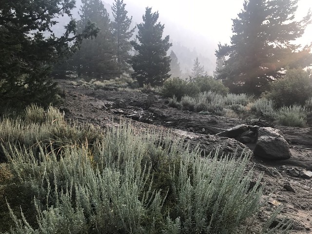
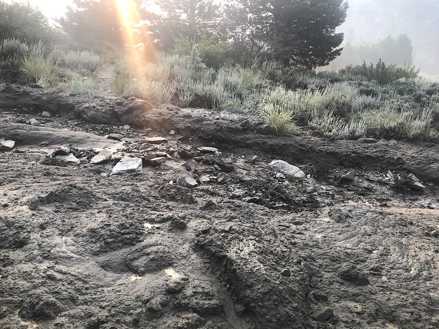
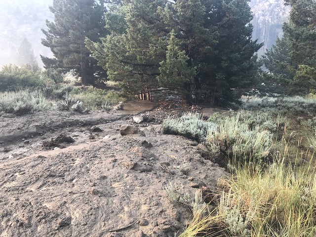
We were ready to get home. Up at 6, on the trail before 7. No breakfast this morning. We had plans to eat in Bridgeport. Fast hiking this morning. The only thing that slowed us down was the remains of a mudslide from the previous night’s storm. It was maybe 15 feet across and came from way up on the canyon wall. There were rocks as big as dorm refrigerators in this mud flow. What a sight that must have been! Smoke was also very bad this morning. Some of the mountain tops were not visible with all the smoke. We finally made it back to the car. Luckily, it was not surrounded by a puddle like some other unfortunates in the parking lot. Off to the Bridgeport Inn for breakfast and then the journey home.