TR: Circle of Solitude + Longley/South Guard, 6/30-7/7
Posted: Thu Jul 26, 2018 11:08 am
A long trip means a long trip report, but hopefully the photos will keep your interest
Day 0 (5’45” drive): We (myself and my wife, Caroline) got a late start out of Oakland (9:30pm), but made it to Bishop by 3:15am via Tioga Pass/Yosemite. We pulled over on a road a couple miles outside of Bishop, right off the 395, cracked the windows, and slept for a little over 3 hours.
Day 1 (11 miles, +2900, -3900, trail): Onion Valley over Kearsarge Pass, through Vidette Meadow to Junction Meadow.
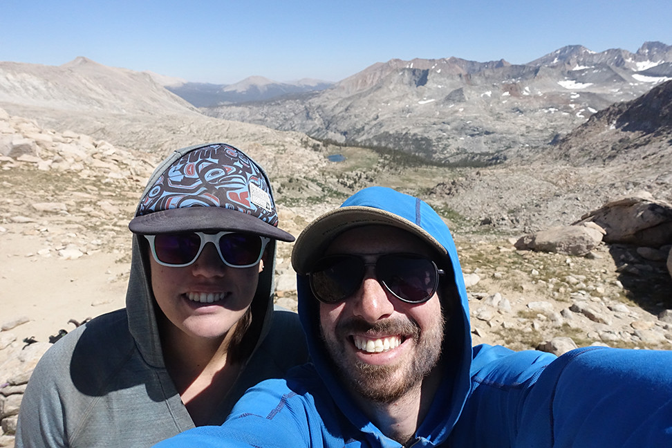
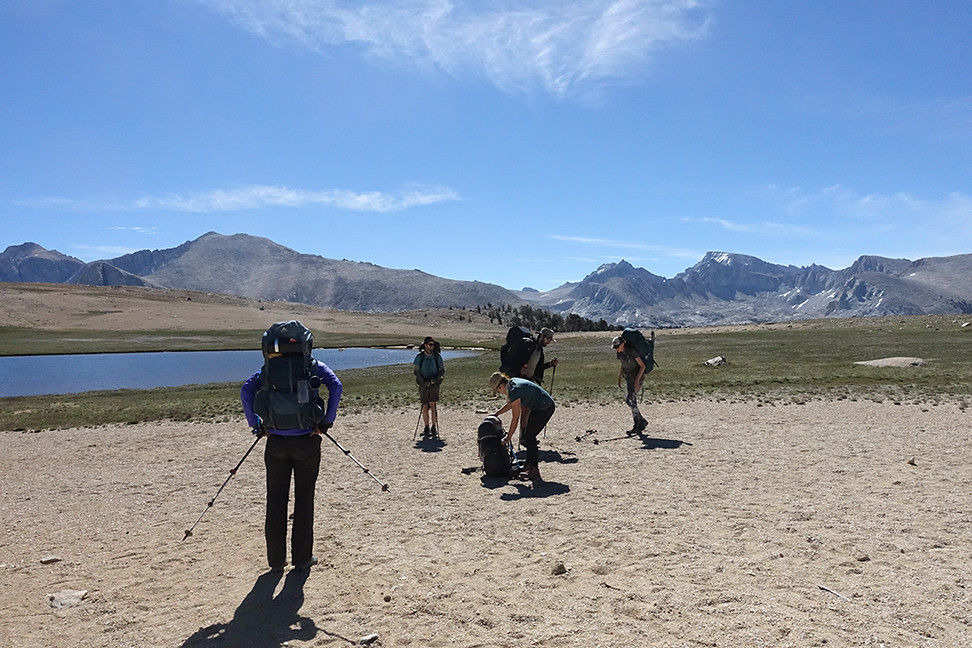
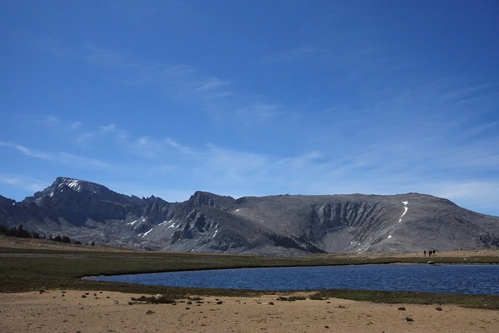
Waking up in Hotel Volvo never gets old. We had no issues getting walkup same day permits for Kearsarge Pass at the White Mountain Ranger Station (anyone else love the zany ranger who’s always there?) The drive up Onion Valley Rd was fun. There were lots of fellow hikers and backpackers on the trail up to the pass, which is beautiful but very exposed to the sun.
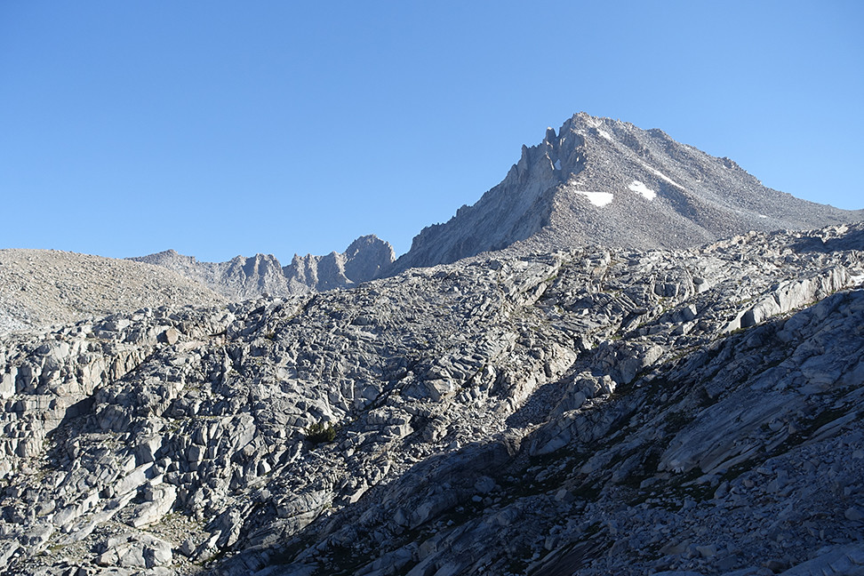
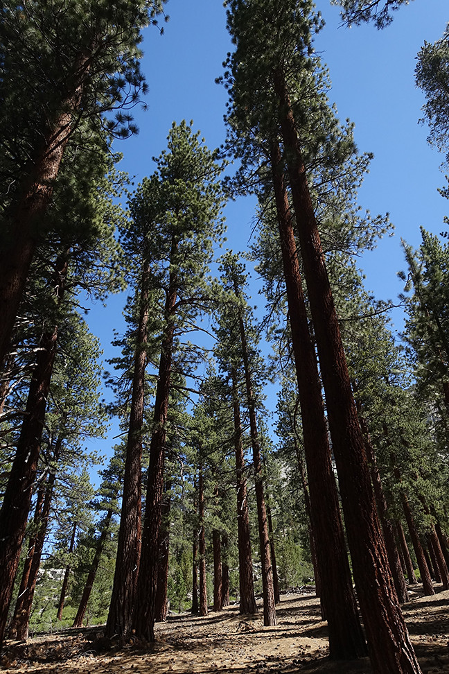
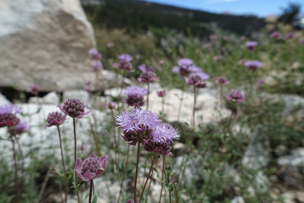
This guy was warming up from the cold evening on the warm pavement, and couldn't be bothered to move much (but wasn't dead). Clean and stoked Onion Valley Road getting smaller as we ascend a stairway to heaven Big Pothole Lake with University Peak in the distance A photo obscuring the crowds on the pass This friend was quite familiar with the bounty associated with all the human traffic... We chatted with some PCTers about the merits of shorts vs pants at a stream above Kearsarge Lakes. Kearsarge Pinnacles looked stellar and the flowers were out. I admired the views of Dragon Peak that emerged as we continued west away from Kearsarge Pass and Mt. Gould.
Mosquitos started pouncing as we descended towards Vidette Meadows.
Sooty grouse hen and chicks... soon after we could hear the hoots of at least one male, which we never were able to spot. Some backpackers warned us of a bear on the trail near Junction Meadow, and we saw it minutes later, ambling up the trail. When the bear saw us, it headed up the hill, off the trail, and munched on something on the ground, uninterested in its audience 30 yards away. It was small and alone, likely adolescent, but still, our first wilderness bear! (No decent pictures unfortunately, due to late afternoon shadows and limited telephoto)
We couldn’t camp at the sites with bear boxes north of Bubbs Creek due to a huge camp of trailbuilders. One of them suggested we cross the creek on some upstream logs, but that beta was sketchy - the first log, over Bubbs, went OK (it looks like its partial break will soon give out under some amount of weight), but the second log, over East Creek, was too skinny and covered in branches for comfort. We retreated to a mediocre but worn site north of the trail, near the East Lake trail junction, ate dinner quickly and crashed, ready to replenish our REMs.
Day 2 (4 miles, +2000, -100, trail): Junction Meadow to Lake Reflection; 3ft wade over Bubbs Creek
Having discussed our backup plans should wading Bubbs fail, we were heartened to hear from another couple that the wade in the meadow west of the East Lake trail was fine. It was easy to find a good place to cross, 3ft at its deepest. Elated, we took a short break to dry our socks and shoes and Leukotape our feet. I caught the last dozen feet of Caroline's wade on my phone. https://youtu.be/qCKo_na43Ck
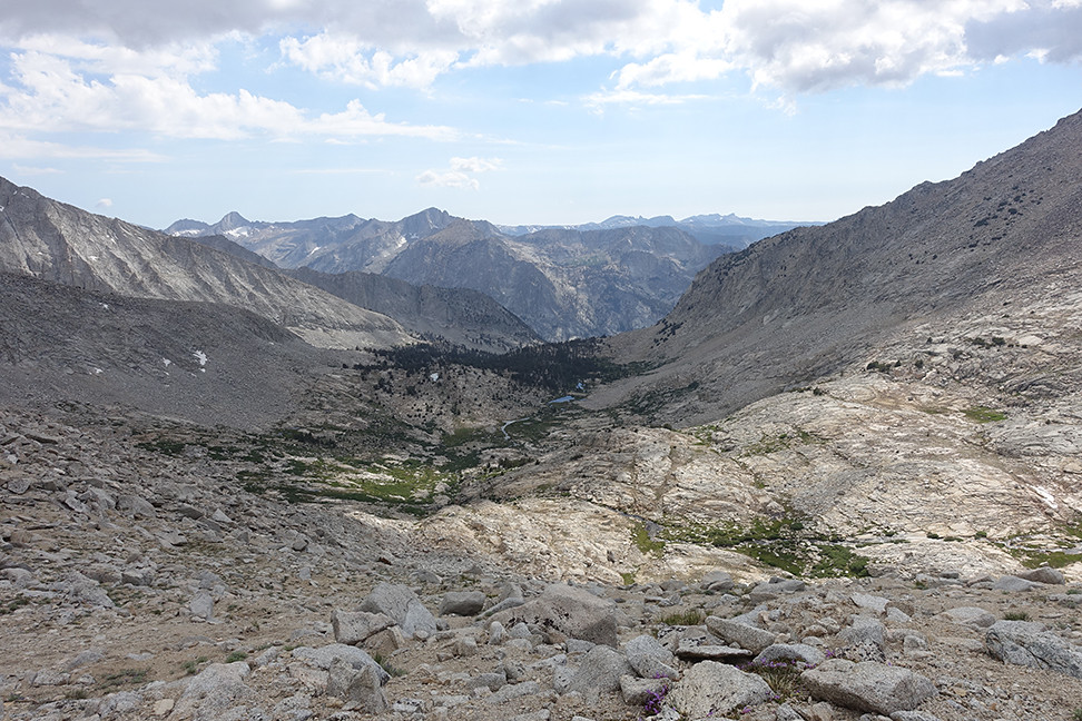
The trail to East Lake was pleasant, with many interesting views on all sides. Lots of flowers, mosquitos were mild. We saw some people at East Lake, including some trailbuilders, and a group that told us the area towards Lake Reflection had been quiet.
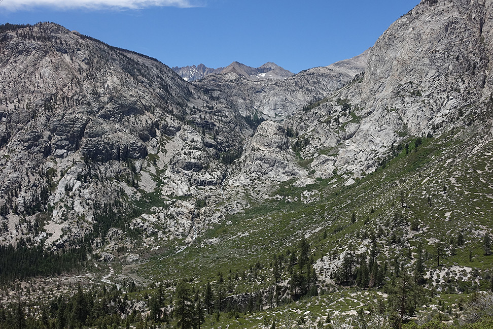
East Lake - I think that's South Guard on the right. After a lunch and foot break, we continued south and up to Lake Reflection. The trail became a little tougher and ambiguous/overgrown at points, but still enjoyable. The mosquitos got worse as we climbed through mud, dirt, sand, rocks, flowers, and storm debris. We lost the trail a few times, but our bearing remained obvious: up.
Plenty of flowers on the trail to Lake Reflection We reached Lake Reflection around 2pm, our work for the day complete. We camped on a granite slab north of the outlet pond that’s north of Lake Reflection, and a breeze kept the mosquitos at bay. It rained lightly/periodically all afternoon but we enjoyed the opportunity to rest and read. I took loads of pictures of fish jumping for mosquitos and got lucky with one, a true winner. The views south to Mt. Jordan were spectacular. We crashed early in preparation for our first xc day.
Coordinating with the jumping fish was futile; pre-framing and shooting on a count of ten repeatedly was not.

Day 3 (6 miles, +3900, -2300, xc): Lake Reflection to South Guard Lake, via Longley Pass, plus South Guard
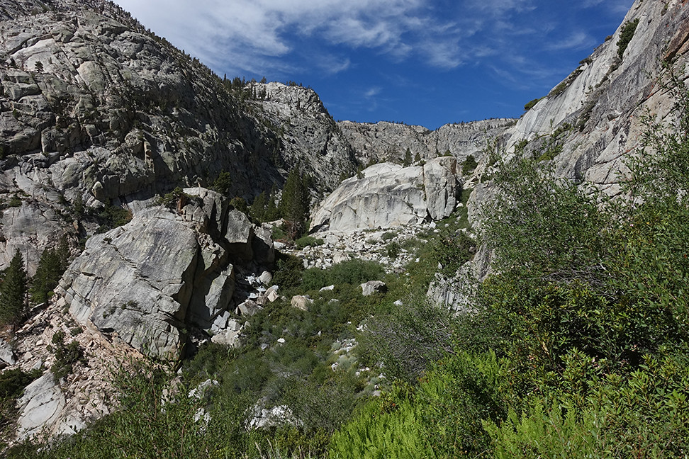
Our pace immediately slowed as we picked our way over Lake Reflection’s northwest shore, clambering up and down to avoid cliffs. Mosquitos were remarkably bad, worse than at our campsite.
The northwest shore of Lake Reflection:
It took us a bit more than an hour to reach the inlet stream to the lake, at which point we began heading uphill. We navigated through lots of variable terrain, including small pockets of forest, mud, flowers, bushes, and talus of all sizes. We took frequent breaks, still acclimating to the thin air.
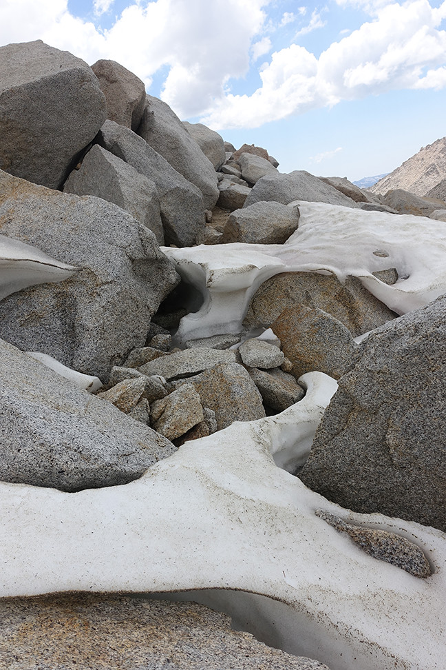
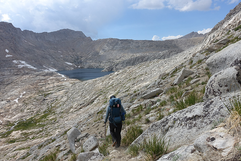
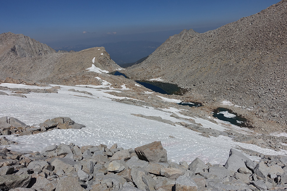
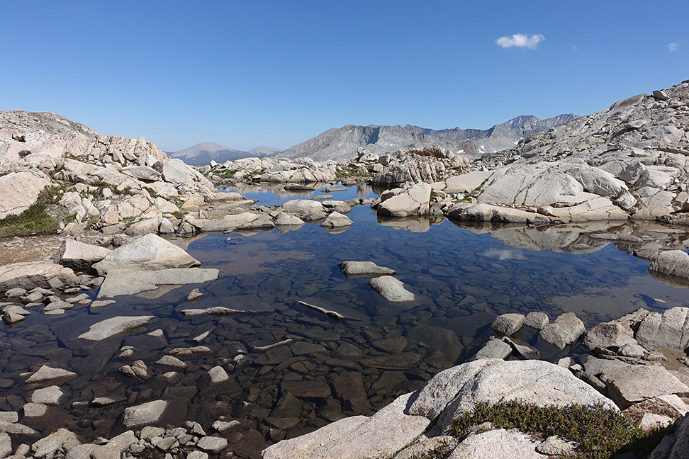
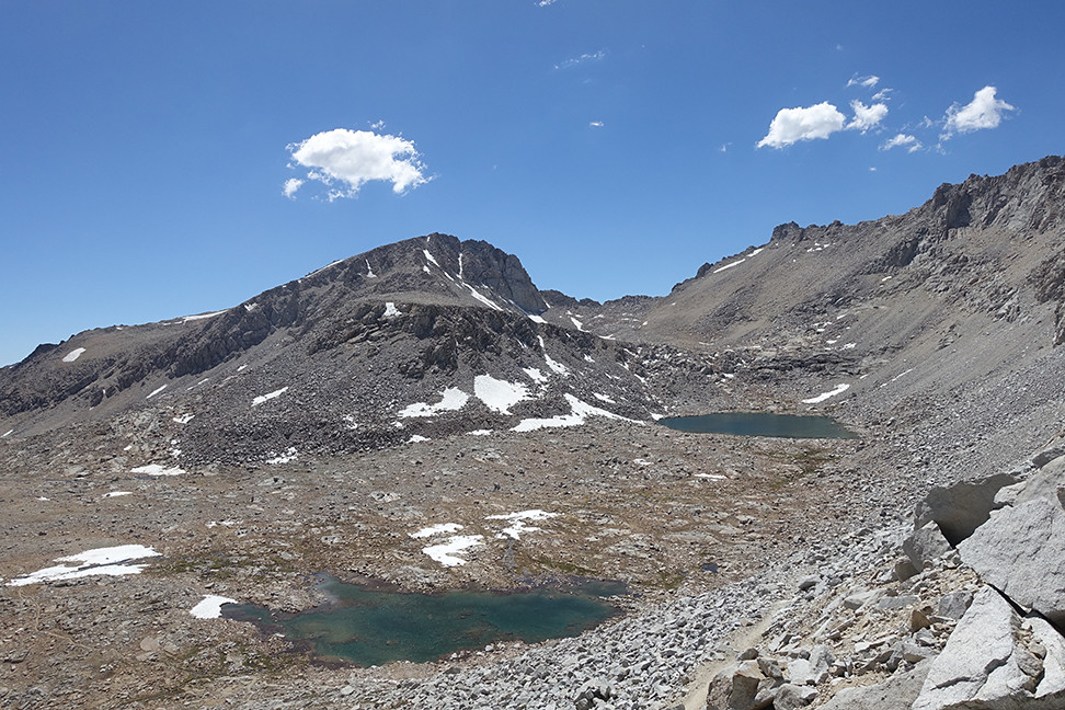
After quite some time, we reached a series of chutes but couldn’t pick out the greenest of them all as recommended. We instead picked one that we could class 2/3 send, and it deposited us on a granite outcropping just above the biggest lake, east of and below Longley Pass. (Two smaller lakes to the south were hundreds of feet below us).
The top of the chute:
Caroline ascending:
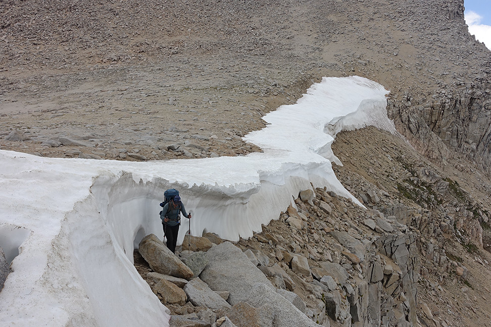
The big lake below Longley Pass, with a distant view of its cornice:
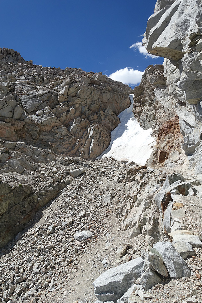
We ate lunch at that lake. I didn’t feel great but gulped down my food and one ibuprofen. We followed some ducks and seeming paths first northwest, past a tarn, and then more due west towards the pass. The cornice on Longley didn’t look doable from afar but I was hopeful it would look safer as we approached. We arrived at the tarn directly below the pass around 1:15pm. We took deep breaths, discussed our mutual veto power if we had to turn back, treated some water, and began following faint, switchbacking footsteps in the sandy ascent up the east side of Longley.
Our rockin' view as we ascended towards the pass:
The pass looms as we traverse over to a sandier portion of the route
Caroline following faint switchbacking footsteps, probably those of cgunderson and his wife
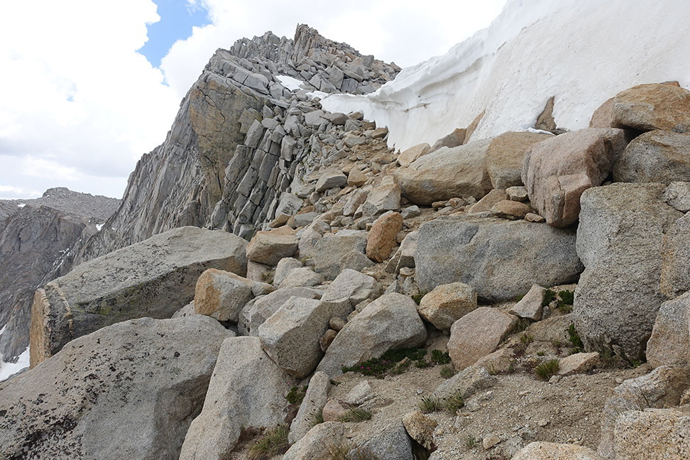
When we finally reached the cornice, we could see across the whole traverse, and our hearts soared - we could do it! We carefully picked our path across, basking in the moment - the grandiose cornice, the steeps on all sides, the cloud-peppered sky, our cortisol and adrenaline. The last part of the traverse was skinny, with significant exposure over cliffs, but the rocks and gravel behaved like well-trained horses under our feet. Cgunderson’s step over the cornice had melted to reveal an easy and very short class 3 scramble to freedom over the pass, and we whooped and hollered.
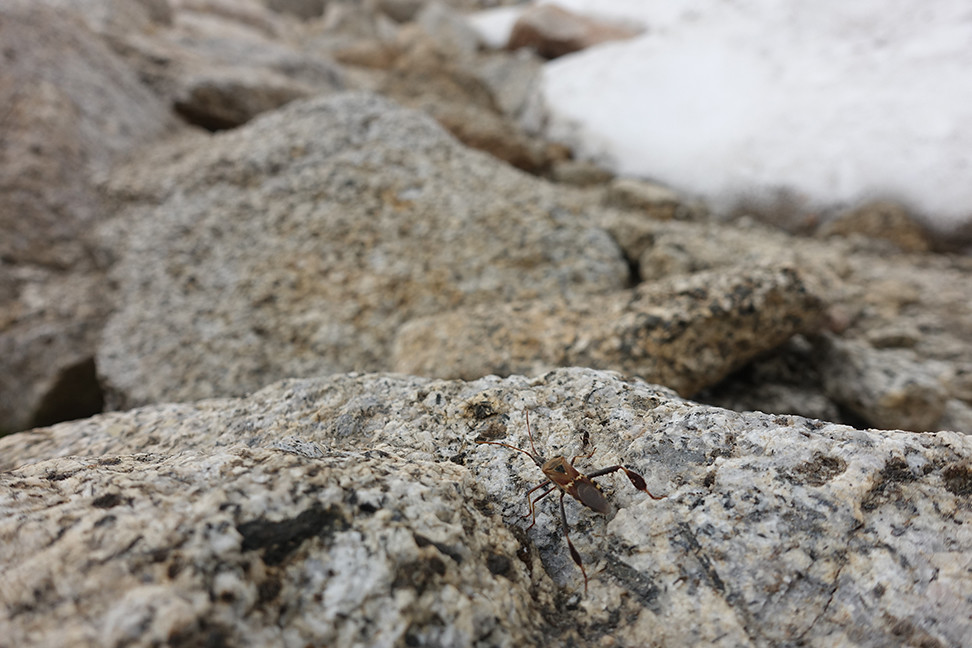
Possibly an assassin bug?
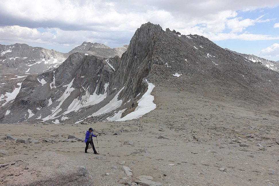
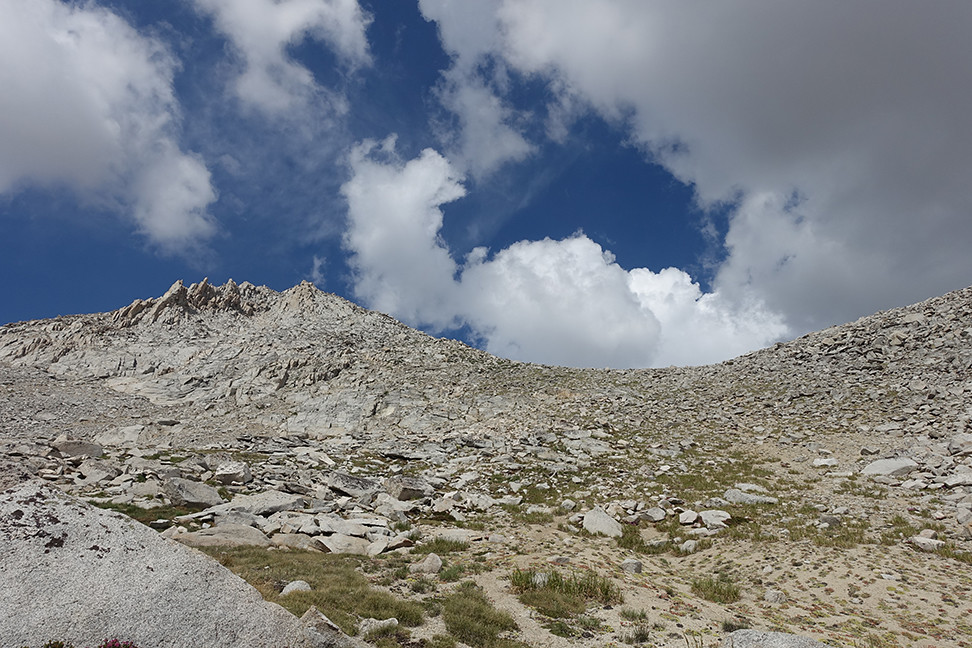
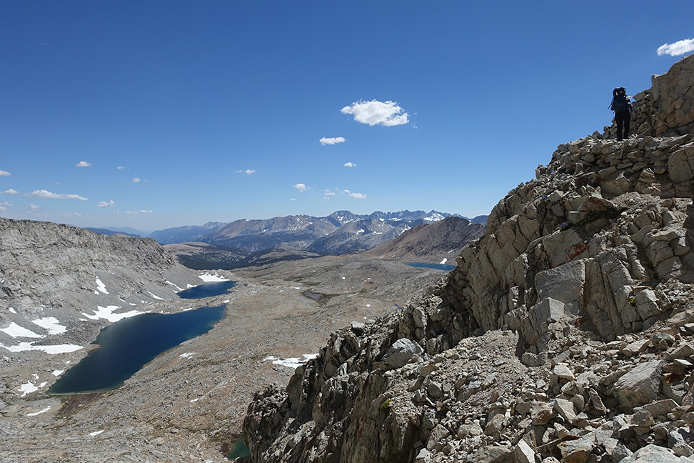
Our success inspired us to tackle the easy south slope of South Guard, since it was only 2:30pm. We stashed much of our gear and Caroline’s pack in some trash bags by a boulder, since there were storm clouds many miles off to the northeast (but blue skies and friendly clouds above us). I felt much better since lunch, but Caroline was losing some steam now, so I was happy to blaze our sandy switchbacks upwards.
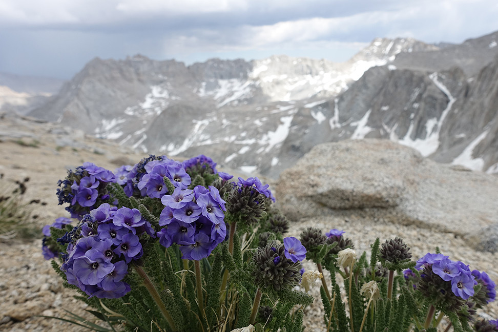
Sky pilot on South Guard's south slope
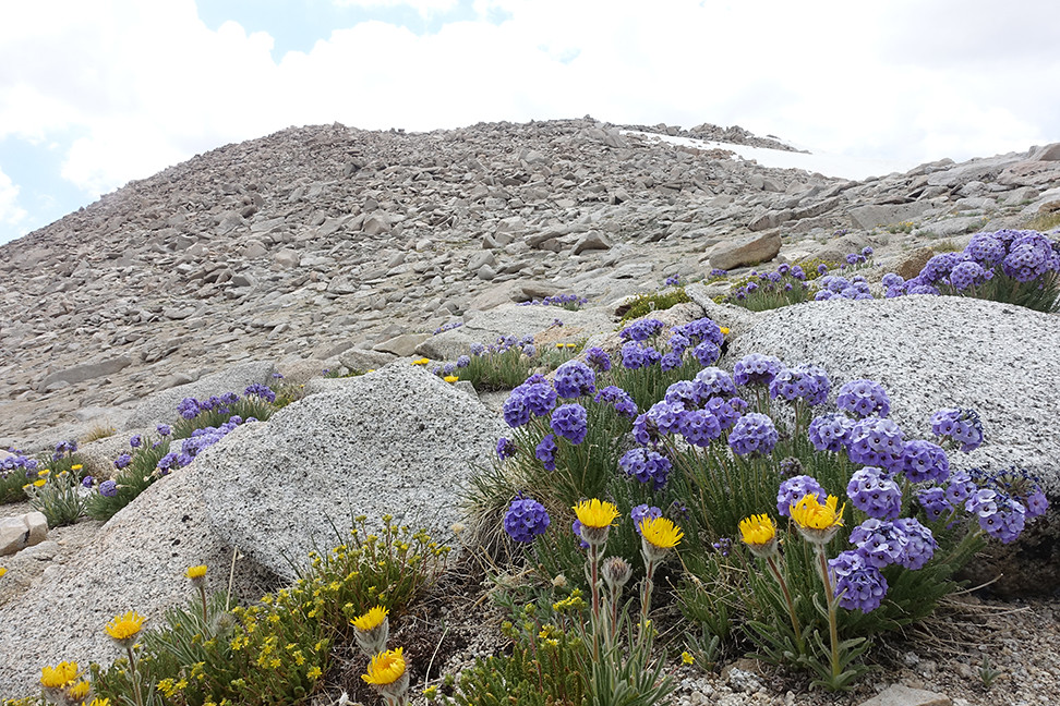
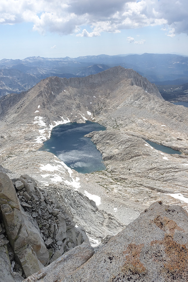
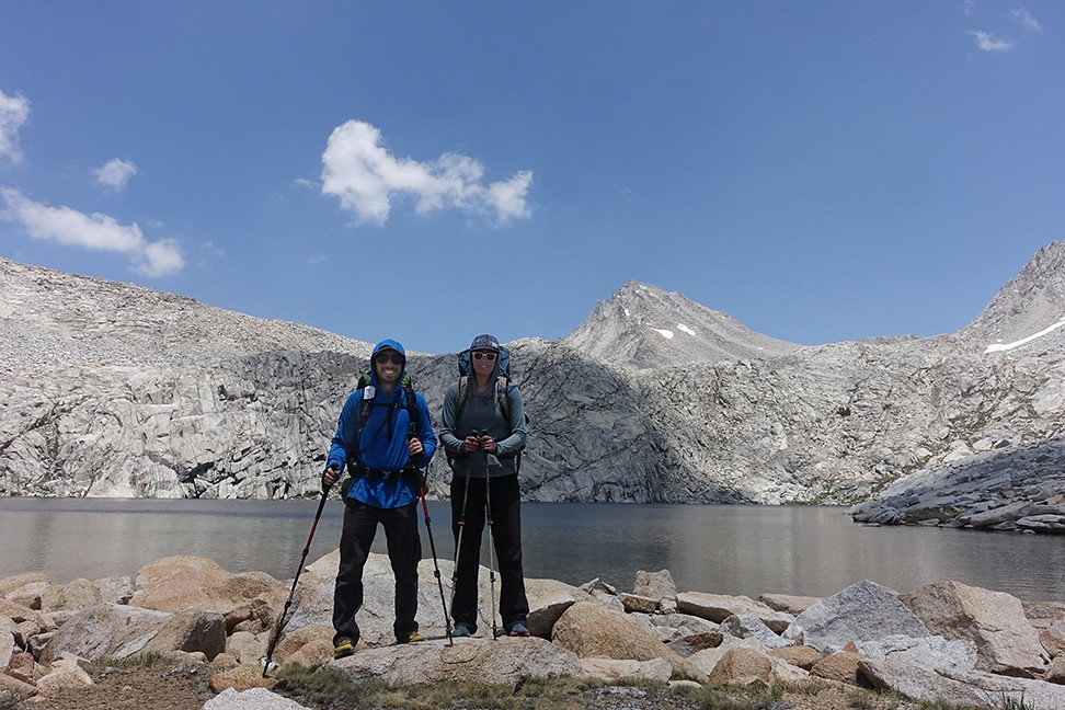
It took 60 minutes to summit, with plentiful sky pilots and flower friends among the rocks. We admired Brewer and the west ridge of North Guard, and South Guard Lake, our destination for the day, from the summit, and quickly descended to our gear in 30 minutes. We were so happy to have achieved what we thought was the biggest logistical hurdle to our long route.
South Guard Lake, from the summit of South Guard:
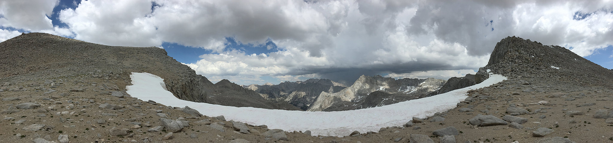
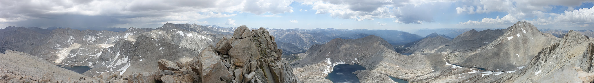
Summit panorama:
The end of our South Guard descent (which I partially ran down, so much fun with the sand)
The flat, mild top of Longley Pass (on the west side)
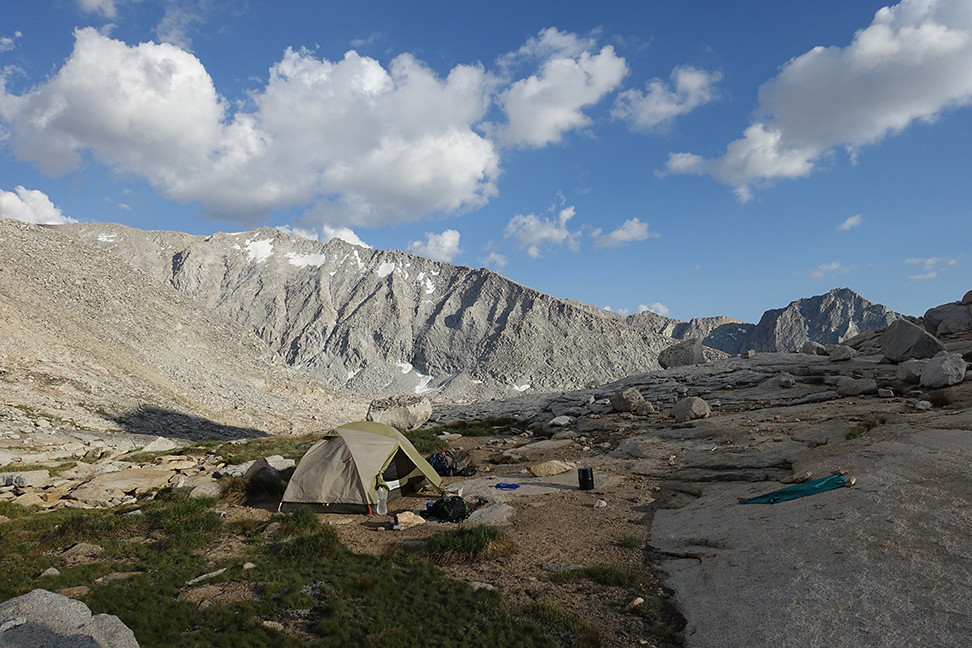
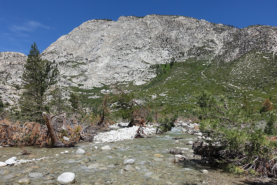
The descent to Cunningham Creek and then up to South Guard Lake was pleasant and pretty, and we scored a perfect campsite right by the outlet of the lake. It was interesting to camp at the exact same elevation as the lake itself, in the shadow of South Guard. Mt. Brewer’s south slope loomed in the distance, as did Thunder’s long western shoulder. We bathed, snacked, ate dinner, read a bit, and ended the day with a cannabis edible. Also, zero mosquitos on this side of Longley to this point.
Cunningham Creek on our descent
South Guard Lake and our campsite within reach
A view back up to South Guard on the left and towards Longley Pass on the right
Our campsite, right by the beginning of South Guard Lake's outlet, with a spectacular view of Thunder Mountain's long western ridge (behind me are views of Brewer and South Guard)
I woke up in the middle of the night, and used the opportunity to stick my head out of the tent and enjoy the moonlit moonscape of 11,500. There was no one around, not even little animals. Bliss.
Day 4 (7 miles, +1200, -4100, xc and trail): Exploration of Brewer’s south slope, then South Guard Lake to Big Wet Meadow via Cunningham Creek
Morning views of South Guard Lake, with Mt. Brewer in the distance and South Guard looming.... hnnnnnng
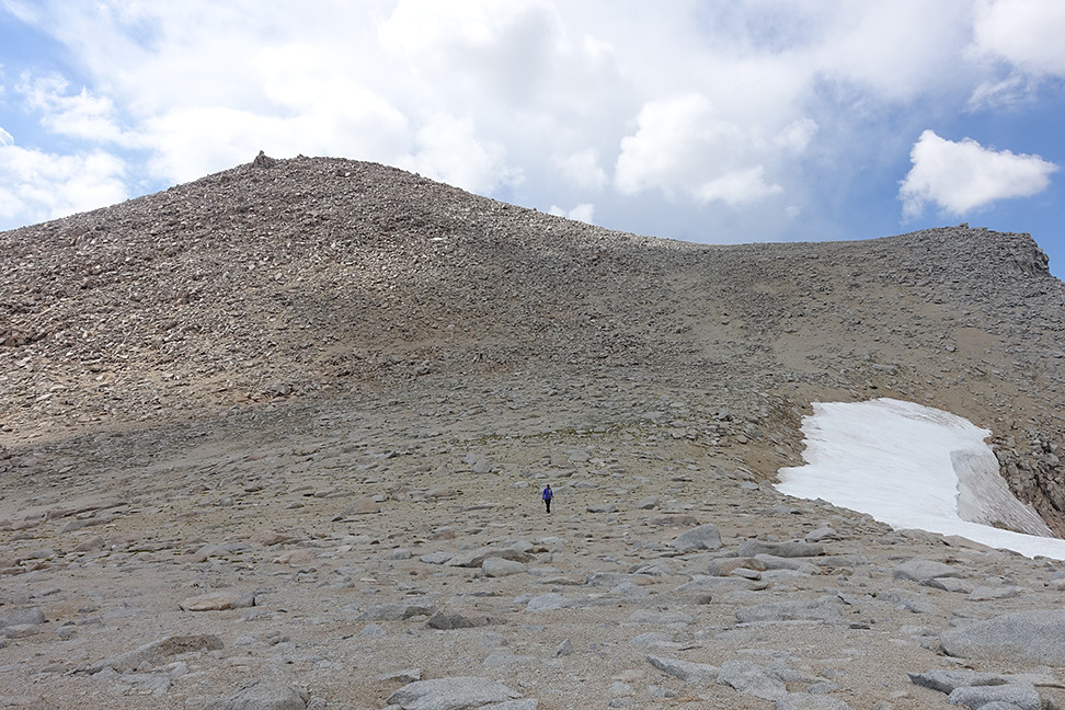
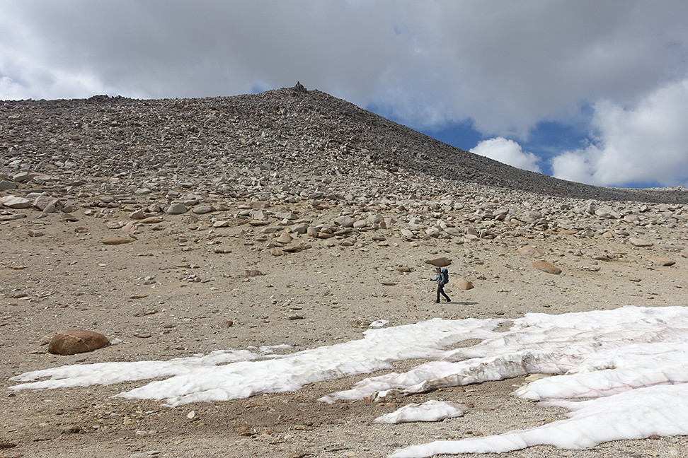
We wanted to climb Brewer via its snow-free southern slope, but snow proved to be too much on our approach. We used our microspikes on a few low angle snowfields but eventually, our decision to stay high on South Guard’s northwestern slope prematurely ran its course. We agreed to summit Brewer some other day, maybe via the northwest slope as a one-two with North Guard in the fall, or via the eastern ridge from East Lake, and we returned to our camp. The whole jaunt took nearly 3 hours but was still fun, with good views of Big Brewer Lake and parts of the surrounding passes and shoulders. Lots of snowfields everywhere, but if you stay low in this area, you’ll probably have no trouble bouncing between rock piles and crossing low angle snow.
One of our few views of North Guard behind Mt. Brewer, as we ascended hopefully towards the saddle between Mt. Brewer and South Guard
Looking back on South Guard Lake, across the talus and snowfields we had already traversed over
A mild snowfield, where our doubts began to grow
Where we stopped due to snow and the desire to enjoy more of our day
Probably doable but uncomfortable, steep and quickly softening snow
Looking down towards Big Brewer Lake and the various lower routes towards the Sphinx area
Defeated by early season snow but still smiling
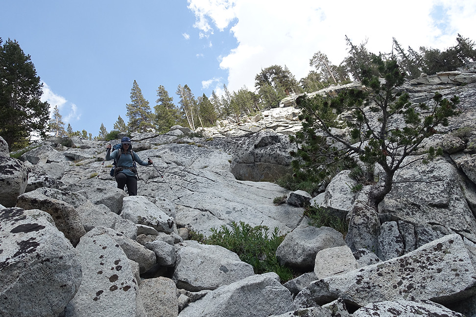
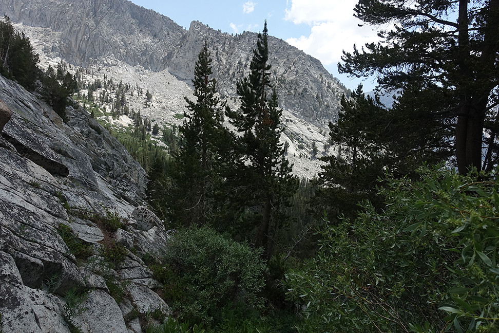
After eating at camp we packed up and began our descent down Cunningham Creek, our last significant xc segment. It was easy for the first mile and a half, but when it became steep, the going got rough. We couldn’t find the cow trail on the north side of the creek, but not for lack of trying. At one point we got cliffed out and had to backtrack, class 3, about 50ft up, before traversing further north, away from the creek, to reach softer and slightly milder terrain. After some tricky talus hopping we were carving our own switchbacks and edging in our trail runners down steep, steep soil, dodging trees and bushes when possible. It occasionally looked like trail but that may have been wishful thinking. It only eased when it got flat and forested.
The chute that eventually wouldn't go
The end of our chute
The more northerly acceptable descent
The second steep part of the descent was characterized by endless and tricky bushwhacking. So much manzanita and aspen! Super frustrating and we did our best to mutually prop up our morales. This time, when the slope relented, we were still left with more bushwhacking. I would love to see a picture of a cow or even a horse in this terrain, what the hell. I promised Caroline we wouldn’t do this again. We finally reached the trail in Cloud Canyon late in the afternoon and rejoiced, but had to keep walking — the skeeters were back, and we were now out of water.
Bushwhack bushwhack, but we escaped with very few scrapes or bruises

We hiked another few miles, grateful for trail, to Big Wet Meadow, where we were treated to views of Whaleback framed by flowers. We saw a teeny tiny frog on a rock at one point, like a message from the earth spirits that we’d be ok. We took a long break by the river to treat our water, rehydrate, and soothe our feet, what a relief to be out of the worst (I swear we normally aren’t this wimpy). As the sun retreated behind the canyon walls, we walked back to a good campsite in the trees, and we chatted with a solo, older male backpacker, who was also doing the Circle of Solitude but all on trail. He was surprised to see us, and while the feeling was mutual it was fun to have a minute of outsider connection. He had heard us earlier that day, probably while we swore at the local flora up Cunningham for obstructing our path.
Taken from the northern side of Big Wet Meadow looking south towards Whaleback
We ate quickly to avoid the mosquitos, and collapsed easily into our sleeping bags. The views weren’t otherworldy, but the simple comforts did their job.
Day 5 (7 miles, +3500, -2000, trail): Big Wet Meadow over Colby Pass to Gallats area
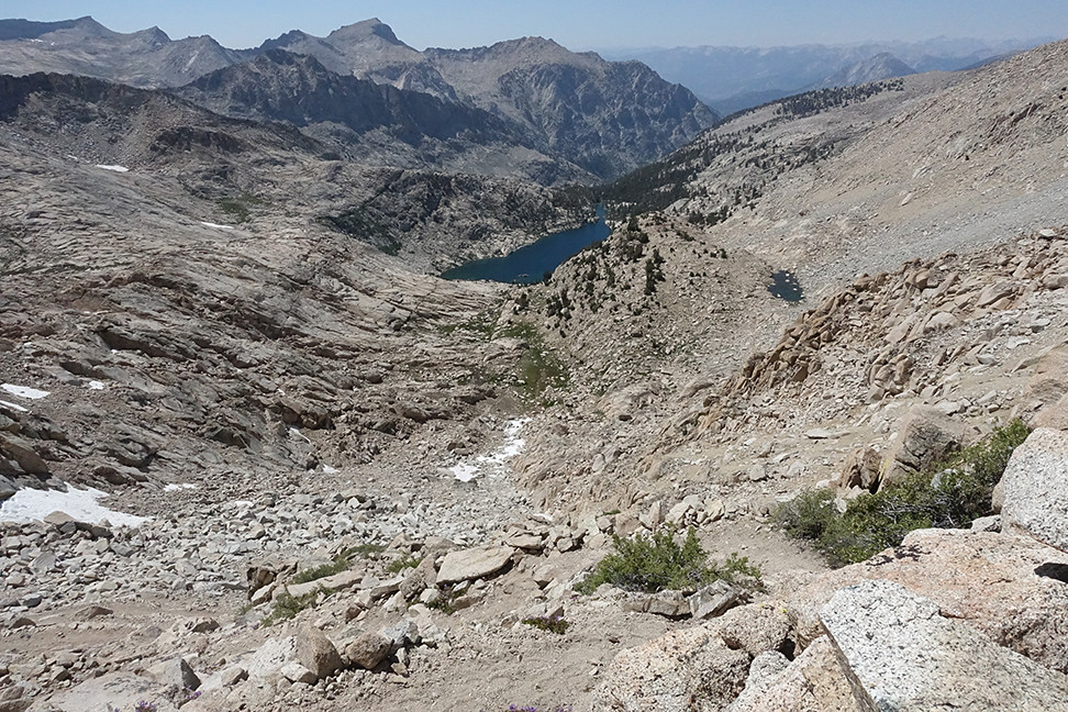
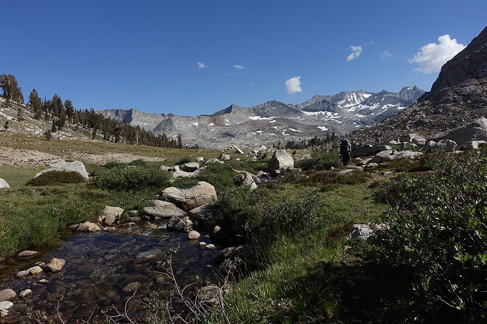
Ah, trail! Trail trail trail. The trail towards Colby Pass is obviously not popular, giving it a wonderful feel when you have it to yourself on the fourth of July in a national park. We enjoyed some easy creek crossings and plenty of flowers, and we withstood the moderate mosquito hordes. The trail seems to head into Cloud Canyon but then uses the northern prow of Whaleback to traverse up towards Colby Lake, providing very cool perspectives of the surrounding topology. Our spirits were great and the altitude wasn’t an issue any more. We rested at Colby Lake for lunch and watched the fish, who weren’t as acrobatic as those in Lake Reflection.
View north from the traverse up the prow of Whaleback:
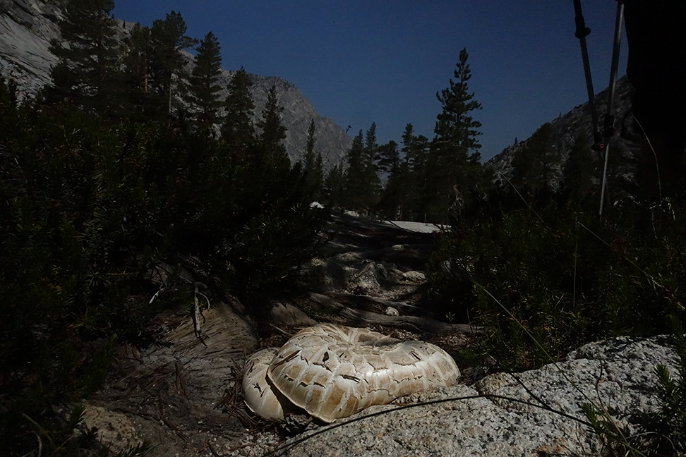
A gigantic mushroom growing in the middle of the Colby Pass Trail
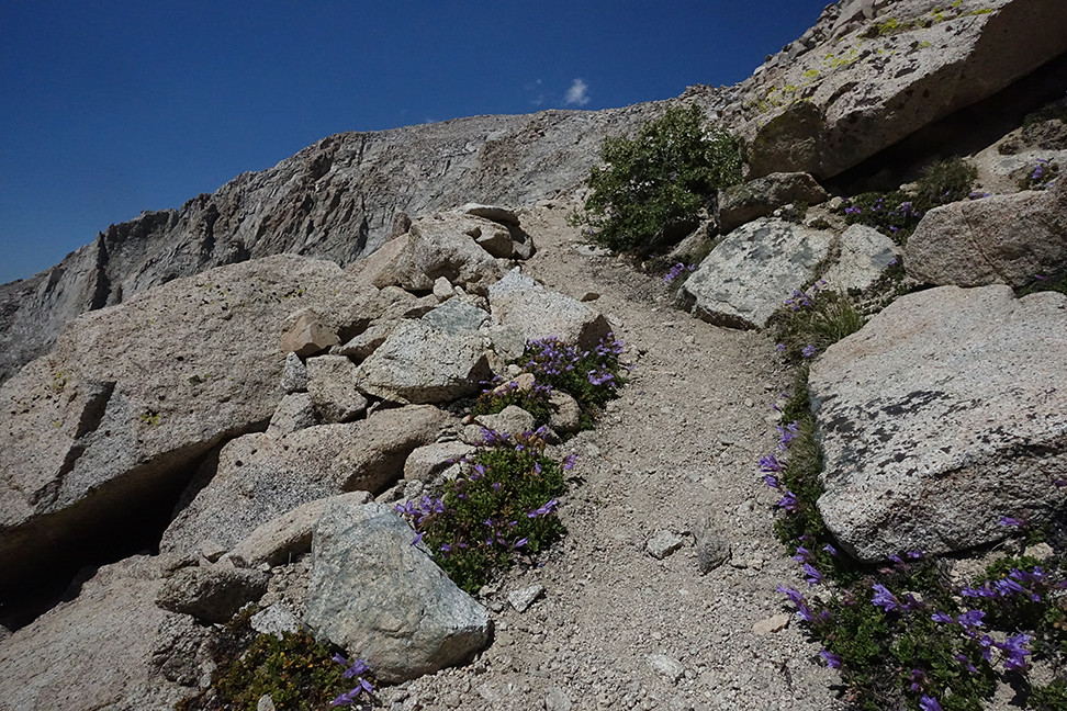
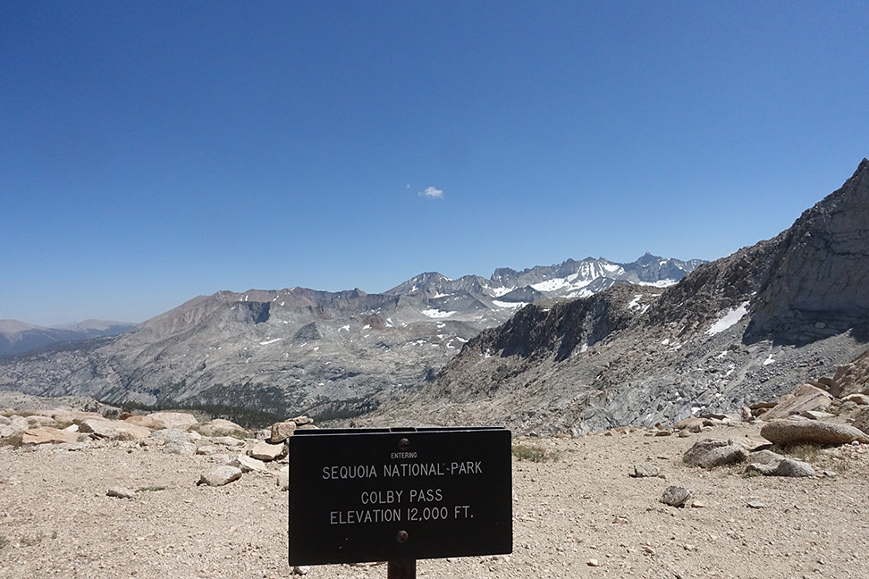
The trail up to Colby Pass became much more alpine above the lake, and went from overgrown to rocky as we gained elevation. The mosquitos above 10,000ft were surprisingly bold so we kept moving. The switchbacks up to Colby were impressive and we made quick work of the ascent. We had the pass all to ourselves in the sun on the fourth of July, win win win! Great views on both sides into Sequoia NP (SE) Colby Lake/Kings Canyon (NW). A bighorn sheep must’ve recently enjoyed the view, too, based on week-old poop on top of a perfect boulder pile right on the pass.
Colby Lake from the Colby Pass Trail
Another alpine pass!
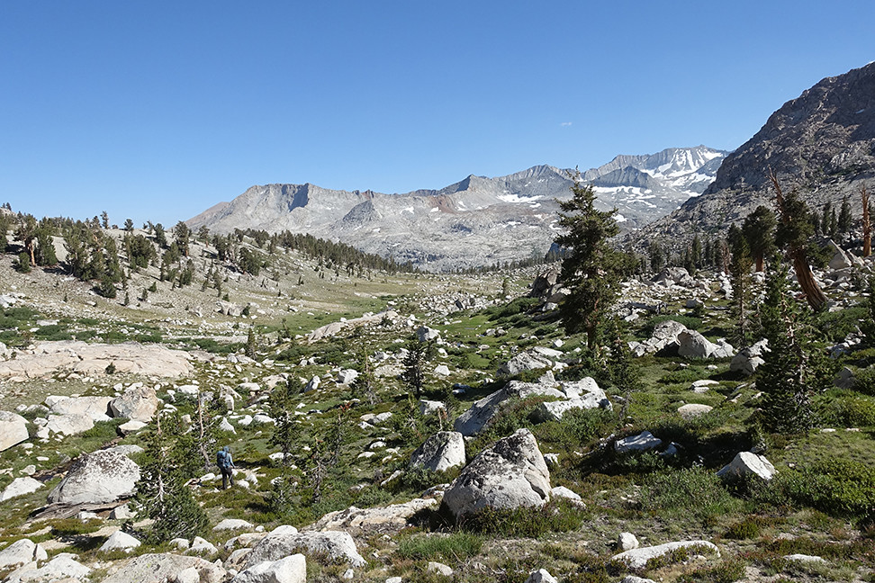
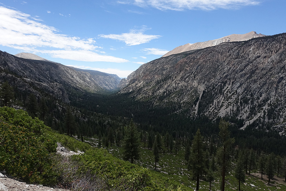
Our descent was chouette. The nearby tarns and meadows were gorgeous, with growing views of the Kaweahs, Kern Point, Picket Guard, and Mt. Guyot. Eventually the hike felt like a frolic through Narnia, with twisted trees somehow thriving among the talus. We hoped to find a worn site up here, rather than a thousand feet down, but even the promising ones had vegetation, so we proceeded on.
A tarn just below Colby Pass
Hiking through Narnia with Picket Guard and the Kaweahs in the distance
I packed out this gigantic piece of plastic that was stuck on a bush in a small stream
I think that's Milestone Mountain in the distance, but I'm not sure. The view is up towards Milestone Basin, which we will hopefully visit within the next few years... we just didn't have time to explore it if we wanted to meet our friends the next day at Bighorn Plateau.
I was sad to descend out of the Narnia environment. The mosquitos went crazy around 10,800, and at a certain point I made Caroline stop so I could spray her butt with DEET (permethrin had done nothing and no less than 30 mosquitos were now attacking her rear).
The steep descent down towards Gallat's Lake area, where the mosquitos attacked
After we lost a few hundred feet and reached a roaring Kern Kaweah river, we scored a nice site just off trail near a waterfall, avoiding a sister site that was occupied by dozens of bowl-sized ant holes. The views were mediocre but the setting was nicer than Big Wet Meadow, and we were still all alone. I finally was able to sleep easily, too, having acclimated well.
Day 6 (12 miles, +3700, -2500, trail): Near Gallats to Bighorn Plateau, via Junction Meadow (Sequoia)
Tonight we hoped to meet our friends at Bighorn Plateau, so we got moving by 7:30am. It had been cold the evening before, but the frost fended off the mosquitos as we hiked through Gallats. The horseshoe bend in the river was pretty, as were the surrounding slopes and short peaks. Sequoia is a cool park!
Horseshoe bend in the Kern Kaweah River, with a sweet view of Picket Guard's funky amphitheater formation

The trail remained lightly used, keeping us on our toes. As the air warmed the skeeters emerged, and we were glad to have broken into our DEET. The trail takes a fun turn up and around a big granite bump before it makes the final descent towards Junction Meadow, giving some great views back towards Gallats.
Why are we heading UPHILL on a descent? Oh.
The view back up the canyon
We encountered fields of white flowers, which smelled like bubblegum, as our descent continued, and were thankful when the trail deftly cut between groves of manzanita and aspen. We could see the trail we’d be on in a few hours - a long traversing cut in the forest, which is a 4 mile segment of the High Sierra Trail.
Haven't quite figured out which flowers these were, but they were everywhere
Eventually we reached the wide intersection of the Kern with the Kern-Kaweah River. It was a long but shallow wade over multiple braids and granite piles, but it kept us cool in the sun.
The trail led us into a calm grove of pines, and we ate at the junction with the High Sierra Trail. No other humans in sight.
Snowplant in the Jeffrey pine grove
A forest all to ourselves (we must've been in between High Sierra Trail hikers, since we talked to JMTers who encountered boatloads of em)
Soon we were regaining the altitude we had just lost, climbing long switchbacks a few hundred feet from the Kern. The views southward and west were satisfying, with classic U-valleys, a cave that more skilled climbers should someday conquer, and an expansive view of our morning descent. It was great seeing the Kaweahs from this perspective.
You can barely make out the descent we had completed a couple hours prior, including the granite bump.
Southward into Sequoia
We filled up on water where Wright joins Wallace creek, the waterfall lining up perfectly with the view down canyon. Mosquitos here weren’t bad.

Further up, we walked through an old, partially burned forest on easy trail. Occasionally there were switchbacks through more talus like terrain but it was still easy.
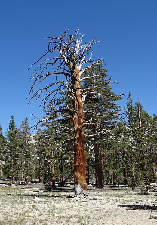
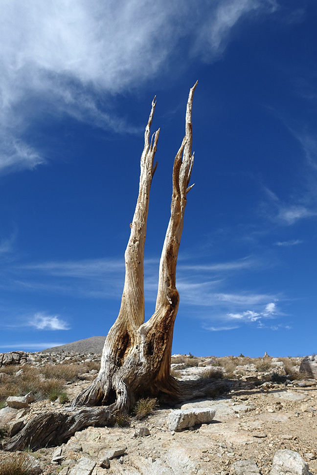
When we finally merged with the JMT, we encountered hikers for the first time since Big Wet Meadow. We still had hundreds of feet to climb to Bighorn Plateau but our excitement grew knowing we’d soon be with some great friends. As the trail meandered through slowly ascending terrain, we glimpsed Mt. Whitney and Mt. Williamson. Just as we rounded a bend towards the last half mile before our destination, I found my favorite dead tree of the trip. Win!
Whitney - our first ever views from the west!
Tawny Point looming under awesome clouds, with Tyndall and Williamson peeking through the shadows in the distance
Favorite dead tree
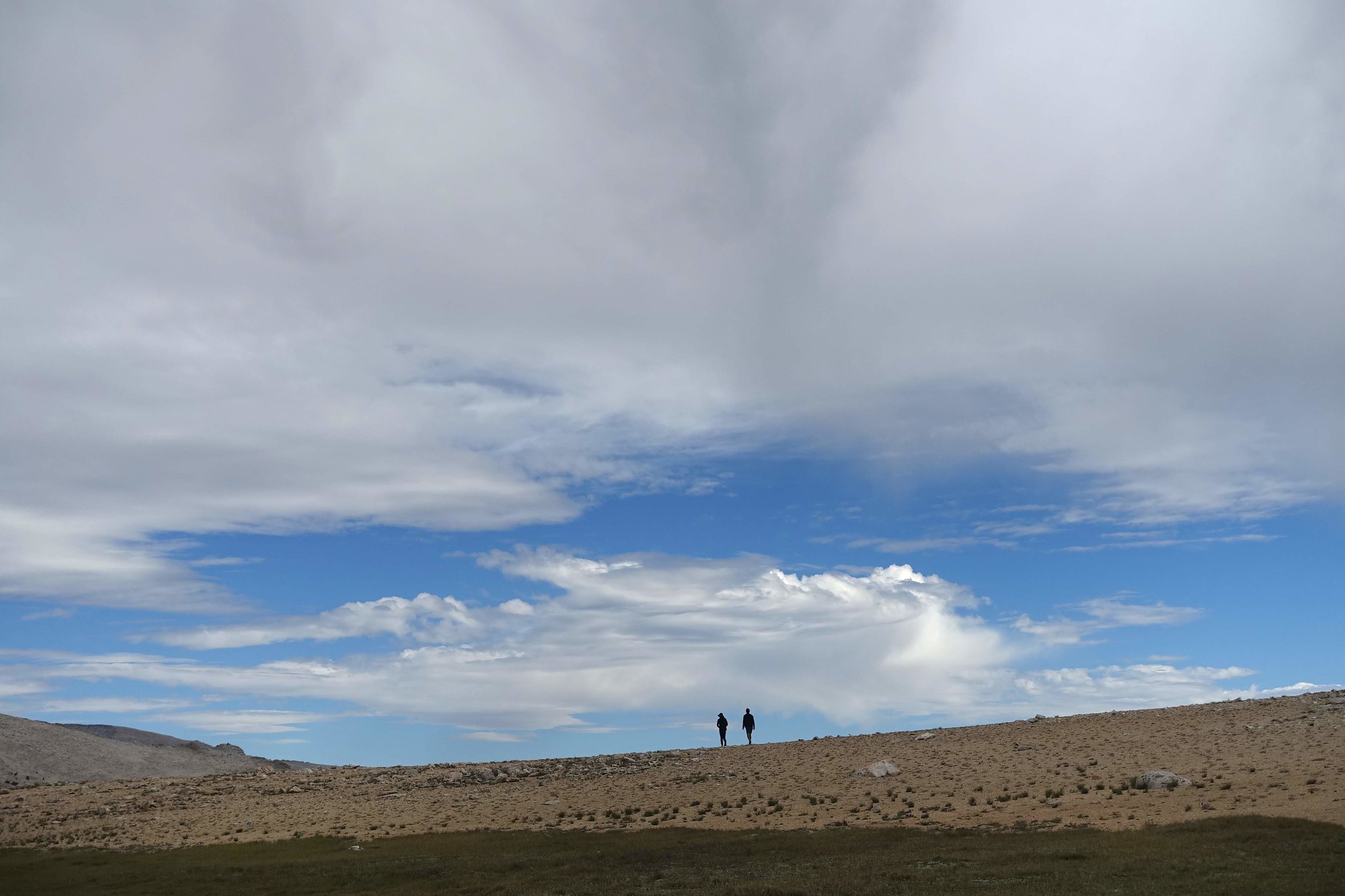
Once on the plateau, I identified the small lake that we had agreed we’d try to meet at on this particular Thursday in July in the year of our science 2018. The tents nearby were clearly not those of our friends, but four figures were sitting further off, so we approached. It was them!
Two of our four friends, an hour after we had met up, on the southern boundary of the plateau
What a great place to camp!

Williamson, Whitney, Guyot, Kaweahs
Tawny Point
Perspective distortion with Williamson in the backdrop
Whitney again just because
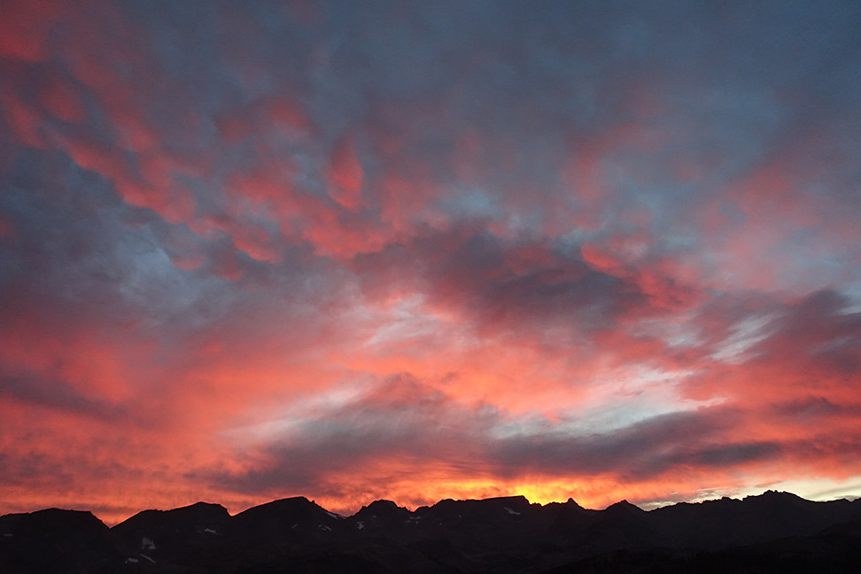
It was so wonderful to be with our friends. They shared some of their food from their last resupply, since this was their second to last day of the JMT. The views on the plateau were easily the best of the trip. The tallest peaks of the Sierra Crest to the east, the Kaweahs to the south, the GWD to the west. Deerhorn Mountain looked particularly slick, and earned itself the nickname, the Madonnas, by unanimous vote. We had a ball sharing stories and provisions all afternoon, culminating in a secular tea ceremony on top of a prominence just south of our tents that gave a 360 view of the said ranges. Whitney and Williamson treated us to true alpenglow around 8:20pm, and we were then treated with an amazing sunset to light the panorama. What a win.
Great Western Divide to Junction Peak

Deerhorn Mtn, Caltech Peak, Diamond Mesa, and Junction Mtn
Alpenglow on Williamson (on the left)
Alpenglow on Whitney!!!
Sunset over Table Mtn
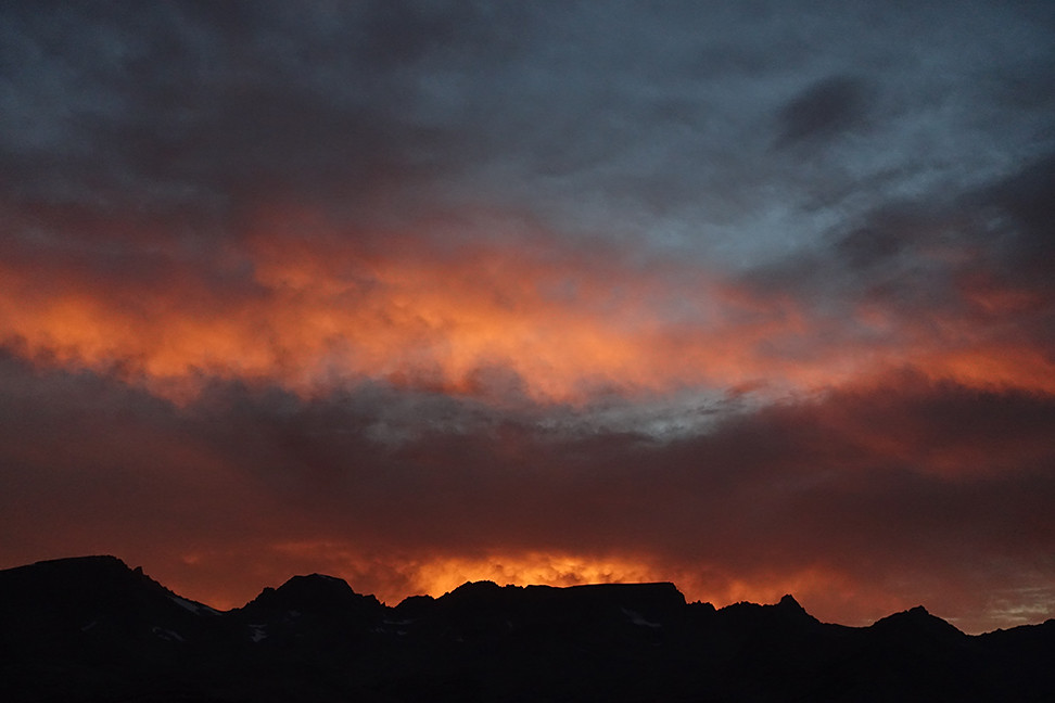
More sunset, now with better views of Midway, Milestone, and I believe Thunder Mtn
Day 7 (14 miles, +2400, -3700, trail): Bighorn Plateau to Bubbs Creek via Forester Pass
We said goodbye and good luck to our friends, who were headed to Guitar Lake before a sunrise summit of Whitney. Our path, in the opposite direction, went around Tawny Point and up past Diamond Mesa towards Forester Pass.
Goodbye, friends!
Our compadres head off with their summit sunrise destination on the horizon
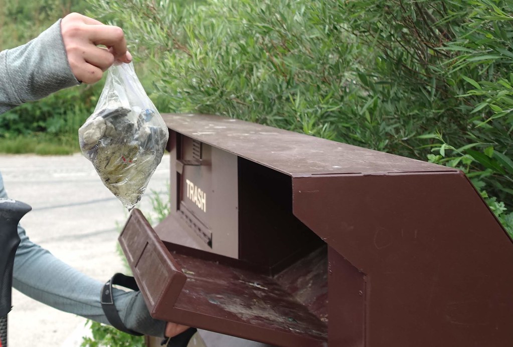
We cleaned up lots of trash at JMT sites, including someone's abandoned TP bag , just north of the junction with the trail to the Tyndall Creek ranger station. We saw a smattering of JMT’ers all day.
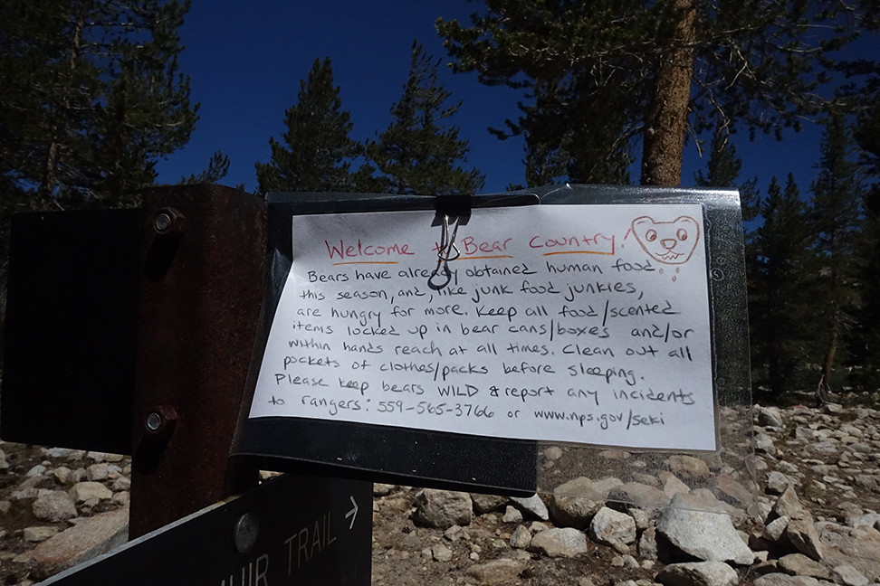
This sign was clearly warranted:
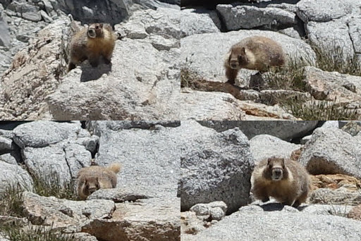
Near the lakes just south of Forester, we watched a curious marmot with a couple from Bend, OR, who were doing the JMT.
We stopped for lunch and eyed Caltech Peak from among some boulders near the trail. I had read about the northeast slope of Caltech working well, class 2/3, but Caroline was now itching to make significant miles today to enable exiting on Saturday and splitting our return drive in half at my grandparents’ cabin in Twain Harte CA (an idea that also appealed to me). We explored the base of Caltech and decided we didn’t feel like tackling steep talus traverses over steep snowfields to reach its summit. Instead, we cleaned our legs in the newly-melted lake, at 12,500, and returned to our gear.
Our final alpine bath, with a shoulder of Caltech on the left

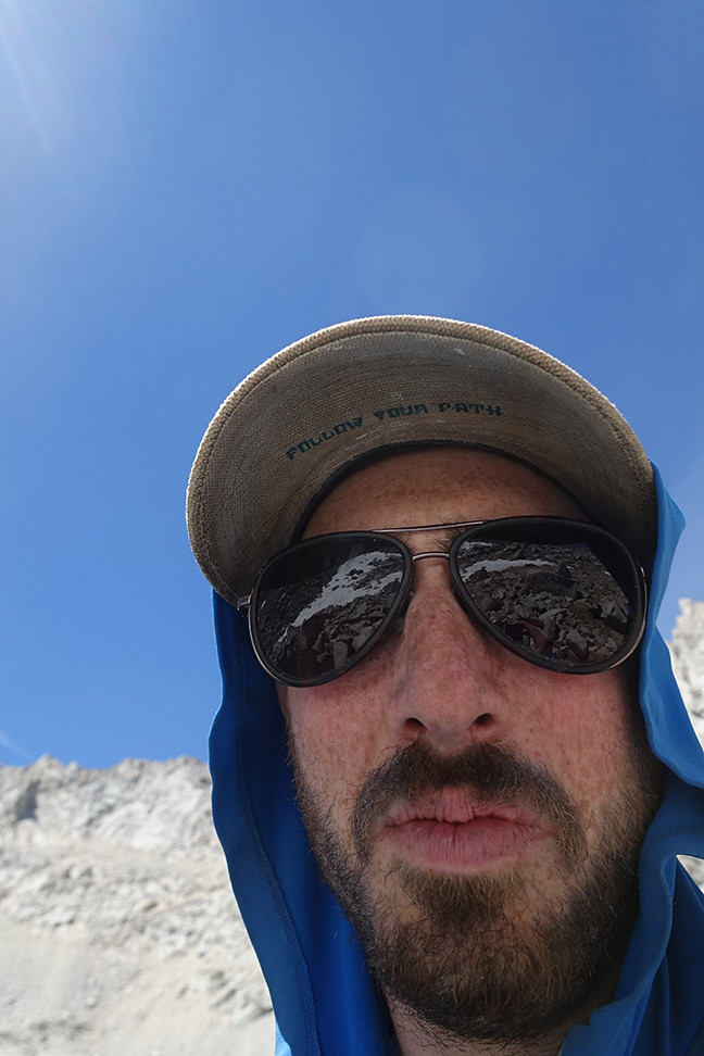
My iPath hat's message is timeless
We leapfrogged with other hikers on our way up Forester, which has some impressive switchbacks at the top, and shared the pass with a half dozen people. We had fun chatting with them about our mutual adventures — no one really knows about Colby Pass and beyond! We scarfed down one of Clif Bar’s newer builder bar concoctions, which was like a cinnamon bun in bar form, and then began the long descent down.
Caltech Peak and unnamed lakes, from the trail up to Forester Pass
Forester Pass's major problem for early-season PCTers, now dry
Glorious switchbacks right below the pass
Victory, and other people to take our photo!
The views of Junction Peak behind us were quite rewarding, and the trail was fun and steep.
The basin north of Junction Peak
We could see our destination deep in the canyon, on the southern side of Kearsarge Pinnacles, and it kept us motivated.
Looking back up at Junction Peak

I wish I had taken a few more of these, to ensure a sharp one, since the deer underneath this weird granite dome looked so awesome, but we had a pace to maintain.
We were undecided regarding a push all the way to Vidette, which would shorten our last day out, but found a good campsite about 2 miles from Vidette, at just over 10,000ft. We camped next to a gorgeous section of Bubbs Creek, where it flows strongly but mere inches deep over wide granite slabs, with views of the pinnacles peeking through the trees. It would be our last night in the wilderness, and we were very content.
Kearsarge Pinnacles from the south
Day 8 (10 miles, +2500, -3500, trail): Bubbs Creek over Kearsarge Pass and out
Hello, friend!
This would be our last hike of the trip. It was uneventful, but we took time to admire the views one last time, when we could. It was a lot easier to identify the peaks we had walked around all week as we ascended east towards the final pass.
East Vidette, the star of many a SEKI album
Shoulder of West Vidette, South Guard, and the east ridge of Brewer
I believe this is Deerhorn from the north, taken from Bullfrog Lake
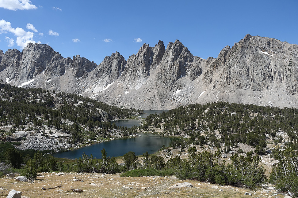
Final view of Kearsarge Pinnacles and Lakes
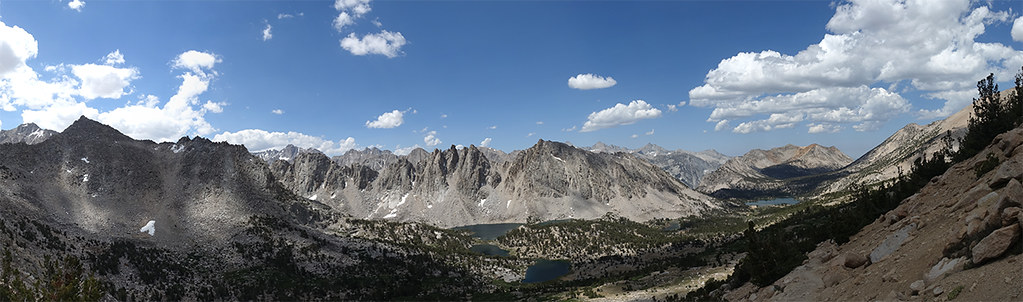
Final panorama from Kearsarge Pass-ish (maybe just west of it?)
There was again a large party of many people, dayhikers and backpackers and thru hikers, at the top (“oh so you’re from Sherman Oaks too!?!?”) so we didn’t linger long. We practically sprinted down to the car, excited for the Gatorades we had stashed in the car and Burger Barn in Bishop. We passed some firefighters, one who was hiking shirtless, as we descended. When we reached our station wagon, it was all alone in the dirt pullout - I guess the crowds had been worse the weekend prior to July 4th as opposed to following. We disposed of some of the trash we had collected on trail (though I guess I do slightly regret not packing out someone’s lost shoe that I spotted near Lake Reflection earlier in the week), retrieved our excess food from a bear box, and got snacks and Gatorade ready for our hourlong drive to Bishop.
Our pace picked up on our descent

OTHER PEOPLE'S TRASH UGH BUT YES I'LL BE A HERO
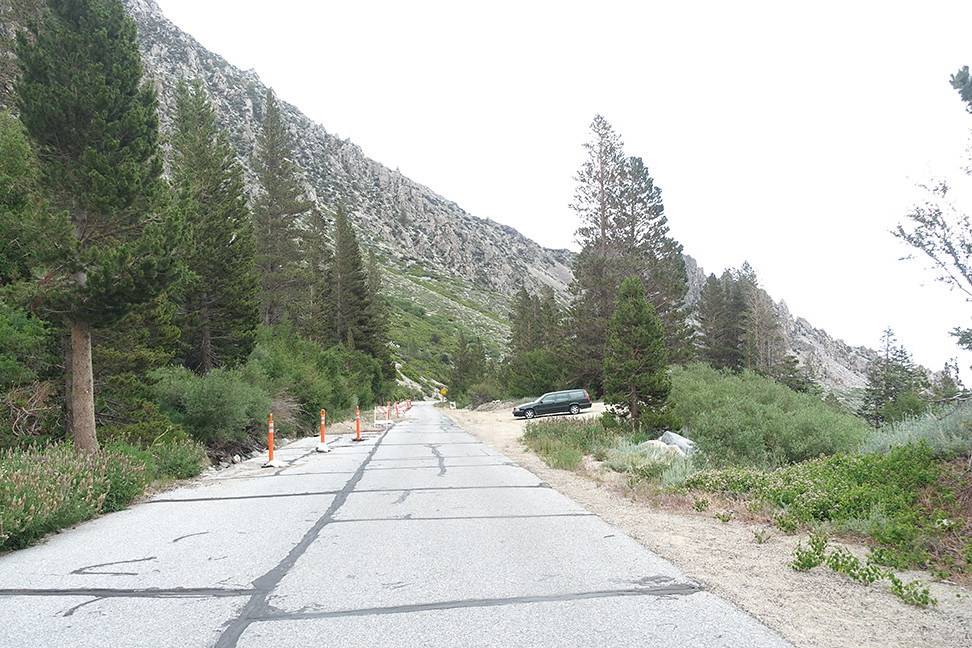
Volvo! <3
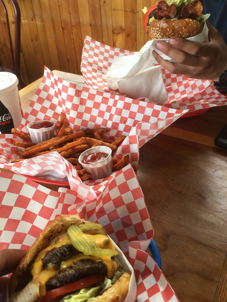
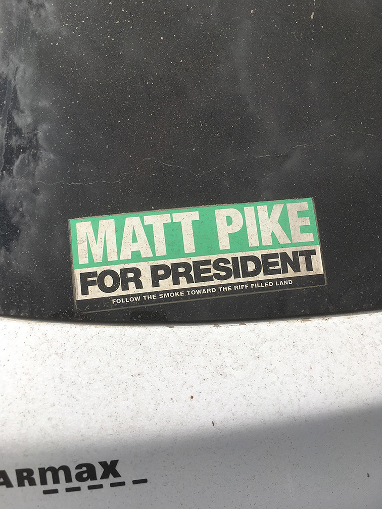
Burger Barn was great, though it was over 100 degrees F in the Owens Valley. We saw a sticker that said "Matt Pike for President," and our hearts melted... our first date, over five years ago, was at a High On Fire show. Metalheads can love the high sierra, too
The drive to Twain Harte, over Sonora Pass, was fun — all the snow we had seen in mid-May on the pass, after a splitboarding trip, was gone, leaving just dirt! Just west of the pass, I had to slow down for a pair (yes a PAIR) of marmots just lazing about on the road in the late sun. What a happy sight. I had no vehicular company in my direction on the pass, which was wonderful. Back in Twain Harte, we picked up some ready-made salad and mac and cheese and beer for dinner. We showered, carefully removed our Leukotape, and enjoyed the foothill civilization, a good intermediate before our return to the city.
Day 9: Back to the Bay
Sunday morning, Caroline took care of the drive back to Oakland, and we had the day to prepare for work. Even over a week out, I still haven’t recovered emotionally. North Guard, Brewer, Milestone Bowl, Caltech — we missed you this time, but we’ll be back.
Day 0 (5’45” drive): We (myself and my wife, Caroline) got a late start out of Oakland (9:30pm), but made it to Bishop by 3:15am via Tioga Pass/Yosemite. We pulled over on a road a couple miles outside of Bishop, right off the 395, cracked the windows, and slept for a little over 3 hours.
Day 1 (11 miles, +2900, -3900, trail): Onion Valley over Kearsarge Pass, through Vidette Meadow to Junction Meadow.
Waking up in Hotel Volvo never gets old. We had no issues getting walkup same day permits for Kearsarge Pass at the White Mountain Ranger Station (anyone else love the zany ranger who’s always there?) The drive up Onion Valley Rd was fun. There were lots of fellow hikers and backpackers on the trail up to the pass, which is beautiful but very exposed to the sun.
This guy was warming up from the cold evening on the warm pavement, and couldn't be bothered to move much (but wasn't dead). Clean and stoked Onion Valley Road getting smaller as we ascend a stairway to heaven Big Pothole Lake with University Peak in the distance A photo obscuring the crowds on the pass This friend was quite familiar with the bounty associated with all the human traffic... We chatted with some PCTers about the merits of shorts vs pants at a stream above Kearsarge Lakes. Kearsarge Pinnacles looked stellar and the flowers were out. I admired the views of Dragon Peak that emerged as we continued west away from Kearsarge Pass and Mt. Gould.
Mosquitos started pouncing as we descended towards Vidette Meadows.
Sooty grouse hen and chicks... soon after we could hear the hoots of at least one male, which we never were able to spot. Some backpackers warned us of a bear on the trail near Junction Meadow, and we saw it minutes later, ambling up the trail. When the bear saw us, it headed up the hill, off the trail, and munched on something on the ground, uninterested in its audience 30 yards away. It was small and alone, likely adolescent, but still, our first wilderness bear! (No decent pictures unfortunately, due to late afternoon shadows and limited telephoto)
We couldn’t camp at the sites with bear boxes north of Bubbs Creek due to a huge camp of trailbuilders. One of them suggested we cross the creek on some upstream logs, but that beta was sketchy - the first log, over Bubbs, went OK (it looks like its partial break will soon give out under some amount of weight), but the second log, over East Creek, was too skinny and covered in branches for comfort. We retreated to a mediocre but worn site north of the trail, near the East Lake trail junction, ate dinner quickly and crashed, ready to replenish our REMs.
Day 2 (4 miles, +2000, -100, trail): Junction Meadow to Lake Reflection; 3ft wade over Bubbs Creek
Having discussed our backup plans should wading Bubbs fail, we were heartened to hear from another couple that the wade in the meadow west of the East Lake trail was fine. It was easy to find a good place to cross, 3ft at its deepest. Elated, we took a short break to dry our socks and shoes and Leukotape our feet. I caught the last dozen feet of Caroline's wade on my phone. https://youtu.be/qCKo_na43Ck
The trail to East Lake was pleasant, with many interesting views on all sides. Lots of flowers, mosquitos were mild. We saw some people at East Lake, including some trailbuilders, and a group that told us the area towards Lake Reflection had been quiet.
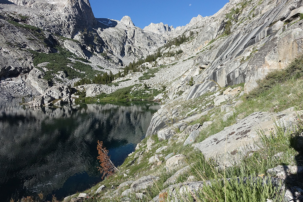
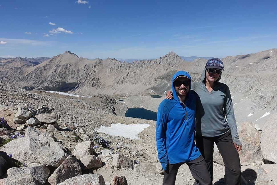
East Lake - I think that's South Guard on the right. After a lunch and foot break, we continued south and up to Lake Reflection. The trail became a little tougher and ambiguous/overgrown at points, but still enjoyable. The mosquitos got worse as we climbed through mud, dirt, sand, rocks, flowers, and storm debris. We lost the trail a few times, but our bearing remained obvious: up.
Plenty of flowers on the trail to Lake Reflection We reached Lake Reflection around 2pm, our work for the day complete. We camped on a granite slab north of the outlet pond that’s north of Lake Reflection, and a breeze kept the mosquitos at bay. It rained lightly/periodically all afternoon but we enjoyed the opportunity to rest and read. I took loads of pictures of fish jumping for mosquitos and got lucky with one, a true winner. The views south to Mt. Jordan were spectacular. We crashed early in preparation for our first xc day.
Coordinating with the jumping fish was futile; pre-framing and shooting on a count of ten repeatedly was not.
Day 3 (6 miles, +3900, -2300, xc): Lake Reflection to South Guard Lake, via Longley Pass, plus South Guard
Our pace immediately slowed as we picked our way over Lake Reflection’s northwest shore, clambering up and down to avoid cliffs. Mosquitos were remarkably bad, worse than at our campsite.
The northwest shore of Lake Reflection:
It took us a bit more than an hour to reach the inlet stream to the lake, at which point we began heading uphill. We navigated through lots of variable terrain, including small pockets of forest, mud, flowers, bushes, and talus of all sizes. We took frequent breaks, still acclimating to the thin air.
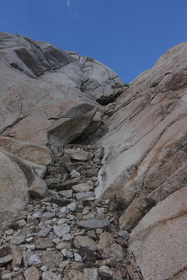
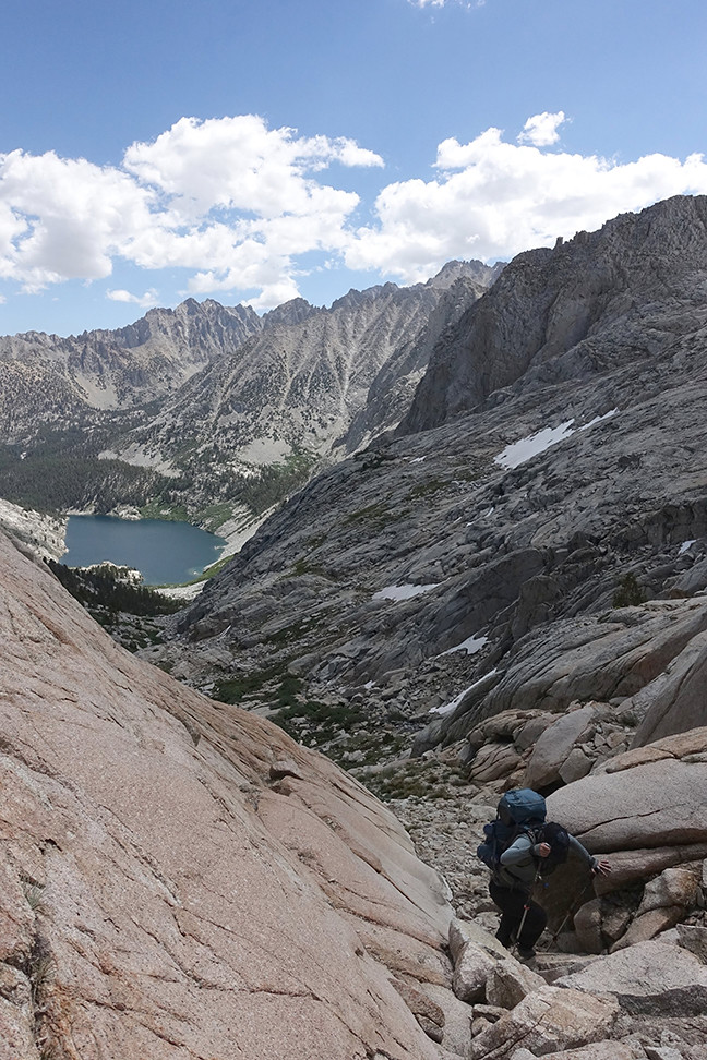
After quite some time, we reached a series of chutes but couldn’t pick out the greenest of them all as recommended. We instead picked one that we could class 2/3 send, and it deposited us on a granite outcropping just above the biggest lake, east of and below Longley Pass. (Two smaller lakes to the south were hundreds of feet below us).
The top of the chute:
Caroline ascending:
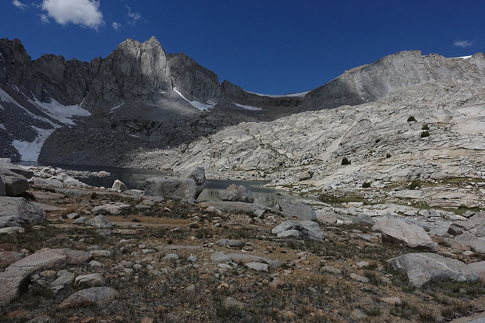
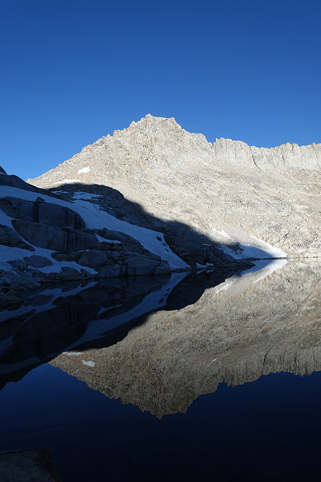
The big lake below Longley Pass, with a distant view of its cornice:
We ate lunch at that lake. I didn’t feel great but gulped down my food and one ibuprofen. We followed some ducks and seeming paths first northwest, past a tarn, and then more due west towards the pass. The cornice on Longley didn’t look doable from afar but I was hopeful it would look safer as we approached. We arrived at the tarn directly below the pass around 1:15pm. We took deep breaths, discussed our mutual veto power if we had to turn back, treated some water, and began following faint, switchbacking footsteps in the sandy ascent up the east side of Longley.
Our rockin' view as we ascended towards the pass:
The pass looms as we traverse over to a sandier portion of the route
Caroline following faint switchbacking footsteps, probably those of cgunderson and his wife
When we finally reached the cornice, we could see across the whole traverse, and our hearts soared - we could do it! We carefully picked our path across, basking in the moment - the grandiose cornice, the steeps on all sides, the cloud-peppered sky, our cortisol and adrenaline. The last part of the traverse was skinny, with significant exposure over cliffs, but the rocks and gravel behaved like well-trained horses under our feet. Cgunderson’s step over the cornice had melted to reveal an easy and very short class 3 scramble to freedom over the pass, and we whooped and hollered.
Possibly an assassin bug?
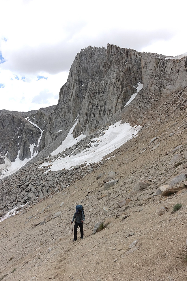
Our success inspired us to tackle the easy south slope of South Guard, since it was only 2:30pm. We stashed much of our gear and Caroline’s pack in some trash bags by a boulder, since there were storm clouds many miles off to the northeast (but blue skies and friendly clouds above us). I felt much better since lunch, but Caroline was losing some steam now, so I was happy to blaze our sandy switchbacks upwards.
Sky pilot on South Guard's south slope
It took 60 minutes to summit, with plentiful sky pilots and flower friends among the rocks. We admired Brewer and the west ridge of North Guard, and South Guard Lake, our destination for the day, from the summit, and quickly descended to our gear in 30 minutes. We were so happy to have achieved what we thought was the biggest logistical hurdle to our long route.
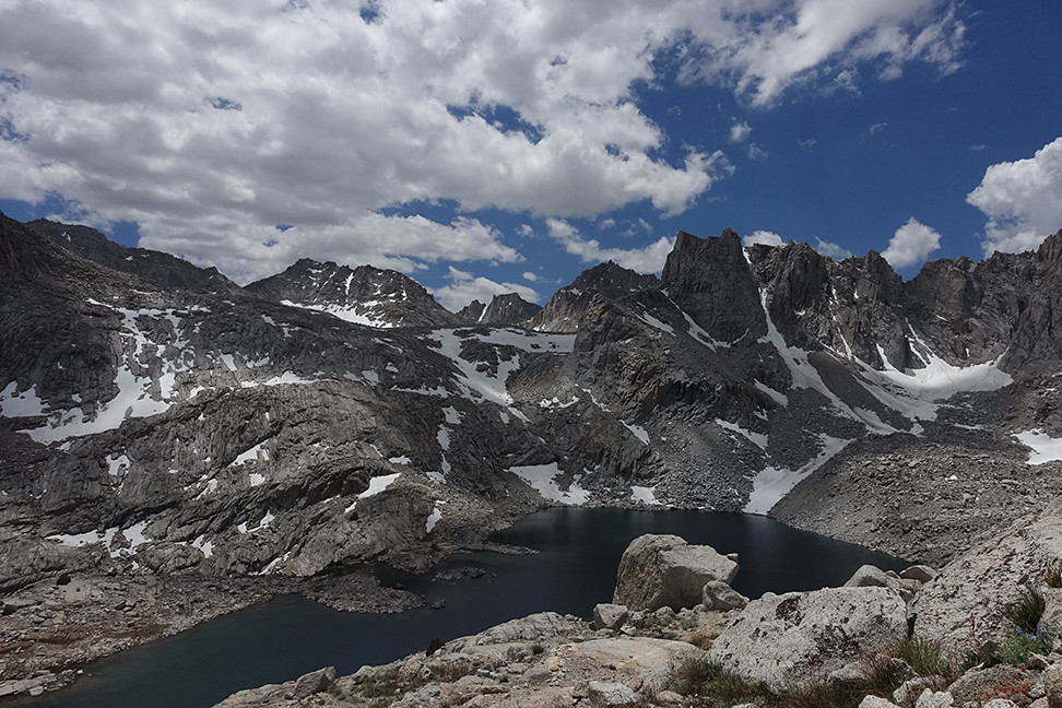
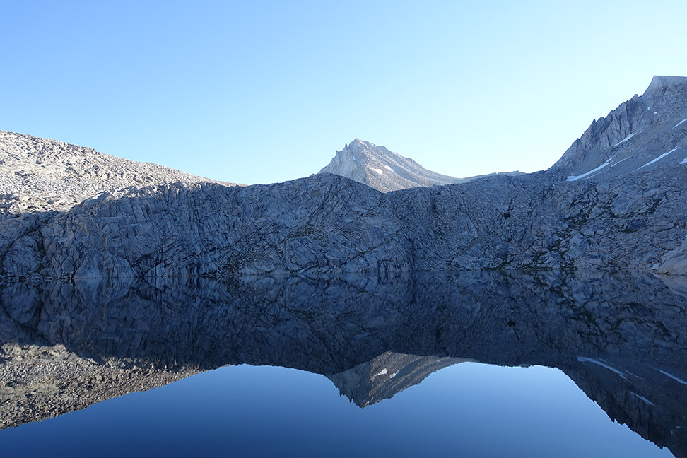
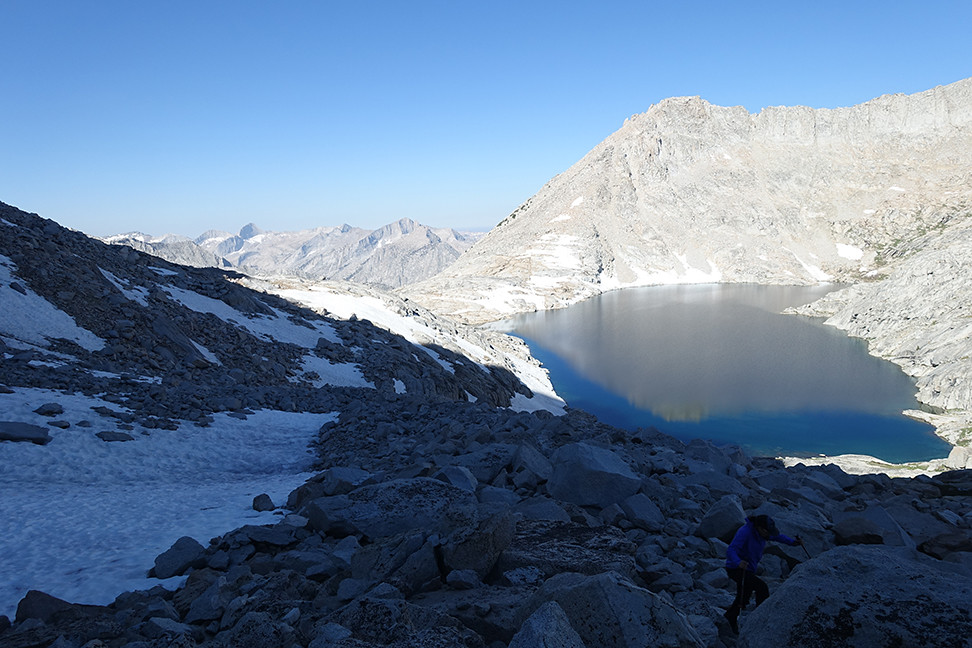
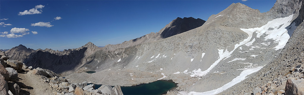
South Guard Lake, from the summit of South Guard:
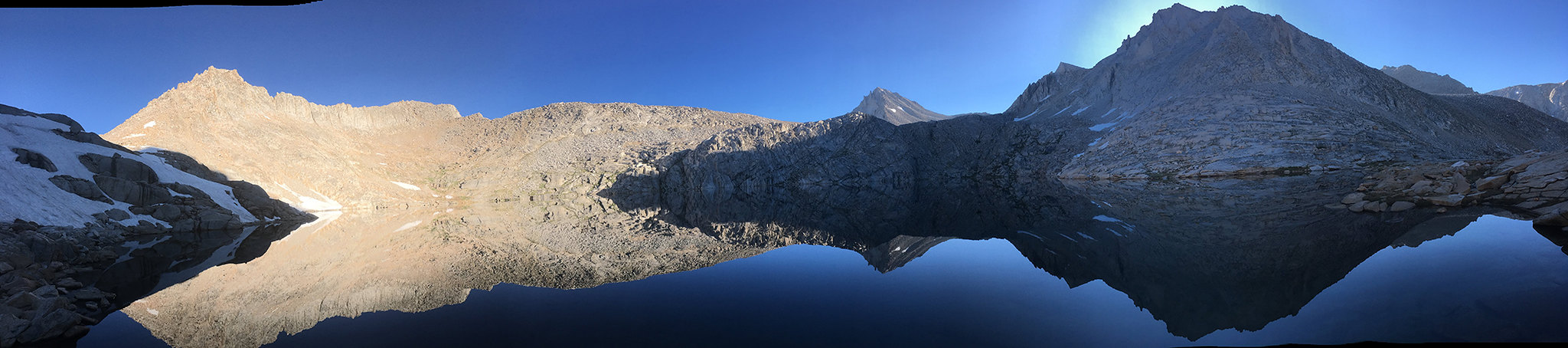
Summit panorama:
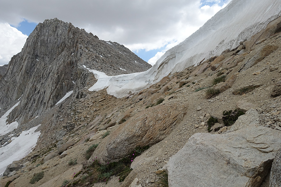
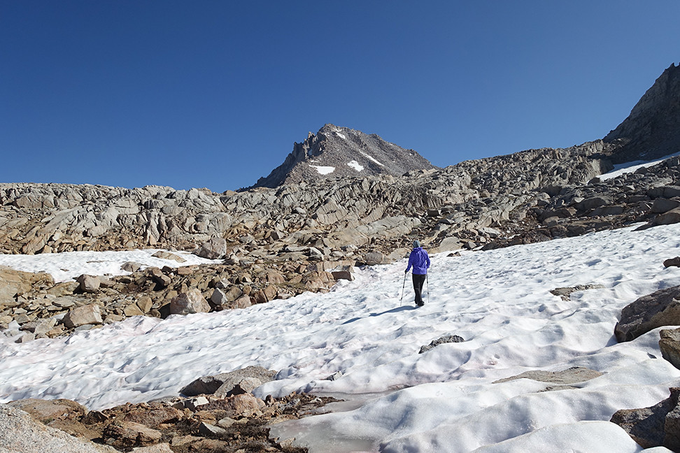
The end of our South Guard descent (which I partially ran down, so much fun with the sand)
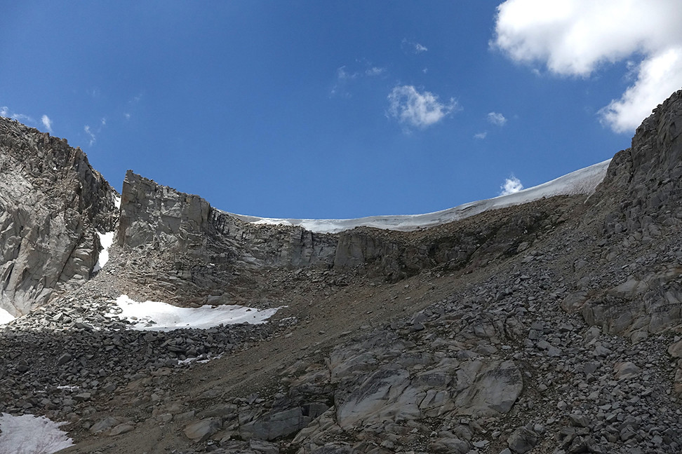
The flat, mild top of Longley Pass (on the west side)
The descent to Cunningham Creek and then up to South Guard Lake was pleasant and pretty, and we scored a perfect campsite right by the outlet of the lake. It was interesting to camp at the exact same elevation as the lake itself, in the shadow of South Guard. Mt. Brewer’s south slope loomed in the distance, as did Thunder’s long western shoulder. We bathed, snacked, ate dinner, read a bit, and ended the day with a cannabis edible. Also, zero mosquitos on this side of Longley to this point.
Cunningham Creek on our descent
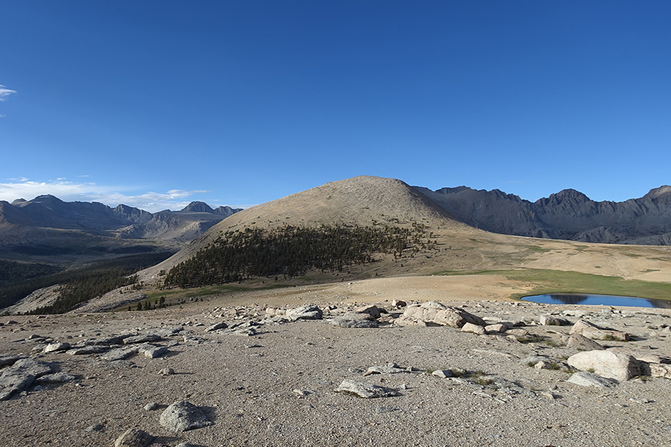
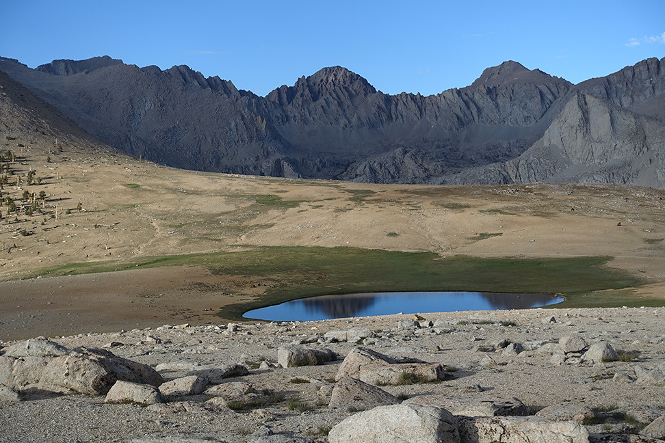
South Guard Lake and our campsite within reach
A view back up to South Guard on the left and towards Longley Pass on the right
Our campsite, right by the beginning of South Guard Lake's outlet, with a spectacular view of Thunder Mountain's long western ridge (behind me are views of Brewer and South Guard)
I woke up in the middle of the night, and used the opportunity to stick my head out of the tent and enjoy the moonlit moonscape of 11,500. There was no one around, not even little animals. Bliss.
Day 4 (7 miles, +1200, -4100, xc and trail): Exploration of Brewer’s south slope, then South Guard Lake to Big Wet Meadow via Cunningham Creek
Morning views of South Guard Lake, with Mt. Brewer in the distance and South Guard looming.... hnnnnnng
We wanted to climb Brewer via its snow-free southern slope, but snow proved to be too much on our approach. We used our microspikes on a few low angle snowfields but eventually, our decision to stay high on South Guard’s northwestern slope prematurely ran its course. We agreed to summit Brewer some other day, maybe via the northwest slope as a one-two with North Guard in the fall, or via the eastern ridge from East Lake, and we returned to our camp. The whole jaunt took nearly 3 hours but was still fun, with good views of Big Brewer Lake and parts of the surrounding passes and shoulders. Lots of snowfields everywhere, but if you stay low in this area, you’ll probably have no trouble bouncing between rock piles and crossing low angle snow.
One of our few views of North Guard behind Mt. Brewer, as we ascended hopefully towards the saddle between Mt. Brewer and South Guard
Looking back on South Guard Lake, across the talus and snowfields we had already traversed over
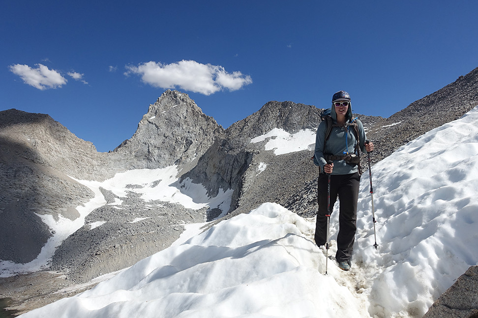
A mild snowfield, where our doubts began to grow
Where we stopped due to snow and the desire to enjoy more of our day
Probably doable but uncomfortable, steep and quickly softening snow
Looking down towards Big Brewer Lake and the various lower routes towards the Sphinx area
Defeated by early season snow but still smiling
After eating at camp we packed up and began our descent down Cunningham Creek, our last significant xc segment. It was easy for the first mile and a half, but when it became steep, the going got rough. We couldn’t find the cow trail on the north side of the creek, but not for lack of trying. At one point we got cliffed out and had to backtrack, class 3, about 50ft up, before traversing further north, away from the creek, to reach softer and slightly milder terrain. After some tricky talus hopping we were carving our own switchbacks and edging in our trail runners down steep, steep soil, dodging trees and bushes when possible. It occasionally looked like trail but that may have been wishful thinking. It only eased when it got flat and forested.
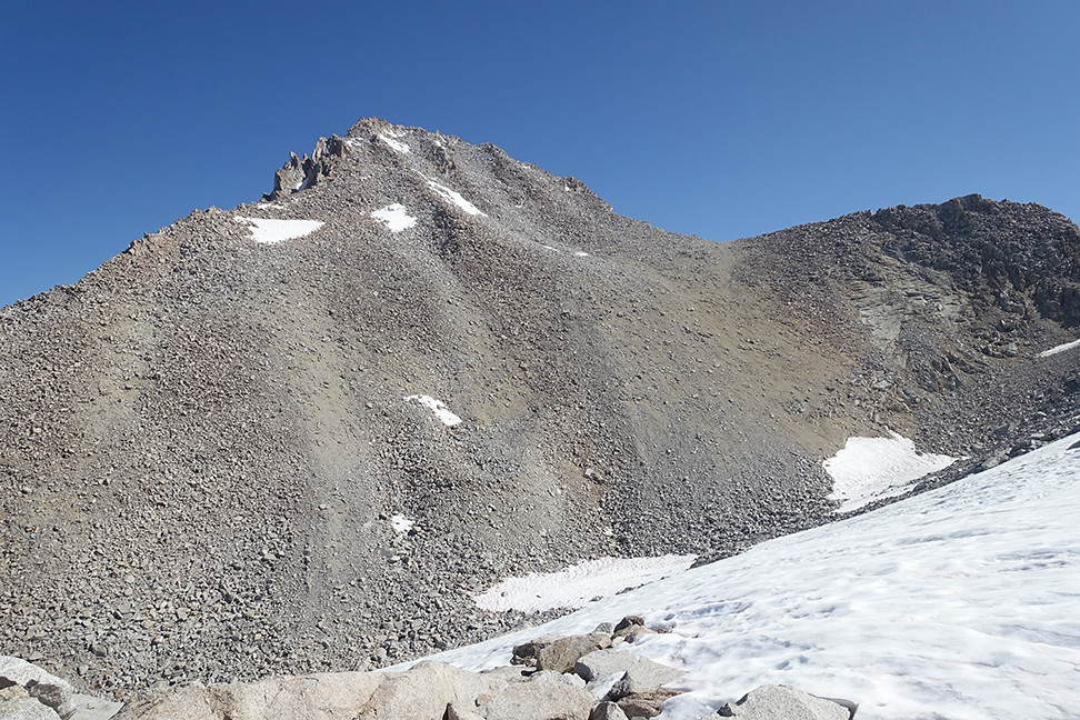
The chute that eventually wouldn't go
The end of our chute
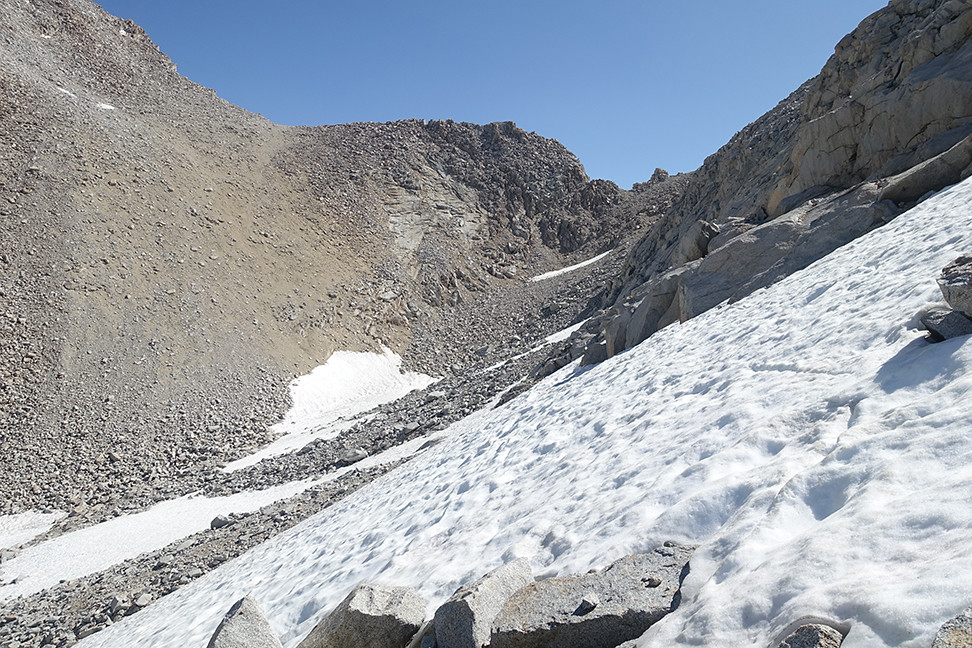
The more northerly acceptable descent
The second steep part of the descent was characterized by endless and tricky bushwhacking. So much manzanita and aspen! Super frustrating and we did our best to mutually prop up our morales. This time, when the slope relented, we were still left with more bushwhacking. I would love to see a picture of a cow or even a horse in this terrain, what the hell. I promised Caroline we wouldn’t do this again. We finally reached the trail in Cloud Canyon late in the afternoon and rejoiced, but had to keep walking — the skeeters were back, and we were now out of water.
Bushwhack bushwhack, but we escaped with very few scrapes or bruises
We hiked another few miles, grateful for trail, to Big Wet Meadow, where we were treated to views of Whaleback framed by flowers. We saw a teeny tiny frog on a rock at one point, like a message from the earth spirits that we’d be ok. We took a long break by the river to treat our water, rehydrate, and soothe our feet, what a relief to be out of the worst (I swear we normally aren’t this wimpy). As the sun retreated behind the canyon walls, we walked back to a good campsite in the trees, and we chatted with a solo, older male backpacker, who was also doing the Circle of Solitude but all on trail. He was surprised to see us, and while the feeling was mutual it was fun to have a minute of outsider connection. He had heard us earlier that day, probably while we swore at the local flora up Cunningham for obstructing our path.
Taken from the northern side of Big Wet Meadow looking south towards Whaleback
We ate quickly to avoid the mosquitos, and collapsed easily into our sleeping bags. The views weren’t otherworldy, but the simple comforts did their job.
Day 5 (7 miles, +3500, -2000, trail): Big Wet Meadow over Colby Pass to Gallats area
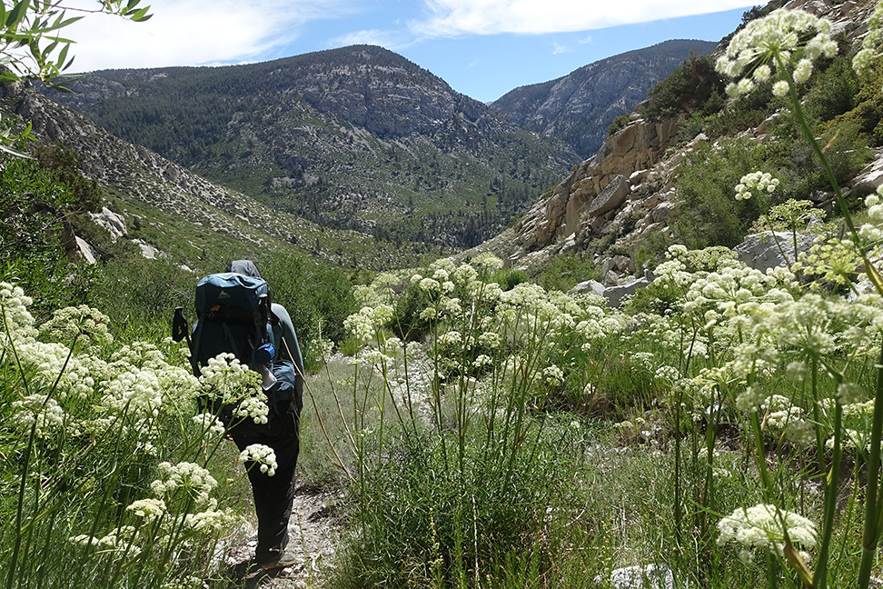
Ah, trail! Trail trail trail. The trail towards Colby Pass is obviously not popular, giving it a wonderful feel when you have it to yourself on the fourth of July in a national park. We enjoyed some easy creek crossings and plenty of flowers, and we withstood the moderate mosquito hordes. The trail seems to head into Cloud Canyon but then uses the northern prow of Whaleback to traverse up towards Colby Lake, providing very cool perspectives of the surrounding topology. Our spirits were great and the altitude wasn’t an issue any more. We rested at Colby Lake for lunch and watched the fish, who weren’t as acrobatic as those in Lake Reflection.
View north from the traverse up the prow of Whaleback:
A gigantic mushroom growing in the middle of the Colby Pass Trail
The trail up to Colby Pass became much more alpine above the lake, and went from overgrown to rocky as we gained elevation. The mosquitos above 10,000ft were surprisingly bold so we kept moving. The switchbacks up to Colby were impressive and we made quick work of the ascent. We had the pass all to ourselves in the sun on the fourth of July, win win win! Great views on both sides into Sequoia NP (SE) Colby Lake/Kings Canyon (NW). A bighorn sheep must’ve recently enjoyed the view, too, based on week-old poop on top of a perfect boulder pile right on the pass.
Colby Lake from the Colby Pass Trail
Another alpine pass!
Our descent was chouette. The nearby tarns and meadows were gorgeous, with growing views of the Kaweahs, Kern Point, Picket Guard, and Mt. Guyot. Eventually the hike felt like a frolic through Narnia, with twisted trees somehow thriving among the talus. We hoped to find a worn site up here, rather than a thousand feet down, but even the promising ones had vegetation, so we proceeded on.
A tarn just below Colby Pass
Hiking through Narnia with Picket Guard and the Kaweahs in the distance
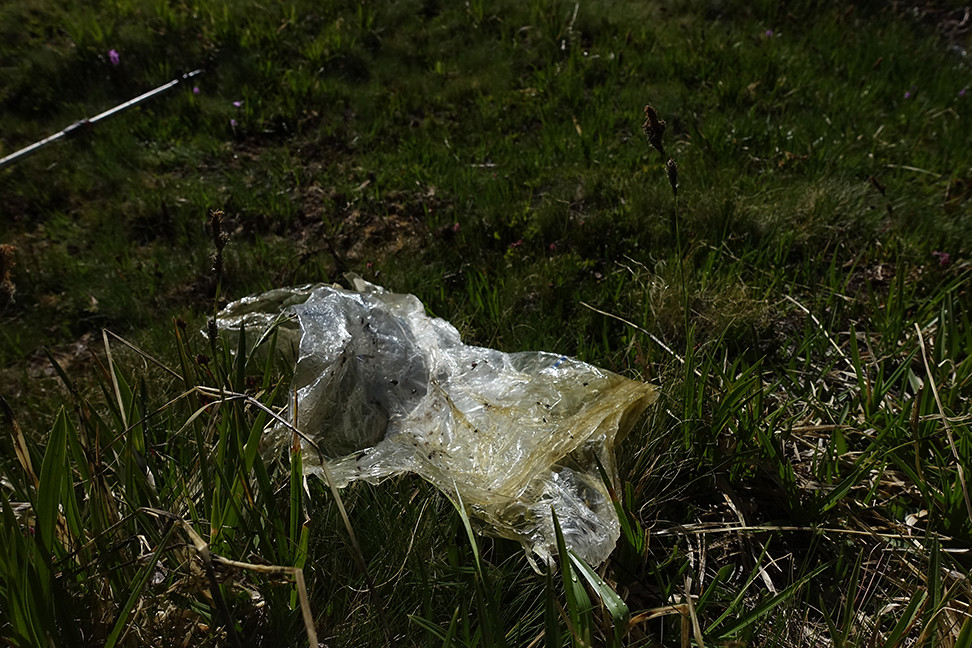
I packed out this gigantic piece of plastic that was stuck on a bush in a small stream
I think that's Milestone Mountain in the distance, but I'm not sure. The view is up towards Milestone Basin, which we will hopefully visit within the next few years... we just didn't have time to explore it if we wanted to meet our friends the next day at Bighorn Plateau.
I was sad to descend out of the Narnia environment. The mosquitos went crazy around 10,800, and at a certain point I made Caroline stop so I could spray her butt with DEET (permethrin had done nothing and no less than 30 mosquitos were now attacking her rear).
The steep descent down towards Gallat's Lake area, where the mosquitos attacked
After we lost a few hundred feet and reached a roaring Kern Kaweah river, we scored a nice site just off trail near a waterfall, avoiding a sister site that was occupied by dozens of bowl-sized ant holes. The views were mediocre but the setting was nicer than Big Wet Meadow, and we were still all alone. I finally was able to sleep easily, too, having acclimated well.
Day 6 (12 miles, +3700, -2500, trail): Near Gallats to Bighorn Plateau, via Junction Meadow (Sequoia)
Tonight we hoped to meet our friends at Bighorn Plateau, so we got moving by 7:30am. It had been cold the evening before, but the frost fended off the mosquitos as we hiked through Gallats. The horseshoe bend in the river was pretty, as were the surrounding slopes and short peaks. Sequoia is a cool park!
Horseshoe bend in the Kern Kaweah River, with a sweet view of Picket Guard's funky amphitheater formation
The trail remained lightly used, keeping us on our toes. As the air warmed the skeeters emerged, and we were glad to have broken into our DEET. The trail takes a fun turn up and around a big granite bump before it makes the final descent towards Junction Meadow, giving some great views back towards Gallats.
Why are we heading UPHILL on a descent? Oh.
The view back up the canyon
We encountered fields of white flowers, which smelled like bubblegum, as our descent continued, and were thankful when the trail deftly cut between groves of manzanita and aspen. We could see the trail we’d be on in a few hours - a long traversing cut in the forest, which is a 4 mile segment of the High Sierra Trail.
Haven't quite figured out which flowers these were, but they were everywhere
Eventually we reached the wide intersection of the Kern with the Kern-Kaweah River. It was a long but shallow wade over multiple braids and granite piles, but it kept us cool in the sun.
The trail led us into a calm grove of pines, and we ate at the junction with the High Sierra Trail. No other humans in sight.
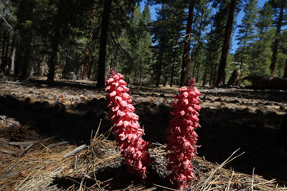
Snowplant in the Jeffrey pine grove
A forest all to ourselves (we must've been in between High Sierra Trail hikers, since we talked to JMTers who encountered boatloads of em)
Soon we were regaining the altitude we had just lost, climbing long switchbacks a few hundred feet from the Kern. The views southward and west were satisfying, with classic U-valleys, a cave that more skilled climbers should someday conquer, and an expansive view of our morning descent. It was great seeing the Kaweahs from this perspective.
You can barely make out the descent we had completed a couple hours prior, including the granite bump.
Southward into Sequoia
We filled up on water where Wright joins Wallace creek, the waterfall lining up perfectly with the view down canyon. Mosquitos here weren’t bad.
Further up, we walked through an old, partially burned forest on easy trail. Occasionally there were switchbacks through more talus like terrain but it was still easy.
When we finally merged with the JMT, we encountered hikers for the first time since Big Wet Meadow. We still had hundreds of feet to climb to Bighorn Plateau but our excitement grew knowing we’d soon be with some great friends. As the trail meandered through slowly ascending terrain, we glimpsed Mt. Whitney and Mt. Williamson. Just as we rounded a bend towards the last half mile before our destination, I found my favorite dead tree of the trip. Win!
Whitney - our first ever views from the west!
Tawny Point looming under awesome clouds, with Tyndall and Williamson peeking through the shadows in the distance
Favorite dead tree
Once on the plateau, I identified the small lake that we had agreed we’d try to meet at on this particular Thursday in July in the year of our science 2018. The tents nearby were clearly not those of our friends, but four figures were sitting further off, so we approached. It was them!
Two of our four friends, an hour after we had met up, on the southern boundary of the plateau
What a great place to camp!
Williamson, Whitney, Guyot, Kaweahs
Tawny Point
Perspective distortion with Williamson in the backdrop
Whitney again just because
It was so wonderful to be with our friends. They shared some of their food from their last resupply, since this was their second to last day of the JMT. The views on the plateau were easily the best of the trip. The tallest peaks of the Sierra Crest to the east, the Kaweahs to the south, the GWD to the west. Deerhorn Mountain looked particularly slick, and earned itself the nickname, the Madonnas, by unanimous vote. We had a ball sharing stories and provisions all afternoon, culminating in a secular tea ceremony on top of a prominence just south of our tents that gave a 360 view of the said ranges. Whitney and Williamson treated us to true alpenglow around 8:20pm, and we were then treated with an amazing sunset to light the panorama. What a win.
Great Western Divide to Junction Peak
Deerhorn Mtn, Caltech Peak, Diamond Mesa, and Junction Mtn
Alpenglow on Williamson (on the left)
Alpenglow on Whitney!!!
Sunset over Table Mtn
More sunset, now with better views of Midway, Milestone, and I believe Thunder Mtn
Day 7 (14 miles, +2400, -3700, trail): Bighorn Plateau to Bubbs Creek via Forester Pass
We said goodbye and good luck to our friends, who were headed to Guitar Lake before a sunrise summit of Whitney. Our path, in the opposite direction, went around Tawny Point and up past Diamond Mesa towards Forester Pass.
Goodbye, friends!
Our compadres head off with their summit sunrise destination on the horizon
We cleaned up lots of trash at JMT sites, including someone's abandoned TP bag
This sign was clearly warranted:
Near the lakes just south of Forester, we watched a curious marmot with a couple from Bend, OR, who were doing the JMT.
We stopped for lunch and eyed Caltech Peak from among some boulders near the trail. I had read about the northeast slope of Caltech working well, class 2/3, but Caroline was now itching to make significant miles today to enable exiting on Saturday and splitting our return drive in half at my grandparents’ cabin in Twain Harte CA (an idea that also appealed to me). We explored the base of Caltech and decided we didn’t feel like tackling steep talus traverses over steep snowfields to reach its summit. Instead, we cleaned our legs in the newly-melted lake, at 12,500, and returned to our gear.
Our final alpine bath, with a shoulder of Caltech on the left
My iPath hat's message is timeless
We leapfrogged with other hikers on our way up Forester, which has some impressive switchbacks at the top, and shared the pass with a half dozen people. We had fun chatting with them about our mutual adventures — no one really knows about Colby Pass and beyond! We scarfed down one of Clif Bar’s newer builder bar concoctions, which was like a cinnamon bun in bar form, and then began the long descent down.
Caltech Peak and unnamed lakes, from the trail up to Forester Pass
Forester Pass's major problem for early-season PCTers, now dry
Glorious switchbacks right below the pass
Victory, and other people to take our photo!
The views of Junction Peak behind us were quite rewarding, and the trail was fun and steep.
The basin north of Junction Peak
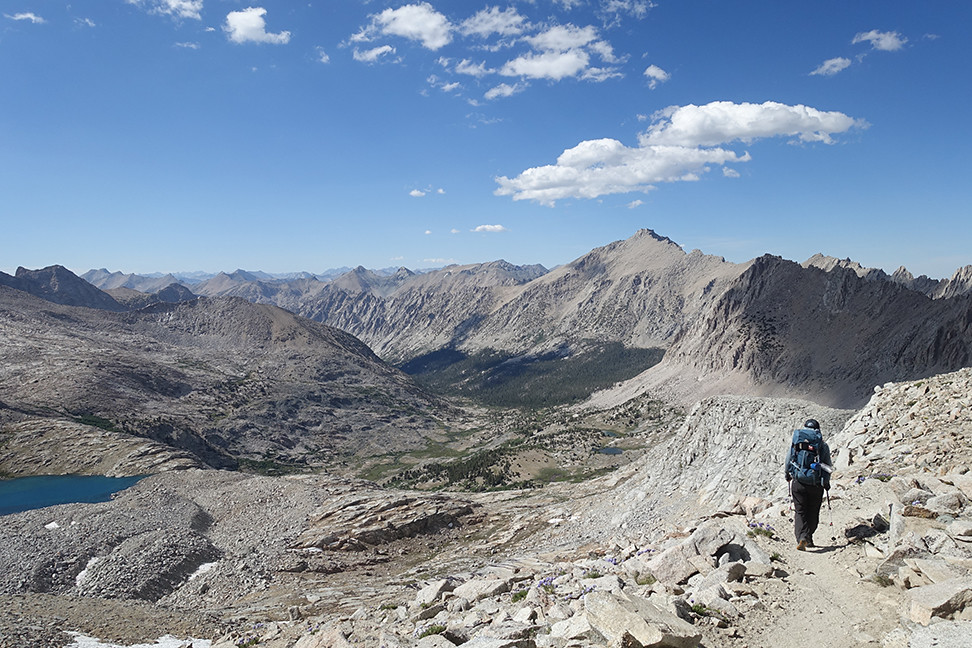
We could see our destination deep in the canyon, on the southern side of Kearsarge Pinnacles, and it kept us motivated.
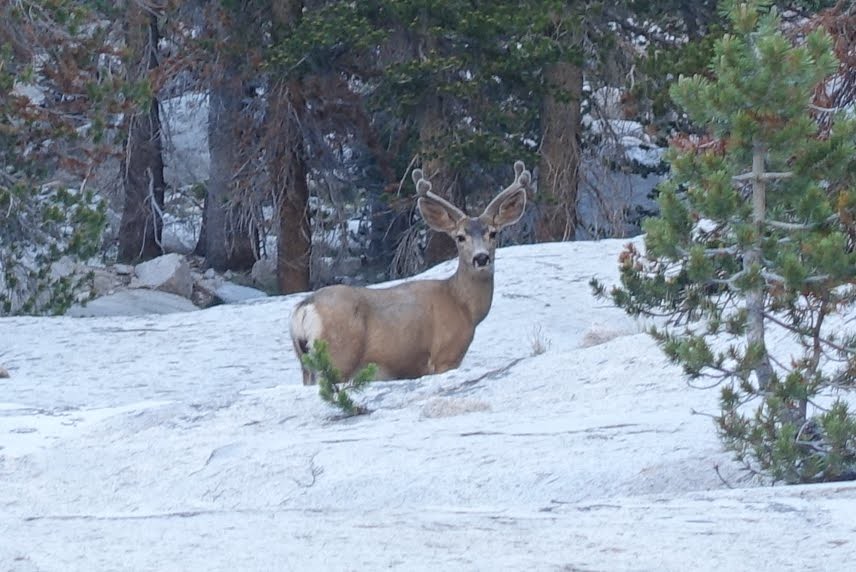
Looking back up at Junction Peak
I wish I had taken a few more of these, to ensure a sharp one, since the deer underneath this weird granite dome looked so awesome, but we had a pace to maintain.
We were undecided regarding a push all the way to Vidette, which would shorten our last day out, but found a good campsite about 2 miles from Vidette, at just over 10,000ft. We camped next to a gorgeous section of Bubbs Creek, where it flows strongly but mere inches deep over wide granite slabs, with views of the pinnacles peeking through the trees. It would be our last night in the wilderness, and we were very content.
Kearsarge Pinnacles from the south
Day 8 (10 miles, +2500, -3500, trail): Bubbs Creek over Kearsarge Pass and out
Hello, friend!
This would be our last hike of the trip. It was uneventful, but we took time to admire the views one last time, when we could. It was a lot easier to identify the peaks we had walked around all week as we ascended east towards the final pass.
East Vidette, the star of many a SEKI album
Shoulder of West Vidette, South Guard, and the east ridge of Brewer
I believe this is Deerhorn from the north, taken from Bullfrog Lake
Final view of Kearsarge Pinnacles and Lakes
Final panorama from Kearsarge Pass-ish (maybe just west of it?)
There was again a large party of many people, dayhikers and backpackers and thru hikers, at the top (“oh so you’re from Sherman Oaks too!?!?”) so we didn’t linger long. We practically sprinted down to the car, excited for the Gatorades we had stashed in the car and Burger Barn in Bishop. We passed some firefighters, one who was hiking shirtless, as we descended. When we reached our station wagon, it was all alone in the dirt pullout - I guess the crowds had been worse the weekend prior to July 4th as opposed to following. We disposed of some of the trash we had collected on trail (though I guess I do slightly regret not packing out someone’s lost shoe that I spotted near Lake Reflection earlier in the week), retrieved our excess food from a bear box, and got snacks and Gatorade ready for our hourlong drive to Bishop.
Our pace picked up on our descent
OTHER PEOPLE'S TRASH UGH BUT YES I'LL BE A HERO
Volvo! <3
Burger Barn was great, though it was over 100 degrees F in the Owens Valley. We saw a sticker that said "Matt Pike for President," and our hearts melted... our first date, over five years ago, was at a High On Fire show. Metalheads can love the high sierra, too
The drive to Twain Harte, over Sonora Pass, was fun — all the snow we had seen in mid-May on the pass, after a splitboarding trip, was gone, leaving just dirt! Just west of the pass, I had to slow down for a pair (yes a PAIR) of marmots just lazing about on the road in the late sun. What a happy sight. I had no vehicular company in my direction on the pass, which was wonderful. Back in Twain Harte, we picked up some ready-made salad and mac and cheese and beer for dinner. We showered, carefully removed our Leukotape, and enjoyed the foothill civilization, a good intermediate before our return to the city.
Day 9: Back to the Bay
Sunday morning, Caroline took care of the drive back to Oakland, and we had the day to prepare for work. Even over a week out, I still haven’t recovered emotionally. North Guard, Brewer, Milestone Bowl, Caltech — we missed you this time, but we’ll be back.