TR: North Lake to North Lake Loop ~ October 2017

If you've been searching for the best source of information and stimulating discussion related to Spring/Summer/Fall backpacking, hiking and camping in the Sierra Nevada...look no further!
User avatar
Bluewater
Topix Expert
Posts: 584
Joined: Sun Oct 23, 2011 3:33 pm
Experience: Level 4 Explorer
Location: Laguna Beach
Contact:

TR: North Lake to North Lake Loop ~ October 2017

Post by Bluewater »

The popular "North Lake to South Lake Loop" or "Evolution Loop" is usually referred to as a "loop". . . The Forest Service and Recreation.gov describe it as the "North Lake to South Lake Loop". There are countless online trip reports for the "loop" including some on Summitpost, Backpackinglight and even here at High Sierra Topix. I stopped counting after finding 14 videos for the "loop" on YouTube.

According to the FKT site the current fastest known time for the "Evolution Loop" is 10 hours and 31 minutes. Impressive, although not so much considering the FKT holder had to hitch a ride back to North Lake after "finishing" at South Lake.

I have often wondered what it would be like to do a proper loop and include the last section over the Tyee Plateau and close the circle back to North Lake . . . So last week I hiked from North Lake to North Lake and along the way threw in some cross country travel and peak bagging to keep it interesting. In the end it was a 64+ mile loop with four passes and 34,200' of elevation change.

I started with my usual late night drive through the desert on Wednesday night to camp at the base of the East Side of the Sierra near Independence. Spending a night at 4,000' always helps me acclimatize to the big climb over the Sierra Crest on the first day, and by Thursday morning I was ready for the climb over Lamarck Col from the North Lake trailhead.


north lake to north lake loop.JPG

Day 1: 11 miles, 4,000' up, 2,000' down.

The lingering snowfield at the base of Lamarck Col.

Image

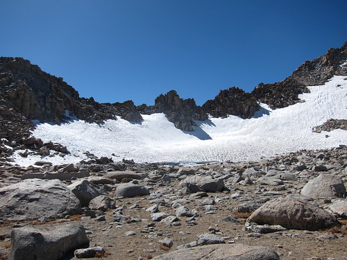
Crossing the final snowfield on the way over Lamarck Col.

Image

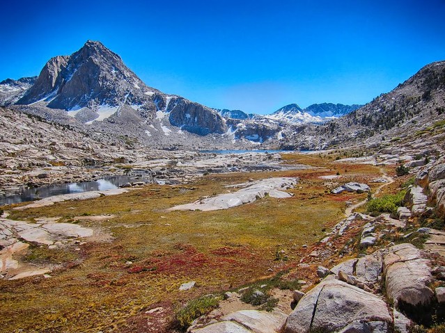
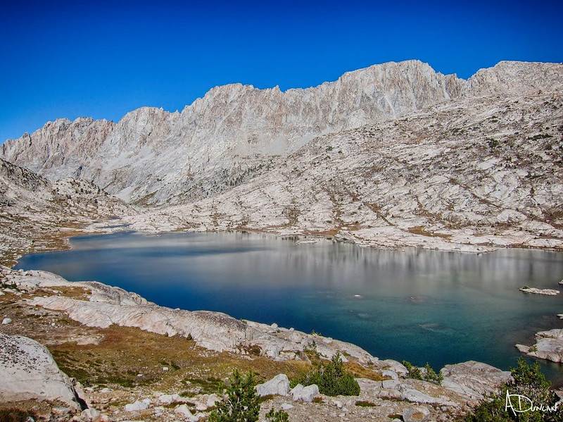
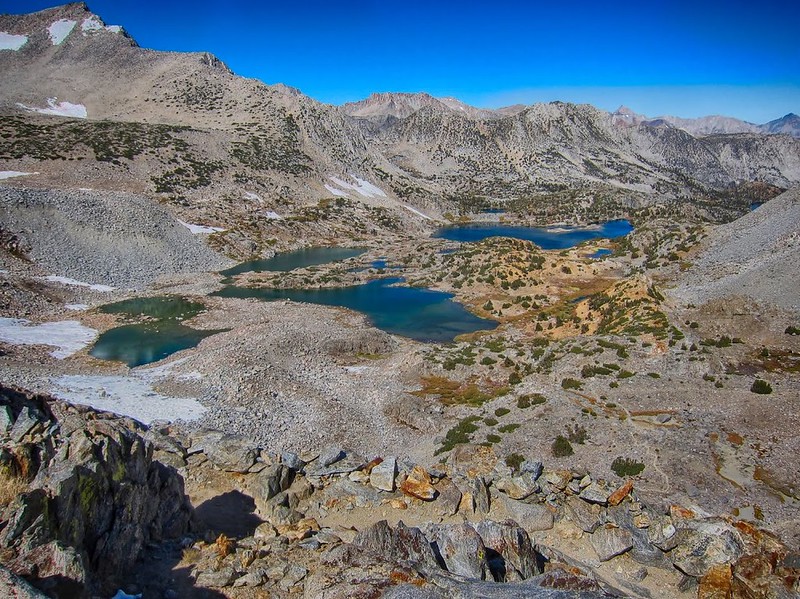
Emerald Lakes in Darwin Canyon.

Image


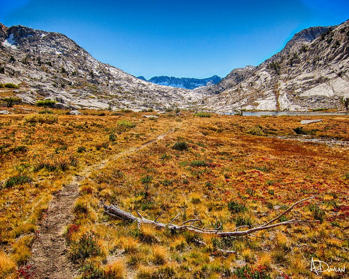
After trudging along the sometimes slow going through the boulders in Darwin Canyon I made it to the idyllic Darwin Bench with plenty of time to find a nice place to camp and have dinner before settling in to watch the alpenglow.

Image


Day 2: 11 miles, 1,700' up, 1,200' down:

After a windy night I was looking forward to seeing the fall colors in one of my favorite areas of the High Sierra: Evolution Basin.

The contrast between the lingering snow, high water and abundant wildflowers from earlier this summer and the dry golden meadows and low water levels in fall was striking. I strolled along the JMT, over Muir Pass and made camp above Helen Lake.

Fall colors on the outlet of Darwin Bench.
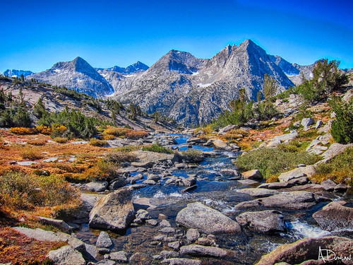
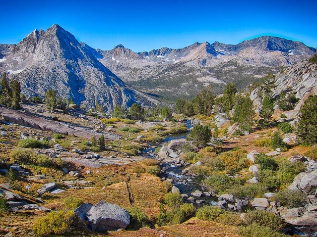
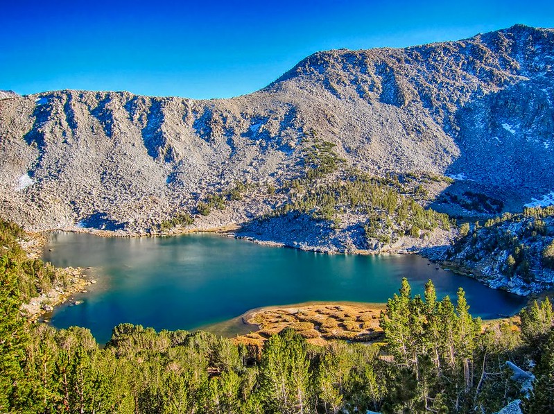
Image

Image

Evolution Basin:

Image

Image

Image

Image

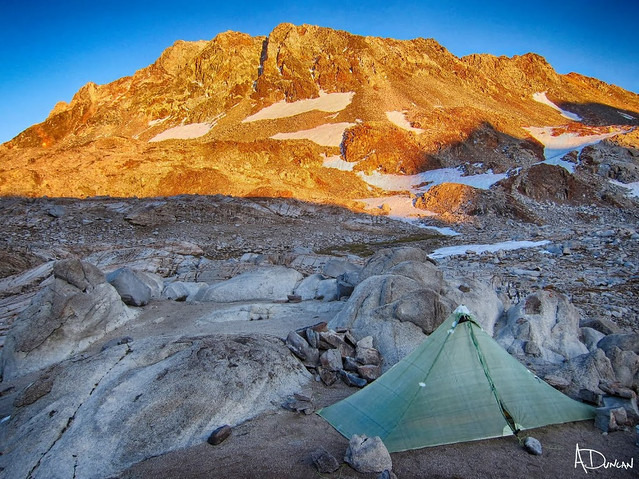
Alpenglow on the Black Divide from camp above Helen Lake.

Image


Day 3: 14 miles, 3,200' up, 5,400' down:

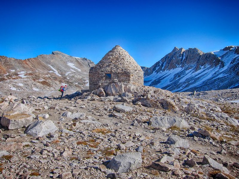
As all of my backpacking buddies know, for me an "alpine start" begins at about 8:00 am. . . at the earliest. This morning was no different, and by 8:00 am I was starting the approach to Black Giant Pass. I made it up the straightforward route to the top of Black Giant by 11:45 am and after taking a few photos I scree-skied down the west slopes of Black Giant and got back to camp by 1:30 pm. With many hours left in the day I packed up and headed back onto the JMT and down through the beautiful outlet of Helen Lake.

While taking a break at the top of a huge waterfall overlooking LeConte Canyon I accidentally let my bear canister roll over a ledge. I watched as it bounced off hundreds of feet of granite ledges and waterfalls until it finally reached the river below. As it floated down the river I figured it was lost for ever, until it got stuck in a pool created by some downed trees.

It wasn't long before I found a cross country route to the river below, waded across the river, unloaded the water from inside the canister, reloaded it in my pack, re-crossed the river and finally rejoined the JMT. Somehow the canister survived with only a small dent in the metal corner on top and no damage to the carbon fiber sides. Amazing. Thank you Wild Ideas for making a solid canister!

The trail crews had already cleared much of the avalanche debris in lower LeConte Canyon and I made good time on the JMT to the Bishop Pass trail junction. After a dinner break there was still time to head up the switchbacks toward Dusy Basin and by 7:00 pm I found a place to cowboy camp on a ledge about 1,000' above LeConte Canyon.

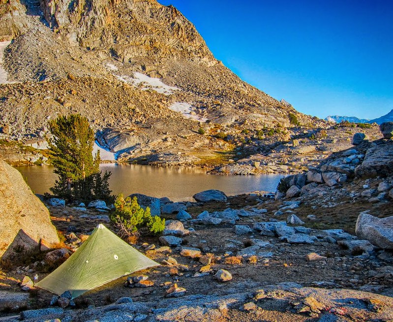
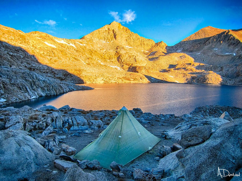
Sunrise on Helen Lake.

Image

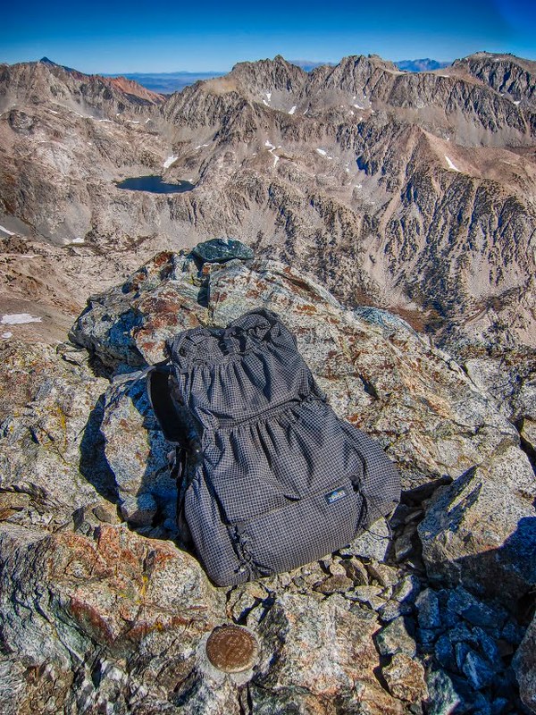
A Zpacks Arc Haul compresses into a nice little summit pack.

Image

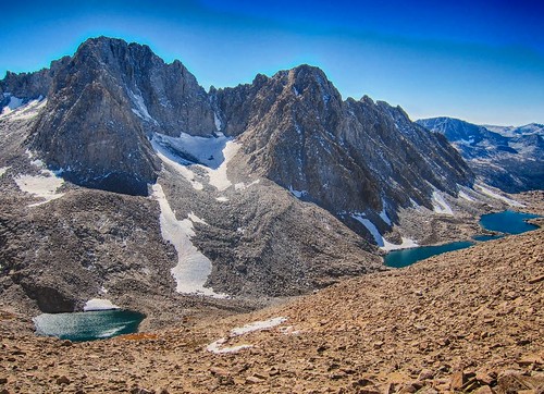
The Palisades from Black Giant:

Image

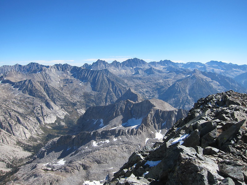
Ionian Basin from Black Giant:

Image


Day 4: 27 miles, 8,200' up, 8,500' down:

After spending some relatively easy days enjoying Evolution Basin it was time to make tracks back to North Lake. Although it would be a long day I was looking forward to seeing the Tyee Lakes and Tyee Plateau.

I wasn't sure how long the hike back to the car would be. I had already been through most of the route many times and I hadn't bothered to bring a map or measure the distance beforehand. It ended up being a 12 hour day to make the 27+ miles back to the North Lake parking lot. My usual 8:00 am start meant that I would be doing some night hiking by headlamp at the end. . . but since this was probably my last trip of the season I wanted to make the most of it and a little night hiking was fine with me.

The trail hiking through Dusy Basin and the Tyee Lakes was beautiful. Unfortunately a few miles of road walking was necessary to make this a real loop. There is a short section, about 1.5 miles from the South Lake trailhead to the Tyee Lakes trailhead, and another 2.5 miles from the Lake Sabrina trailhead to the North Lake parking lot.

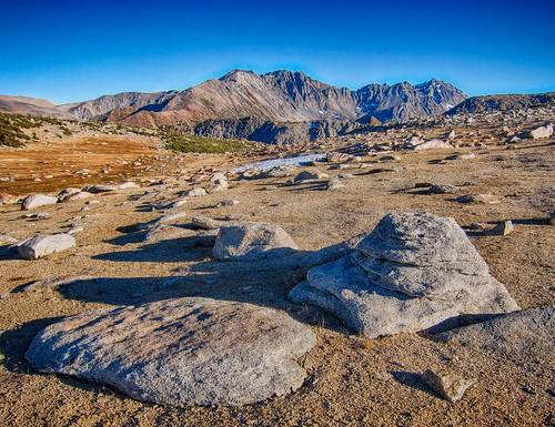
I was surprised by the beauty of the Tyee Lakes, the stark solitude of the Tyee Plateau and the incredible views of the Palisades and Piute Crags from the top. The well maintained trail up made for some good hiking but the final approach to the Tyee Plateau and the downhill section to George Lake was more like a narrow sandy single track, similar to the final climb to Mt. Langley.

By the time I made it to the Lake Sabrina trailhead it was dark, cold and windy so I put on an extra layer and hiked the final 2.5 miles by headlamp to North Lake. It was 37 degrees when I finally made it to the car and I cranked the heat as I sped downhill to a welcome cheeseburger in Bishop.

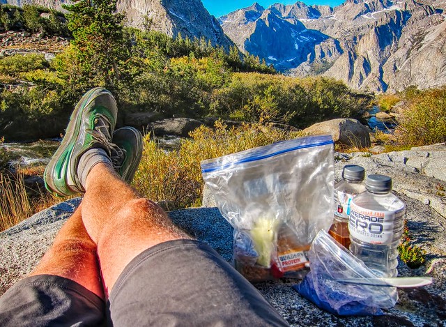
Breakfast in a bag, overlooking LeConte Canyon from Dusy Basin.
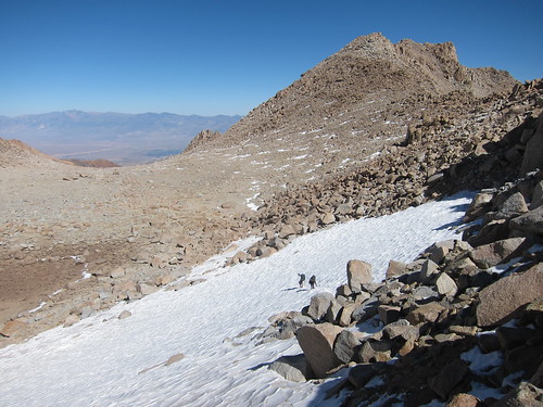
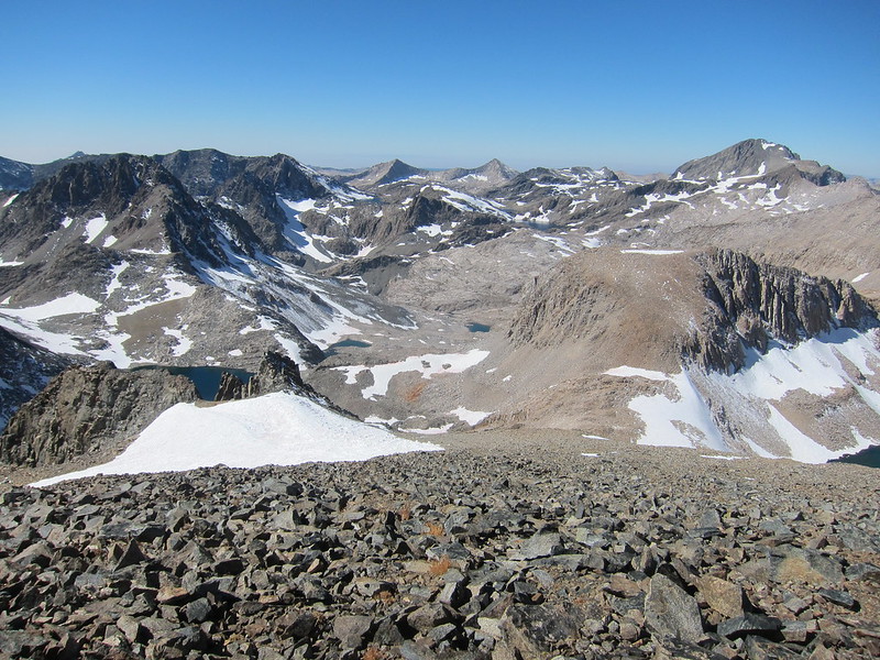
Image

Bishop Pass view.

Image

Upper Tyee Lake:

Image

The Palisades from Tyee Plateau:

Image

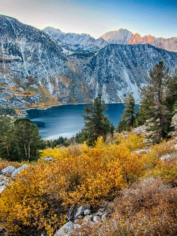
Fall colors at sunset over Lake Sabrina.

Image


Thanks for reading. For the whole story I did a more detailed trip report here:

https://seatosummitultralight.blogspot. ... .html#more
You do not have the required permissions to view the files attached to this post.
Last edited by Bluewater on Tue Oct 17, 2017 1:24 pm, edited 1 time in total.
User avatar
giantbrookie
Founding Member & Forums Moderator
Posts: 3582
Joined: Wed Dec 28, 2005 10:22 am
Experience: N/A
Location: Fresno
Contact:

Re: TR: North Lake to North Lake Loop ~ October 2017

Post by giantbrookie »

Beautiful fall High Sierra photos! As nice as all of them are, I really like the Black Giant summit views. This provides angles we don't usually see in photos of that region.
Since my fishing (etc.) website is still down, you can be distracted by geology stuff at: http://www.fresnostate.edu/csm/ees/facu ... ayshi.html" onclick="window.open(this.href);return false;
User avatar
hiac
Topix Acquainted
Posts: 28
Joined: Wed Aug 05, 2015 7:45 pm
Experience: Level 4 Explorer

Re: TR: North Lake to North Lake Loop ~ October 2017

Post by hiac »

very nice. is your gear DIY?
User avatar
kpeter
Topix Fanatic
Posts: 1449
Joined: Mon Jan 04, 2010 1:11 pm
Experience: Level 3 Backpacker

Re: TR: North Lake to North Lake Loop ~ October 2017

Post by kpeter »

Gorgeous to see the complete loop at this time of year. Nice photos.

I turned it into a complete loop but did it via Piute Canyon, and was much less ambitious than you were in speed and elevation. I was inspired by Timberline who posted here about using Tyee Lakes to make it into a genuine loop. He started on the West side, though. Either way, I really think that the Tyee Lakes portion adds quite a lot to the trip. Thank you for taking me back down memory lane! I really like the fall colors!

http://highsierratopix.com/community/vi ... ete#p46912

http://www.highsierratopix.com/communit ... f=1&t=5811
User avatar
Hobbes
Topix Fanatic
Posts: 1120
Joined: Wed Apr 27, 2011 8:09 am
Experience: N/A
Location: The OC

Re: TR: North Lake to North Lake Loop ~ October 2017

Post by Hobbes »

Nice. Did you check out the via francigena when you were in tuscany?

We've been coming across hikers during our day trips. Looks interesting.
User avatar
oldhikerQ
Topix Regular
Posts: 264
Joined: Mon Jan 21, 2013 9:50 am
Experience: Level 3 Backpacker
Location: South OC, CA

Re: TR: North Lake to North Lake Loop ~ October 2017

Post by oldhikerQ »

Thanks for a great trip report. It is interesting to see the fall colors in this area. I've been through the area twice, but both times in summer (July and early September) and have never seen colors like these.
Two roads diverged in a wood, and I — I took the one less traveled by,
And that has made all the difference.
Robert Frost
User avatar
tie
Topix Regular
Posts: 129
Joined: Mon Jun 16, 2014 11:42 am
Experience: N/A

Re: TR: North Lake to North Lake Loop ~ October 2017

Post by tie »

Great trip report. Black Giant does have excellent views.

(Note: You'd get higher quality images if you turned off HDR on your phone. This is a bit offensive: "Impressive, although not so much considering the FKT holder had to hitch a ride back to North Lake after 'finishing' at South Lake.")
User avatar
Bluewater
Topix Expert
Posts: 584
Joined: Sun Oct 23, 2011 3:33 pm
Experience: Level 4 Explorer
Location: Laguna Beach
Contact:

Re: TR: North Lake to North Lake Loop ~ October 2017

Post by Bluewater »

Thanks for checking out the photos and for everyone's comments.

I haven't done a lot of peak bagging, and seeing the views from Black Giant was one of the high points of the trip. I had planned on exploring Ionian Basin but the route up the north side of Wanda Pass was still holding a lot of snow and I couldn't find my axe and crampons, so I decided to skip it and stay mainly on trail. Once I saw all of the snow still lingering in Ionian I knew it was a good call.

@hiac, much of my gear is homemade, but on this trip it was only my 10/50 quilt, w/b cuben mittens and a some cuben stuff sacks etc. If you're interested I did a post on the quilt here: http://seatosummitultralight.blogspot.c ... oidal.html

Thanks for the links Kpeter, I always enjoy reading your trip reports and I remember reading the one about North Lake to South Lake and some of the one about the South Lake - North Lake - South Lake loop. Your photos from the Tyee Lakes area look very different with all of the lush wildflowers. Nice!

@Hobbes, we didn't get a chance to check out the via francigena this time, but we are definitely headed back for more in the Mediterranean, probably Greece next time and in the 'off season'. August in Italy was like a really hot day at Disneyland although the crowds thinned out in Venice, Murano and Burano. Here's the usual tourist scene at Trevi Fountain:
trevi.JPG
@tie, It does seem a bit offensive that the FKT holder would claim he had done a "loop" :D . . . sometimes my sense of humor doesn't translate well in writing although my wife would question if I really have one.
You do not have the required permissions to view the files attached to this post.
User avatar
maverick
Forums Moderator
Forums Moderator
Posts: 11834
Joined: Thu Apr 06, 2006 5:54 pm
Experience: Level 4 Explorer

Re: TR: North Lake to North Lake Loop ~ October 2017

Post by maverick »

. sometimes my sense of humor doesn't translate well in writing although my wife would question if I really have one.
:lol: Sounds like my wife Andy.
Professional Sierra Landscape Photographer

I don't give out specific route information, my belief is that it takes away from the whole adventure spirit of a trip, if you need every inch planned out, you'll have to get that from someone else.

Have a safer backcountry experience by using the HST ReConn Form 2.0, named after Larry Conn, a HST member: http://reconn.org
User avatar
cgundersen
Topix Fanatic
Posts: 1338
Joined: Sun Jul 16, 2006 1:07 pm
Experience: N/A

Re: TR: North Lake to North Lake Loop ~ October 2017

Post by cgundersen »

bluewater,
I was impressed to see that much snow still on the northern faces of the peaks. For how chilly it's been getting up there, it looks like a lot of that stuff will stick around till next year. Speaking of chilly, even on the trip I took in August, we had mornings with thin glazes of ice coating standing water. But, you only alluded to feeling the cold on the way out, so I take it you were well prepared for the conditions; and, dang, the crisp blue skies look pretty inviting! Cameron
Post Reply

Who is online

Users browsing this forum: No registered users and 53 guests