I wanted to do a different variation on the Little 5/Big 5 Lakes loop. I did a variation (Timber Gap -> Bear Paw Meadow -> Kaweah Gap -> Little 5 Lakes -> Big 5 Lakes -> Lost Canyon -> Sawtooth Pass) a couple years ago and had a great time but had to cut a couple side trips short due to thunderstorms. I wanted to repeat as little as possible from the previous trip.
This year I went out Franklin and came back over Sawtooth again.
Day 0 - July 23rd
Trailhead -> Eagle Lake
Could not get a permit for Sawtooth or Franklin for day of as a walk in. All gone before 9 am, the ranger stated it was busier than 4th of July weekend. No problem and on to plan B. Got pie at Silver City and waited until 1 pm to get a next day Franklin Pass permit and an Eagle Lake Permit for same day. Hiked up to Eagle Lake. Pretty lake with too many people camped on the waters edge and hanging food very poorly. Found a nice quiet area up and away from the crowds.
Day 1 - July 24
Eagle Lake -> Trailhead -> Franklin Pass -> Little Claire Lake
Left Eagle Lake for a quick trip down and then started the "official" trip. Lots of flowers on the way up to Franklin Pass. The whole area around Franklin Pass has great views. Once down into Rattlesnake Creek it isn't as scenic.
[rimg]https://c7.staticflickr.com/9/8805/2855 ... 58d9_o.jpg[/rimg]
[rimg]https://c2.staticflickr.com/9/8036/2858 ... cd10_o.jpg[/rimg]
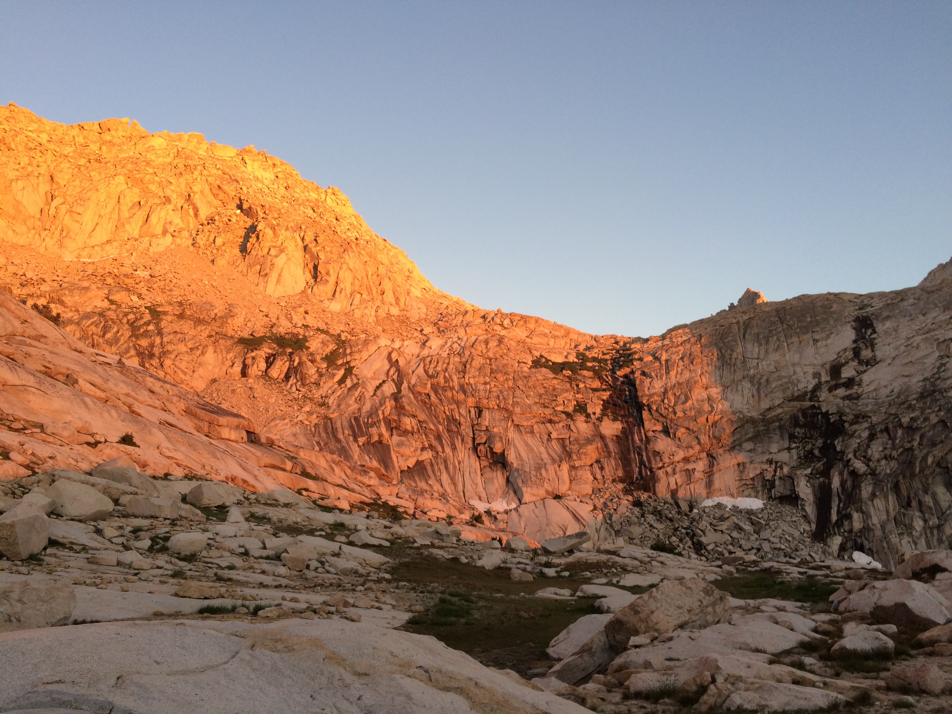
Day 2 - July 25
Little Claire Lake ->Lost Canyon Junction -> Upper Big 5 Lakes -> xcountry to Upper Little 5 Lakes -> Black Rock Pass -> Spring Lake -> Cyclamen Lake
This board was useful in finding out the cross country portion from Big 5 to Little 5 was easy. Found an unnecessary ducked route from Spring to Cyclamen. The glow at sunset from Cyclamen lake was spectacular.
[rimg]https://c1.staticflickr.com/9/8811/2848 ... a066_o.jpg[/rimg]
[rimg]https://c3.staticflickr.com/9/8732/2797 ... 219f_o.jpg[/rimg]
[rimg]https://c2.staticflickr.com/9/8370/2850 ... 3fd1_o.jpg[/rimg]
Day 3 - July 26
Cyclamen Lake -> Columbine Lake -> Sawtooth Pass and Peak -> trailhead
From this board I also learned you could travel from Cyclamen to Columbine Lake. I didn't find any specifics on the route, just that it was possible and class 2. It was easy enough to figure out on the fly although I did not pick the best route and found some class 3 sections. Apparently there is a ducked route but I never found it. I camped at Columbine lake exactly 2 years ago. I went by that spot this year and it was still covered in a snow bank. Much more snow this year. Summited vertigo inducing Sawtooth Peak on the way out.
[rimg]https://c4.staticflickr.com/9/8712/2850 ... ac8a_o.jpg[/rimg]
[rimg]https://c8.staticflickr.com/9/8364/2858 ... c258_o.jpg[/rimg]
[rimg]https://c5.staticflickr.com/9/8221/2855 ... fdb8_o.jpg[/rimg]
All pictures with a cell phone. Sorry, not a photographer.
A couple thoughts about the trip:
-It was hot every day and night. I didn't need a sleeping bag, down jacket, or windbreaker on the trip even camping at ~10.5k each night.
-Mosquitoes were not too bad.
-I only ran into people once at Black Rock Pass between Franklin Pass and Sawtooth Pass. Almost devoid of people once over the divide despite the number of permits issued.
-I wish there was a better permit system although I don't know what the solution is. Franklin Pass was booked, yet no one went over the pass to camp. Competing for permits with people who just camp at the closest lakes in large groups makes it tough.