Taboose Pass ~ October 2015
Posted: Mon Nov 30, 2015 4:35 pm
Taboose Pass - Upper Basin - Lake Marjorie - Bench Lake
With only a few days of good weather before the first real winter storms hit I headed up Taboose Pass for a five day cross country solo trek. Once over the pass the plan was to cross three off-trail passes into some remote basins that have been on my radar for a few years. The fall colors were beautiful but unfortunately there was enough snow lingering on the north facing slopes that I had to avoid my cross country plans and stay in the relative safety of Upper Basin, Lake Marjorie and Bench Lake.
After sleeping at a nearby trail camp I got an early start on Taboose Pass. I had read about how challenging (and hot) this hike can be in the summer but the cool fall temperatures made for an enjoyable hike out of the desert.
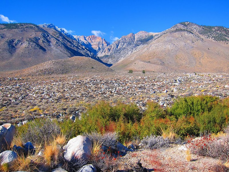
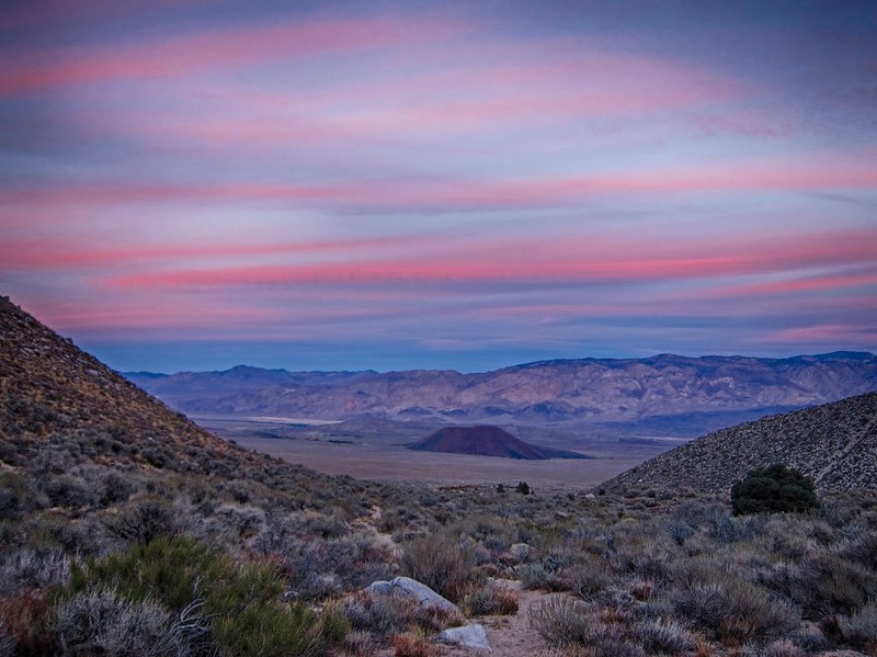
The start of the Taboose Pass trail on the desert floor. The pass is up there somewhere:
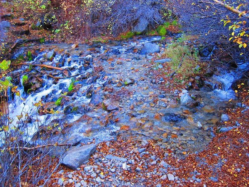
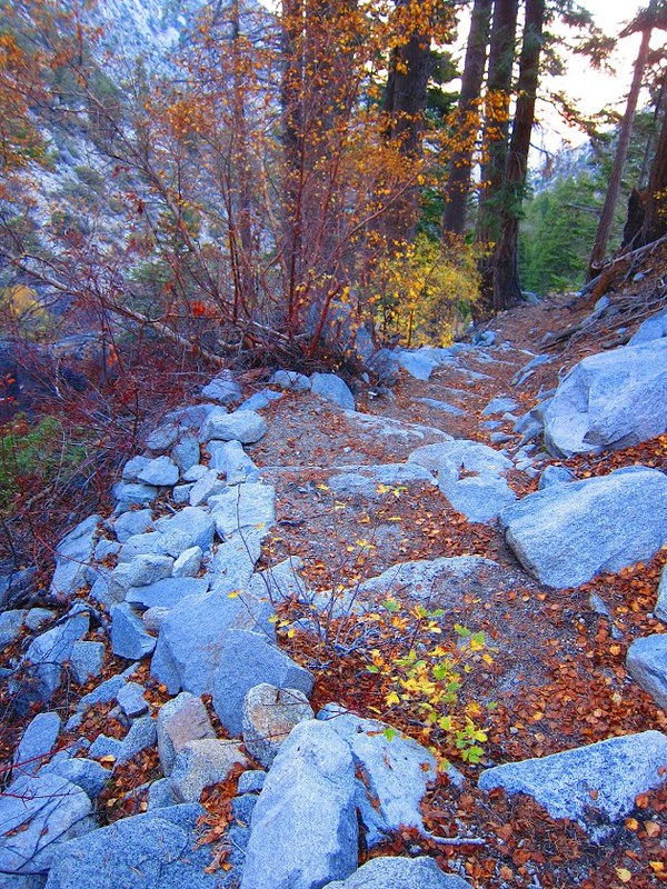
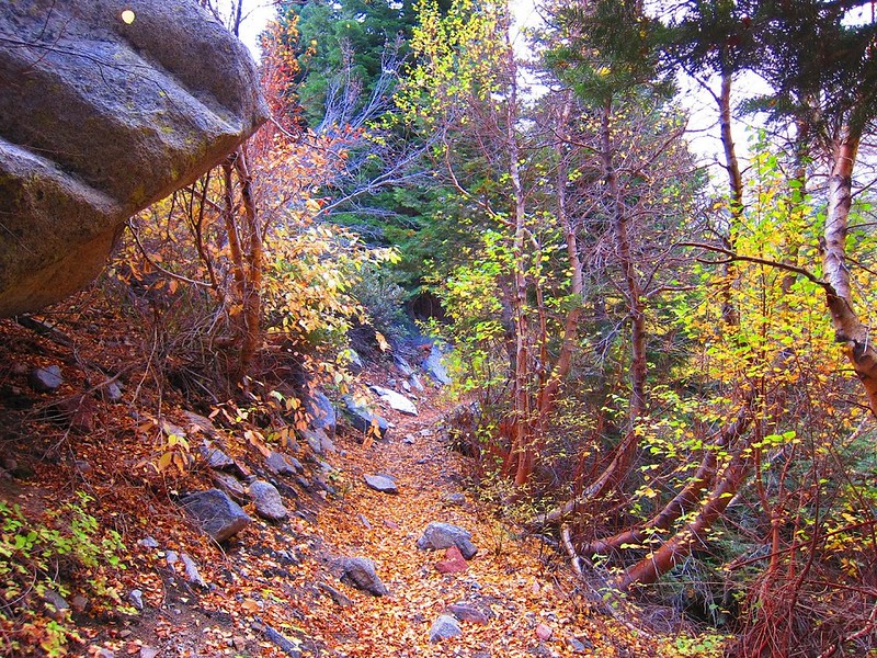
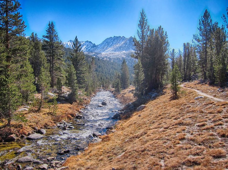
It wasn't long before I made the first creek crossing and hiked into the forested section. The fall colors were a striking difference from the desert I left behind:
The clouds rolled in by mid morning and would stay with me for the rest of the day. The forecast was for clear skies but this wouldn't be the first time an 'unscheduled' storm would blow through on this trip.
At first I was keeping track of the location of water sources and places to camp along the way for future trips, but there were so many I stopped making any notes and just enjoyed the hike.
Another flat place to camp:

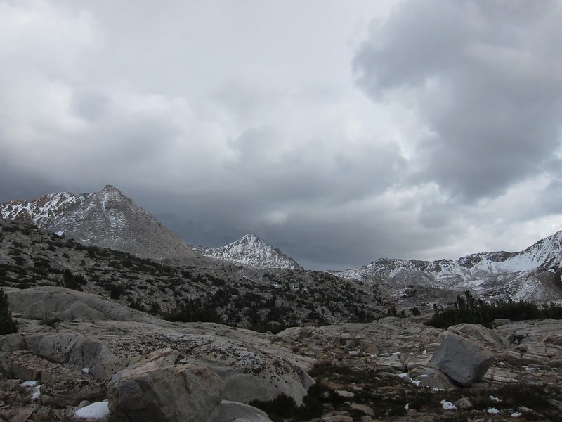
More storm clouds on the way:
I made it to the pass in time for sunset and quickly got to lower elevation to find a stealth camp in the shelter of the forest. It was windy and cold that night!
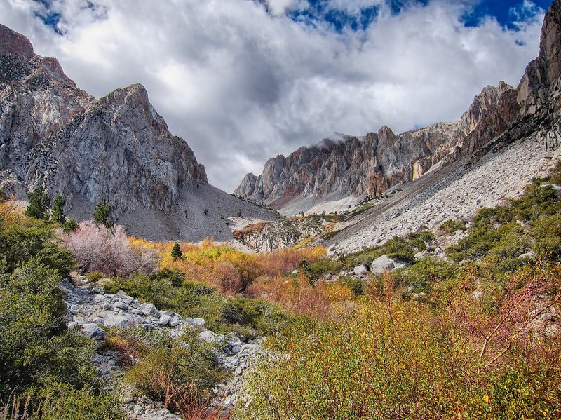
The next morning I headed into Upper Basin to check out the condition of UBC (Upper Basin Crossing: HST Map). From where I camped the trail descends over 600' to the Kings River before joining the JMT for the trudge back up to Upper Basin, so I stayed at about 10,600' and contoured via easy cross country and finally met the JMT near the outlet of Cardinal Lake.
Panorama looking down to the South Fork Kings River from camp:
Fall along the JMT on the way to Upper Basin:

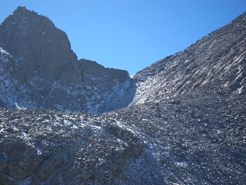
I left the JMT at around 11,000' and headed cross country toward UBC. On the way I could see snow on the northeast side of Frozen Lake Pass and the other north facing slopes in the area. UBC was holding snow and I knew the other XC passes on my planned route would be worse. I had been looking forward to seeing Amphitheater Lake, Dumbell Lakes and Lakes Basin as part of a cross country loop back to Taboose Pass, but after much internal deliberation I finally decided to play it safe and stay on more reasonable cross country and trailed areas nearby.
Intermittent snow on Frozen Lake Pass:
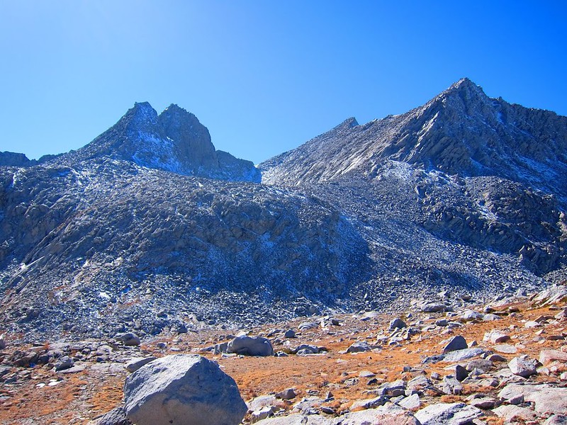
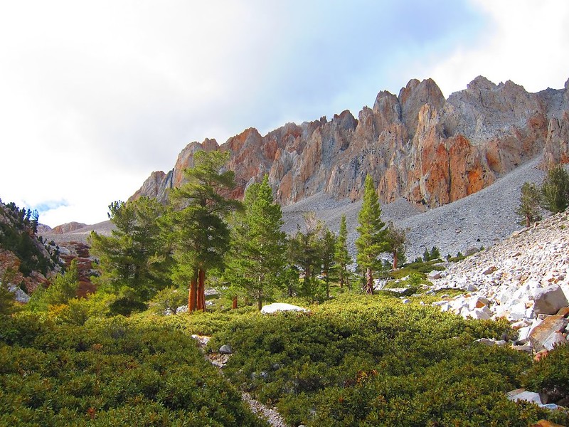
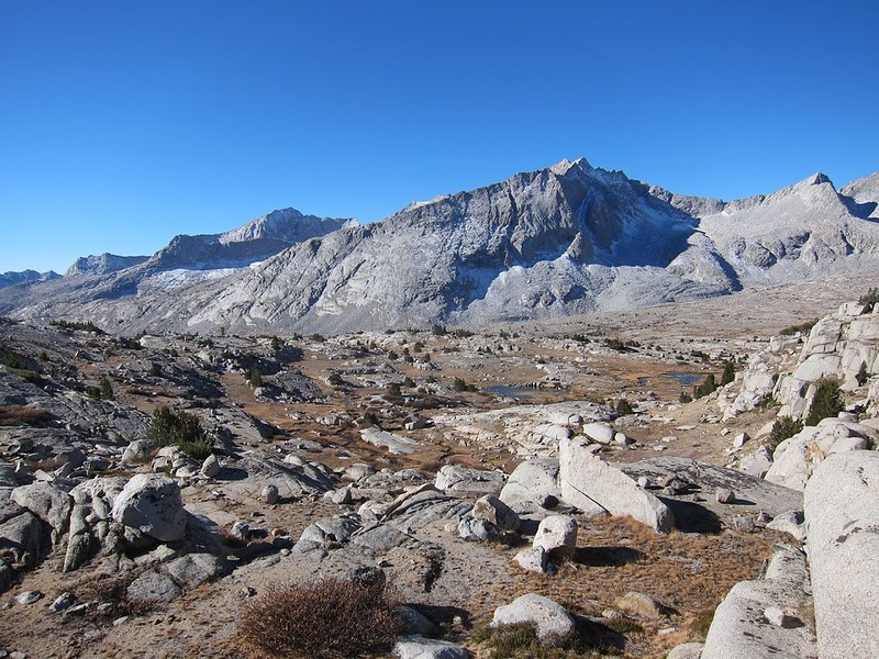
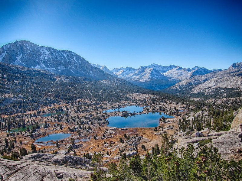
Once free of my planned route I enjoyed a more comfortable pace and explored Upper Basin. I remember wanting to come back here while passing through on the JMT in 2011. I decided to head across toward Lake 11,592 at the base of Split Mountain.
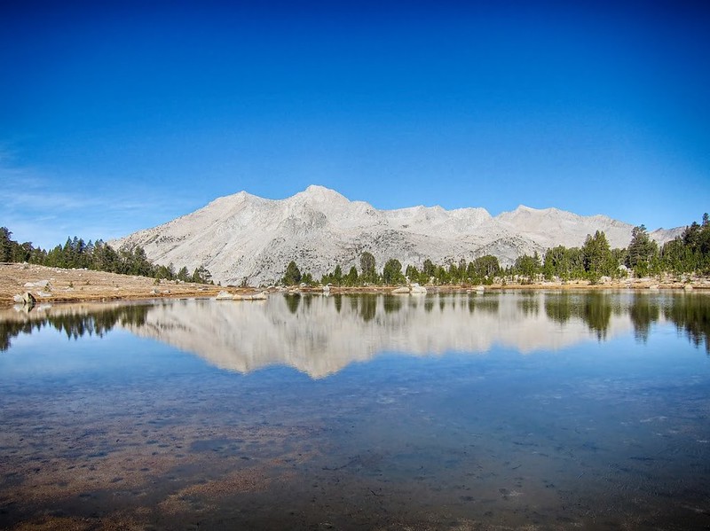
Looking across Upper Basin toward Split Mount from an un-named lake:

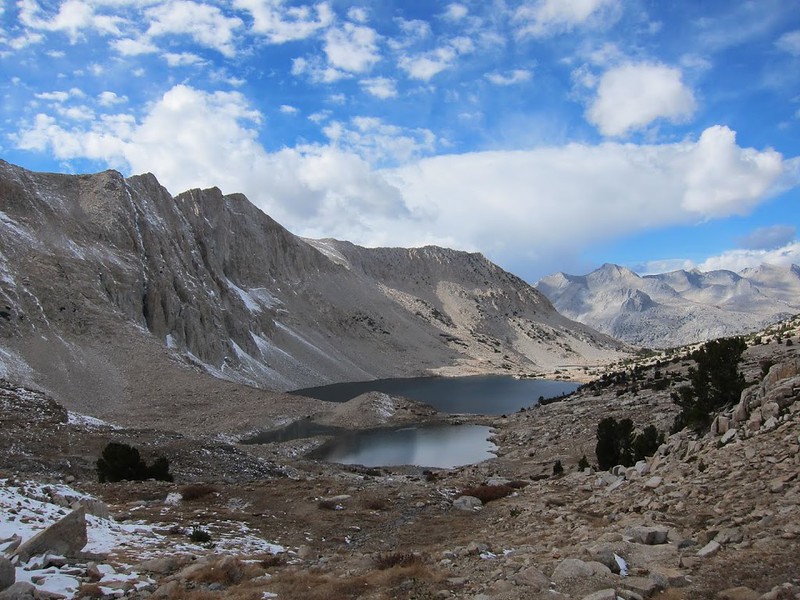
Lake 11,592:
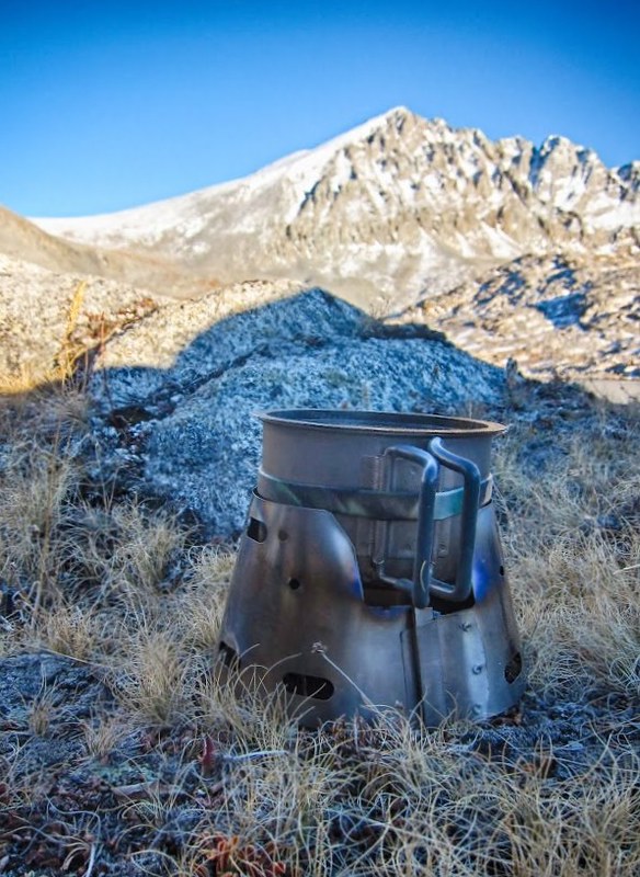
Simple stove for making dinner:
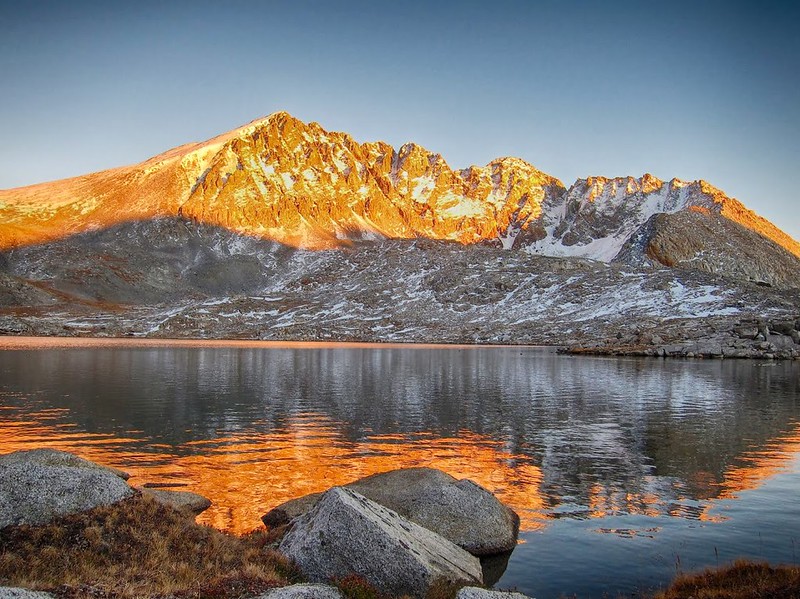
Sunset on Split Mountain:
Camp near the outlet of Lake 11,592:
I fell asleep listening to the ducks nearby (there were a lot of ducks). It got cold and windy that night, I must have been sleeping in a pocket of cold air because it got down to 21 f and I was just barely warm enough to sleep.
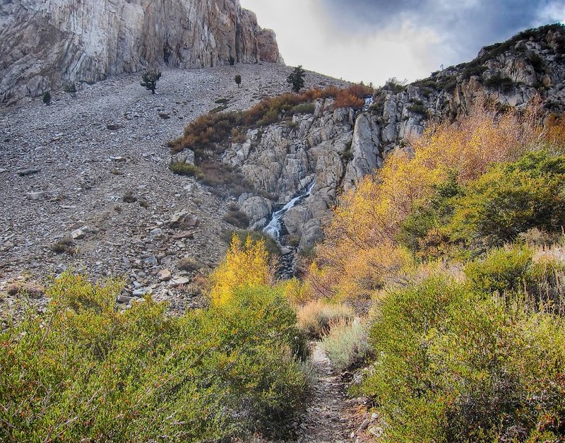
The next morning I explored the waterfalls, meadows and small lakes along the east side of Upper Basin. This was easy cross country travel through some very nice meadows and lakes that didn't show a sign of any human impact. . . and all under a 1/2 mile from the JMT corridor.
Meadow in Upper Basin:
Un-named lake at about 11,010':
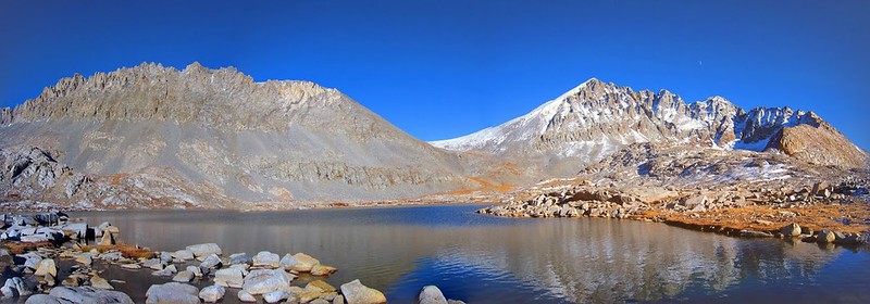
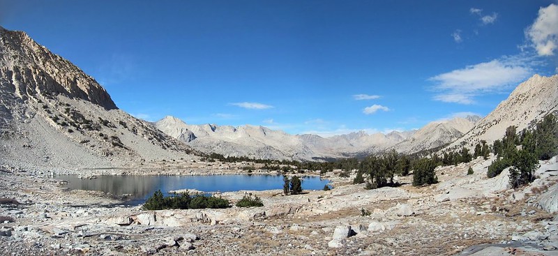
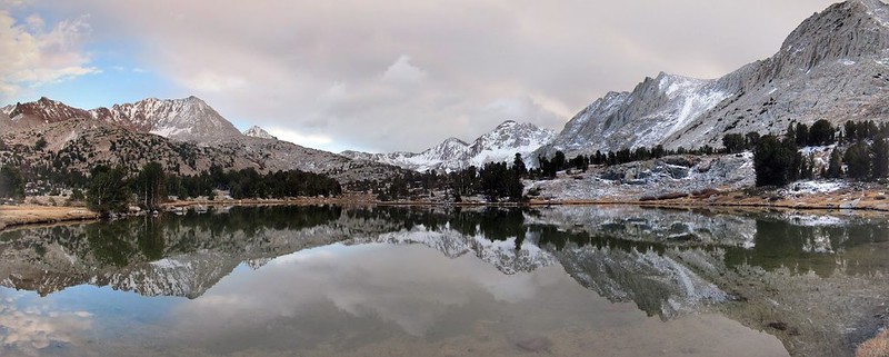
After rejoining the JMT I headed to Lake Marjorie with the idea that I could make it over Pinchot Pass and camp in the beautiful meadows on the south side. I remembered the idyllic landscape on the south side of Pinchot Pass from thru-hiking the JMT and had always planned on going back for another visit. By 1:00 pm I made it to Lake Marjorie and took a lunch break and short nap on the grassy shoreline.
Looking back toward Upper Basin from a tarn below Lake Marjorie:
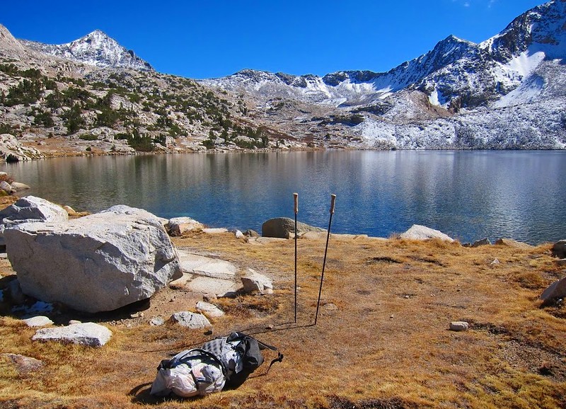
Perfect spot for a break at Lake Marjorie:
The sun was warm and the skies were perfectly blue, not a cloud in sight. While taking a short break I noticed the sun was getting blocked intermittently but it was just a single puffy cloud. Later I noticed a chill in the air and a few more clouds. I checked behind me and was surprised to see storm clouds approaching from the north. I decided it was time to get moving and over the pass before it was too late.
By the time I reached the final switchbacks the sky was black and I could hear rumbling above me. I could hardly believe that it had been perfectly clear less than 1 hour before. I had some basic snow gear (microspikes, gaiters, GTX socks) but I did not want to get stuck on the opposite side of the pass in a snow storm. I kept thinking about Larry Conn and as conditions continued to get worse I turned back and quickly got to lower ground.
Approaching clouds:
Dark skies near the top:
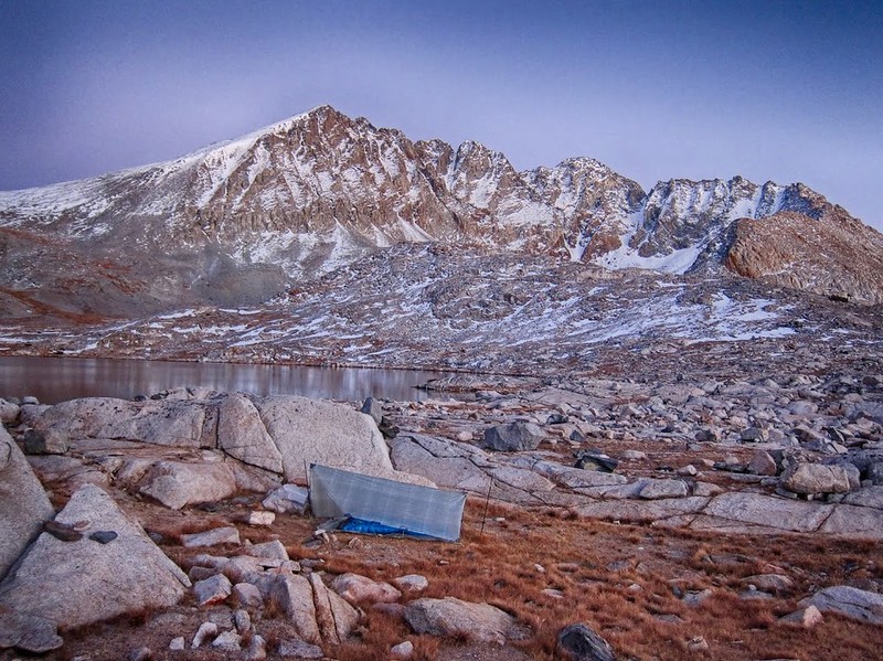
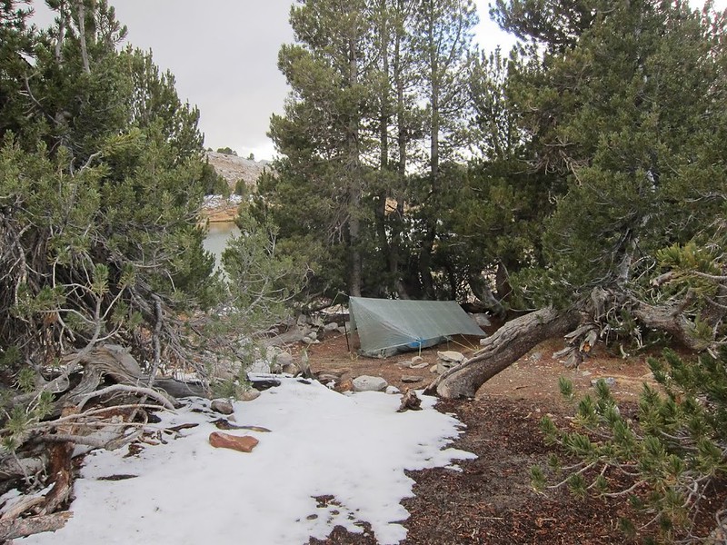
I setup my tarp in storm mode in a familiar spot under the cover of some trees. I camped at this same spot after getting stuck in a storm in 2011. This would be the second time a storm kept me from crossing Pinchot Pass!
After a few hours the storm cleared, but by then it was almost sunset so I made dinner and settled in for another cold night.
Sunset near Lake Marjorie:
Storm clouds clearing from the Palisades:
The next morning I started to suspect that the weather from the day before may have been an indication of an approaching larger storm system. I decided it would be a good idea to hike out a day early. I kept thinking about Larry Conn getting stuck in a storm at the top of Taboose Pass in October, 2012.
With plenty of time to explore before heading back down Taboose Pass I headed to Bench Lake.
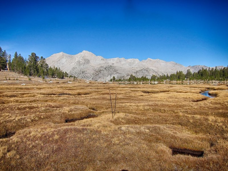
Meandering creeks and golden brown meadows on the way to Bench Lake:
Mt. Ruskin in the background:
Bench Lake & Arrow Peak:

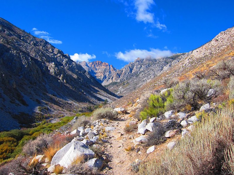
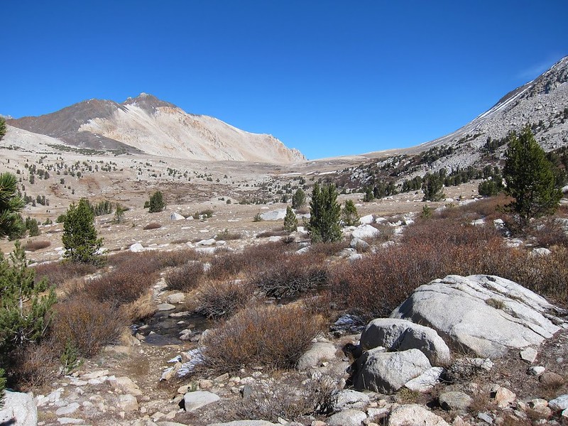
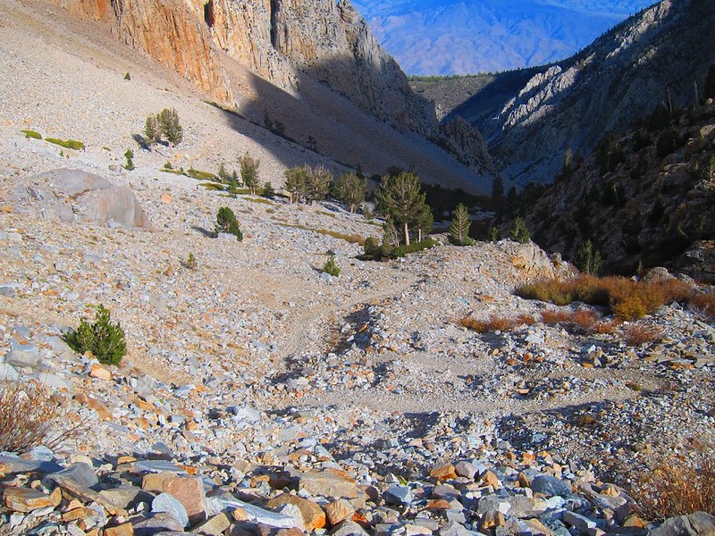
The west side of Taboose Pass:
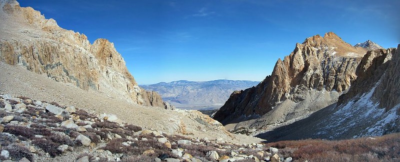
Taboose Pass:

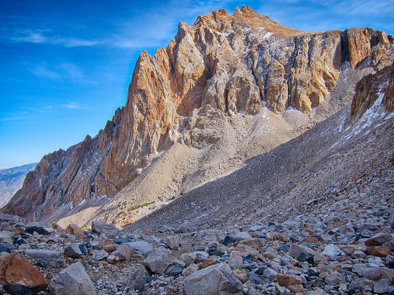
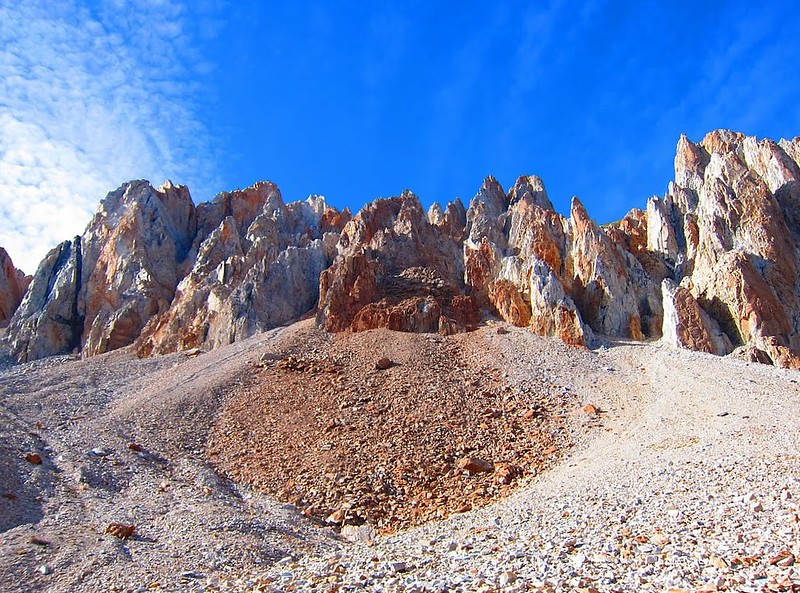
While hiking down Taboose Pass I felt like I was on an entirely new trail. I hadn't noticed the colors of the canyon walls on the way up, and the long shadows in the afternoon sun made for some amazing views.
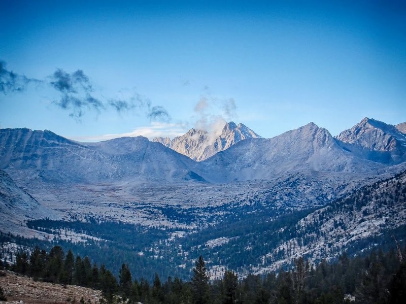
Clear skies on the hike out:
Endless rocky switchbacks:
By the time I reached the desert section of the trail it was getting dark and after a beautiful sunset I hiked about 30 minutes by headlamp back to the car. The dirt road to the trailhead is rough in some places, but I made it back to civilization with plenty of time for a post hike cheese burger in Lone Pine.
Thanks for reading.
If you're interested I did a trip report with more photos and route details here:
http://seatosummitultralight.blogspot.c ... -2015.html
With only a few days of good weather before the first real winter storms hit I headed up Taboose Pass for a five day cross country solo trek. Once over the pass the plan was to cross three off-trail passes into some remote basins that have been on my radar for a few years. The fall colors were beautiful but unfortunately there was enough snow lingering on the north facing slopes that I had to avoid my cross country plans and stay in the relative safety of Upper Basin, Lake Marjorie and Bench Lake.
After sleeping at a nearby trail camp I got an early start on Taboose Pass. I had read about how challenging (and hot) this hike can be in the summer but the cool fall temperatures made for an enjoyable hike out of the desert.
The start of the Taboose Pass trail on the desert floor. The pass is up there somewhere:
It wasn't long before I made the first creek crossing and hiked into the forested section. The fall colors were a striking difference from the desert I left behind:
The clouds rolled in by mid morning and would stay with me for the rest of the day. The forecast was for clear skies but this wouldn't be the first time an 'unscheduled' storm would blow through on this trip.
At first I was keeping track of the location of water sources and places to camp along the way for future trips, but there were so many I stopped making any notes and just enjoyed the hike.
Another flat place to camp:
More storm clouds on the way:
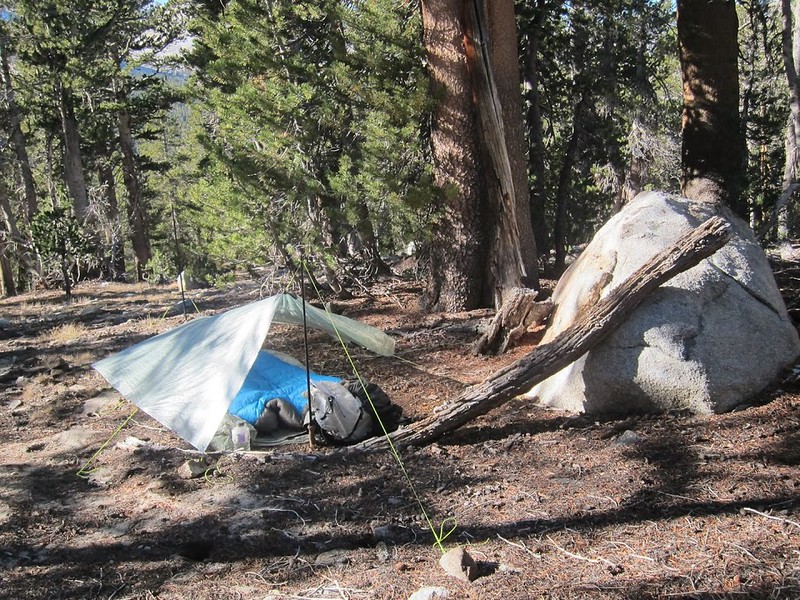
I made it to the pass in time for sunset and quickly got to lower elevation to find a stealth camp in the shelter of the forest. It was windy and cold that night!
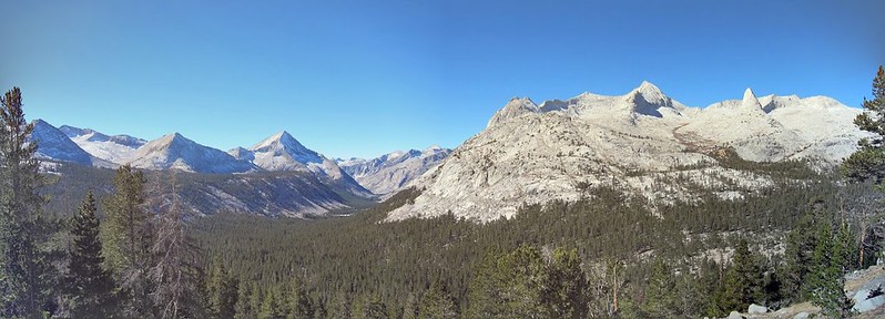
The next morning I headed into Upper Basin to check out the condition of UBC (Upper Basin Crossing: HST Map). From where I camped the trail descends over 600' to the Kings River before joining the JMT for the trudge back up to Upper Basin, so I stayed at about 10,600' and contoured via easy cross country and finally met the JMT near the outlet of Cardinal Lake.
Panorama looking down to the South Fork Kings River from camp:
Fall along the JMT on the way to Upper Basin:
I left the JMT at around 11,000' and headed cross country toward UBC. On the way I could see snow on the northeast side of Frozen Lake Pass and the other north facing slopes in the area. UBC was holding snow and I knew the other XC passes on my planned route would be worse. I had been looking forward to seeing Amphitheater Lake, Dumbell Lakes and Lakes Basin as part of a cross country loop back to Taboose Pass, but after much internal deliberation I finally decided to play it safe and stay on more reasonable cross country and trailed areas nearby.
Intermittent snow on Frozen Lake Pass:
Once free of my planned route I enjoyed a more comfortable pace and explored Upper Basin. I remember wanting to come back here while passing through on the JMT in 2011. I decided to head across toward Lake 11,592 at the base of Split Mountain.
Looking across Upper Basin toward Split Mount from an un-named lake:
Lake 11,592:
Simple stove for making dinner:
Sunset on Split Mountain:
Camp near the outlet of Lake 11,592:
I fell asleep listening to the ducks nearby (there were a lot of ducks). It got cold and windy that night, I must have been sleeping in a pocket of cold air because it got down to 21 f and I was just barely warm enough to sleep.
The next morning I explored the waterfalls, meadows and small lakes along the east side of Upper Basin. This was easy cross country travel through some very nice meadows and lakes that didn't show a sign of any human impact. . . and all under a 1/2 mile from the JMT corridor.
Meadow in Upper Basin:
Un-named lake at about 11,010':
After rejoining the JMT I headed to Lake Marjorie with the idea that I could make it over Pinchot Pass and camp in the beautiful meadows on the south side. I remembered the idyllic landscape on the south side of Pinchot Pass from thru-hiking the JMT and had always planned on going back for another visit. By 1:00 pm I made it to Lake Marjorie and took a lunch break and short nap on the grassy shoreline.
Looking back toward Upper Basin from a tarn below Lake Marjorie:
Perfect spot for a break at Lake Marjorie:
The sun was warm and the skies were perfectly blue, not a cloud in sight. While taking a short break I noticed the sun was getting blocked intermittently but it was just a single puffy cloud. Later I noticed a chill in the air and a few more clouds. I checked behind me and was surprised to see storm clouds approaching from the north. I decided it was time to get moving and over the pass before it was too late.
By the time I reached the final switchbacks the sky was black and I could hear rumbling above me. I could hardly believe that it had been perfectly clear less than 1 hour before. I had some basic snow gear (microspikes, gaiters, GTX socks) but I did not want to get stuck on the opposite side of the pass in a snow storm. I kept thinking about Larry Conn and as conditions continued to get worse I turned back and quickly got to lower ground.
Approaching clouds:
Dark skies near the top:
I setup my tarp in storm mode in a familiar spot under the cover of some trees. I camped at this same spot after getting stuck in a storm in 2011. This would be the second time a storm kept me from crossing Pinchot Pass!
After a few hours the storm cleared, but by then it was almost sunset so I made dinner and settled in for another cold night.
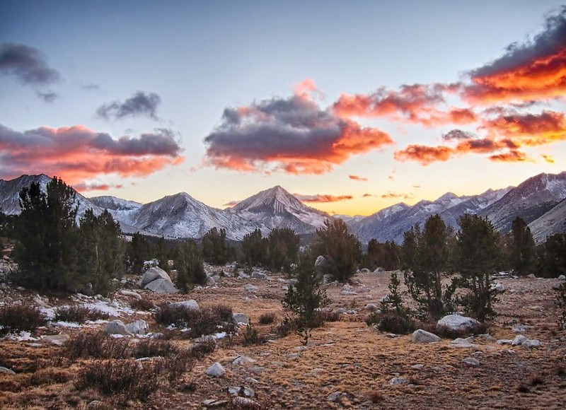
Sunset near Lake Marjorie:
Storm clouds clearing from the Palisades:
The next morning I started to suspect that the weather from the day before may have been an indication of an approaching larger storm system. I decided it would be a good idea to hike out a day early. I kept thinking about Larry Conn getting stuck in a storm at the top of Taboose Pass in October, 2012.
With plenty of time to explore before heading back down Taboose Pass I headed to Bench Lake.
Meandering creeks and golden brown meadows on the way to Bench Lake:
Mt. Ruskin in the background:
Bench Lake & Arrow Peak:
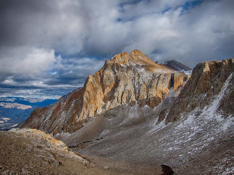
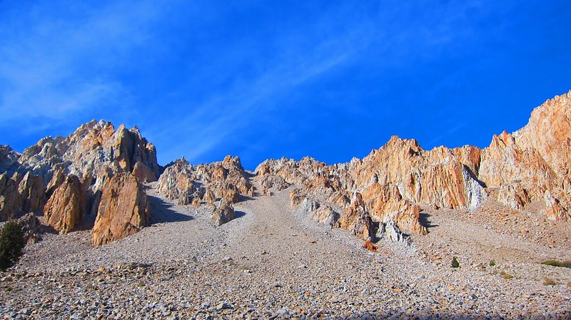
The west side of Taboose Pass:
Taboose Pass:
While hiking down Taboose Pass I felt like I was on an entirely new trail. I hadn't noticed the colors of the canyon walls on the way up, and the long shadows in the afternoon sun made for some amazing views.
Clear skies on the hike out:
Endless rocky switchbacks:
By the time I reached the desert section of the trail it was getting dark and after a beautiful sunset I hiked about 30 minutes by headlamp back to the car. The dirt road to the trailhead is rough in some places, but I made it back to civilization with plenty of time for a post hike cheese burger in Lone Pine.
Thanks for reading.
If you're interested I did a trip report with more photos and route details here:
http://seatosummitultralight.blogspot.c ... -2015.html