a Sierra High Route – the first segment
Posted: Tue Nov 17, 2015 5:00 am
a Sierra High Route – the first segment

I’m tired but I’m content. I’m happy and where I want to be in this moment. It won’t last, it never does, but there will be other moments and other times.
I forget most pain and fear; this means I can continue to play the game of hard fun. Do we all do that or does fear reside? Some lives in me now, after death and threat; it’s not to be overcome – rather to be relaxed into, accepted, but not yet explained or understood.
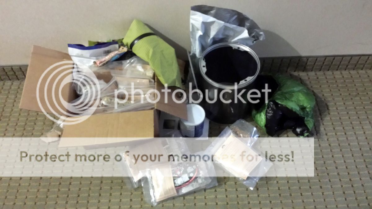
Reno is my summer base. Everything is decanted onto the floor; the Bearikade Weekender I’m going to have to carry for the next month is light and well made….but is still a lump of carbon fibre and aluminium that has to live in my pack.
Thank God for IPA and peppermint patties (not twin call-girls).

The best food in the locale – and but three minutes’ walk away is at the fine and cheap El Paisano Mexican and Salvadorian Food restaurant; truly good eats and value. This eatery is complemented by the Silver States Food Mart at the gas station – the source of the aforementioned vittles’.

And yes – the alternate is Denny’s; I will admit to ‘dining’ there a few times – needs must. Sadly the night I arrived was one occasion, everything else walkable – well after being up for 23 hours - being shut.
The evening stroll back looms stormy.

Yet in the morn my pack swallows all the gear and the unwieldy can without demurring.

Up early to eat a groaningly big breakfast from the buffet – a mere 45 minutes pass ere I waddle away. Then I take the hotel shuttle to the bus and a longish ride down to Bridgeport.


The weather does not enthuse. But the Sierras are always sunny….or so I thought…

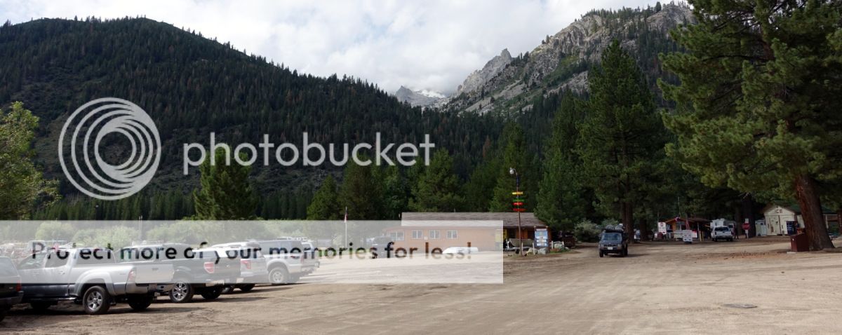
At Bridgeport I meet up with Geoff – a local ranger who has gone out of his way to help me with getting a permit; thanks Jeffrey – a great favour you did me. Very much appreciated.
The motel is old (for the US) and funky.
Tawdry grandeur.

The first segment – four days with 20 tent hours whilst storms rage
Just to be clear – this is a Sierra High Route – not the SHR as proposed by Roper; I’m dipping in and out of it. More a series of closely (and almost connected) walks that try and stay near the do-able (well, for me) crest of the Sierras.


The Sierras bask in the glow of tales told in reverential voices about their brutal grandeur; and grand they are. A John Muir Trail (years ago now) brought me to them – and frankly although I loved the trip I did get a little white rock, turquoise lake, blue skied out; the horror. But back now to dip into some of the off-trail wonders, as I promised myself in that other lifetime; away from the bustle of the trail, the sanitisation of experience, the people, and hopefully towards space and my own form of unconscious meditation.
Diamox.
Breakfast.


I walk up the road and put my thumb out. Time and vehicles pass. Then Ray and Susan (made those names up) stop for me, They are doing the SHR too and are adding an extension to it that the same guys who wrote up the Wind Rivers High Route that served as my inspiration for doing that trail have blogged about. The car is jammed with gear. A great ride to Twin Lakes – thanks chaps.
Obviously I get disorientated (also known as lost) within the first hundred yards….then the third hundred yards.
Dammit.
But but but.


Must be doing something right.
The climb away from Twin Lakes via Horsetail Falls is well graded and easy – but the sky threatens.


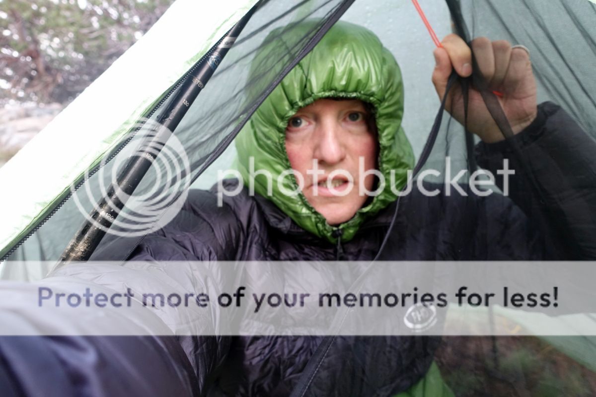
The clouds growl and then vent, first with hard painful hail and after that a deluge – thunder roils around the basin I occupy and lightning flashes. Sensibly I stand under a tree…I mean what else would you do, sit on your pack and freeze to death while safe from lightning?

But that is it really, early afternoon and it is time to stop. I’m already drenched but carrying on in this is not wise – at 8,000’ life is getting mean. Little do I know as the tent goes up that I’ll be in it for the whole day.
Happy at first.


Time palls.

It is around 11am before the cessation of the deluge allows onward progress; the snowline is down to 9,000’ on the surrounding mountains….a pity the first pass (of three in this segment) is at 10,700’.


The storm has cost me a day – and I’m going to run out of food unless plans are changed.

Loop up on a peek-a-boo use trail through snakes of moraine.


Looking back, there’s no turning to be done though as the snow-choked pass is gained.


The south side is a delight of meadows and rock slabs at very amenable angles, although the cloud clamped onto the Three Peaks to the east is daunting.


Yes well.

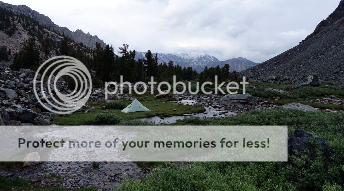
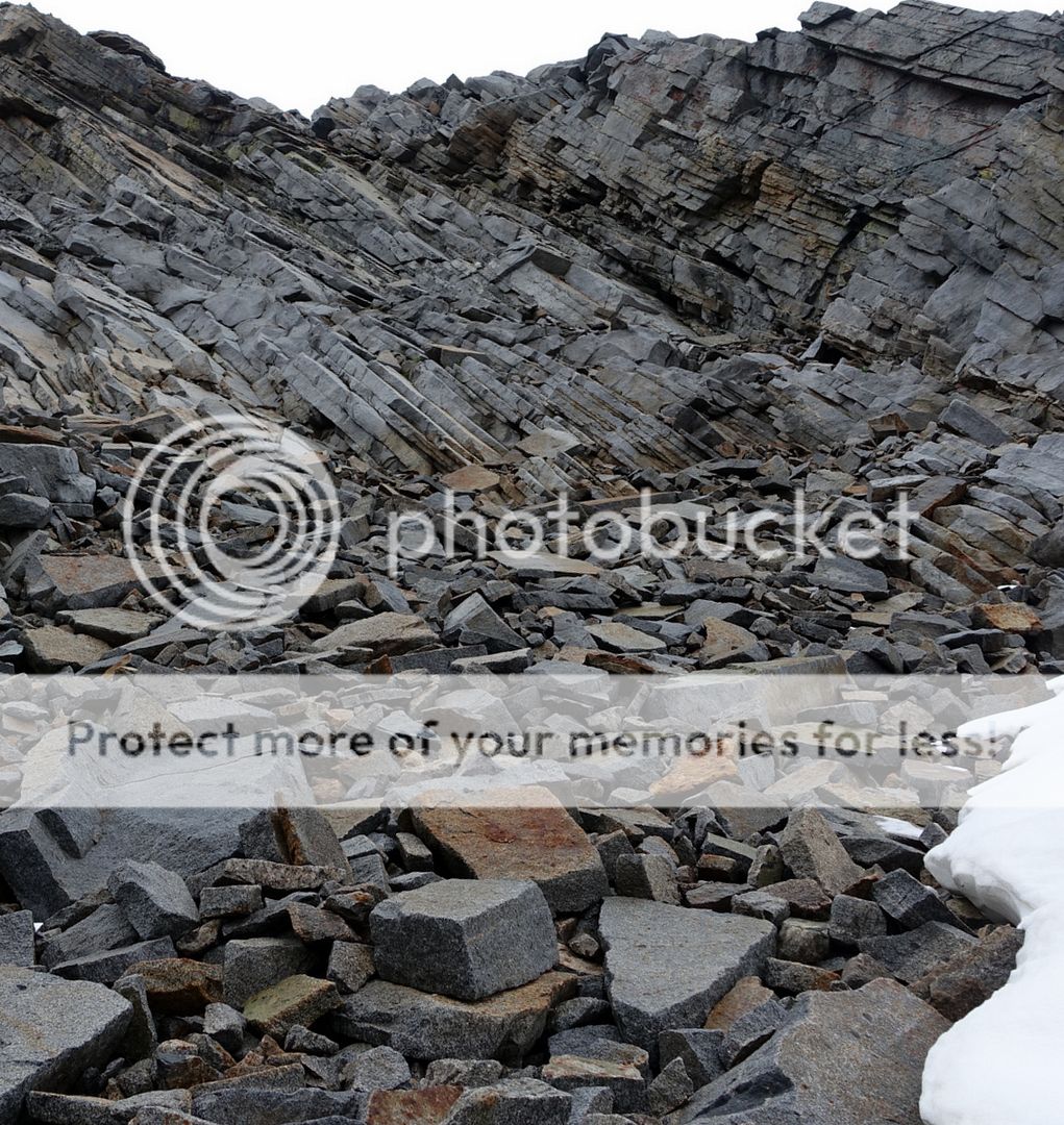
Talus looms large as does the realisation that I’ll not make it over the next pass today; or rather, I don’t want to make it over the next pass. Cast around for somewhere to pitch amongst the rubble before gaining a high grassy bench and settling in for the evening.


The pass in the background is Stanton – a Class 3-4 that looks decidedly unwelcome; yet it must be turned the morrow.


Spaghetti Bolognese.
A beep. A smile.

Things don’t look exactly tickety-boo in the morning either. Ho hum. The 11,170’ Stanton Pass looks grey, damp, and stolid.

Things certainly don’t look tickety-boo in the morning.
But off to work we go – the talus is treacherous and mobile – and as I near, the top right slab looks to be the line for me, albeit steeper than I’d like.

The Class 3 was exactly that, not technically hard but with a Class 4 landing to die for. Temporarily exhausted; a 1500 calorie altitude-induced regimen does not help, or the extra weight, or the lack of general oomph. It is July – and I’m not fit enough, despite the 165 miles of the Tahoe Rim Trail in my legs.

The adrenaline come down is almost over and euphoria spreads, chasing away the fear and the memory of that fear so I can do this again.

There is lots of easy talus down and to the east of Soldier Lake before a rapid descent over fine and dandy slabs down into the woods that line Virginia Creek.


And a trail. A trail!

But it is a trail merely to be crossed before some arduous cross-country climbing through woods.
After what seems like forever grinding my way through trees, blowdowns, and grassy meadows (all of which is in ascent) I exhaustedly gasp onto an occasional use trail that heads to Shepherd Lake at 10,300’. It is cold and dank here, with an icy wind coming down from the distant 11,600’ Sky Pilot Col.


The evening is pretty dismal.


But the morning shows promise.

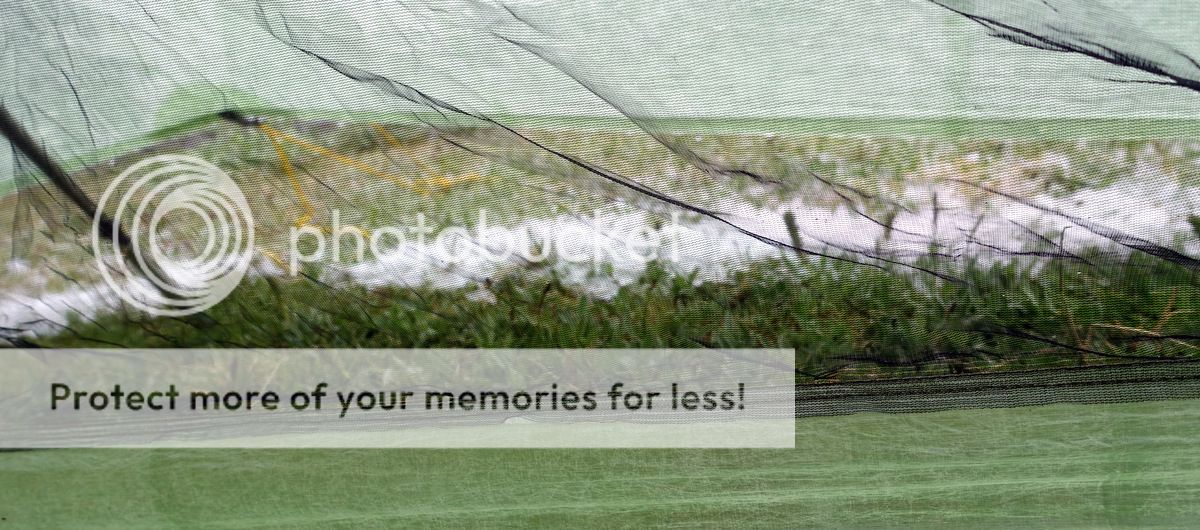
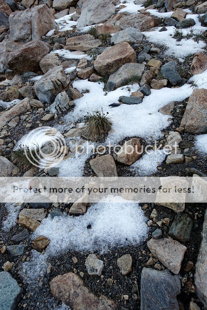
Yes, that is ice on the lake….it also rimed the tent and my water bottles.

This is the good bit, relatively straightforward climbing over largely avoidable talus up towards a huge glacial bowl before the col.


Yes, well.

Then there is this, a vast crucible packed with large sharp volcanic talus; joy of joys it also is slick with verglas in places.
I cast around looking for a good line.
There simply isn’t one.

It is hard, somewhat painful, and quite brutal work.

A lonely, sunless place at this hour.

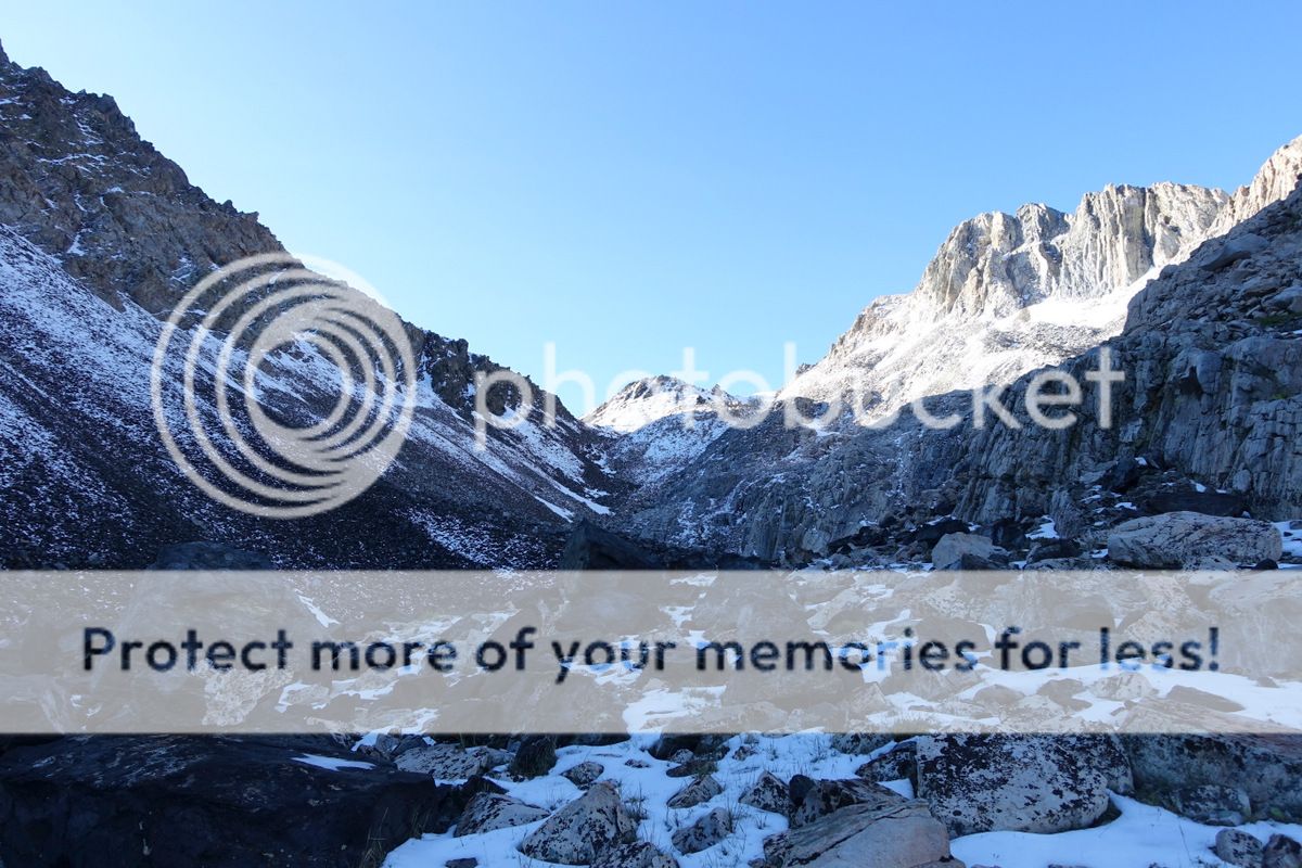
A snow-packed runnel leads up to where it should be easy to traverse to Sky Pilot Col (so named by Roper after the abundance of flowers at the pass – not today though).


But it is not going to be that easy, the storm has dumped recent snow which covers the col and as the sun comes up the approach is a shooting gallery of falling rock. I think about it; scared. Push on up the eastern arête above the pass, steep but just safe in trail shoes.
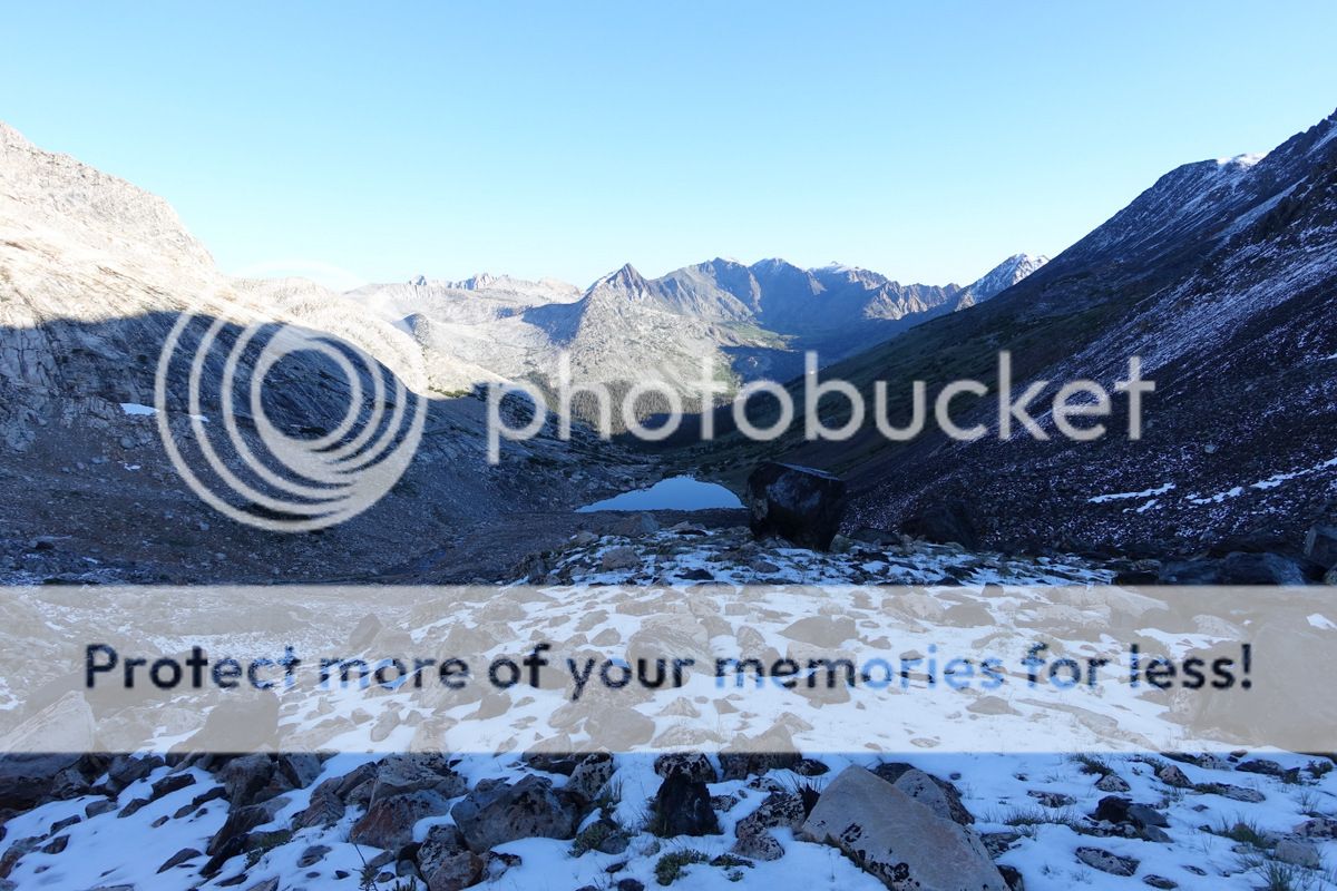
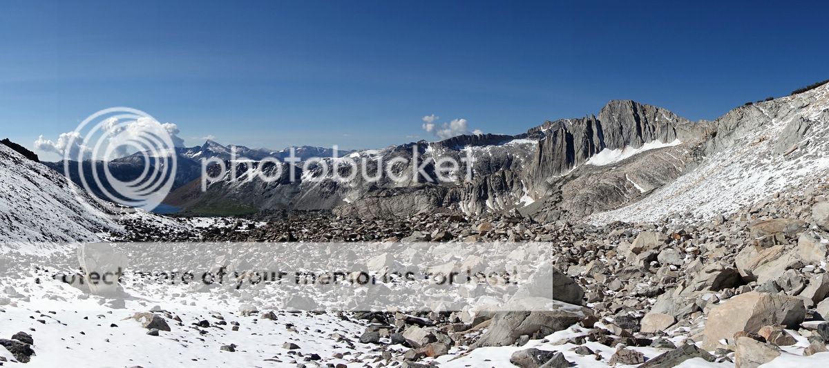
Views all the way back to Shepherd Lake.

Thwarted again as I thought I’d be able to cross this; but the sun has yet to make it submissive.
Dammit.

Up.

Decide to climb above that rotten rock ‘nunatak’ then drop down to it along the arête at least that way I’ll be on the flat, albeit with a bit of a drop either side.


Wild views open up of the country to the south. The air aches - bright blue and cold in my lungs.

I’m done – but my ego isn’t…

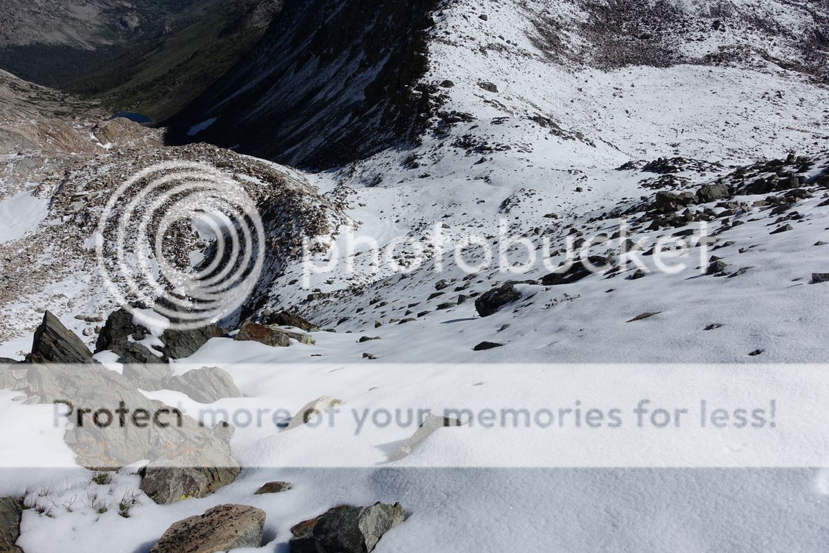
Drop down easy slopes of soft snow to steep-sided benches and a nice traverse. With only one handful of peanuts left I’m getting off this segment via that lake on the left – a trailhead and a possibility for a ride.
Looking back up Sky Pilot Col after the descent.

Sadly this means a chunk of the route I’d planned has to go. Sad or glad – a bit of both I think. I’m tired.


The Saddlebag Lake Trailhead I’ve walked out to snaps the line I’d wanted to take; but needs must.

It is not an easy hitch until some rangers stop for me and drop me down to the Tioga road where a quick ride takes me to Lee Vining and some fine fish tacos. The first car stops for me after that and is going all the way to Mammoth; nice.
Some R&R is required – and Red (I wonder why he is called that) at the Sierra Lodge makes me very welcome.

There are UL devotees around…

…somewhere.
Other more immediate delights are for the taking too.


There appears to be a theme here…

The next segment awaits – but first more food.
Link to the second segment
I’m tired but I’m content. I’m happy and where I want to be in this moment. It won’t last, it never does, but there will be other moments and other times.
I forget most pain and fear; this means I can continue to play the game of hard fun. Do we all do that or does fear reside? Some lives in me now, after death and threat; it’s not to be overcome – rather to be relaxed into, accepted, but not yet explained or understood.
Reno is my summer base. Everything is decanted onto the floor; the Bearikade Weekender I’m going to have to carry for the next month is light and well made….but is still a lump of carbon fibre and aluminium that has to live in my pack.
Thank God for IPA and peppermint patties (not twin call-girls).
The best food in the locale – and but three minutes’ walk away is at the fine and cheap El Paisano Mexican and Salvadorian Food restaurant; truly good eats and value. This eatery is complemented by the Silver States Food Mart at the gas station – the source of the aforementioned vittles’.
And yes – the alternate is Denny’s; I will admit to ‘dining’ there a few times – needs must. Sadly the night I arrived was one occasion, everything else walkable – well after being up for 23 hours - being shut.
The evening stroll back looms stormy.
Yet in the morn my pack swallows all the gear and the unwieldy can without demurring.
Up early to eat a groaningly big breakfast from the buffet – a mere 45 minutes pass ere I waddle away. Then I take the hotel shuttle to the bus and a longish ride down to Bridgeport.
The weather does not enthuse. But the Sierras are always sunny….or so I thought…
At Bridgeport I meet up with Geoff – a local ranger who has gone out of his way to help me with getting a permit; thanks Jeffrey – a great favour you did me. Very much appreciated.
The motel is old (for the US) and funky.
Tawdry grandeur.
The first segment – four days with 20 tent hours whilst storms rage
Just to be clear – this is a Sierra High Route – not the SHR as proposed by Roper; I’m dipping in and out of it. More a series of closely (and almost connected) walks that try and stay near the do-able (well, for me) crest of the Sierras.
The Sierras bask in the glow of tales told in reverential voices about their brutal grandeur; and grand they are. A John Muir Trail (years ago now) brought me to them – and frankly although I loved the trip I did get a little white rock, turquoise lake, blue skied out; the horror. But back now to dip into some of the off-trail wonders, as I promised myself in that other lifetime; away from the bustle of the trail, the sanitisation of experience, the people, and hopefully towards space and my own form of unconscious meditation.
Diamox.
Breakfast.
I walk up the road and put my thumb out. Time and vehicles pass. Then Ray and Susan (made those names up) stop for me, They are doing the SHR too and are adding an extension to it that the same guys who wrote up the Wind Rivers High Route that served as my inspiration for doing that trail have blogged about. The car is jammed with gear. A great ride to Twin Lakes – thanks chaps.
Obviously I get disorientated (also known as lost) within the first hundred yards….then the third hundred yards.
Dammit.
But but but.
Must be doing something right.
The climb away from Twin Lakes via Horsetail Falls is well graded and easy – but the sky threatens.
The clouds growl and then vent, first with hard painful hail and after that a deluge – thunder roils around the basin I occupy and lightning flashes. Sensibly I stand under a tree…I mean what else would you do, sit on your pack and freeze to death while safe from lightning?
But that is it really, early afternoon and it is time to stop. I’m already drenched but carrying on in this is not wise – at 8,000’ life is getting mean. Little do I know as the tent goes up that I’ll be in it for the whole day.
Happy at first.
Time palls.
It is around 11am before the cessation of the deluge allows onward progress; the snowline is down to 9,000’ on the surrounding mountains….a pity the first pass (of three in this segment) is at 10,700’.
The storm has cost me a day – and I’m going to run out of food unless plans are changed.
Loop up on a peek-a-boo use trail through snakes of moraine.
Looking back, there’s no turning to be done though as the snow-choked pass is gained.
The south side is a delight of meadows and rock slabs at very amenable angles, although the cloud clamped onto the Three Peaks to the east is daunting.
Yes well.
Talus looms large as does the realisation that I’ll not make it over the next pass today; or rather, I don’t want to make it over the next pass. Cast around for somewhere to pitch amongst the rubble before gaining a high grassy bench and settling in for the evening.
The pass in the background is Stanton – a Class 3-4 that looks decidedly unwelcome; yet it must be turned the morrow.
Spaghetti Bolognese.
A beep. A smile.
Things don’t look exactly tickety-boo in the morning either. Ho hum. The 11,170’ Stanton Pass looks grey, damp, and stolid.
Things certainly don’t look tickety-boo in the morning.
But off to work we go – the talus is treacherous and mobile – and as I near, the top right slab looks to be the line for me, albeit steeper than I’d like.
The Class 3 was exactly that, not technically hard but with a Class 4 landing to die for. Temporarily exhausted; a 1500 calorie altitude-induced regimen does not help, or the extra weight, or the lack of general oomph. It is July – and I’m not fit enough, despite the 165 miles of the Tahoe Rim Trail in my legs.
The adrenaline come down is almost over and euphoria spreads, chasing away the fear and the memory of that fear so I can do this again.
There is lots of easy talus down and to the east of Soldier Lake before a rapid descent over fine and dandy slabs down into the woods that line Virginia Creek.
And a trail. A trail!
But it is a trail merely to be crossed before some arduous cross-country climbing through woods.
After what seems like forever grinding my way through trees, blowdowns, and grassy meadows (all of which is in ascent) I exhaustedly gasp onto an occasional use trail that heads to Shepherd Lake at 10,300’. It is cold and dank here, with an icy wind coming down from the distant 11,600’ Sky Pilot Col.
The evening is pretty dismal.
But the morning shows promise.
Yes, that is ice on the lake….it also rimed the tent and my water bottles.
This is the good bit, relatively straightforward climbing over largely avoidable talus up towards a huge glacial bowl before the col.
Yes, well.
Then there is this, a vast crucible packed with large sharp volcanic talus; joy of joys it also is slick with verglas in places.
I cast around looking for a good line.
There simply isn’t one.
It is hard, somewhat painful, and quite brutal work.
A lonely, sunless place at this hour.
A snow-packed runnel leads up to where it should be easy to traverse to Sky Pilot Col (so named by Roper after the abundance of flowers at the pass – not today though).
But it is not going to be that easy, the storm has dumped recent snow which covers the col and as the sun comes up the approach is a shooting gallery of falling rock. I think about it; scared. Push on up the eastern arête above the pass, steep but just safe in trail shoes.
Views all the way back to Shepherd Lake.
Thwarted again as I thought I’d be able to cross this; but the sun has yet to make it submissive.
Dammit.
Up.
Decide to climb above that rotten rock ‘nunatak’ then drop down to it along the arête at least that way I’ll be on the flat, albeit with a bit of a drop either side.
Wild views open up of the country to the south. The air aches - bright blue and cold in my lungs.
I’m done – but my ego isn’t…
Drop down easy slopes of soft snow to steep-sided benches and a nice traverse. With only one handful of peanuts left I’m getting off this segment via that lake on the left – a trailhead and a possibility for a ride.
Looking back up Sky Pilot Col after the descent.
Sadly this means a chunk of the route I’d planned has to go. Sad or glad – a bit of both I think. I’m tired.
The Saddlebag Lake Trailhead I’ve walked out to snaps the line I’d wanted to take; but needs must.
It is not an easy hitch until some rangers stop for me and drop me down to the Tioga road where a quick ride takes me to Lee Vining and some fine fish tacos. The first car stops for me after that and is going all the way to Mammoth; nice.
Some R&R is required – and Red (I wonder why he is called that) at the Sierra Lodge makes me very welcome.
There are UL devotees around…
…somewhere.
Other more immediate delights are for the taking too.
There appears to be a theme here…
The next segment awaits – but first more food.
Link to the second segment