TR: Maverick's 2015 Annual HST Meet-Up 7/22-7/24/15

If you've been searching for the best source of information and stimulating discussion related to Spring/Summer/Fall backpacking, hiking and camping in the Sierra Nevada...look no further!
Post Reply
User avatar
richlong8
Topix Expert
Posts: 839
Joined: Tue Nov 25, 2008 6:02 pm
Experience: Level 4 Explorer

Re: TR: Maverick's 2015 Annual HST Meet-Up 7/22-7/24/15

Post by richlong8 »

The best part of the HST Meetup for me was meeting and seeing some of the members in person. The first members I ran into were Rocky Road(Michael) and Oleander(Lisa) at the lowest Picket Lake on Wednesday, 7/22 about 1pm. Oleander is a remarkable and capable routefinder and all round woodsperson. Rocky Road just has this way about him, a very humble, nice, soft spoken guy, the type of person you want to be around. The 3 of us traveled over to Island Lake the next morning together. Lisa found a tarp tent close to the outlet stream that we were hoping was a fellow member. Later that afternoon the owner of the tarp tent, YubeRiver(Christina), and Hobbes(Karl) showed up together. Christina(Gazelle) seemed like a very competent climber, and was the only one of us who got into the meetup location on Wednesday, and was in position to catch the great shot of Kaweak Peaks Ridge and the lake that she posted. Hobbes is Hobbes, on the cutting edge of lightweight backpacking methods, very nice guy. I tried to travel with him on Friday, when we left Picket to come down to the Kern-Kaweah River, become separated, and never could catch him, only follow his footprints! Bluewater came in about 5-6pm Thursday, and it was amazing to watch and listen to him and Hobbes compare notes about building their own equipment, and comparing lightweight equipment, and doing various difficult routes. I thought I was doing pretty well at carrying 35 pounds for this 11 day trip, which included a liter of water, and camera stuff. I doubt either of those 2 guys were even carrying 25 pounds. I have a lot to learn. Finally, Rodger(MN2Capisco) and Andray came in about 730pm, all the way from Hamilton Lake. That was impressive. They both hail from my town, much aligned Bakersfield, California. They seemed like very competent climber/backpackers, and like all the members that showed up, very nice and fun to be around.
My itinerary for the trip was as follows, with a few photos, and I might post a few more details later, as others post their reports.

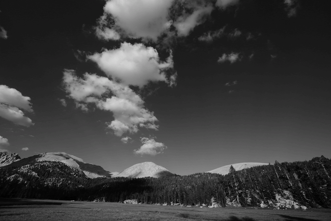
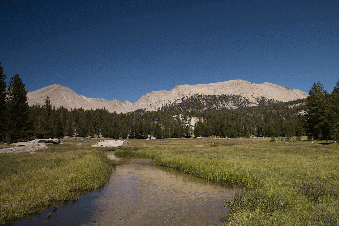
Thursday, 7/16: headed out from Cottonwood Pass trailhead @1115 and pulled into the outlet stream campsites of Soldier Lake late in the afternoon. Felt great, and weather was great.

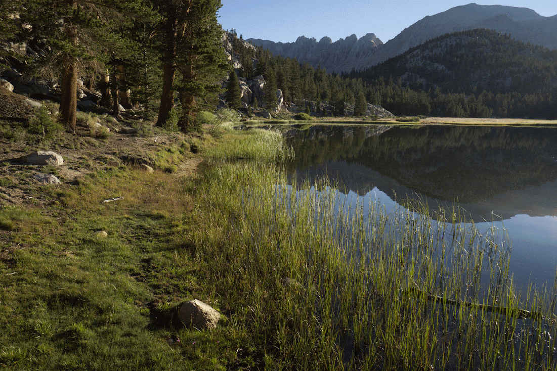
Friday, felt very tired, weak, not well, assumed it was a lack of elevation acclimatization, and dawdled, rested, and read a book, around the area all day. Traveled a short distance down to the Rock Creek tarn, and setup a new camp, with plans to hike up Rock Creek to Miter Basin Saturday morning.

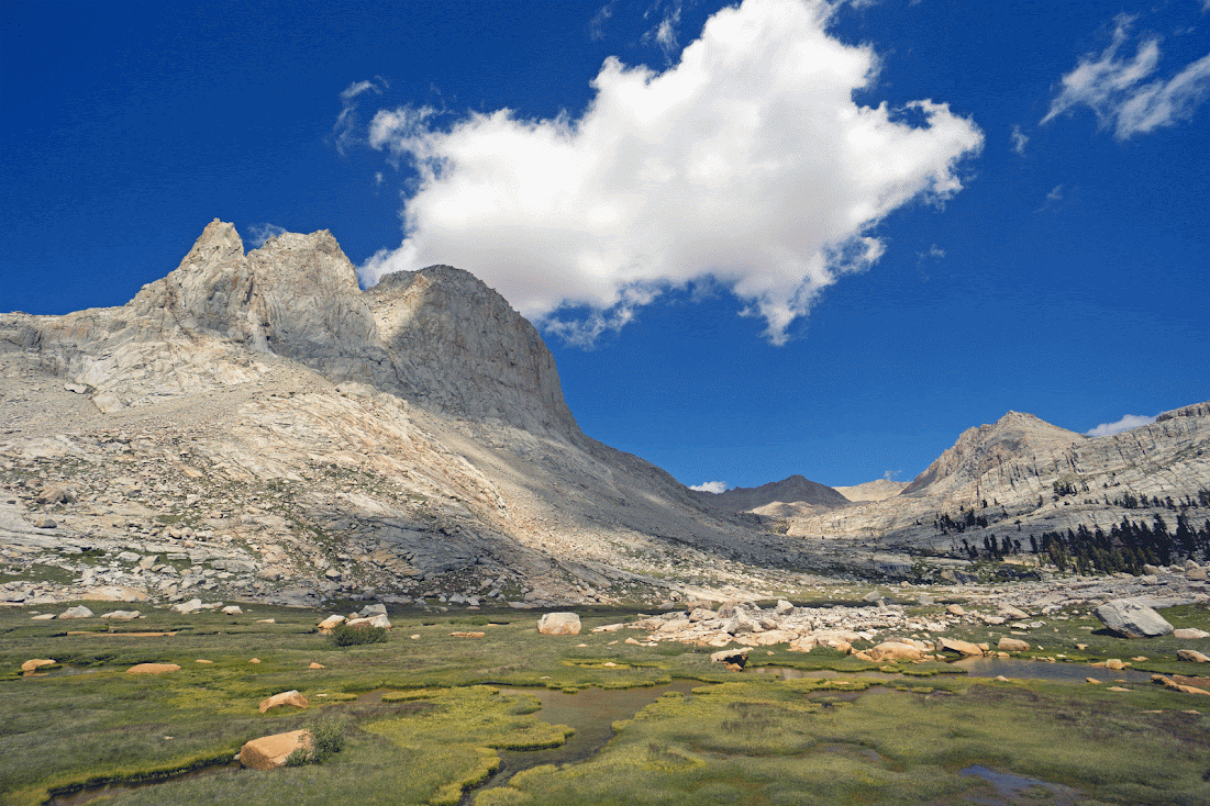
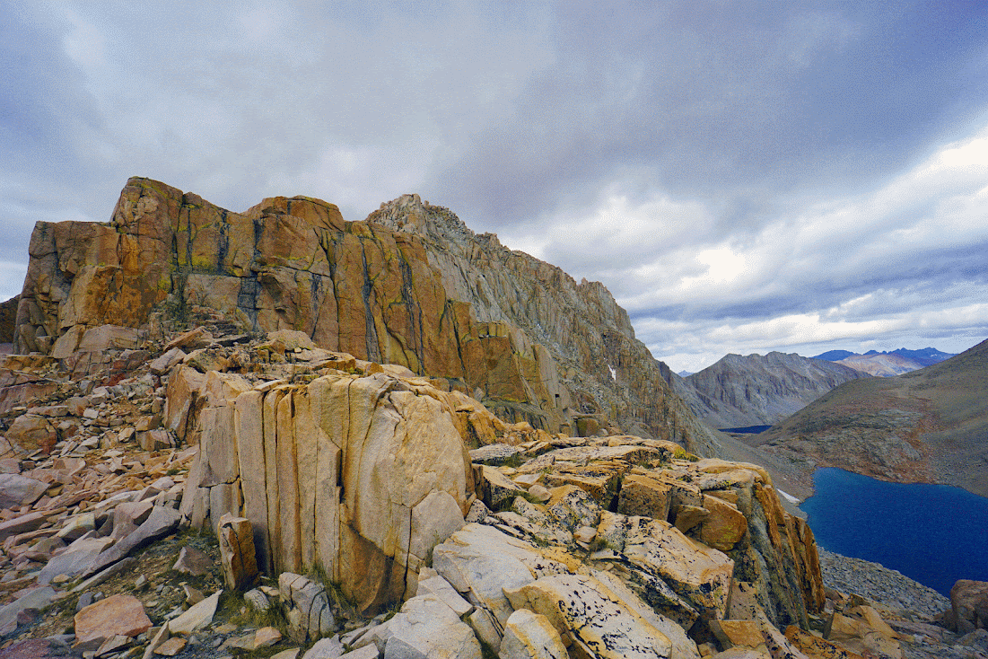
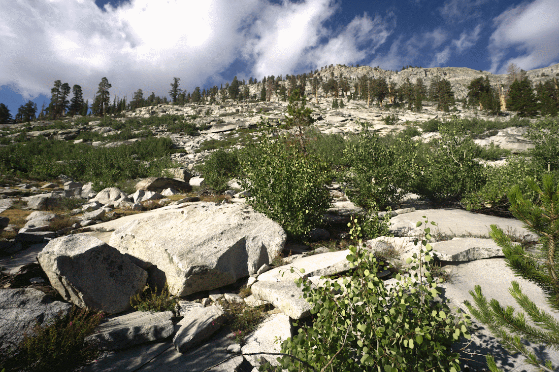
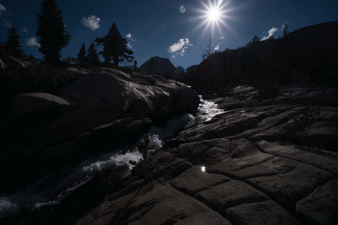
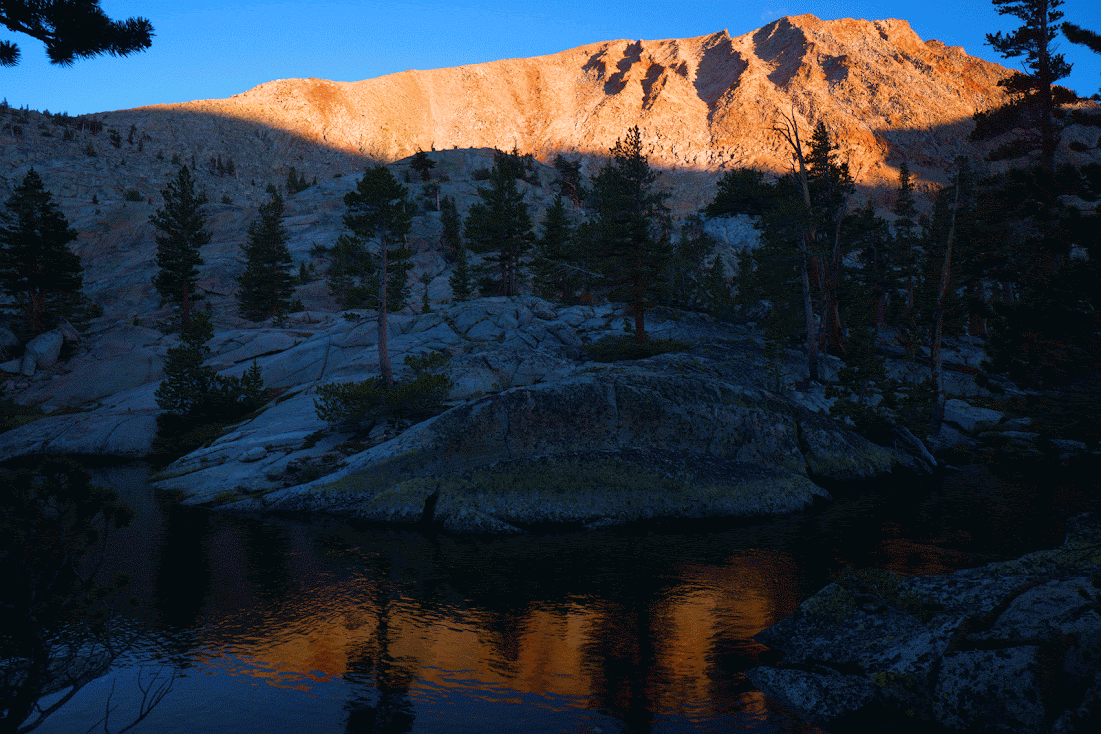
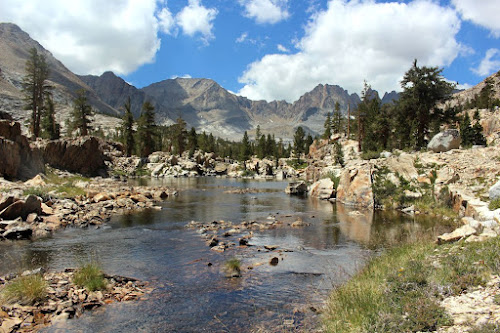
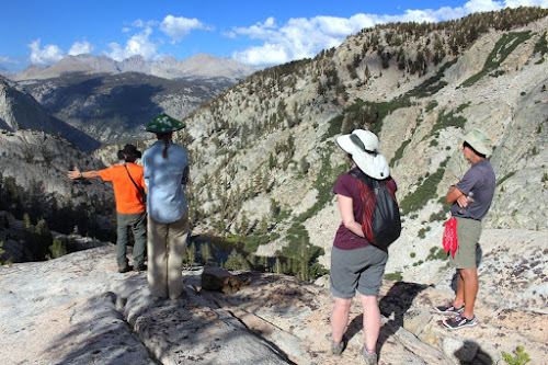
Saturday: Felt great again, must have been the altitude as I suspected. Hiked up Rock Creek to Miter Basin. The clouds started to roll in, and this was my first time in Miter, and might I say, it is amazing. I probably reached Sky Blue lake around 2 pm, looked at the incoming weather clouds, and my barometer, and decided it would be wise to get my shelter setup, and make sure my gear was dry.I camped on the east side of the lake, about a 3 minute walk from the inlet creek, so I would be in position to go up to Crabtree(Miter) Pass in the morning. I started fishing, walking past the inlet to a rock partway around the lake. I got in maybe a dozen casts, catching just a couple of moderate sized goldens, and a vicious hail storm come up. I retreated to my tent at 4pm, and stayed in there til the next morning, except a brief lull in the storm, in which I cooked dinner, and took care of personal business. This weather pattern repeated itself the next 4 days. So I would always get up early, traveled while it was "safe", and had a shelter setup by 3-4 pm to keep myself and my equipment dry. The real casualties were not just an overabundance of tent time, but being in Miter Basin, and Crabtree Lake basins, and having my fishing curtailed for big goldens because of the weather. The fishing for the trip was a clunker, but not because of the locations, just the difficulty of being out in storms fishing. I chose to stay dry. But the cloudiness added some color and beauty to the high altitude country that was devoid of snow. Saw no people on Saturday, except one day hiker below Sky Blue.

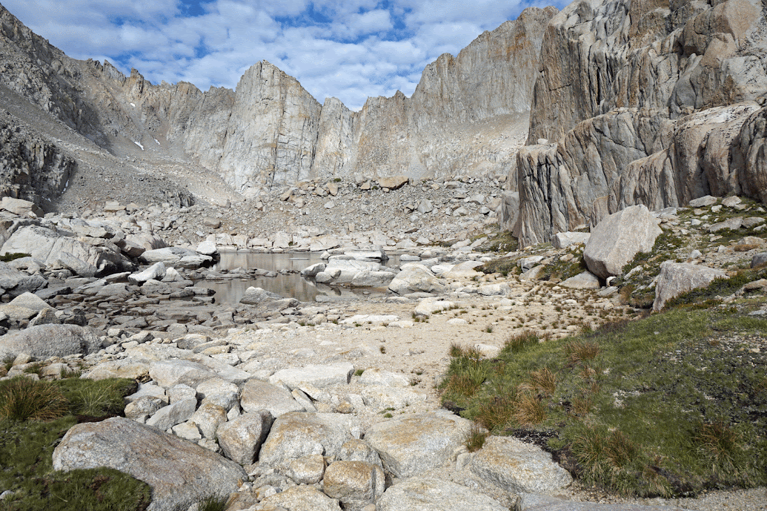
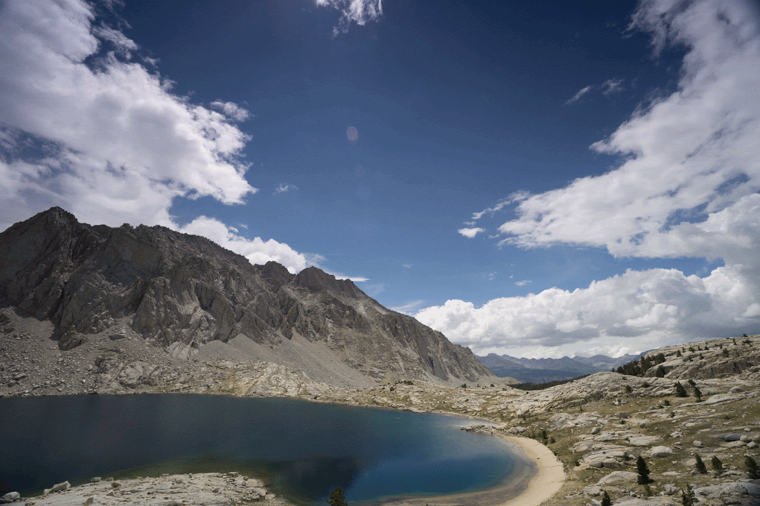
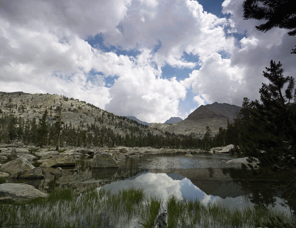
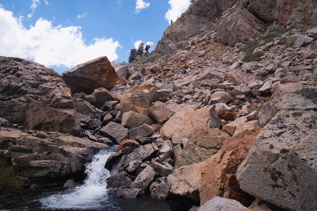
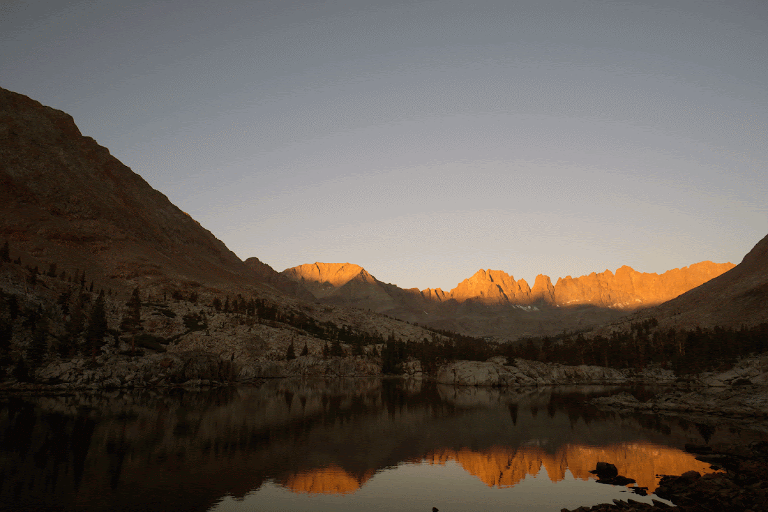
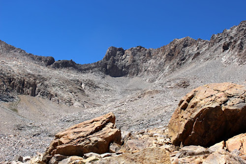
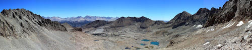
Sunday: I went from Sky Blue Lake to Crabtree Pass. I took the route that stays more to the left going up, following the inlet creek, avoiding the cliffs. Still I might say, Crabtree Pass is not trivial, not the easiest pass I have done, nor the hardest. Not a walk in the park. By the time I got to the top, the weather was really rolling in. I thought the way down was not near as hard as I have seem described in some reports. I saw a group of five young guys as I was eating lunch, at Upper Crabtree Lake, who were headed for the pass. I felt old as I watched them quickly scrambling up the slopes to the pass. I did not even make it around the lake before they were on top. I traveled down the chain of Crabtree Lakes to the inlet of the lowest lake,and this is an absolutely beautiful walk. I made a camp in a great natural location, and once again, just in time, and just ahead of a storm that raged all night long.

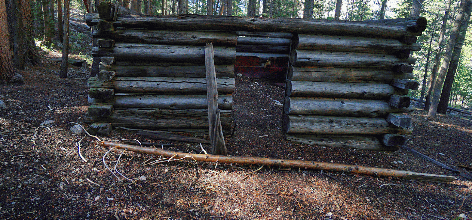
Monday:(7/20/15): This was a wet, dreary day from Crabtree Lake to the Kern River area, most of the day using the JMT and the HST. I did not have a pack cover, so I tied my Mountain Hardwear jacket around the pack to keep most of the rain off my backpack. I decided to go a little north of the High Sierra Trail junction with the Kern River Trail to avoid the crowds at Junction Meadow. An old guide said there were good campsites to the north, and there were. Mine was at the location of an old Shorty Lovelace cabin, with the roof off. An interesting anomaly about the JMT, especially: Dozens of people traveling. I tend to ask folks on the trail where they are headed to, etc; 99.9% of the people said they were headed to Mt. Whitney, usually camping at Guitar lake. I guess the vast majority in the High Sierra today prefer to camp in overcrowded, dirty, heavy watched and regulated areas along with others. Hmmh...not my idea of a good time.

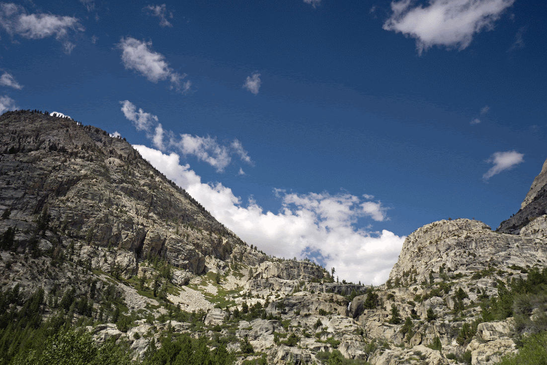
Tuesday:Relatively short day from the Kern River to the Kern-Kaweah, using the Colby Pass trail, to about 9500 foot elevation. The route fords the Kern River(double channel) west of Junction meadow. The ford was not particularly high or hazardous, even though the rain was falling. The presence of much algae on the Kern shows how desperately this state needs water, a big water year, to flush these streams out with clean water. The weather was so bad I decided to stop, rather that go up the slippery, exposed 1000 foot slope to Picket Creek Lake in the foul weather that afternoon. The Colby Pass trail is beautiful, a marvel of engineering and design. I played around @ midday catching little fish out of Rockslide Lake, which is really just the Kern-Kaweah pooling up in the area of a slide, not a lake, by any means.I stayed at an old packer site on the Kern-Kaweah, which was flawed by some overzealous person dismantling a firepit, and leaving soot covered rocks all over the landscape. Needless, to say, I rebuilt the pit with the same rocks, and had a nice fire to get me warm that cold, wet evening. Yes, it was a legal location, not very close to water, only 9500 foot, more dead wood lying around than politicians who lay around resorts all year at the taxpayer's expense.

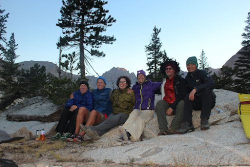
Wednesday: I climbed the slope up to the lowest Picket Creek Lake, coming out on the bluff above the lakeshore. Not necessarily the recommended route. Lots of class 2, with enough class 3 rock to avoid, or not, that it is quite taxing with a backpack. I arrived at this beautiful lake about midday, and I saw no point in moving over to Island Lake in Kaweah Basin. This lake was quite scenic in its own right. The clouds were rolling in, so I set camp up early,but it ended up being a false alarm. The weather pattern was finally ending, and there was only a brief shower that day. It was quite nice to see Oleander and Rocky Road showing up. I had wondered if I would be the only one, considering the weather. Wednesday afternoon, and Thursday were the best days of the trip to me, meeting the members, and socializing/exchanging info.

I took off Friday morning, tentatively planning on traveling with Hobbes to Shepherd pass, but it did not work out. I did not find the ramp that runs from the east side of Pickett to Gallants lake, and I lost him as well. He is very fast, and I am not. But I followed his footprints down the trail for a number of miles, never catching up, like a 3 legged mountain lion trying to catch up with a young deer. I ended up hiking the last 28 miles or so out to the car at Cottonwood Pass, split between Saturday and Sunday. Great trip, great members, I am ready to do it again...sort of. An August trip next year would be great, a more stable weather pattern, for those of those who typically only get one long trip a year. However, I do believe that I will be heading to the Shepherd Pass area in late August, or early September this year, wandering the south side of the Kings-Kern Divide for 8-10 days, and perhaps visiting Williamson Bowl. Milestone Creek basin, or Lake Wallace.
Happy Trails.

Image
Image
Image
Image
Image
Image
Image
Image
Image
Image
Image
Image
Image
Image
Image

Image

Image

Image

Image
User avatar
rlown
Topix Docent
Posts: 8225
Joined: Thu Oct 25, 2007 5:00 pm
Experience: Level 4 Explorer
Location: Wilton, CA

Re: TR: Maverick's 2015 Annual HST Meet-Up 7/22-7/24/15

Post by rlown »

nice report! I liked your pic https://lh3.googleusercontent.com/plY50 ... 02-h734-no

very nice color/contrast/height/depth.. hmm what else can I add to that.. :thumbsup:

oh.. nice selfie as well. :D
User avatar
richlong8
Topix Expert
Posts: 839
Joined: Tue Nov 25, 2008 6:02 pm
Experience: Level 4 Explorer

Re: TR: Maverick's 2015 Annual HST Meet-Up 7/22-7/24/15

Post by richlong8 »

Thanks, I appreciate the comments. The pic you mentioned is Crabtree pass. The photo of me is not a selfie. Hobbes took it at his request, and I took one of him with his camera per his request. I am 60, I don't do selfies!
User avatar
oleander
Topix Expert
Posts: 480
Joined: Wed Aug 18, 2010 10:15 am
Experience: N/A

Re: TR: Maverick's 2015 Annual HST Meet-Up 7/22-7/24/15

Post by oleander »

Rich, you can add yourself to the list of very talented photographers on this forum. I love the way you framed Crabtree Pass. And I recognize the crescent beach from the second Crabtree Lake.

We were so relieved to see you at Picket! I liked the mini-meet-ups that occurred on the way to and from Island Lake as much as I liked the big meet-up itself. It was a nice chance to get to know people just two or three at a time. Our stroll through Picket basin and over the saddle to Island was downright reverent.

- Elizabeth
User avatar
Rockyroad
Topix Regular
Posts: 275
Joined: Tue Aug 17, 2010 9:05 pm
Experience: N/A
Contact:

Re: TR: Maverick's 2015 Annual HST Meet-Up 7/22-7/24/15

Post by Rockyroad »

Such great trip reports and fantastic photos so far. Here is mine...

Day 1, Sat: After a long drive from the Bay Area, my hike began in Crescent Meadows under partially cloudy skies. By about 2pm, occasional sprinkles fell and thunder rumbled in the distance. The clouds continued to build as the day progressed and rain became more frequent as I arrived at Buck Creek. After I set up my tent, the rain, lightning, and thunder escalated quickly and the creek flow suddenly became torrential.

Image

Day 2, Sun: I had underestimated the day’s hike and struggled up the grade in slow-motion with my full pack. The trail was overgrown in many areas. At Hamilton, I could see that the trail led into the dense clouds/fog up the hill. The day was grey, wet, and dreary. Precipice Lake was enshrouded in fog so I wasn’t even able to see this famous lake. Rain fell steadily as I headed towards Kaweah Gap and I felt relieved when Nine Lakes became visible. I set up camp at the southern shore of the heart-shaped lake. I had planned to meet Oleander at this lake today but as the rain continued to fall, I decided to look for her in the morning.
Day 3, Mon: It was still raining when I woke at 5:30am. I came to the realization that these were not your typical summer thunderstorms that quickly come and go away, leaving clear skies in the morning. I contemplated staying inside the tent all day if it continued to rain. But the rain finally stopped at 6am. I found Oleander camped up the hill at the other side of the lake. Though our plan was to go over Pants Pass to get into the Picket Guard basin today, Oleander suggested rerouting down the High Sierra Trail to the lower Kern where we could enter the Kaweah basin from the east, thus avoiding the steep wet granite of Pants Pass. Even though this would require more miles, it would also get us to lower elevation and hopefully away from the storm. We traveled across the Chagoopa Plateau and down to the Kern, camping at Kern Hot Springs along with many others. I was sad to lose the elevation I had worked so hard to gain, and will have to re-gain. The air was warm and humid in the valley and we did not encounter any more rain.

Early morning at Nine Lakes
Image

Chagoopa Plateau
Image

Great Western Divide
Image

Kern Valley
Image

Day 4, Tue: It was a luxury to be able to soak my sore muscles in the hot springs in the morning. After taking advantage of the first sunny morning to dry some of our items, we continued along the Kern, crossing many of its tributaries towards Junction Meadow. We could see dark clouds looming ominously over the higher basins to the west. As we got on the Colby trail, the rain intensified. Then the hail fell. We sped up the trail, stopped to seek shelter under some sparse trees and finally retreated back down the trail since the cold rain/hail did not relent. We quickly set up our tents on piles of pine needles under a tree. Everything was soaking wet again but we were finally drying off and warming up inside our tents. I did not fire up the stove that night and just had snacks for dinner.

Colby Pass Trail
Image

Day 5, Wed: After another late start to dry off in the welcome morning sun, we headed up the Colby Pass trail again. It was a beautiful trail, taking us up and around a knoll, weaving alongside the emerald Kern-Kaweah River. Our goal was to eventually cross the river to make a southern-bound cross country ascent up to Picket Lake. At our target elevation, we checked the river a few times and found an easy rock hop crossing. This location also had the best views up and down the river so was the perfect place to rest and refuel. We later noticed a cairn indicating that others had also found this to be the ideal launch point for the Picket Creek basin. We followed the easy diagonal tree path up in almost a straight line, resisting the temptation to deviate higher up to the peak, ending up at a small saddle which when crested brought us to the SE end of the beautiful Picket Lake. In my excitement on reaching this lake, I neglected to pull the strap of my Crocs over my heels while crossing the outlet stream and ended up watching my right side sandal float down towards the Kern River. I was a little distressed at leaving behind an article in this pristine wilderness. We then crossed the inlet stream that cascaded into the lake and met Richlong8, who had arrived earlier this day.

Diagonal tree-line up to Picket Creek
Image

Kern-Kaweah River crossing to Picket Creek route
Image

Route to Picket Creek
Image

Picket Lake
Image

Picket Lake
Image

(continued)
User avatar
Rockyroad
Topix Regular
Posts: 275
Joined: Tue Aug 17, 2010 9:05 pm
Experience: N/A
Contact:

Re: TR: Maverick's 2015 Annual HST Meet-Up 7/22-7/24/15

Post by Rockyroad »

Day 6, Thur: Our hike up Picket Creek to the Kaweah Basin was slow, as we stopped frequently to soak in the beauty and take photos. It was one of the most enchanting places I’ve been to, surrounded by miniature waterfalls, lush patches of grass, and cool streams flowing in various directions and mountain ranges at both ends. Further up the basin, it was an easy hike up to a saddle where we were rewarded with our first view of the Kaweah Basin. It contained more trees and vegetation than the rocky basin I had imagined. Gorges were cut by rivers leading down to Island Lake. We explored much of the lake, looking for an area with enough space for about 5-6 campsites. At the east end of the lake, near the outlet, we discovered an empty tent and assumed it belonged to an HST member so decided to set up there as well. It turned out to be Gazelle’s tent, who arrived shortly afterwards with Hobbes. The five of us explored the eastern drop-off of the basin where the river flowed down the canyon to join the Kern while some discussions ensued about approach options to Island Lake. I was glad to have taken the easy saddle from the Picket Creek basin. Bluewater arrived as we sat around the communal dinner area and the group buzzed with conversations about gear, routes, and just general happiness at being at such a beautiful location. Oleander and I received some valuable intel from Gazelle since she had come in over Pyra Queen Col, the path we were taking out. She identified a nice tarn to camp at and warned us to stay away from below the snow fields due to the many rock falls she had seen. But mostly what stood out for me was “The rocks will show you the way”. Very simple and true. Or maybe complexly philosophical. Just as everyone was getting ready to tuck in for the night, MN2CAPisco and Andrey arrived, drawing admiration from all of us once we learned they had come in from Hamilton Lake over Pyra Queen Col, a massive amount of ground to cover in one day.

Picket Lake sunrise
Image

Inlet to Picket Lake
Image

Picket Creek
Image

Picket Creek
Image

Kaweah Basin, Island Lake on left
Image

Rockyroad, Oleander, Richlong8 at the saddle between Picket Creek and Kaweah basins
Image

Kaweah Basin
Image

Island Lake
Image

Richlong8, Oleander, Hobbes at the Island Lake outlet
Image

Richlong8, Gazelle, Oleander, Hobbes checking out alternative routes to Island Lake
Image

View east from Island Lake
Image

Bluewater, Hobbes, Oleander, Gazelle, Richlong8, Rockyroad (MN2CAPisco and Andrey arrived later)
Image

Day 7, Fri: This was practically a layover day as Oleander and I had planned to just hike up to camp at the upper Kaweah Basin to stage an assault on the Pyra Queen Col the following day. Bluewater had also planned on exiting over PQC with us but he wanted to explore the Picket Creek basin first. We made plans to meet at the tarn Gazelle had identified. The hike up the basin was outstanding. The terrain of streams, trees, willow patches, slowly changed to granite and scattered metamorphic rock with the occasional tarn as we headed up the canyon. After hiking a bit more to catch a glimpse of the larger tarns at the western end of the basin, we backtracked to Gazelle’s tarn which we thought to be the best camping area in the upper basin and put out a beacon for Bluewater. He arrived around dinnertime just as he had predicted.

Dawn at Island Lake
Image

Morning sun on Island Lake outlet
Image


Panoramic of Kaweah Basin (Can you spot Oleander in the photo?)
Image

Lone pine in upper Kaweah Basin
Image

Pyra Queen Col at upper left
Image

Beacon for Bluewater
Image

Day 8, Sat: I didn’t know what to expect from Pyra Queen Col, but I was excited for the challenge. We (I) slowly made my way up the basin, over large talus blocks. PQC loomed over us and we could not identify the actual col yet. Gazelle’s advice was to go up closer to the right side, then start cutting left, even further left than you would expect, and then follow the path right. “The rocks will show you the way.” Oleander led the charge followed by input by Bluewater. As we were nearing the top, Bluewater and I heard a loud whoop from Oleander, who was standing at the top of the col, waving and cheering happily. Shortly after, all 3 of us were at the top, looking down the even steeper scree field on the west side of PQC. We took some moments at the top to rest and take photos before Oleander led the charge down the other end of the col. We maintained a sizeable distance between each other so that any rockfalls created would not take out the person below. Coming down the top of the pass was more fun than frightening for me. But then as I continued to make my way down, it became more tedious. We made a wide zig zag down, avoiding the smooth granite, finally reaching one of the Nine Lakes at the bottom which was surrounded by more talus blocks. The hike along this lake and the next was slow as we still had to hop talus. However, as we travelled, the talus grew smaller and we saw more patches of grass. I was really impressed by the upper Nine Lakes basin area. It seemed so complex, with small hills and valleys and lakes and streams everywhere. Bluewater must have liked it too since he decided to stay at one of the lakes for the night. Oleander and I continued down to the lower lakes and were back on to the HST trail over the Kaweah Gap. We were headed to Hamilton Lake so that our hike out the next day would leave reasonable time to drive home. The trail looked completely new to me since it was dark, rainy, and cloudy on my way in at the beginning of the trip. I was finally able to appreciate this beautiful trail and even see Precipice Lake. Despite being on our feet with full packs for exactly 12 hours today, I was filled with energy from the excitement of the upper Kaweah basin, PQC, Nine Lakes, and a fresh look at the HST.

One of several tarns in upper Kaweah Basin
Image

Rockyroad, Bluewater, Oleander below the Kaweahs
Image

The larger tarns in the upper Kaweah Basin
Image

Panoramic of upper Kaweah Basin
Image

West side of Pyra Queen Col. The actual col is the light colored chute on top.
Image

Black Kaweah
Image

Bluewater picking a camp location
Image

Nine Lakes basin
Image

Night photography from Hamilton Lake
Image

Day 9, Sun: Hike out to Crescent Meadows.

These 9 days were highlighted by pristine wilderness and meeting new friends who share similar interests. I cherished every moment, the cold wet hailstorm as much as that first glimpse of Picket Lake, because those are the moments that make you feel alive.

If any of you fish the Kern and hook a brown size 9 Croc, please send it to me. I'll pay the shipping. :)
Last edited by Rockyroad on Fri Jul 31, 2015 11:20 am, edited 1 time in total.
User avatar
richlong8
Topix Expert
Posts: 839
Joined: Tue Nov 25, 2008 6:02 pm
Experience: Level 4 Explorer

Re: TR: Maverick's 2015 Annual HST Meet-Up 7/22-7/24/15

Post by richlong8 »

Really interesting trip report and great photos rockyroad(michael). They really convey the cloudiness of the storm. A pleasure meeting you. May your semi conductor pnp junctions always conduct. or not.
User avatar
Hobbes
Topix Fanatic
Posts: 1120
Joined: Wed Apr 27, 2011 8:09 am
Experience: N/A
Location: The OC

Re: TR: Maverick's 2015 Annual HST Meet-Up 7/22-7/24/15

Post by Hobbes »

Great TRs Richard & Michael. Here's a philosophical question: is it better to have good, then bad weather, or bad, then good weather?

Perhaps the initial bad weather will morph into classic type II fun, where memories will fade but the adventure aspects will continue to increase. Already, I'm romanticizing being forced to stick out the storm right below the Shepherd crest. I'm forgetting the reality of actually being under my tarp, but recalling the black clouds, hard rain, rolling thunder and flashes of lightning with fondness.

Later than evening after 10pm, I was awoken by headlamps coming down the trail. (I had set-up camp maybe 10 yards max right off the trail next to some willows in a little hallow - a paltry effort since I was above treeline. Still, the Pothole is like the moon littered with boulders and talus, so this little zone is all there is.) As they came by, I realized they had summitted either Williamson or Tyndall, got caught in the storm, and had to make an emergency bivy somewhere up above.

I recalled passing a tent left back @ Anvil, so I figured it had to be them. Now, imagine for a moment getting caught in that storm on a mountain, having to make an emergency bivy, then deciding to hike down in the dark on wet granite/talus? I mean, that upper section of Shepherd is bad enough in broad daylight (especially since the hard rain washed some of the scree trail sections away), so imagine the motivation to just go for it anyway to get back to a nice warm tent.

And yet, perhaps whatever terror they might have felt will fade and it will be re-counted years from now as that "fantastic adventure". LOL
User avatar
Hobbes
Topix Fanatic
Posts: 1120
Joined: Wed Apr 27, 2011 8:09 am
Experience: N/A
Location: The OC

Re: TR: Maverick's 2015 Annual HST Meet-Up 7/22-7/24/15

Post by Hobbes »

Not a very good photo, but it does sort of capture the nature of an impromptu gathering to study maps & discuss route options. RockyRoad, being an engineer, had printed off a bunch of high resolution images from Earth from different angles & perspectives, of which Gazelle & Oleander were studying:

Gazelle, Oleander, RR (behind branch) & Richard:
Image
User avatar
richlong8
Topix Expert
Posts: 839
Joined: Tue Nov 25, 2008 6:02 pm
Experience: Level 4 Explorer

Re: TR: Maverick's 2015 Annual HST Meet-Up 7/22-7/24/15

Post by richlong8 »

For me, of the 2, I prefer the bad weather at the beginning. The weather almost always changes back to good weather if I am on a long trip, and it cheers me up and keeps me there for the long haul when it gets sunny again. On the other hand, If the weather turns sour, after being good the first several days, I tend to want to bail out and go home. The worst part of bad weather for me is the inordinate amount of time I have to spend in shelter to keep me and my gear from getting too wet, and too cold which leads to the dreaded "h" if you are not careful. I think the more ultralight a person's gear, the more careful they need to be, to stay dry and warm. Even though I had an Iphone with me with some books to read, I really enjoyed having a Louis L'Amour thin paperback to read during the bad weather. It served as great kindling to start a fire, and dry kindling was hard to find, even under large trees, during this trip's early days, because it was so wet.
Post Reply

Who is online

Users browsing this forum: Google Adsense [Bot] and 60 guests