TR: Isberg to Blue Lake 7/23/15-7/25/15
Posted: Wed Jul 29, 2015 9:44 am
The long drive to the trailhead gave me a lot of time to think, and at 4:30am strange thoughts can enter my head, like hiking all the way to Harriet Lake from Isberg trailhead in a day. I knew it was a possibility, but a stretch relative to my more attainable goal of Sadler, or even McGee Lake above. The closer I got the trailhead, the less I thought of my destination and more of just getting on the trail, which I was around 11am.
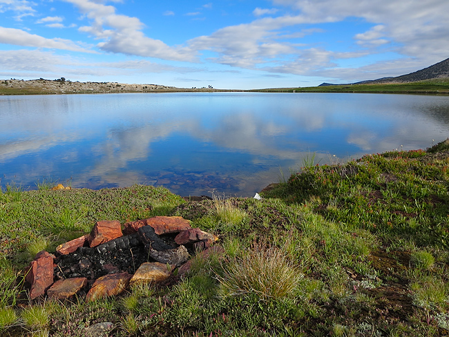
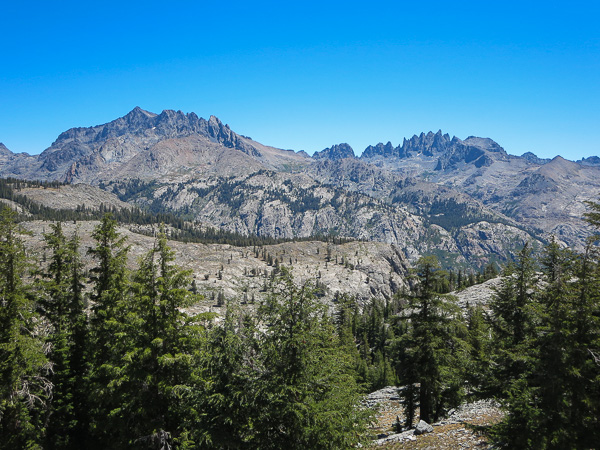
I made my way through the forest and up through the Nitch, taking a lunch break at Granite Creek. Before long I was passing Cora Lakes and heading up Granite Creek past Knoblock Meadow and beyond.
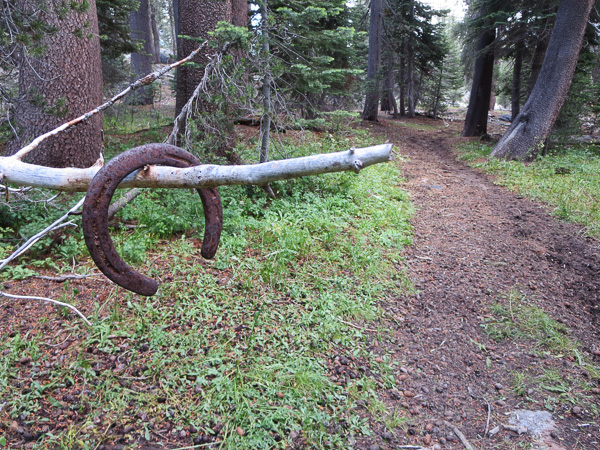
Hanging Horseshoe near Cora Lakes
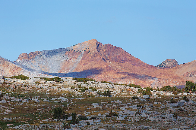
The weather was beautiful, with a slight breeze and on and off clouds, making the hike through the canyon that much more pleasant. I made Sadler Lake by mid-afternoon. Across the lake were a group of boys having a great deal of fun at the expense of peace - I moved on quickly. A short time later Isberg Lakes were in view. With plenty of gas still left in the tank I found myself climbing above the lakes towards Long Mountain. The forest below prevented me from getting a good look at what was to come, and as I climbed higher I finally got good sight of Long Mountain and the ridge to it's west. From this vantage point, the ridge above looked easier than the saddle just west of the peak itself, and based upon my map seemed doable on it's North side as well, so I aimed toward it.
Take three steps, stop, and catch my breath. Take three steps, stop, and catch my breath. I could tell I was coming from sea level, the thin air and long day were taking their toll, but I finally reached the top of the ridge - a spectacular view worth absorbing for longer than I did - the cold wind pushed me into hiking mode again as I traversed the north side of the ridge, high above the lakes below.
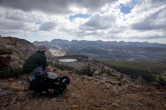
View west from Long Mountain Ridge
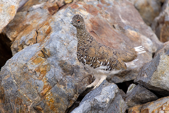
A short time later, several rocks started moving just in front of me. Was I loosing it? The chirps provided a sanity check, and I realized I had stumbled across a flock of Rock Ptarmigan. Very approachable, I dropped my pack and got out my camera gear for a closer look. The birds seemed to just melt into the landscape: the four I initially saw were now three, the fourth of which - only a few feet away - I did not find until I spooked it as I stood up to leave.
Rock Ptarmigan
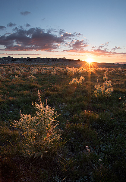
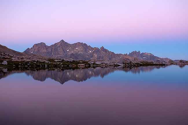
On my way again, the cliff below did not seem like it would subside. Scrambling across the talus mixed with trundra, I finally reached the tarn above Harriet and followed it's outlet creek down through the red rock. Plenty of time left in the day to fish, eat dinner, and lounge before the day gave way to a beautiful sunset.
Harriet Lake Shore
Dusk at Harriet Lake

It was hard to get up the following morning, but I finally inched my way out of the tent. After some breakfast and coffee, I walked around the lake, fishing here and there.
Sigh...
Red Peak
Packed up and ready, I started my way towards Blue Lake Pass. After cresting the first hill, I looked down to notice a party of two shortly behind. The terrain flattened a bit before the climb started again. With a slow but steady pace I climbed through the maze of talus, following the route I had scouted from below. I finally reached the top of the pass, joined a bit later by the two hikers behind.
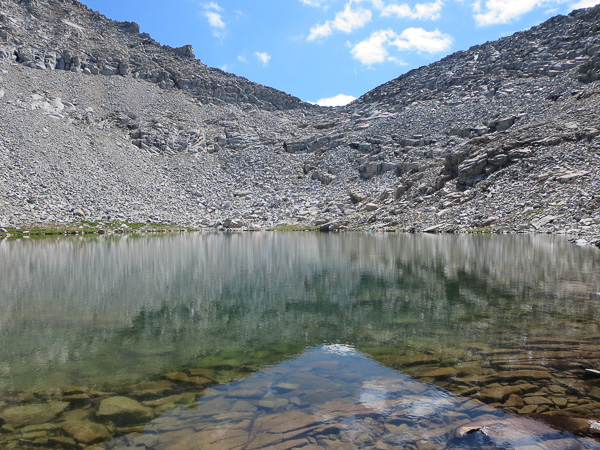
Tarn below Blue Lake Pass (center)
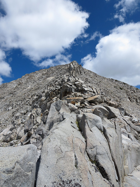
Ridge leading to the summit of Forester Peak
Pack back on I started my way down. I knew I should continued traversing further east, but was tempted to drop down a more directly to check things out. As I did, I found myself at an impasse - a steep, wide, and slippery slab of granite at the base of a gully turned me back up to choose a safer route, which I found a short time later.
The rest of the day was playtime. I fished Blue Lake, explored the saddle between Blue and Rockbound Lakes, explored the upper part of the basin, and stared down into Bench Canyon for what seemed like hours. After an early dinner, I watched the sunset then hit the sack early.
Afternoon at Blue Lake
Earth Shadow
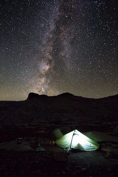
Milky Way
The morning sun hit my tent early, and I was quickly up for some coffee, cereal, and fishing. Places like this are always hard to leave, and after stalling all I could I packed my things and hoisted the pack. Up and over the saddle to Rockbound, I was surprised to see the number of camps about. At the lakes edge, someone approached explaining there was an Outward Bound group at the lake. I didn't spend much time there, rather headed down Long Canyon in a slow but methodical stroll.
View from saddle above Long Creek
My intended route went via the unmaintained trail that leads to Chetwood Cabin. After crossing the creek and taking a much needed break, I miraculously found a use trail heading up into the forest towards the crest above, but found myself loosing the 'trail' more often than finding it. As I crested the saddle, the trail got a bit more pronounced - but the downed trees and meadows often swallowed the trail, and the distance between Chetwood Cabin seemed inversely proportional to the number of curse words uttered. Past the cabin, I met two hikers headed up the 'trail'. After a fun conversation one of them recognized the HST patch on my pack and introduced himself as Electra. Always fun meeting HST folks in the backcountry.
The trail out always seem to be longer than coming in, but despite the sore body made it to the trailhead by 3pm.
Still working on an ~10 minute movie...
I made my way through the forest and up through the Nitch, taking a lunch break at Granite Creek. Before long I was passing Cora Lakes and heading up Granite Creek past Knoblock Meadow and beyond.
Hanging Horseshoe near Cora Lakes
The weather was beautiful, with a slight breeze and on and off clouds, making the hike through the canyon that much more pleasant. I made Sadler Lake by mid-afternoon. Across the lake were a group of boys having a great deal of fun at the expense of peace - I moved on quickly. A short time later Isberg Lakes were in view. With plenty of gas still left in the tank I found myself climbing above the lakes towards Long Mountain. The forest below prevented me from getting a good look at what was to come, and as I climbed higher I finally got good sight of Long Mountain and the ridge to it's west. From this vantage point, the ridge above looked easier than the saddle just west of the peak itself, and based upon my map seemed doable on it's North side as well, so I aimed toward it.
Take three steps, stop, and catch my breath. Take three steps, stop, and catch my breath. I could tell I was coming from sea level, the thin air and long day were taking their toll, but I finally reached the top of the ridge - a spectacular view worth absorbing for longer than I did - the cold wind pushed me into hiking mode again as I traversed the north side of the ridge, high above the lakes below.
View west from Long Mountain Ridge
A short time later, several rocks started moving just in front of me. Was I loosing it? The chirps provided a sanity check, and I realized I had stumbled across a flock of Rock Ptarmigan. Very approachable, I dropped my pack and got out my camera gear for a closer look. The birds seemed to just melt into the landscape: the four I initially saw were now three, the fourth of which - only a few feet away - I did not find until I spooked it as I stood up to leave.
Rock Ptarmigan
On my way again, the cliff below did not seem like it would subside. Scrambling across the talus mixed with trundra, I finally reached the tarn above Harriet and followed it's outlet creek down through the red rock. Plenty of time left in the day to fish, eat dinner, and lounge before the day gave way to a beautiful sunset.
Harriet Lake Shore
Dusk at Harriet Lake
It was hard to get up the following morning, but I finally inched my way out of the tent. After some breakfast and coffee, I walked around the lake, fishing here and there.
Sigh...
Red Peak
Packed up and ready, I started my way towards Blue Lake Pass. After cresting the first hill, I looked down to notice a party of two shortly behind. The terrain flattened a bit before the climb started again. With a slow but steady pace I climbed through the maze of talus, following the route I had scouted from below. I finally reached the top of the pass, joined a bit later by the two hikers behind.
Tarn below Blue Lake Pass (center)
Ridge leading to the summit of Forester Peak
Pack back on I started my way down. I knew I should continued traversing further east, but was tempted to drop down a more directly to check things out. As I did, I found myself at an impasse - a steep, wide, and slippery slab of granite at the base of a gully turned me back up to choose a safer route, which I found a short time later.
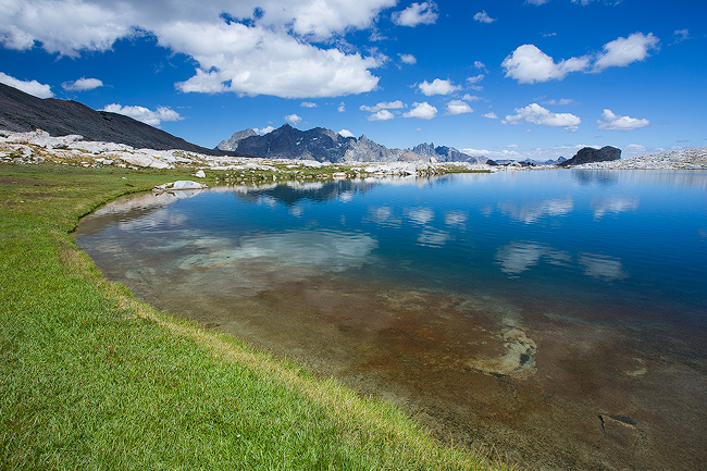
The rest of the day was playtime. I fished Blue Lake, explored the saddle between Blue and Rockbound Lakes, explored the upper part of the basin, and stared down into Bench Canyon for what seemed like hours. After an early dinner, I watched the sunset then hit the sack early.
Afternoon at Blue Lake
Earth Shadow
Milky Way
The morning sun hit my tent early, and I was quickly up for some coffee, cereal, and fishing. Places like this are always hard to leave, and after stalling all I could I packed my things and hoisted the pack. Up and over the saddle to Rockbound, I was surprised to see the number of camps about. At the lakes edge, someone approached explaining there was an Outward Bound group at the lake. I didn't spend much time there, rather headed down Long Canyon in a slow but methodical stroll.
View from saddle above Long Creek
My intended route went via the unmaintained trail that leads to Chetwood Cabin. After crossing the creek and taking a much needed break, I miraculously found a use trail heading up into the forest towards the crest above, but found myself loosing the 'trail' more often than finding it. As I crested the saddle, the trail got a bit more pronounced - but the downed trees and meadows often swallowed the trail, and the distance between Chetwood Cabin seemed inversely proportional to the number of curse words uttered. Past the cabin, I met two hikers headed up the 'trail'. After a fun conversation one of them recognized the HST patch on my pack and introduced himself as Electra. Always fun meeting HST folks in the backcountry.
The trail out always seem to be longer than coming in, but despite the sore body made it to the trailhead by 3pm.
Still working on an ~10 minute movie...