TR: Kearsarge to the Tehipite and down the Middle Fork Aug 2
Posted: Thu Jul 10, 2014 11:29 am
Rough map: https://mapsengine.google.com/map/viewe ... 13hYqCseeI" onclick="window.open(this.href);return false;
Trail report I wrote for some friends last fall, but repost it here. Hope it interest some of you:
So this trip was scheduled by some friends as a boys week out for one of them that went through a nasty divorce earlier this year. That is a story for another day. 3 weeks before the trip, I was invited, so I was all in. My wife, the saint, agreed, and so I bought a backpack that fits (finally) and get ready to head out.
A little background; years ago as a 18 yr old I was an adult leader on a 50 miler where we spent a lot of time on the Middle Fork of the Kings River and specifically in Tehipite Valley. This is one of my favorite places and I have been waiting too long to get back.
The plan was for the trip to start around noon on Friday at Roads End in Kings Canyon. That is a 7 hour drive for me, or a 22 mile hike. I chose the hike. In retrospect, I probably should have driven, but nonetheless, those first 2 days were beautiful.
So I started, solo, on Thursday an hour from my house at about 2:15 in the afternoon. I knew I had to make 22 miles in the next 22 hours, so I went fast. Up and over Kearsarge pass.
Looking east from the pass.
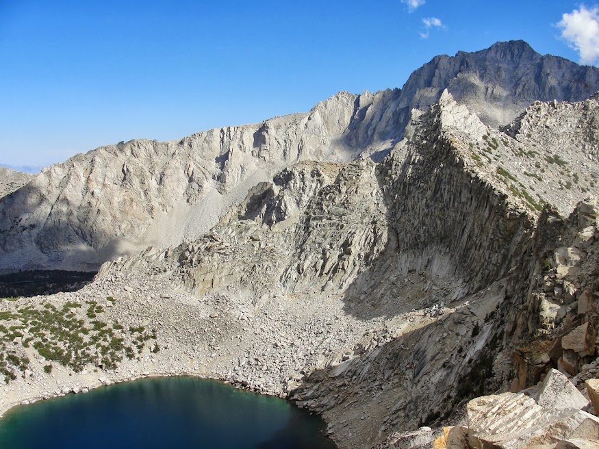 This is one of the best passes for getting into the high county) that evening, hit the pass around 4:30 (5 miles) and headed down hill past the Kearsarge Lakes and into the Bubbs Creek area.
This is looking west from the pass to the lakes and to my eventual campsite in the far canyon.
 Hiked till about 8 pm and I estimate that I got 14 miles in that day.
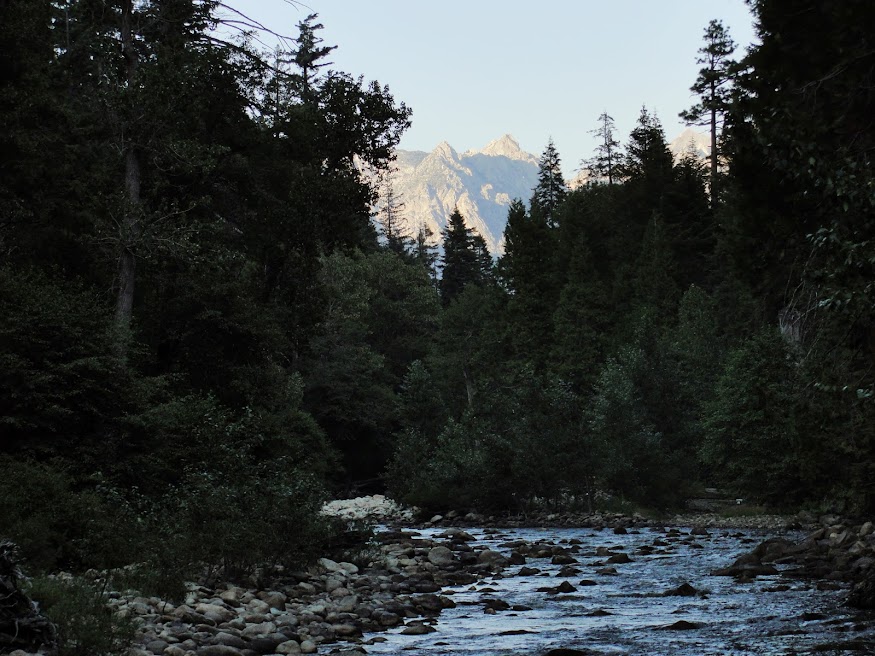
Bubbs Creek:
 I should have stopped a mile earlier near another group where I could have shared a Bear Box, but I had a bear canister, so I trudged on to do it alone for the night. There are tons of bears in this area, so it was a bit of a restless night, but I and my food was left alone.
Day 2- woke up early, for me that is, and was ready to be on the trail at 8:15. Couple of miles down the trial I ran into this guy.
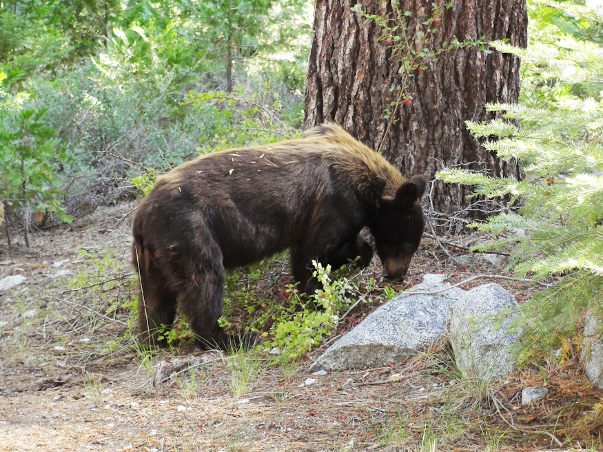
Almost literally ran into him. 5 ft away when I came around the corner. I almost pooped myself. He or she did not care at all and continued eating berries. I took some pictures and continued on.
Descended all the way to Roads End and finished my 8 miles for the day, all downhill, by 11:30 and started waiting for my friends.
My friends who were supposed to arrive at 12, did not show up till after 3, so I just sat there like an idiot and ate my lunch and read my book. They eventually arrived and we were finally on the trial around 3:45 for a brutal, brutal uphill. I think we only made it 4 miles, climbing 3000 ft in the process, when we hit Lower Tent Meadow – there was a bear box and a nice creek and flat places for tents. It was about 7 pm when we hit this point and I was able to convince everyone to stop. I was spent and they were just getting started, but I don’t know how much more I could have done. Turned out it was a good idea to stop, because this was the only place to stop unless we have climbed up 2000 more ft and gone at least 3 more miles. Nice campsite though.
Day 3 – Slept in till 9:00 or so, didn’t get hiking till after 10:30. This is vacation after all. Had to finish the rest of the brutal climb, except now it was hot. Made it up to The Lip (pass into Granite Basin) by about 1 and had lunch up top.
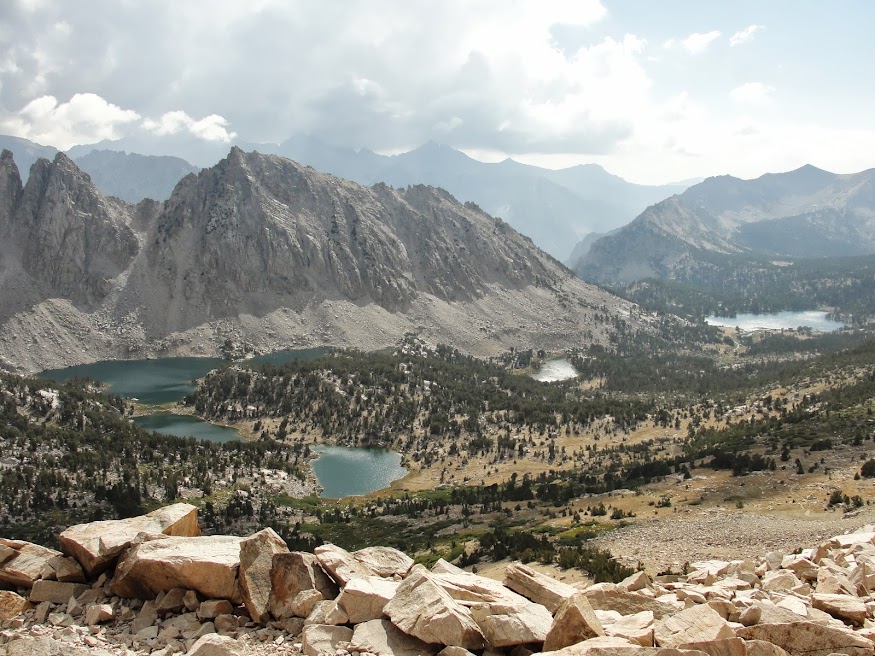
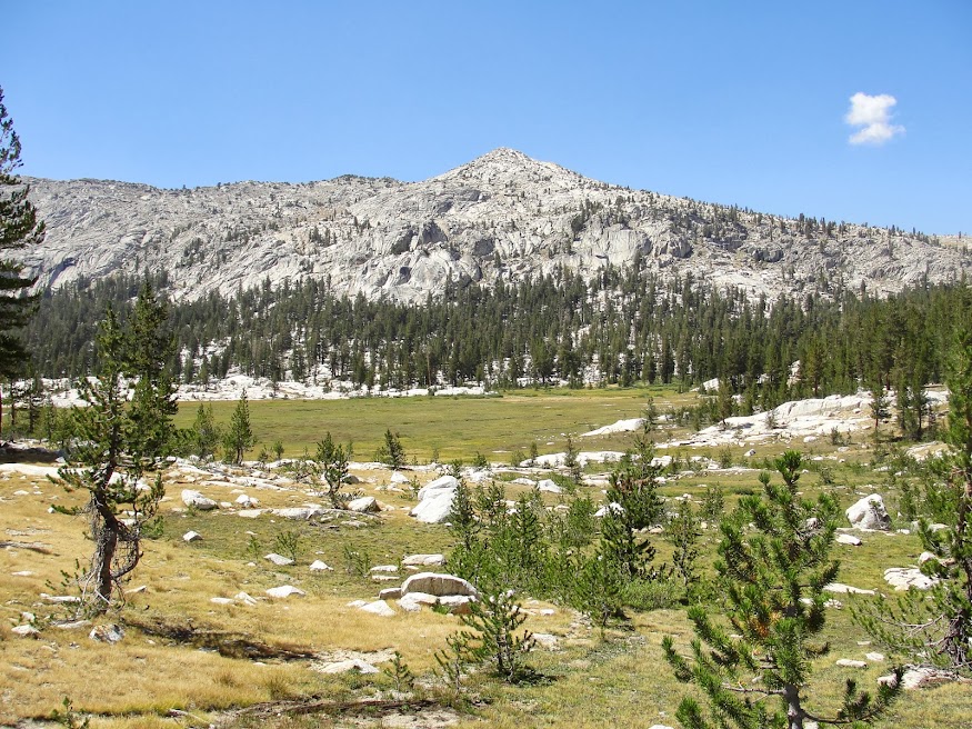
Granite Basin:
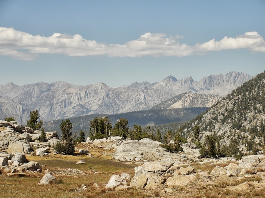
The original plan was to go cross country from this point up a peak and through some different basins to a hanging valley by a lake for camp. The final decision to stick to trails instead was made by the divorcee and so trails it was and we headed off towards the State Lake, by way of Granite Basin and Granite Pass. There were some great views of the Palisade Crest.
From Granite Pass looking at the Palisades:
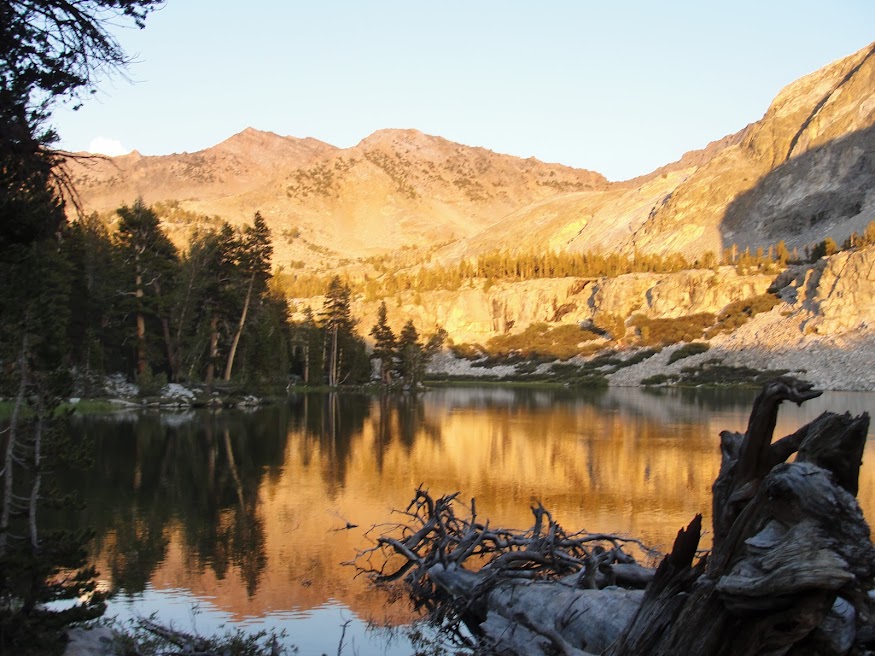
Finally made to the first State Lake as the sun was setting with a nice alpenglow. Rolled in right at 8 pm, at dinner, and set up camp in the dark. Very cold that night at 10,300 ft, especially after spend a stupid ½ hour trying to hang our food from a branch.
and from the campsite at State lakes:
Day 4- Slept in again. On the trail by 10:30 or so.
Continued the loop around State Lakes, then took a 1.25 mile detour out and back to the Horseshoe Lakes for an hour lunch swim. Water felt great. Nice views of the basin. Then we went back and picked up our packs and continued on what was viable of a not so maintained trail. We would lose it every so often, but this is a wide open pine forest, with no underbrush, so I know that if kept going downhill and west that we would hit the main trial eventually.
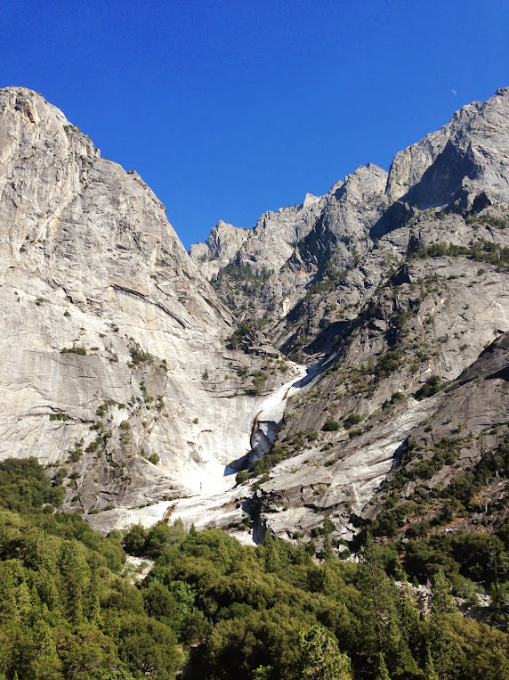
Hit the main trail and descended a nasty section of dry, dusty, sandy switchbacks where we descended 4000 or more feet in about 5 or so miles. The sign at the trail junction at the top warned that there was no water and equated this trail to death. I would concur. I would hate to have to climb this section of trail. It sucked majorly going down. Going up would be hell.
Looking down at the Middle Fork of the Kings(clickable):
After descending what felt like 3 hours, and it may have been, we got to Simpson Meadow along the Middle Fork of the Kings River. Our trail forked left or downstream and then petered out after 100 ft into a marsh.
We found a place to ford the river and then found the trail, along with a big Sierra Club group that was just finishing their 14 mile day. They started on the trail at 7, us 11 and we had gone just as far. Stay young everyone.
Wanting to get a jump on the descent downstream, we headed on for another mile or so till we found a great campsite with an even better swimming hole. After jumping off some nicely placed logs into the river we settled down for dinner and dessert.
Looking upstream from swimming, Middle Fork of the Kings river:
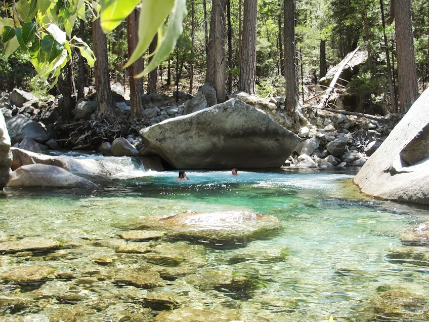
Day 5 – Trip down the middle fork of the Kings. I love this area. Just beautiful. You just need to be on the lookout for poison oak and rattlesnakes. This was a great, but long day. Maybe only 12 or 13 miles, and only 1000 ft of descent if that. Very gradual and there are some great places to stop and swim. We took our time, stopping maybe 3 times, each time for close to an hour to swim and enjoy.
swimming hole:
On one of these stops, I managed to slip off the boulder I was standing on and as I slipped I embedded to small pieces of granite in the heel of my right foot. One was under a flap of skin, so that was easy to remove, but the other was flush with the skin and held on like a mother. And this is why you bring and ER doctor with you on your trip. My friend, sterilized his knife and went to digging that sucker out. It ended up being about ¾ of a cm by ½ a cm. Lots of bad words were said. Oh man it was bad, but once the thing was pried out, it wasn’t too bad. He patched me up and decided that on the next trip he will bring a local anesthetic with him.
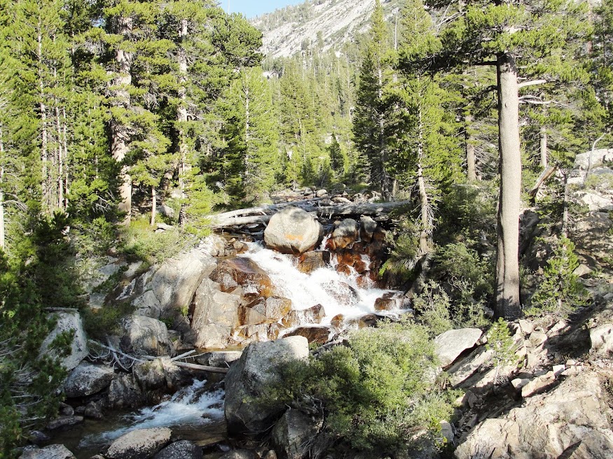
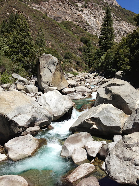
One of the side gorges, with a waterfall:
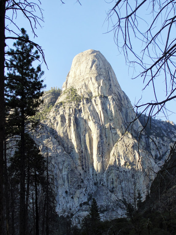
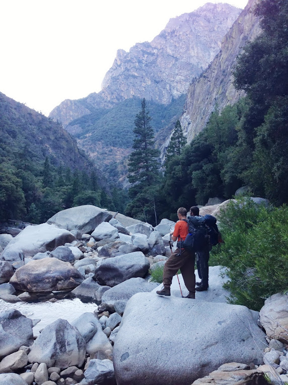
Finally got into Tehipite Valley at the end of the day.
View of Tehipite Dome:
We tried to keep going another mile or so past that (at this point we leave trails behind and embrace bushwhacking) in an attempt to make it to Little Tehipite Valley but we could not make it before dark. Too much poison oak and a cliff that necessitated a river crossing delayed us enough that we scrambled to find a somewhat suitable place to stay that night
Trying to find a route downriver:
Me, finally crossing just above Little Tehipte Valley - picture is facing downriver:

Day 6 – This is day that we were waiting for. No trails down these 10 or so miles of river. I think it is referred to as the “Bottom Nine” by kayakers. It was with some trepidation that we headed out early, at least for us, at 8 in the morning. We knew it was going to be tough, so we decided that we were going to get wet today so no trying to avoid getting the feet wet and that we were going to see a lot of poison oak, so there would be no point in trying to avoid it. I did wear pants and a long sleeve shirt to try and minimize exposure, but as I have already mentioned it was not completely successful. Could be much, much worse.
We rounded a bend after crossing the river and passed through Little Tehipite Valley. Looked back upstream for another great view of Tehipite Dome. This would be the last time we would see it for the day.
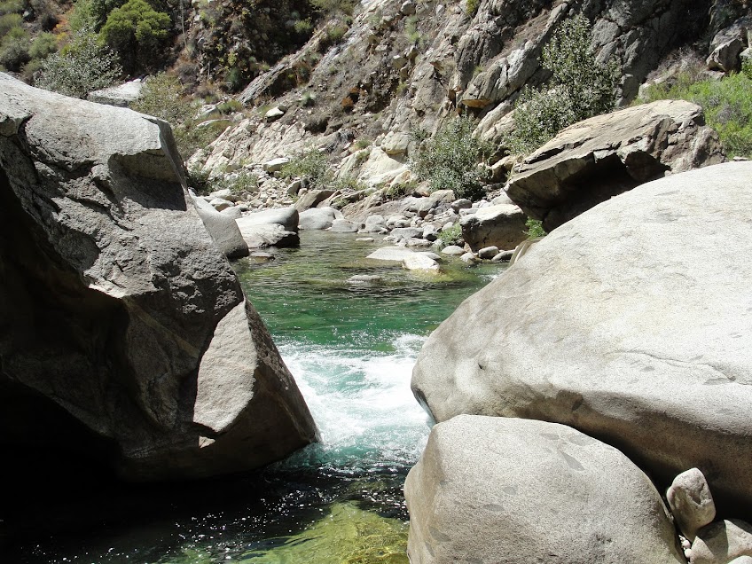
Typical View:
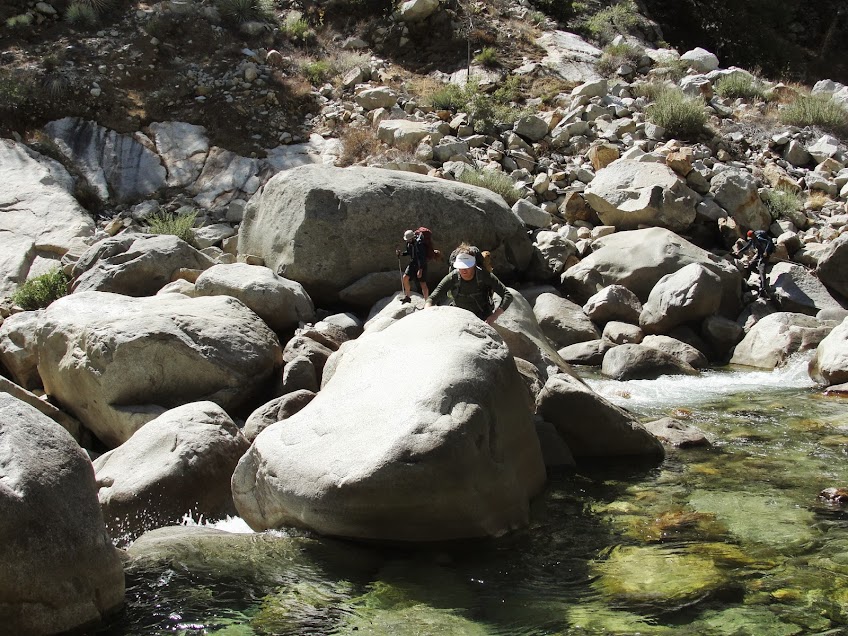
This was a long and grueling day. You wouldn't think it would be that bad, but 10 miles of wild river is tough. Thank heavens for this being a drought year. Would have not been possible if the water was higher. We had to cross the river probably 20 to 25 times. Maybe 10 or so times we came to a point where the river would cut into a wall and we had to make the decision of how to go up and over or through. We did not have dry bags, which in hindsight was a problem. If we had been prepared to get our bags all the way wet, we could have cut a lot of time and swam through some deep holes. As it was, we managed to stay out of water deeper than 4 ft. Waist deep was scary enough at times. This was fast moving water and often times we had to cross above a series of rapids.
River Crossing:
I have a video which I will try and post, of us crossing, which makes it look wimpy, but it was not, I guarantee you. If you went over the rapids, especially with a pack, it could be very bad.
http://www.youtube.com/watch?v=_Qxz18-Hf9o" onclick="window.open(this.href);return false;
Place where we stopped briefly to swim, and where I lost my wedding ring
The bushwhacking was also bad. There was lots of holly and willow and of course poison oak. There were a couple of time on the side a very steep hill that I was not is a happy place as we followed a bear trail. One of the problems with crash through the bush like we did was that it knows off leaves and they get stuck between your pack and your head, and then some of them manage to work their way down the back of your shirt. This is where the worst of my poison oak is. If I could have avoided that, I would have been fine, but I didn't and it really sucked.
The goal was to make it to the confluence of the South Fork and the Middle Fork before it got dark. As the day wore on I was afraid that we would not make it. Around 5 I could see a bend ahead that, based on the map, I determined was the confluence. Maybe it was later, but it seemed close, but it took forever. One of my friends totally bonked, which made it really hard when trying to cross the river or climb over class 3 routes. But we finally made it. I stepped in the crossing at the South Fork of the Kings, at 8:01 pm. Twilight was settling in, but it was enough to see to cross the river for the last time of the day.
We filled up water reservoirs by headlamp for the 2 mile 1000 ft climb up the trail to the road. We hike up from 8:30 to 9:30, and I bonked on the way. Lots of water and almonds later, we made it.
Epic. I know we were not the first to do this, but DAMN!!!
After a few frustrating failed hitchhiking attempts to get the 22 miles up the road to where our car was up at the end of the road, one of our party got a ride and was back to us by 11 at night. We loaded up the car and headed to Visalia. Then it was Dennys at 2 in the morning for hamburgers, some strong steroids from Rite Aid (again, bring a doctor –the idea was to prevent the poison oak from happening by taking some strong stuff, but all it did was delay its onset; it was a nice try) at 3 and then finally shower and bed at 3:30 am at the econolodge.
So hopefully, that is interesting to someone. That was in August of 2013
If you ever wanted to descend the Middle fork from Tehipite, this year would be the year, because this drought can't last forever.
Trail report I wrote for some friends last fall, but repost it here. Hope it interest some of you:
So this trip was scheduled by some friends as a boys week out for one of them that went through a nasty divorce earlier this year. That is a story for another day. 3 weeks before the trip, I was invited, so I was all in. My wife, the saint, agreed, and so I bought a backpack that fits (finally) and get ready to head out.
A little background; years ago as a 18 yr old I was an adult leader on a 50 miler where we spent a lot of time on the Middle Fork of the Kings River and specifically in Tehipite Valley. This is one of my favorite places and I have been waiting too long to get back.
The plan was for the trip to start around noon on Friday at Roads End in Kings Canyon. That is a 7 hour drive for me, or a 22 mile hike. I chose the hike. In retrospect, I probably should have driven, but nonetheless, those first 2 days were beautiful.
So I started, solo, on Thursday an hour from my house at about 2:15 in the afternoon. I knew I had to make 22 miles in the next 22 hours, so I went fast. Up and over Kearsarge pass.
Looking east from the pass.
This is one of the best passes for getting into the high county) that evening, hit the pass around 4:30 (5 miles) and headed down hill past the Kearsarge Lakes and into the Bubbs Creek area. This is looking west from the pass to the lakes and to my eventual campsite in the far canyon.
Hiked till about 8 pm and I estimate that I got 14 miles in that day. Bubbs Creek:
I should have stopped a mile earlier near another group where I could have shared a Bear Box, but I had a bear canister, so I trudged on to do it alone for the night. There are tons of bears in this area, so it was a bit of a restless night, but I and my food was left alone.Day 2- woke up early, for me that is, and was ready to be on the trail at 8:15. Couple of miles down the trial I ran into this guy.
Almost literally ran into him. 5 ft away when I came around the corner. I almost pooped myself. He or she did not care at all and continued eating berries. I took some pictures and continued on.
Descended all the way to Roads End and finished my 8 miles for the day, all downhill, by 11:30 and started waiting for my friends.
My friends who were supposed to arrive at 12, did not show up till after 3, so I just sat there like an idiot and ate my lunch and read my book. They eventually arrived and we were finally on the trial around 3:45 for a brutal, brutal uphill. I think we only made it 4 miles, climbing 3000 ft in the process, when we hit Lower Tent Meadow – there was a bear box and a nice creek and flat places for tents. It was about 7 pm when we hit this point and I was able to convince everyone to stop. I was spent and they were just getting started, but I don’t know how much more I could have done. Turned out it was a good idea to stop, because this was the only place to stop unless we have climbed up 2000 more ft and gone at least 3 more miles. Nice campsite though.
Day 3 – Slept in till 9:00 or so, didn’t get hiking till after 10:30. This is vacation after all. Had to finish the rest of the brutal climb, except now it was hot. Made it up to The Lip (pass into Granite Basin) by about 1 and had lunch up top.
Granite Basin:
The original plan was to go cross country from this point up a peak and through some different basins to a hanging valley by a lake for camp. The final decision to stick to trails instead was made by the divorcee and so trails it was and we headed off towards the State Lake, by way of Granite Basin and Granite Pass. There were some great views of the Palisade Crest.
From Granite Pass looking at the Palisades:
Finally made to the first State Lake as the sun was setting with a nice alpenglow. Rolled in right at 8 pm, at dinner, and set up camp in the dark. Very cold that night at 10,300 ft, especially after spend a stupid ½ hour trying to hang our food from a branch.
and from the campsite at State lakes:
Day 4- Slept in again. On the trail by 10:30 or so.
Continued the loop around State Lakes, then took a 1.25 mile detour out and back to the Horseshoe Lakes for an hour lunch swim. Water felt great. Nice views of the basin. Then we went back and picked up our packs and continued on what was viable of a not so maintained trail. We would lose it every so often, but this is a wide open pine forest, with no underbrush, so I know that if kept going downhill and west that we would hit the main trial eventually.
Hit the main trail and descended a nasty section of dry, dusty, sandy switchbacks where we descended 4000 or more feet in about 5 or so miles. The sign at the trail junction at the top warned that there was no water and equated this trail to death. I would concur. I would hate to have to climb this section of trail. It sucked majorly going down. Going up would be hell.
Looking down at the Middle Fork of the Kings(clickable):
After descending what felt like 3 hours, and it may have been, we got to Simpson Meadow along the Middle Fork of the Kings River. Our trail forked left or downstream and then petered out after 100 ft into a marsh.
We found a place to ford the river and then found the trail, along with a big Sierra Club group that was just finishing their 14 mile day. They started on the trail at 7, us 11 and we had gone just as far. Stay young everyone.
Wanting to get a jump on the descent downstream, we headed on for another mile or so till we found a great campsite with an even better swimming hole. After jumping off some nicely placed logs into the river we settled down for dinner and dessert.
Looking upstream from swimming, Middle Fork of the Kings river:
Day 5 – Trip down the middle fork of the Kings. I love this area. Just beautiful. You just need to be on the lookout for poison oak and rattlesnakes. This was a great, but long day. Maybe only 12 or 13 miles, and only 1000 ft of descent if that. Very gradual and there are some great places to stop and swim. We took our time, stopping maybe 3 times, each time for close to an hour to swim and enjoy.
swimming hole:
On one of these stops, I managed to slip off the boulder I was standing on and as I slipped I embedded to small pieces of granite in the heel of my right foot. One was under a flap of skin, so that was easy to remove, but the other was flush with the skin and held on like a mother. And this is why you bring and ER doctor with you on your trip. My friend, sterilized his knife and went to digging that sucker out. It ended up being about ¾ of a cm by ½ a cm. Lots of bad words were said. Oh man it was bad, but once the thing was pried out, it wasn’t too bad. He patched me up and decided that on the next trip he will bring a local anesthetic with him.
One of the side gorges, with a waterfall:
Finally got into Tehipite Valley at the end of the day.
View of Tehipite Dome:
We tried to keep going another mile or so past that (at this point we leave trails behind and embrace bushwhacking) in an attempt to make it to Little Tehipite Valley but we could not make it before dark. Too much poison oak and a cliff that necessitated a river crossing delayed us enough that we scrambled to find a somewhat suitable place to stay that night
Trying to find a route downriver:
Me, finally crossing just above Little Tehipte Valley - picture is facing downriver:
Day 6 – This is day that we were waiting for. No trails down these 10 or so miles of river. I think it is referred to as the “Bottom Nine” by kayakers. It was with some trepidation that we headed out early, at least for us, at 8 in the morning. We knew it was going to be tough, so we decided that we were going to get wet today so no trying to avoid getting the feet wet and that we were going to see a lot of poison oak, so there would be no point in trying to avoid it. I did wear pants and a long sleeve shirt to try and minimize exposure, but as I have already mentioned it was not completely successful. Could be much, much worse.
We rounded a bend after crossing the river and passed through Little Tehipite Valley. Looked back upstream for another great view of Tehipite Dome. This would be the last time we would see it for the day.
Typical View:
This was a long and grueling day. You wouldn't think it would be that bad, but 10 miles of wild river is tough. Thank heavens for this being a drought year. Would have not been possible if the water was higher. We had to cross the river probably 20 to 25 times. Maybe 10 or so times we came to a point where the river would cut into a wall and we had to make the decision of how to go up and over or through. We did not have dry bags, which in hindsight was a problem. If we had been prepared to get our bags all the way wet, we could have cut a lot of time and swam through some deep holes. As it was, we managed to stay out of water deeper than 4 ft. Waist deep was scary enough at times. This was fast moving water and often times we had to cross above a series of rapids.
River Crossing:
I have a video which I will try and post, of us crossing, which makes it look wimpy, but it was not, I guarantee you. If you went over the rapids, especially with a pack, it could be very bad.
http://www.youtube.com/watch?v=_Qxz18-Hf9o" onclick="window.open(this.href);return false;
Place where we stopped briefly to swim, and where I lost my wedding ring

The bushwhacking was also bad. There was lots of holly and willow and of course poison oak. There were a couple of time on the side a very steep hill that I was not is a happy place as we followed a bear trail. One of the problems with crash through the bush like we did was that it knows off leaves and they get stuck between your pack and your head, and then some of them manage to work their way down the back of your shirt. This is where the worst of my poison oak is. If I could have avoided that, I would have been fine, but I didn't and it really sucked.
The goal was to make it to the confluence of the South Fork and the Middle Fork before it got dark. As the day wore on I was afraid that we would not make it. Around 5 I could see a bend ahead that, based on the map, I determined was the confluence. Maybe it was later, but it seemed close, but it took forever. One of my friends totally bonked, which made it really hard when trying to cross the river or climb over class 3 routes. But we finally made it. I stepped in the crossing at the South Fork of the Kings, at 8:01 pm. Twilight was settling in, but it was enough to see to cross the river for the last time of the day.
We filled up water reservoirs by headlamp for the 2 mile 1000 ft climb up the trail to the road. We hike up from 8:30 to 9:30, and I bonked on the way. Lots of water and almonds later, we made it.
Epic. I know we were not the first to do this, but DAMN!!!
After a few frustrating failed hitchhiking attempts to get the 22 miles up the road to where our car was up at the end of the road, one of our party got a ride and was back to us by 11 at night. We loaded up the car and headed to Visalia. Then it was Dennys at 2 in the morning for hamburgers, some strong steroids from Rite Aid (again, bring a doctor –the idea was to prevent the poison oak from happening by taking some strong stuff, but all it did was delay its onset; it was a nice try) at 3 and then finally shower and bed at 3:30 am at the econolodge.
So hopefully, that is interesting to someone. That was in August of 2013
If you ever wanted to descend the Middle fork from Tehipite, this year would be the year, because this drought can't last forever.