
Who: Just me!
What: Backpacking
When: 7/21/20-7/26/20
Where: Hoover Wilderness + Yosemite NP, native land of the Me-Wuk and Numu
Mileage: 30mi on trail plus 9.5mi xc (plus a little 2mi peak bagging spur)
Elevation gain/loss: +9,000ft/-9,000ft
More photos: here
CalTopo: here
The coronavirus pandemic made 2020 quite an unusual year. I, like many people, completely changed my life around---I moved from Oakland to Tahoe. Most of the summer I spent settling in to my new area and marveling at like wow I can hike to the PCT in an hour from my front door whaaaaaaaat, but I did manage to squeeze in a couple farther flung trips. The permitting process was a mess, especially for walk-ups, but the Hoover Wilderness near Bridgeport always had high quotas and I was able to snag a permit to sneak in through Yosemite's back door from Twin Lakes. I had some magical cross country travel, stormy weather, and a fun little peak bagging excursion.
Day 1
Twin Lakes to Spiller Canyon
2.5 miles, +1,000ft/-1,000ft plus 5 miles +2,600ft/-1,000ft xc
I was excited for the novel experience of living at 6,500ft in Tahoe and being able to just drive a few hours around the lake and down the east side and start hiking the same day with no worries about altitude acclimation. What a life! I arrived at the bustling Twin Lakes campground around 9am and paid the hosts $10 for trailhead parking. There's varying information about whether or not it's allowed to park for a few days on the road by the lake and then walk through the private campground the trailhead, but the $10 is not too steep and saved at least a half hour walk each way, plus I got to ask them where the frick is the trailhead to the trail up Horse Creek actually, since wow this place lives up to its reputation as a maze.
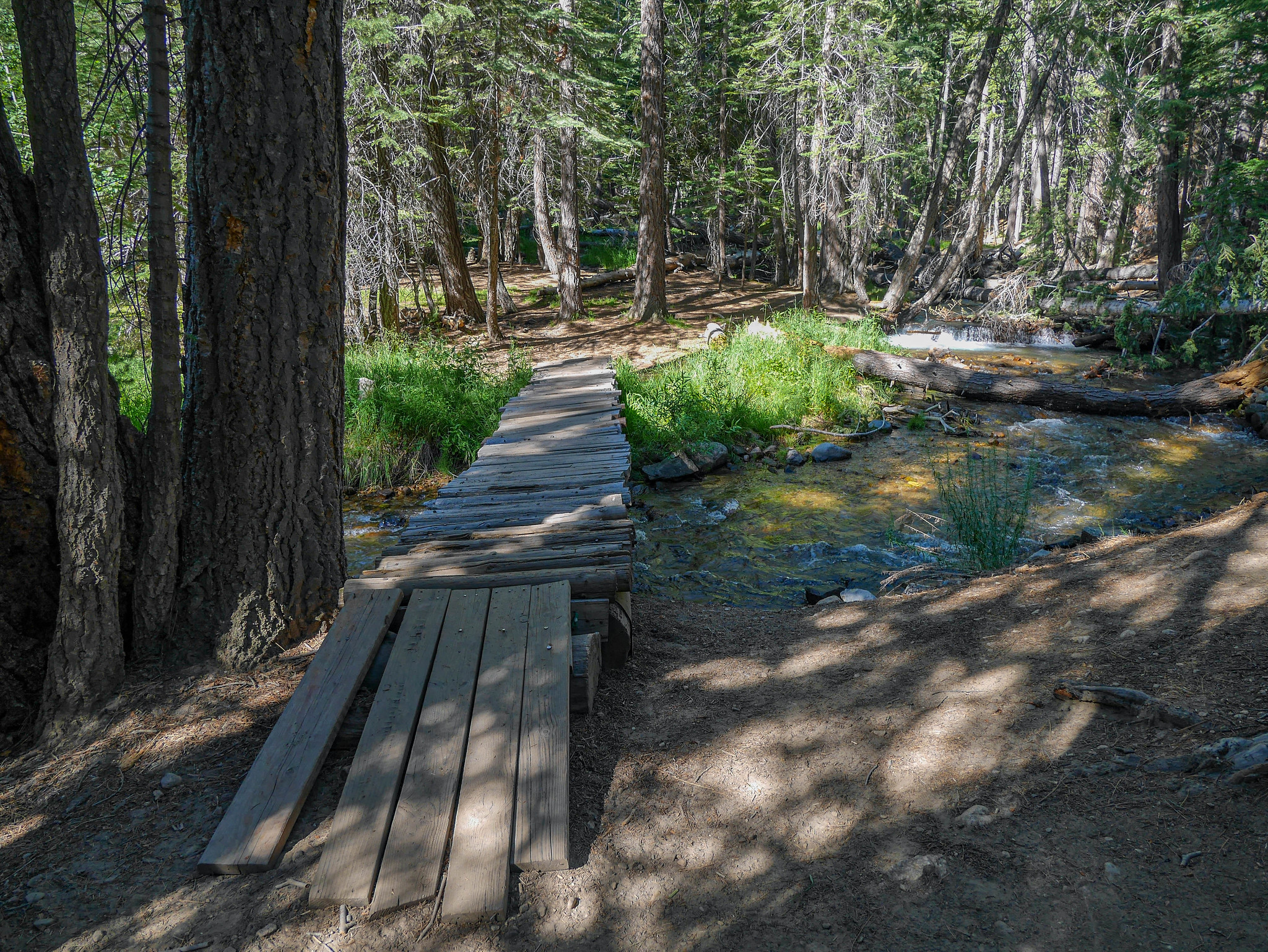
I was instructed to park over by the docks, then walk through the campground between sites something and something I forgot, where I'd see a chain that would indicate where to go down towards the creek to find the trail (wow what a helpful blog aren't you glad you are reading this?). I had no trouble following their instructions and soon found myself crossing Blacksmith Creek and switching back and forth up into the woods as Horse Creek cascaded down to my right. Here's a photo of a bridge I walked across that may or may not help you find the way. ¯\_(ツ)_/¯
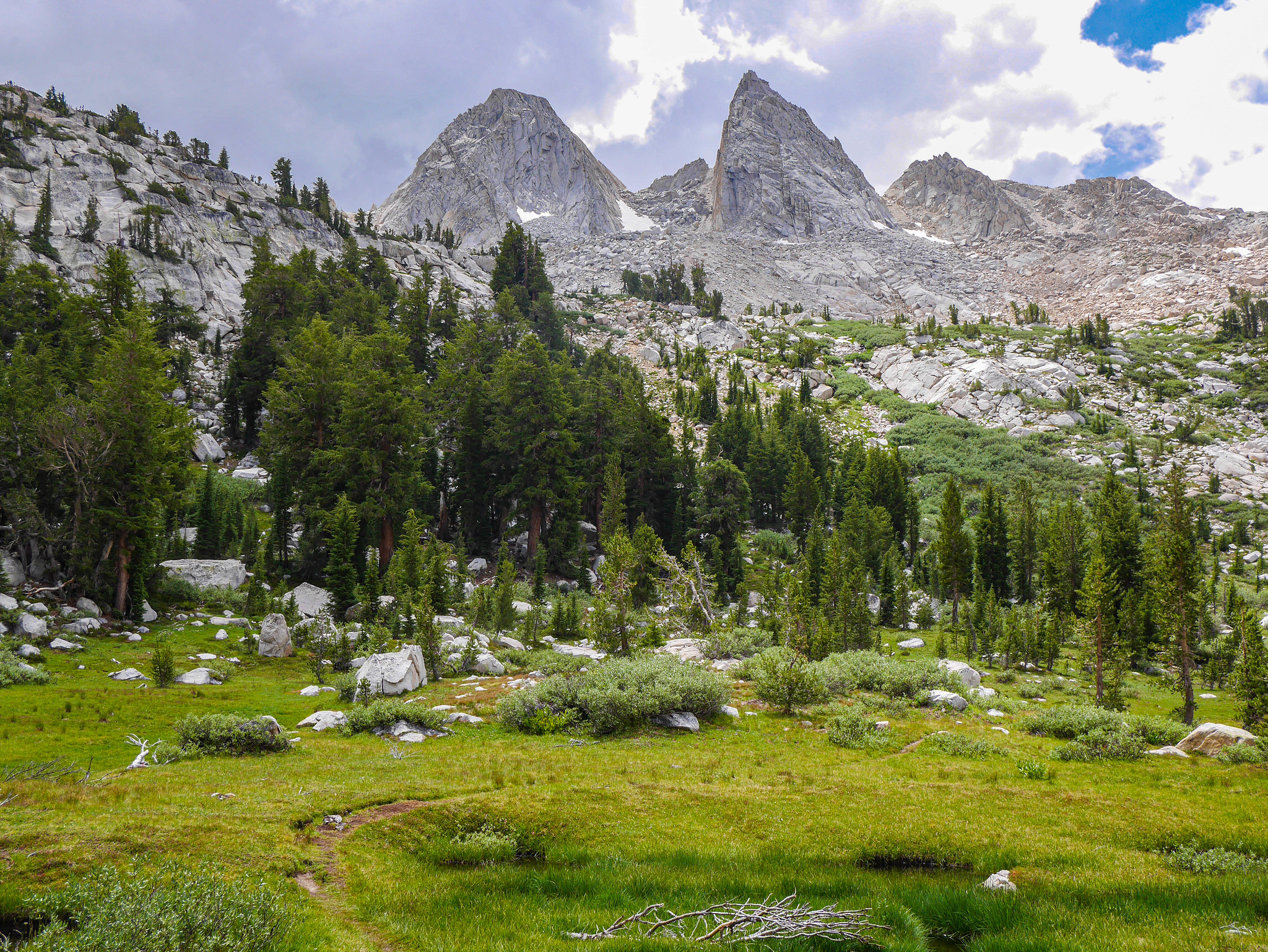
Soon I was switching back through manzanita and lupine, climbing gently east of Horse Creek, looking up at The Cleaver.
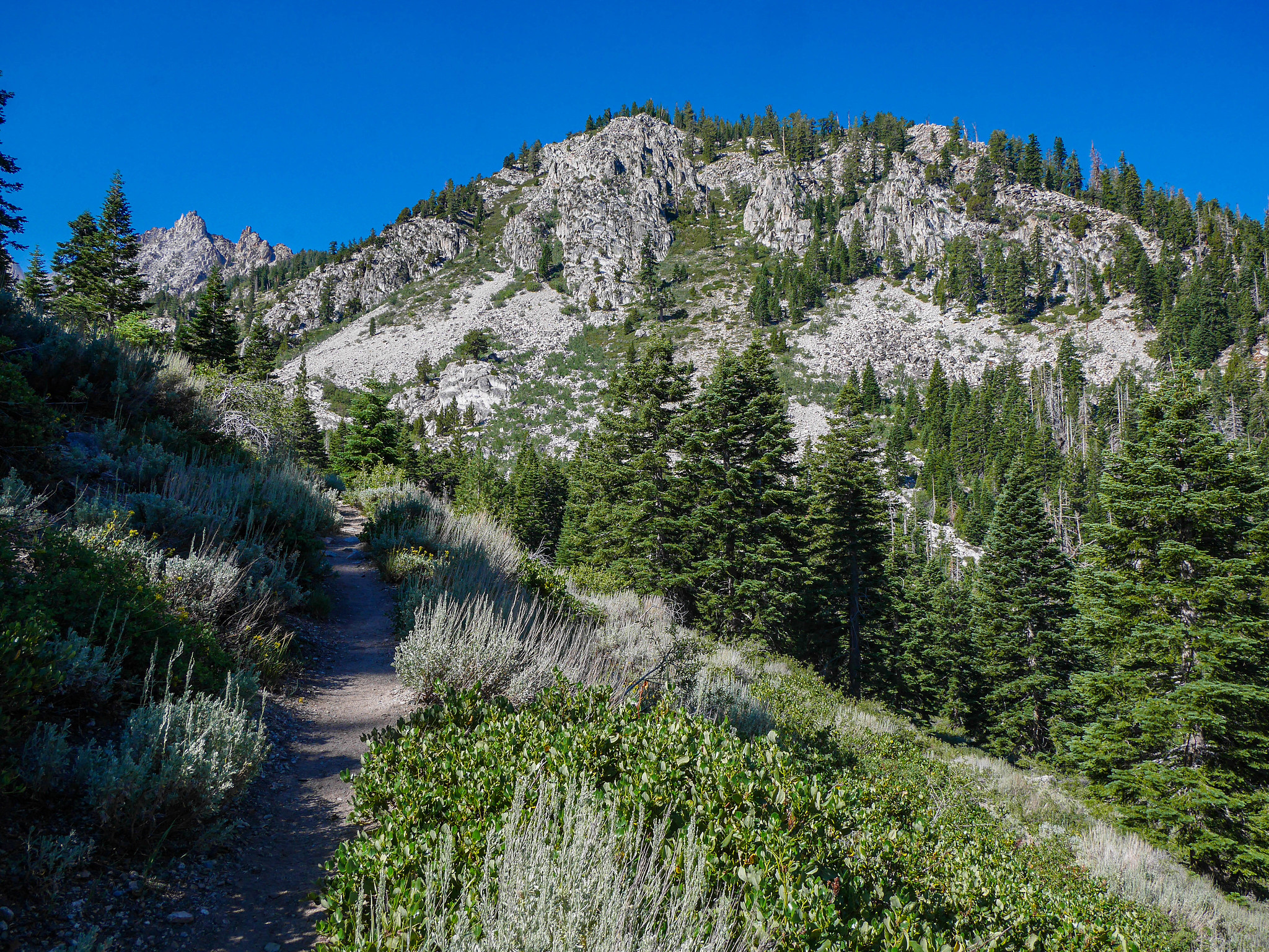


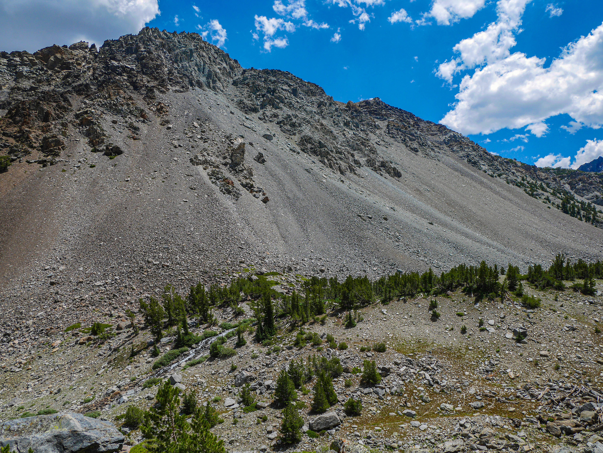
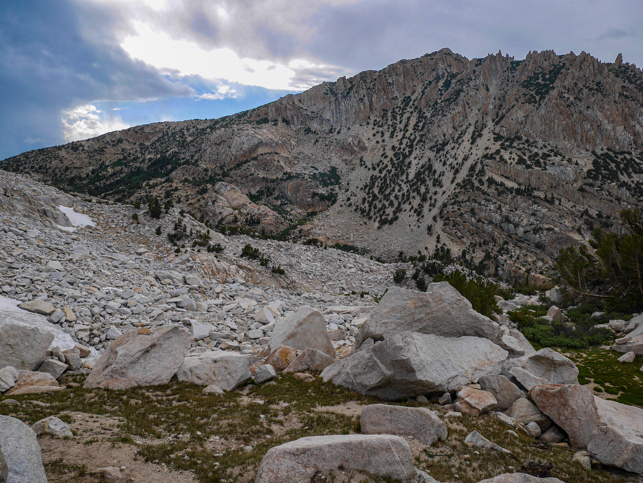
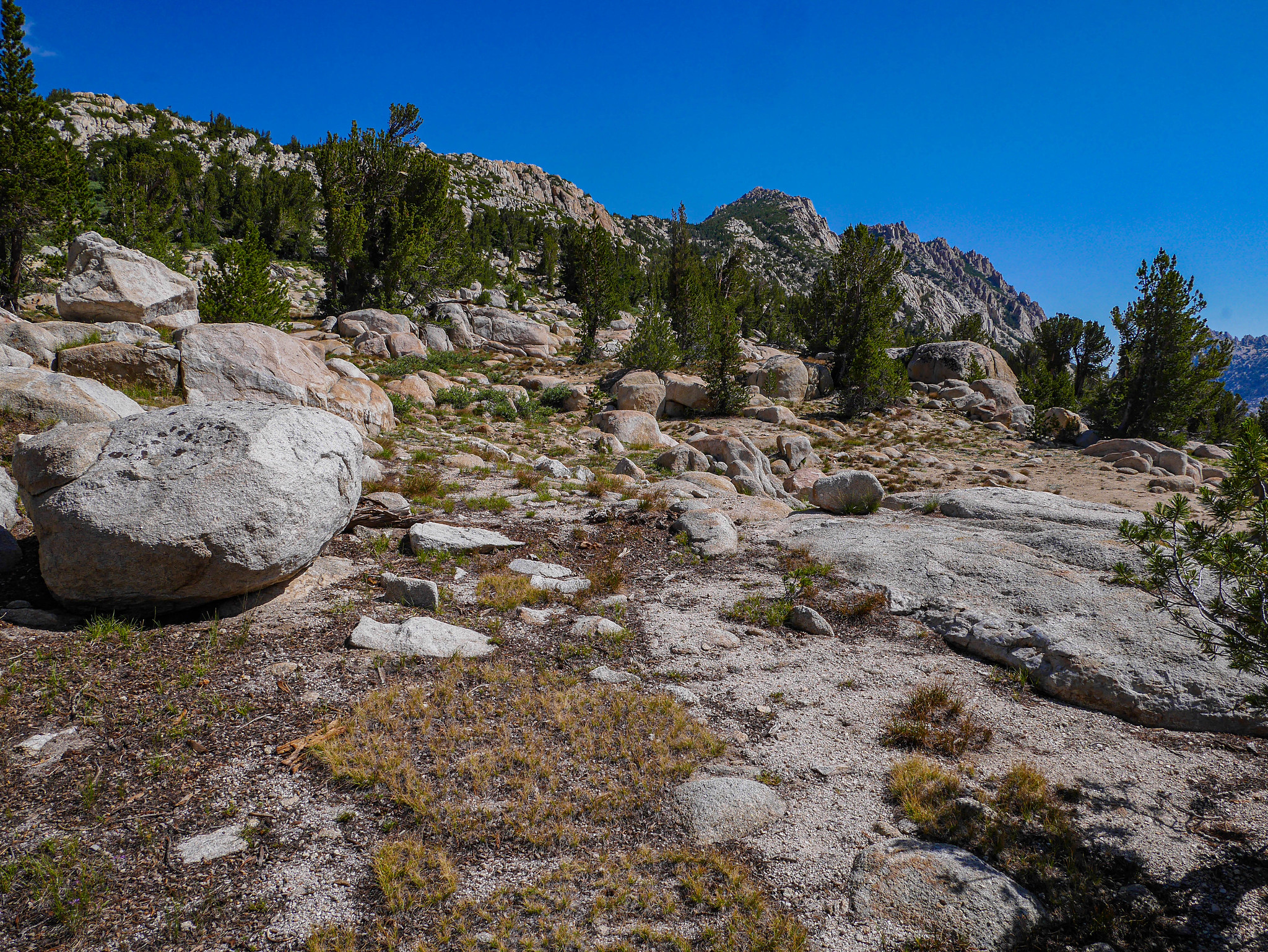
After a flat section through the last of the thicker trees, I got a view up the canyon. There are all sorts of recommendations for the best route up to Horse Creek Pass through here (and above here), beyond the end of the official trail, and indeed you can see that people have chosen quite the plethora of paths, creating a rather annoying maze of use trails. I followed whichever seemed most prominent and easiest for the current moment. I ended up on the low angle talus before the trees in the photo below, then along the edge of the brush, and then off track on a use trail that disappeared on the steeper talus just below the saddle.

 [/url]
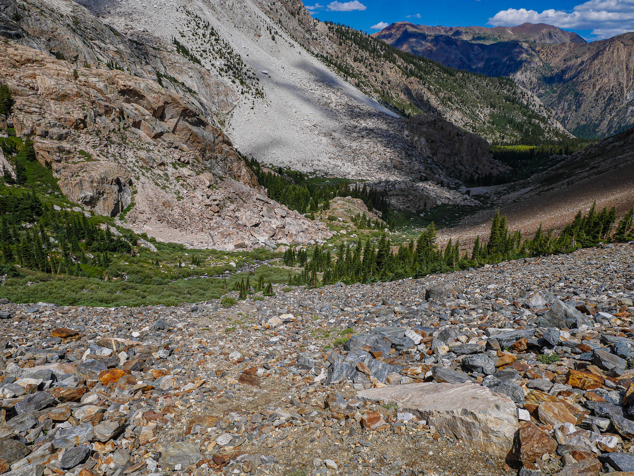
None of this was especially bad or especially loose or especially dangerous. The worst thing that happened on this segment of cross country was an encounter some asshat condescending ultralighter in running shorts with a fanny pack who talked down on me when I asked for beta about the snowfields up top. He seemed really concerned that I was out there as a woman alone. [eyeroll emoji] "Oh it's definitely hard up there, it's really steep and dangerous, are you sure you're ok?" A R G H. You are showing your whole ass in both those shorts and in your attitude towards a solo woman hiker. I know what I'm doing, THAT'S WHY I ASKED FOR BETA. [angry emoji] [vomit emoji]
Refreshed with new determination after drinking from the waters of a "well actually," I continued climbing.

Around here I went the wrong way. There was (yet another) use trail that climbed high to the right. I followed that instead of this one, which would lead across the drainage closer to the creek.


Looking down from above, I realized I was too high. I stopped for a snack and to study the maps. I decided to descend back down and follow the creek.
Along it I found some gorgeous columbine.


I had to cross the creek a few times and all in all this was a rather annoying section. I don't know if it would have maybe been better (faster? safer?) to take the higher, steeper talus route that I was on. I wonder if anyone out there would be willing to explain it to li'l ol' me.


After the lush creek with its frustrating shrubbery, I turned to the right (west) across sharp volcanic shale. I found a use trail and followed that when I could, here and there, trying to keep in mind looking ahead instead of just following and having to backtrack.


Clouds were building and it was raining over Monument Ridge to the east, but it still seemed like I had time to make it up and over the pass. I knew I could always bail back down to the lush shrubbery along the creek below if things got too intense with a storm.
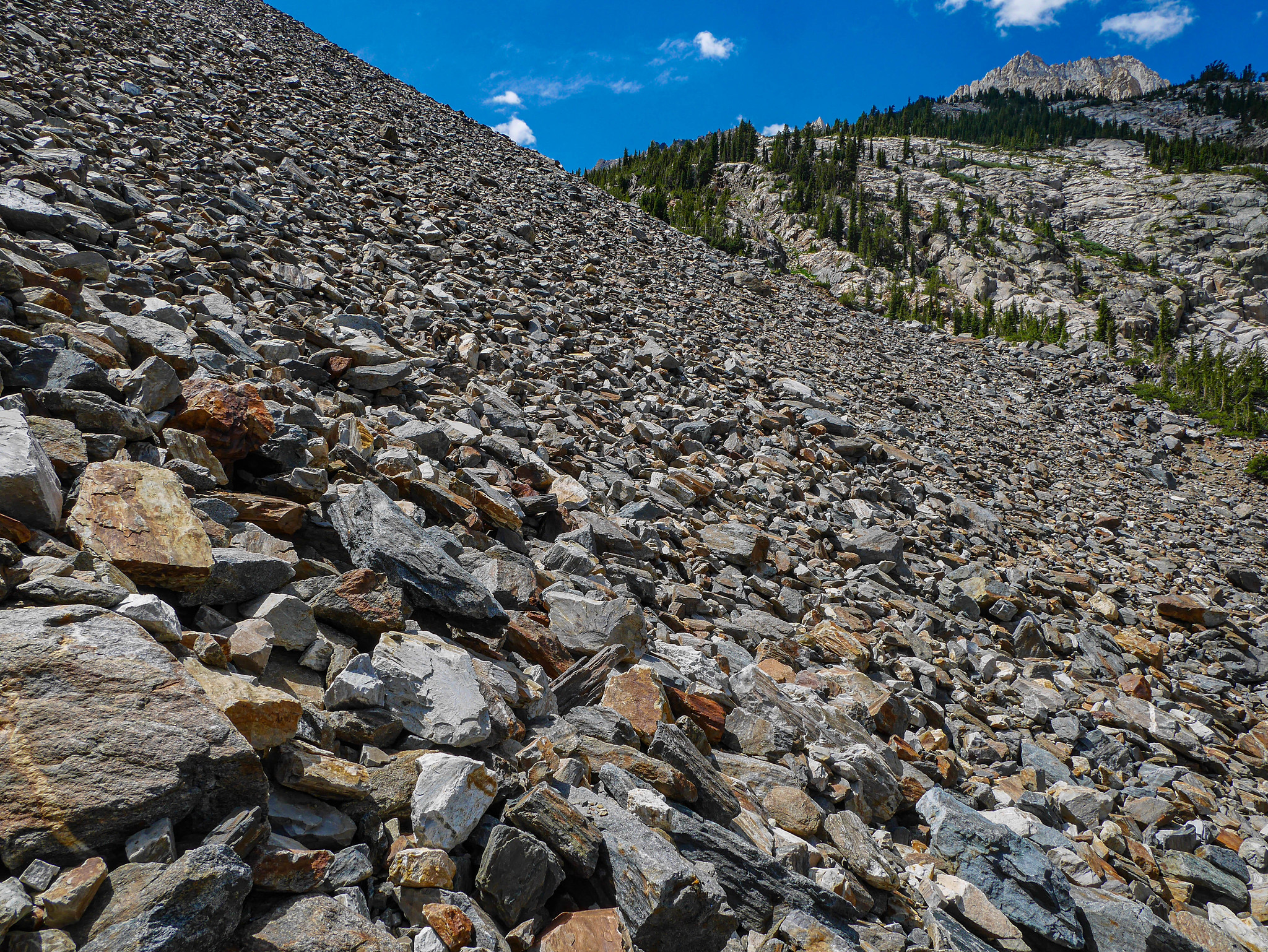
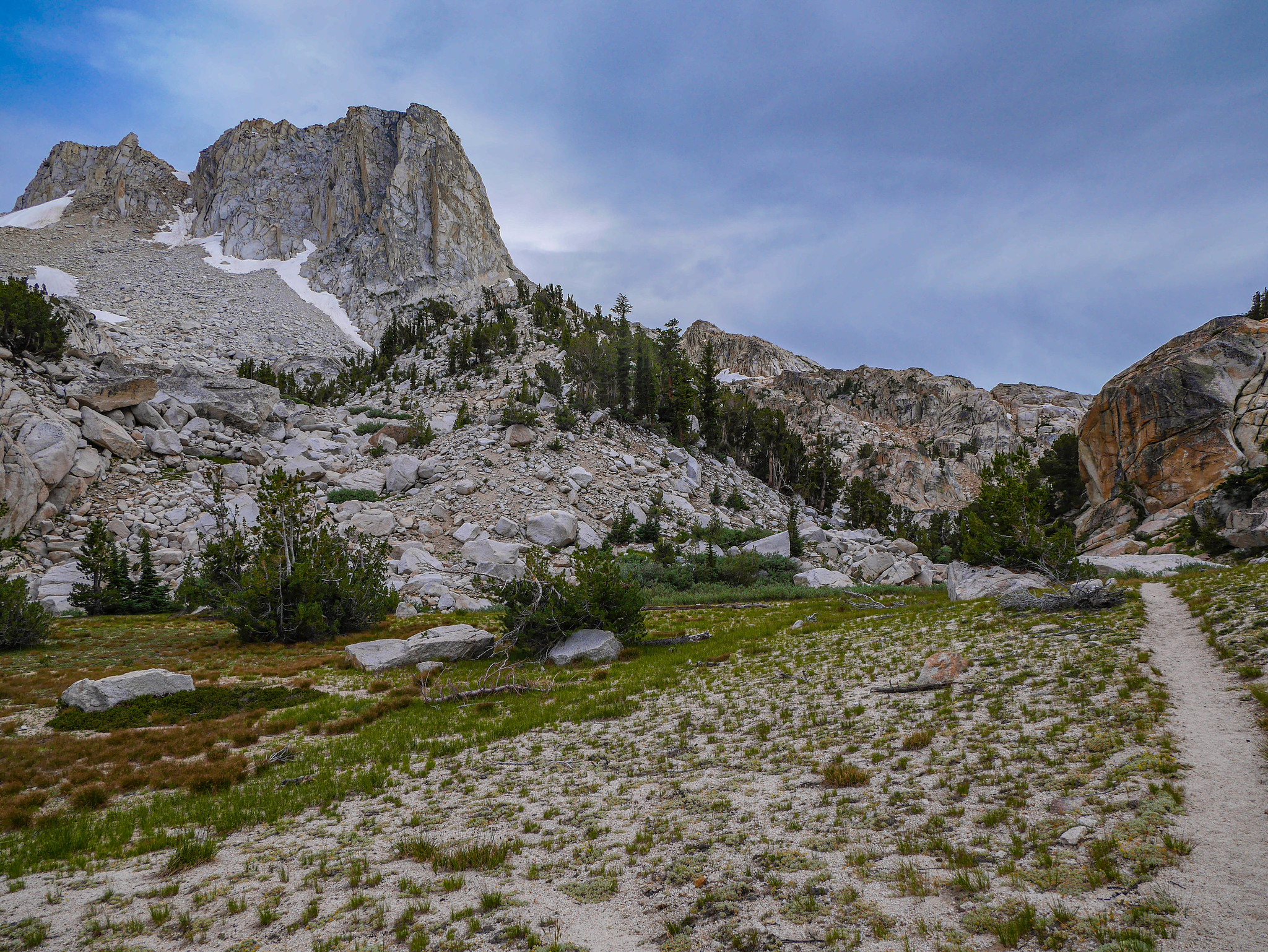
Some snowfields started to appear. I chose to ascend up and to the right of the smaller, low angle one right of center in the photo below. This took me a bit higher than what would probably be the easiest route if there were no snow. Again, there are a ton of ephemeral use trails through this area since this is also the route to climb Matterhorn Peak.
After reaching the saddle above the snowfield mentioned in the photo above, I scrambled across some talus to descend to the valley in the photo below. Then I walked across the snow with no issues (despite all the warnings from running shorts man). It was not steep. It was not dangerous. The biggest hazard here was the dark clouds building to the southeast.
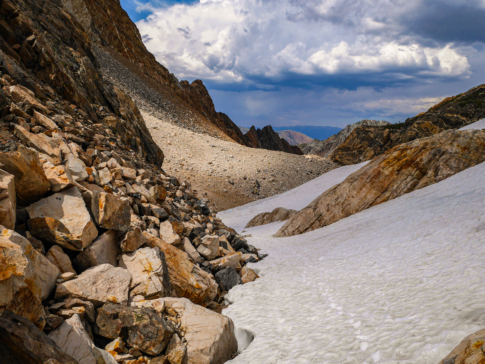
After climbing the snow for a bit, it got a little steeper, so I decided to climb the talus along the right of the snowfield that choked the final section below the pass.

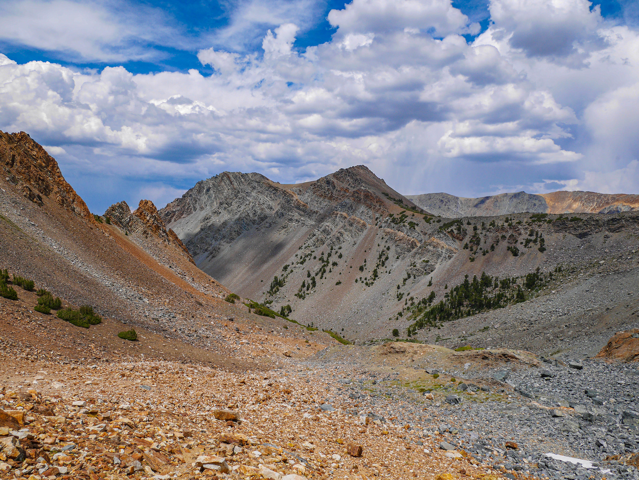
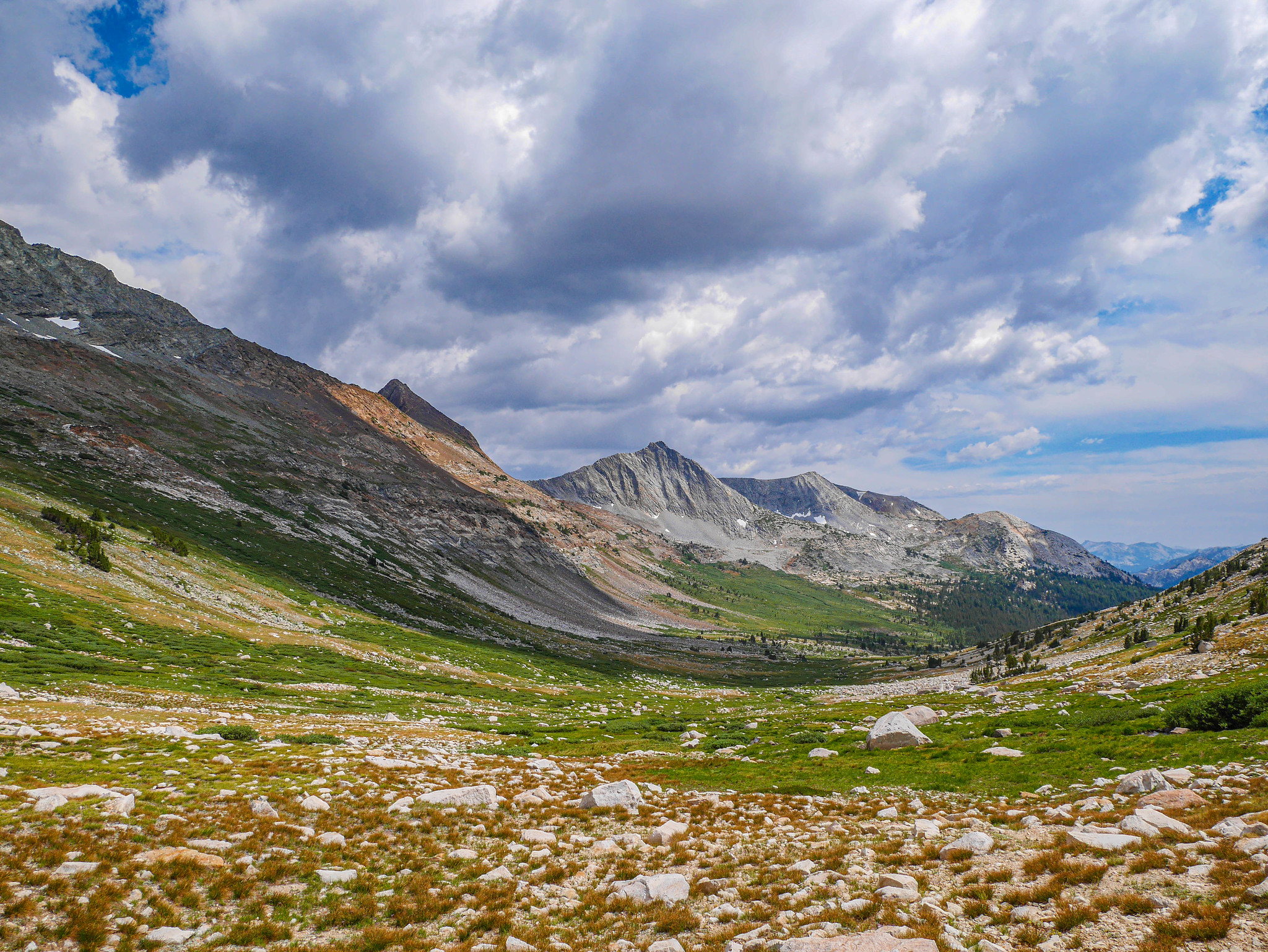
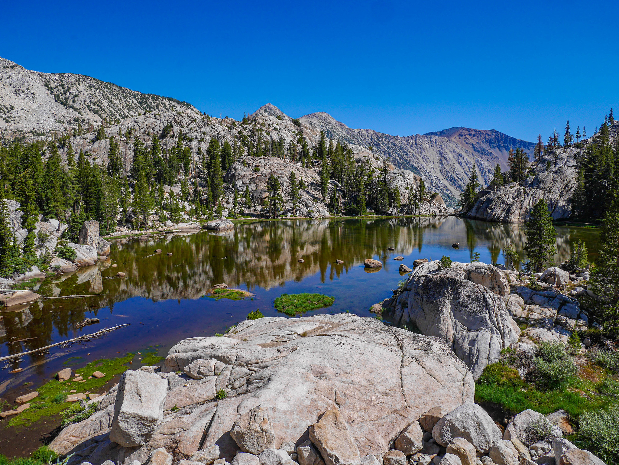
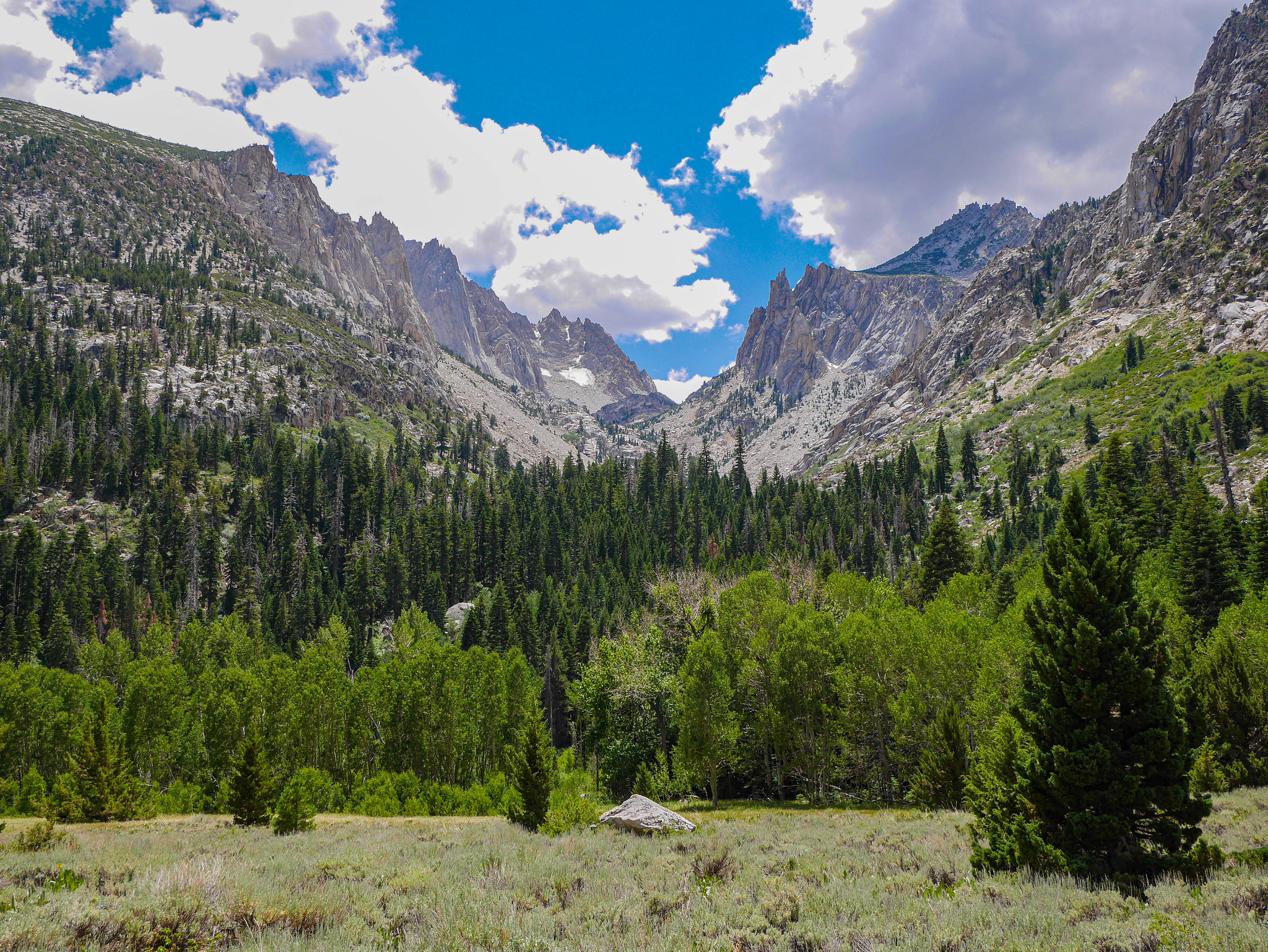
All of a sudden, I was on top! The thunderstorms had stayed to the southeast, and I did not die of being a woman alone on a snowfield. Let us take this moment to rejoice in the magnificence that is Spiller Canyon!
Oh yeah and here is a photo of the east side of Matterhorn Pass, in case your route ever finds you up that way. I had considered crossing there but decided against it once I looked down Spiller and got all these romantic notions of walking all the way down it and then all the way back up the other side.

Can you blame me? I love my curvy wife.


A mile or so down from Horse Creek Pass, I found a spot to set up camp between Whorl Mountain and Stanton Pass. I put up my tent and then inflated my sleeping pad. Or didn't. Because holy heck that is one long gash! Luckily I had some patch materials and was able to fix 'er up (mostly---she still had a slow leak for the duration of the trip).


Stormy weather might make for some questions and risks about heading up over passes, but it also gets you this.


I ate dinner and slept. I dreamed that a big group of boy scouts had a campfire nearby and a bluetooth speaker playing Old Town Road on repeat.
Day 2
Spiller Canyon to Matterhorn Canyon
8.5mi +1,900ft/-1,500ft, plus 4.5mi +0ft/-800ft xc
Oops I did it again, I scraped up my gear, got lost in the game. Oh baby baby.
Packing up my stuff this morning I was like OH ah whoops now I know what happened to my sleeping pad... a sharp rock must have just sliced straight through the pack and the pad when I was scrambling around the north side of Horse Creek Pass somewhere. Well, good thing I carry a repair kit for my pack, too.

I said my goodbyes to Whorl Mountain and hiked down the canyon.


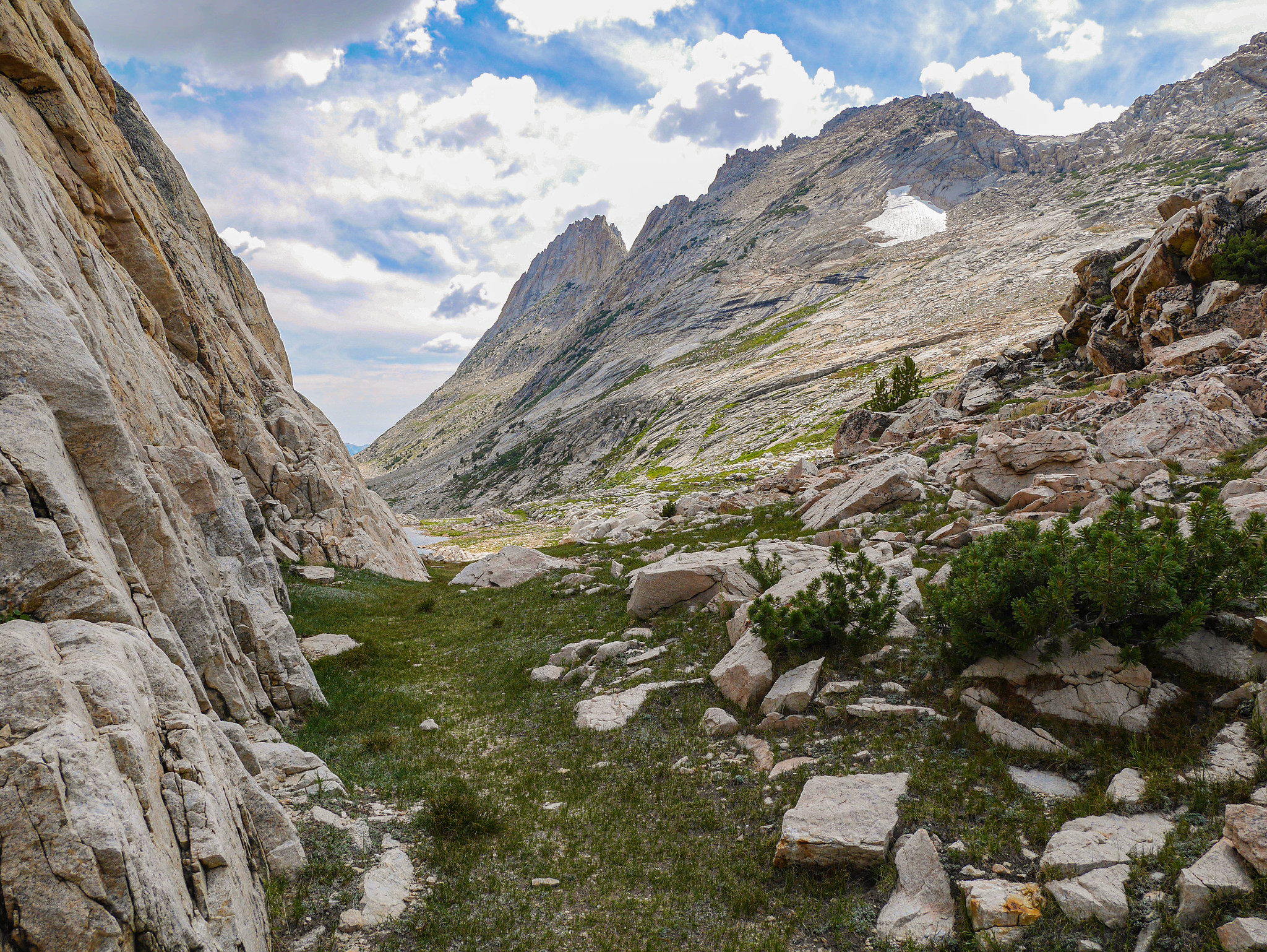
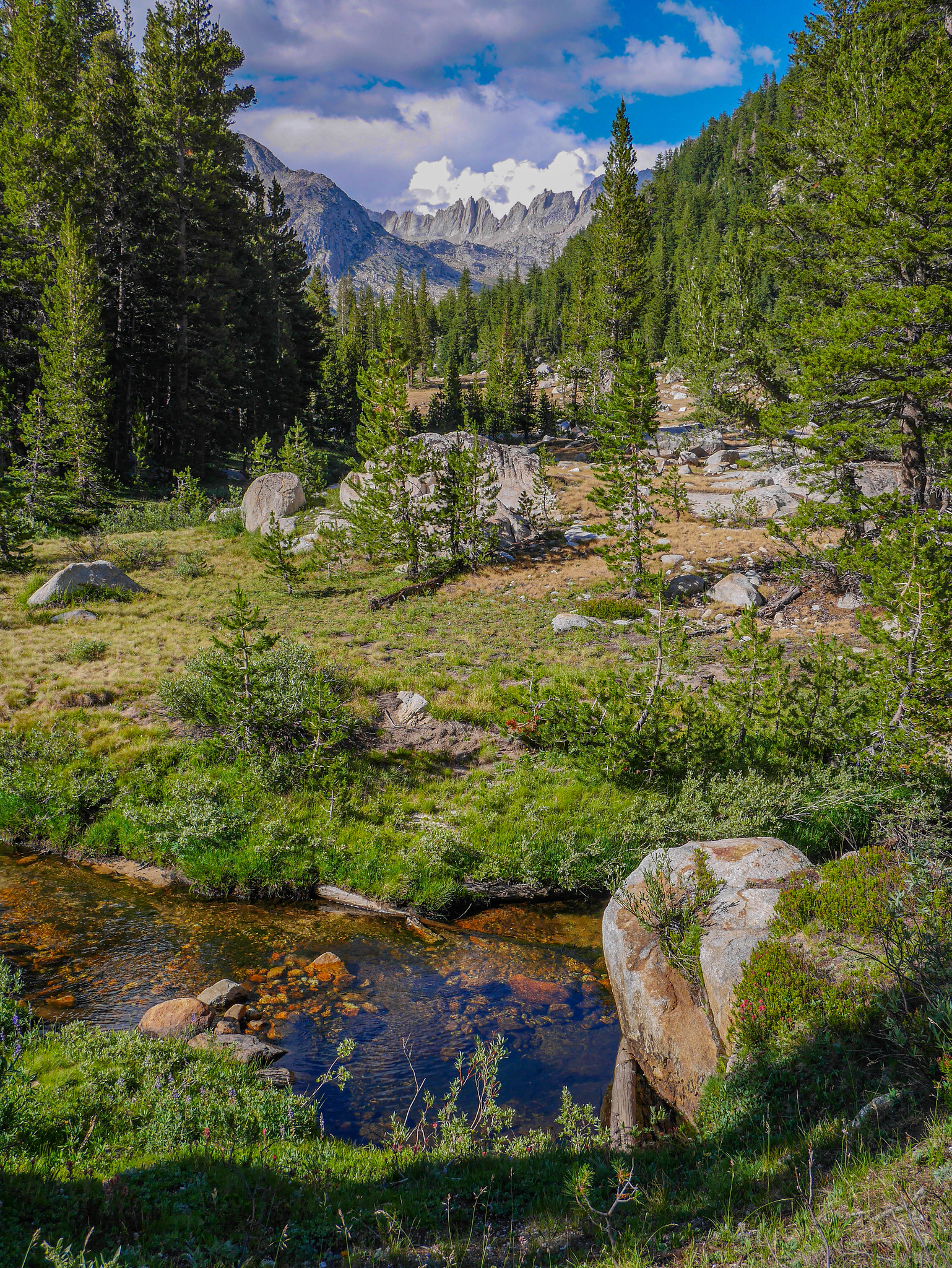
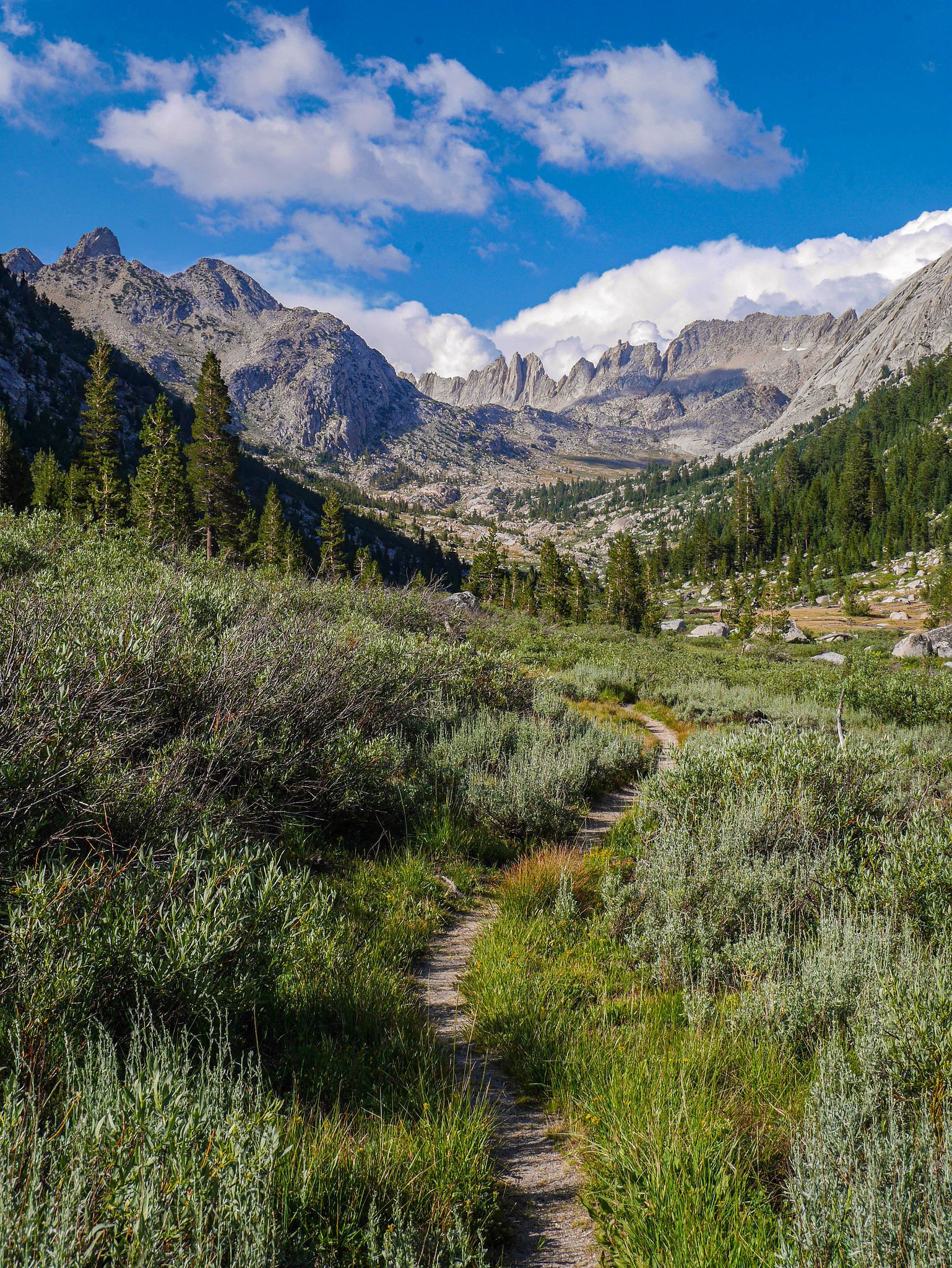
I descended the canyon through mostly easy terrain---grassy shoulders along Spiller Creek with the occasional climb up or down from the creek to avoid thick trees, avalanche downed trees, or steeper cliffy sections towards the bottom. I was amazed with how far I could see into Yosemite down canyon.


I knew it would be essentially impossible to miss the PCT, and I was right. Even though this section of Spiller Canyon was choked with small trees and little annoying slabs, the PCT is like pornography---you know it when you see it.

Somehow hiking cross country down Spiller over bits and bobs of obstacles here and there was way less taxing than climbing the couple hundred feet up to Miller Lake.


Miller Lake was a nightmare of what happens with overuse---the water along the beach was frothy with the oils of too many sunscreened swimmers, and there was this abomination:
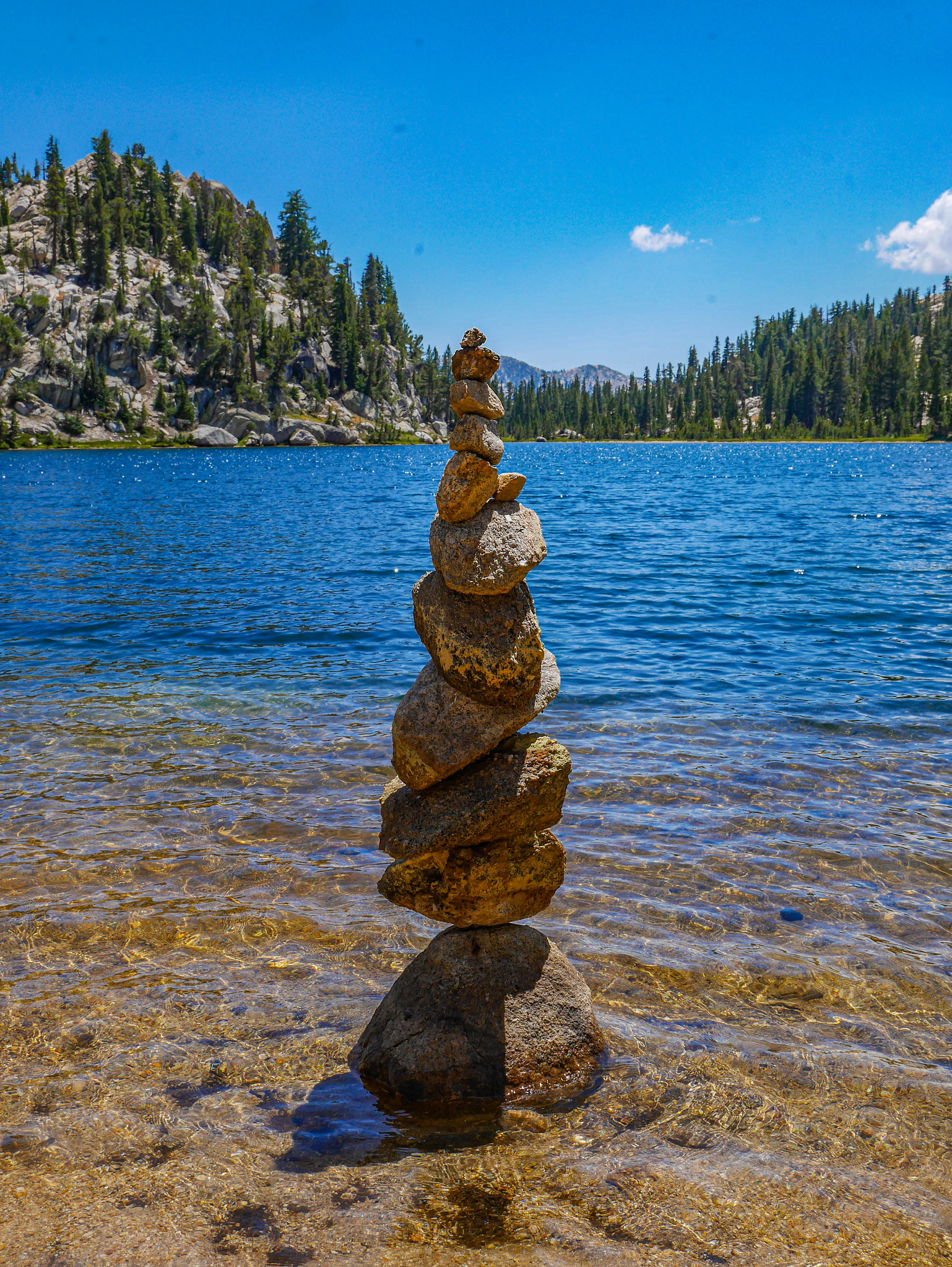
That, my folks, is graffiti. I don't care how zen it makes you feel, do not do this except maybe in your yard. You are disturbing wildlife habitat and ruining the (ever vanishing) sense of nature-absent-human-destruction that the backcountry provides. I kicked this over. Ask me about my new god.
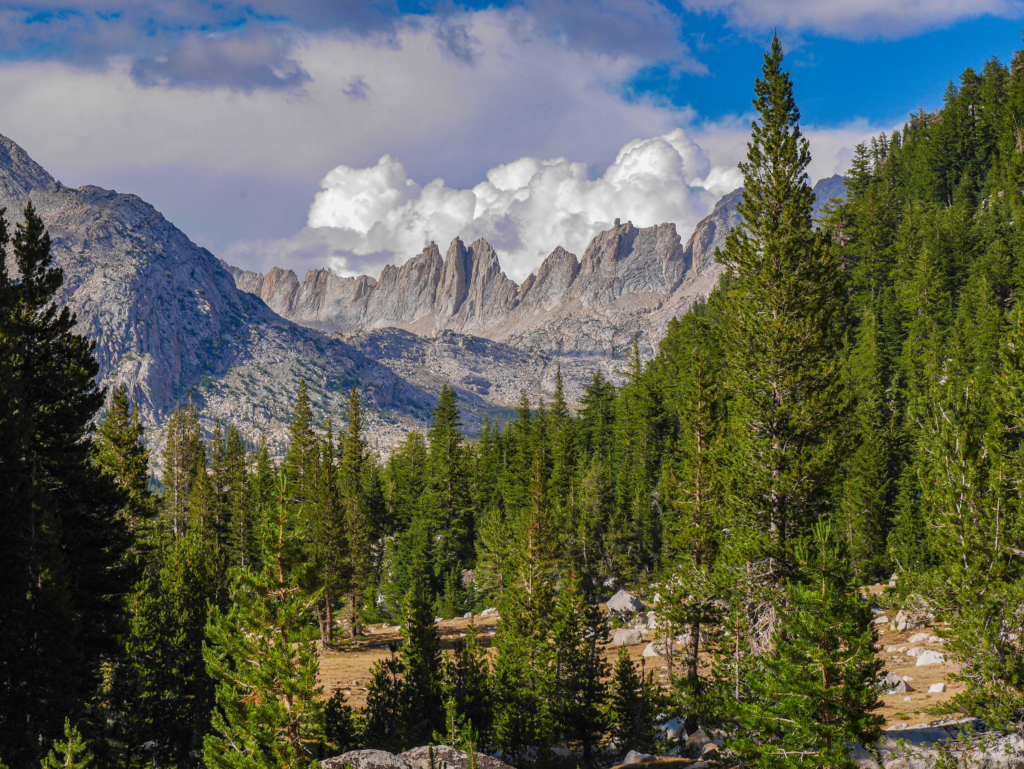
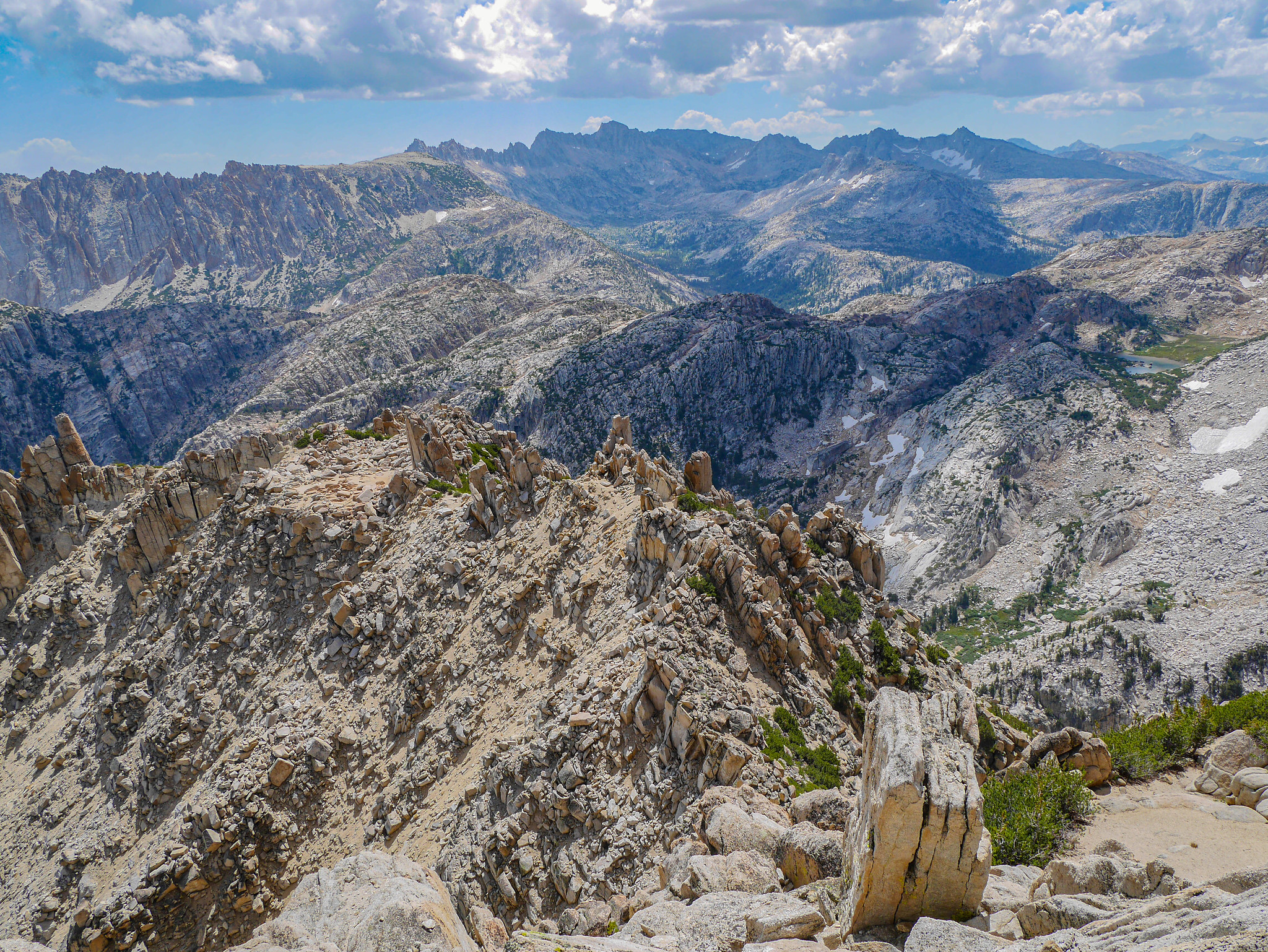
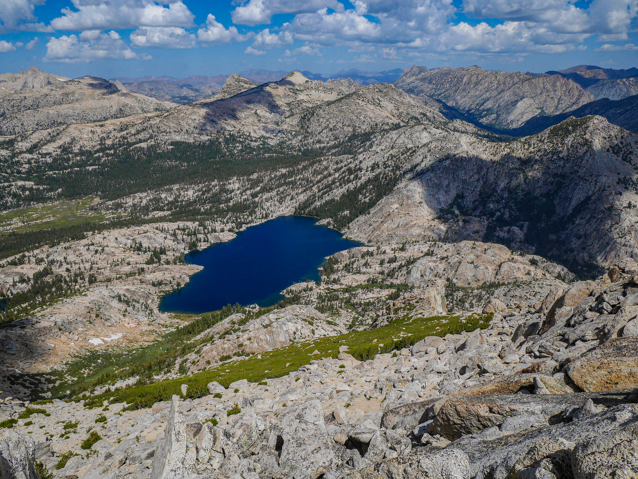
Any regret I had about choosing to descend the whole of Spiller Canyon to the PCT just to go back up Matterhorn vanished when I saw this view.

Let's take a closer look. Ooooh momma. Would you take a look at those honkers the Sawtooth Ridge.


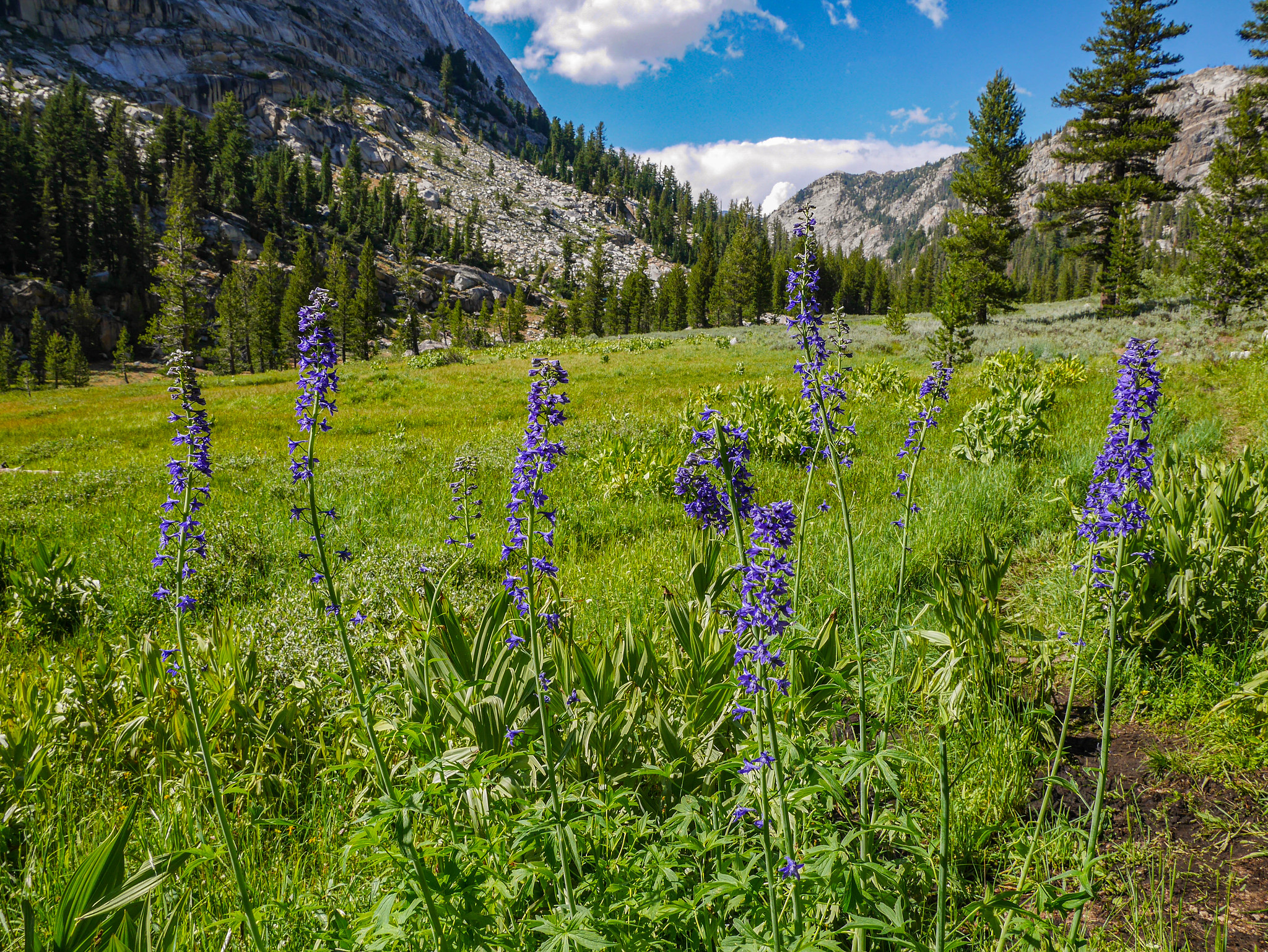
Spirits rejuvenated, I descended switchbacks through the forest and turned off the PCT to head through flower-strewn meadows up towards the head of the canyon. I didn't know where I'd camp---I just planned to keep on walking until my jaw fell flat out of my face down onto the trail.

I could feel my jaw start to weaken around here.
Every step I made complicated things. Should I continue, just a bit farther to be closer? Can I get out of these small trees? There's nowhere great right here, let's keep going. Oh crap, I'm in the shadows and it's cold. Onward. Oh this seems a bit better, but there's no flat spot to pitch a tent!
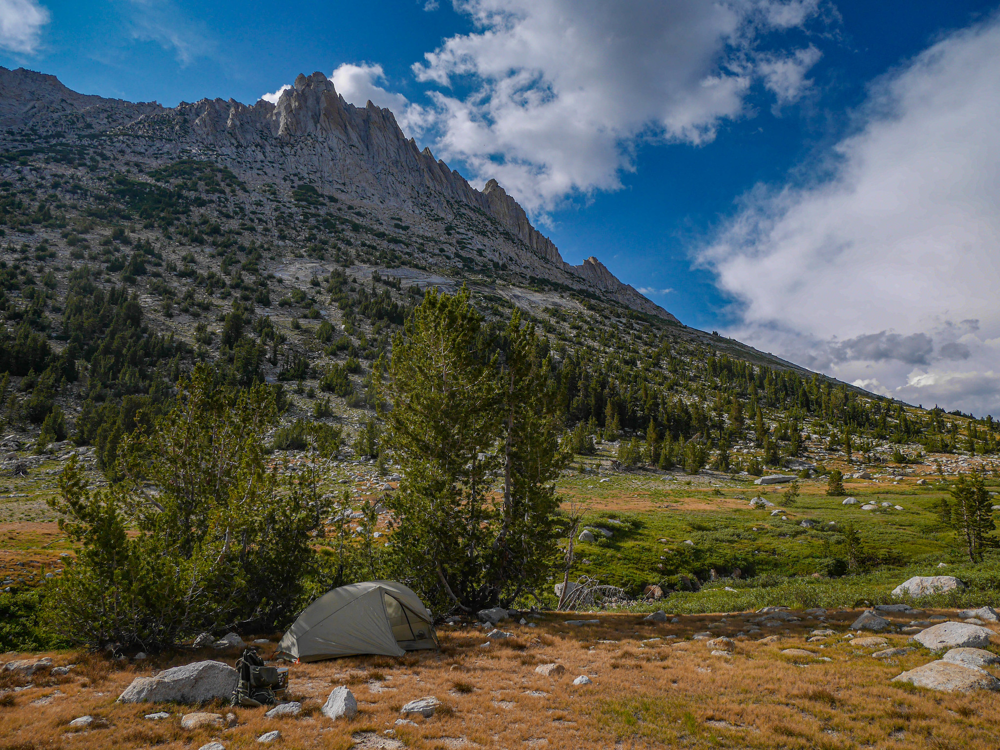
And then, finally, I made a home. It was a good home, and I had a good sleep. Wow. This place.


Day 3
Matterhorn Canyon to Snow Lake
9mi +2,600ft/-2,000ft
I had breakfast with a view down the canyon that I'd hiked up the night before.
Climbing up towards Burro Pass, the trail was fairly gentle and full of that typical Yosemite granite canyon grandeur.

As I climbed higher I could see the west side of Matterhorn Pass, which looked easier than the east side I'd seen thirty six hours before.

But even easier than all that was the trail I was on... literal steps. Thank you, trail crews of yore. I didn't know it yet, but I'd get the opportunity to say thanks to trail crews of present atop the pass. They were reconstructing steps on the north side. Let me just say it once again: THANK YOU!

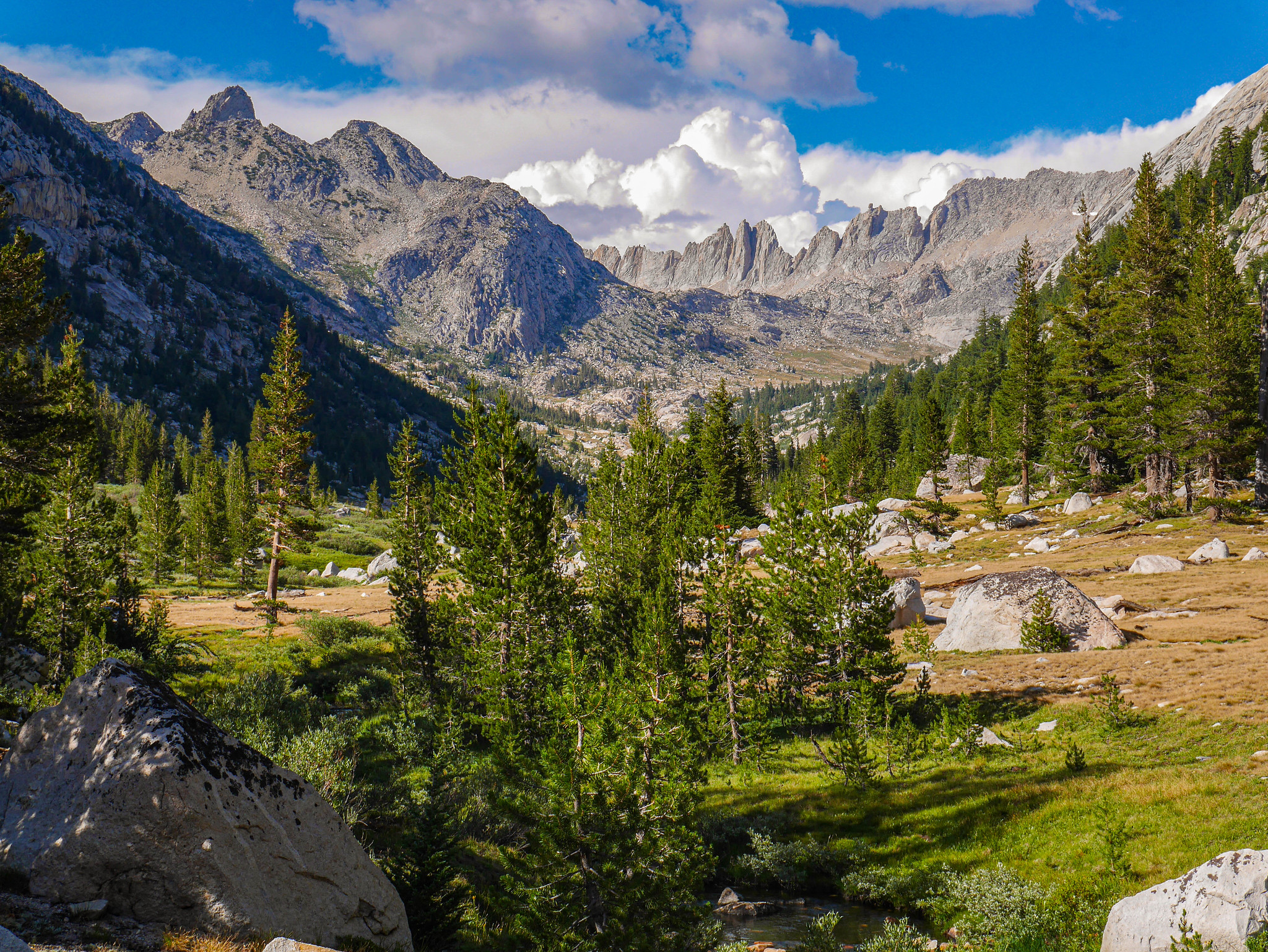
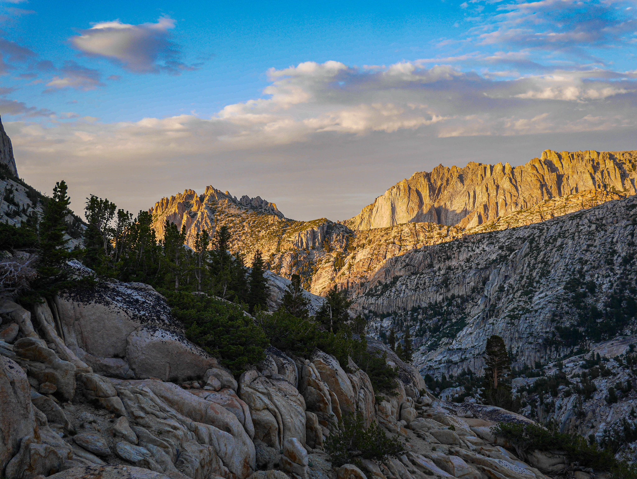
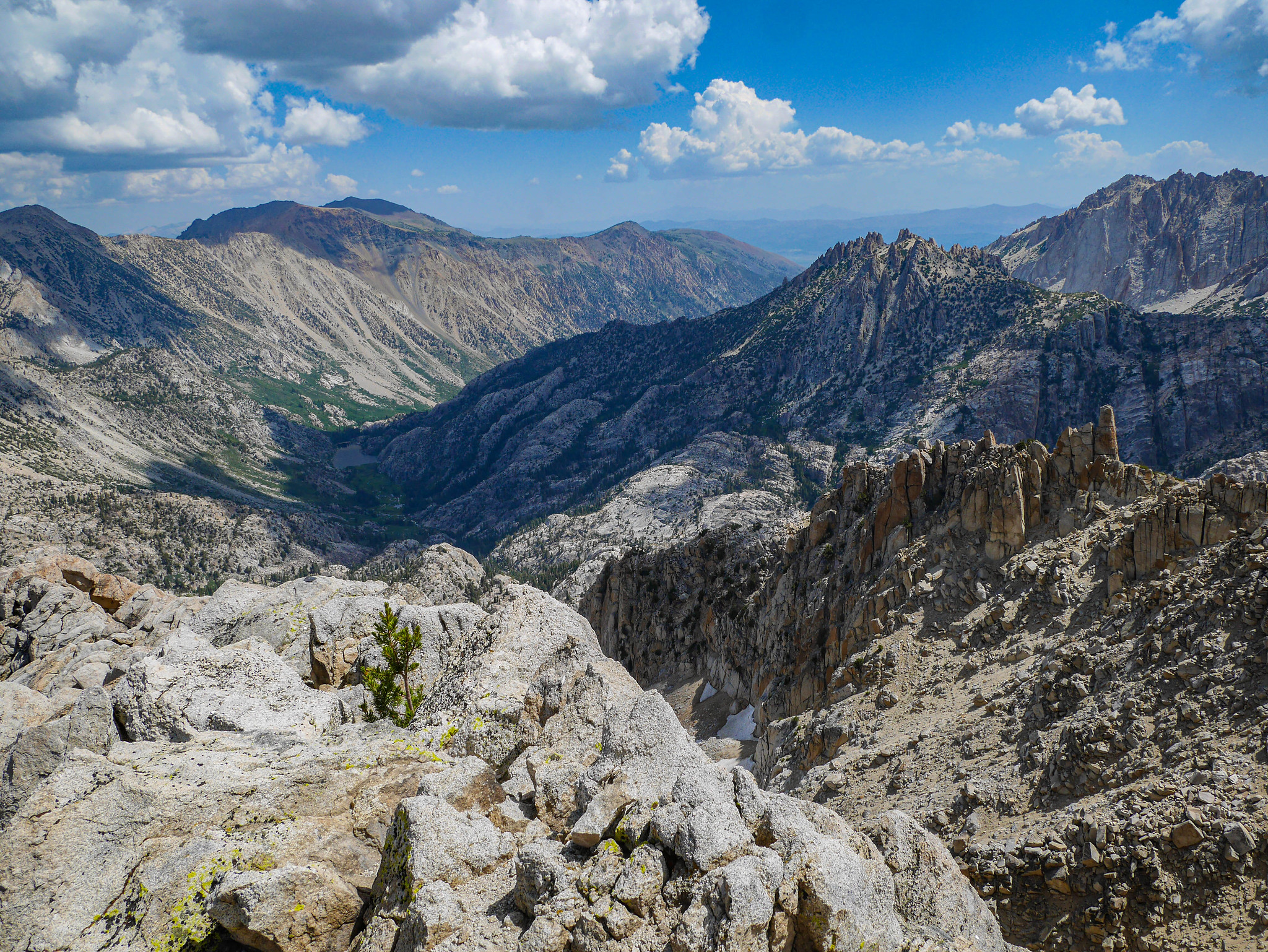
But in the meantime, the views back down Matterhorn Canyon as I climbed were just spectacular.

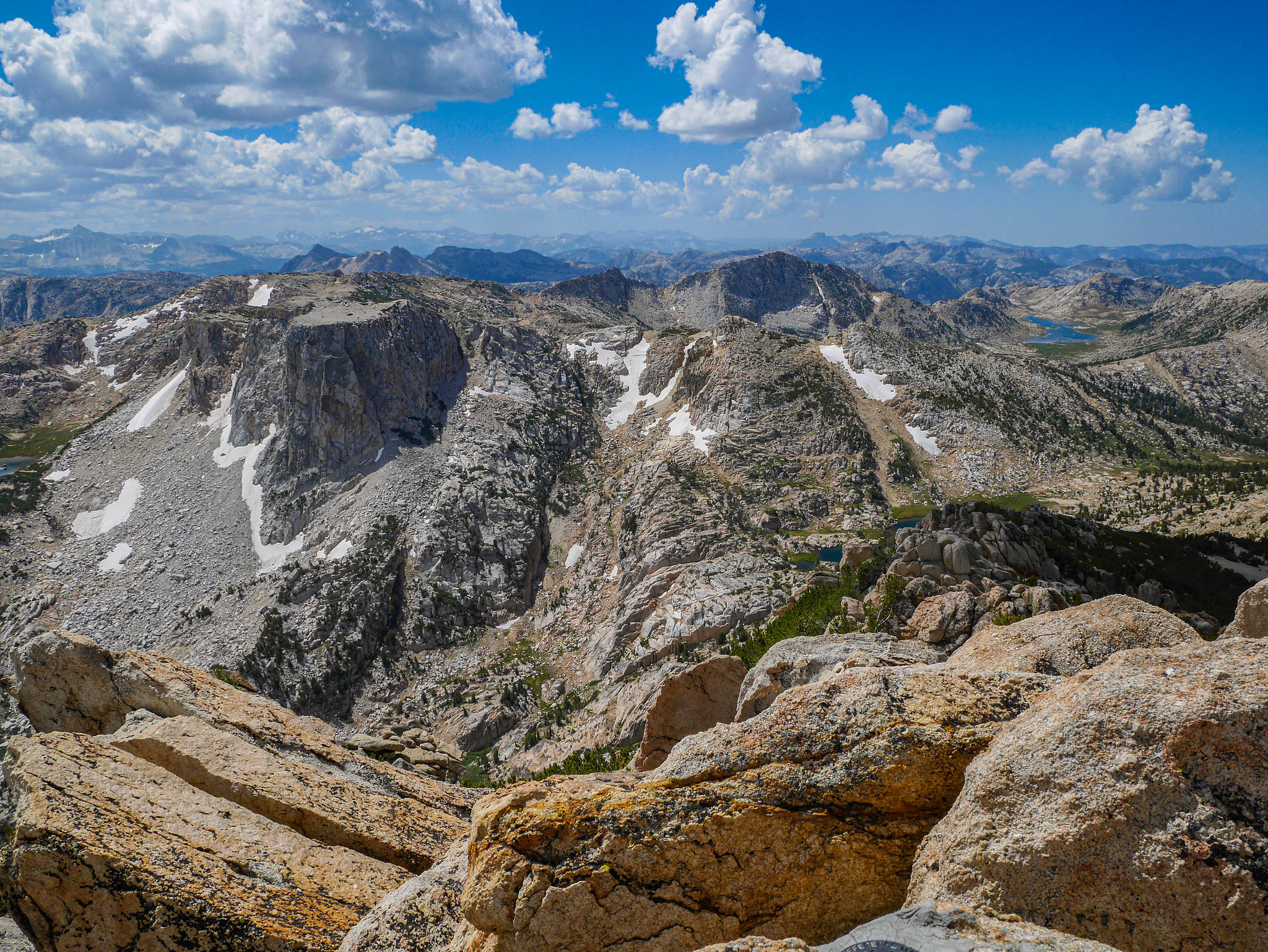
After chatting up trail crew and then taking a good long snack break, I descended the north side of Burro Pass with the Sawtooth Ridge towering over to my right.

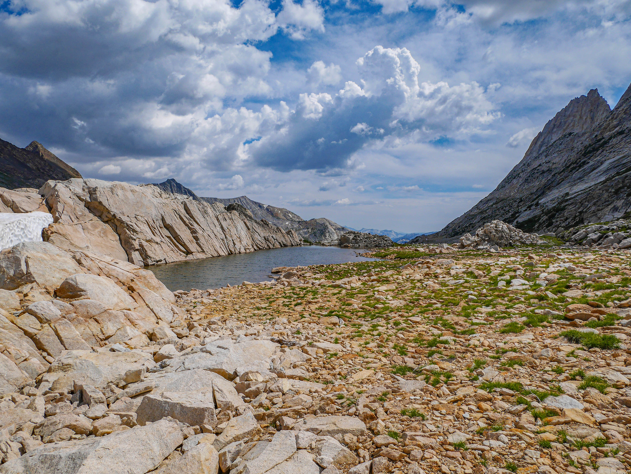
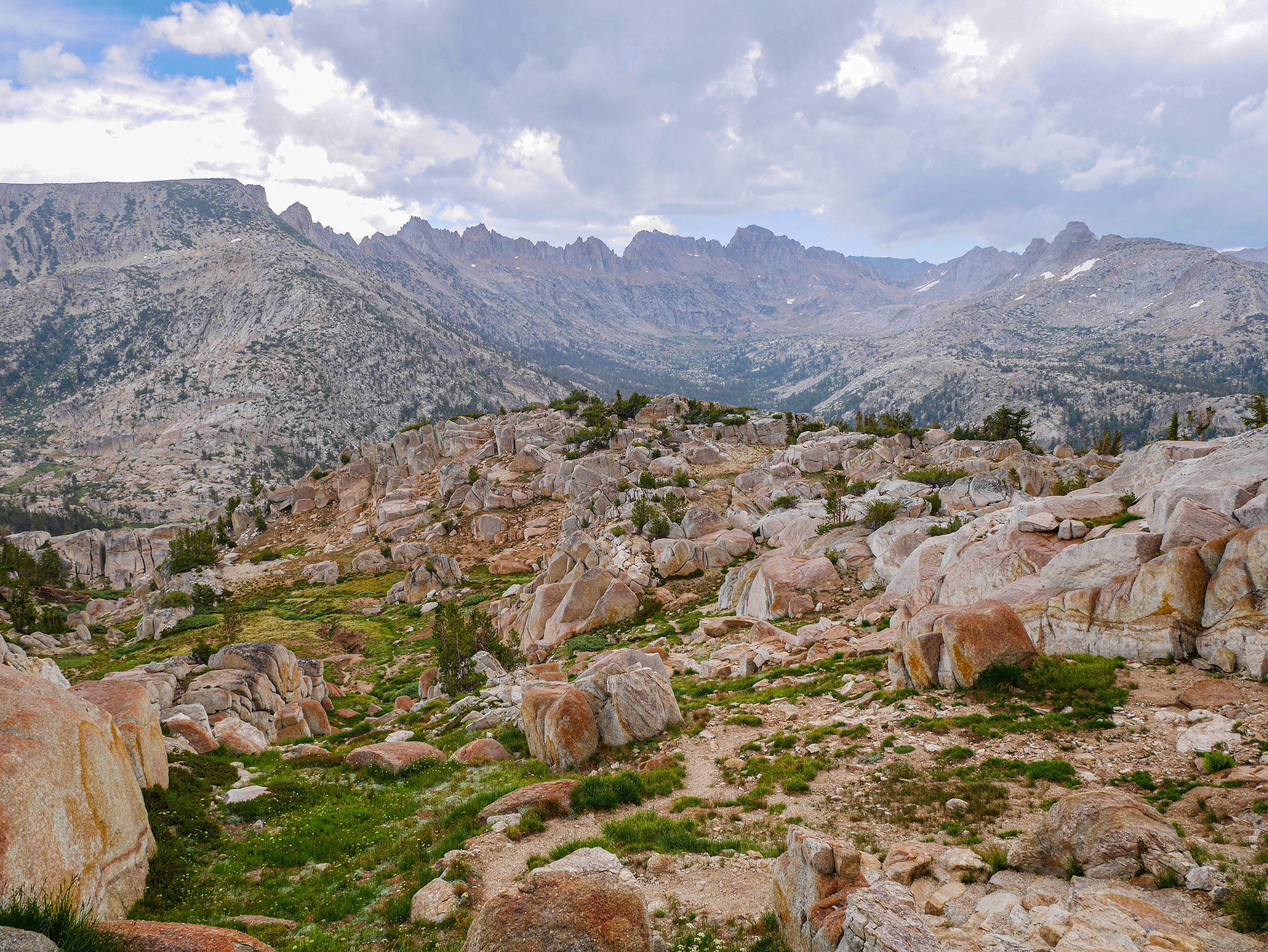
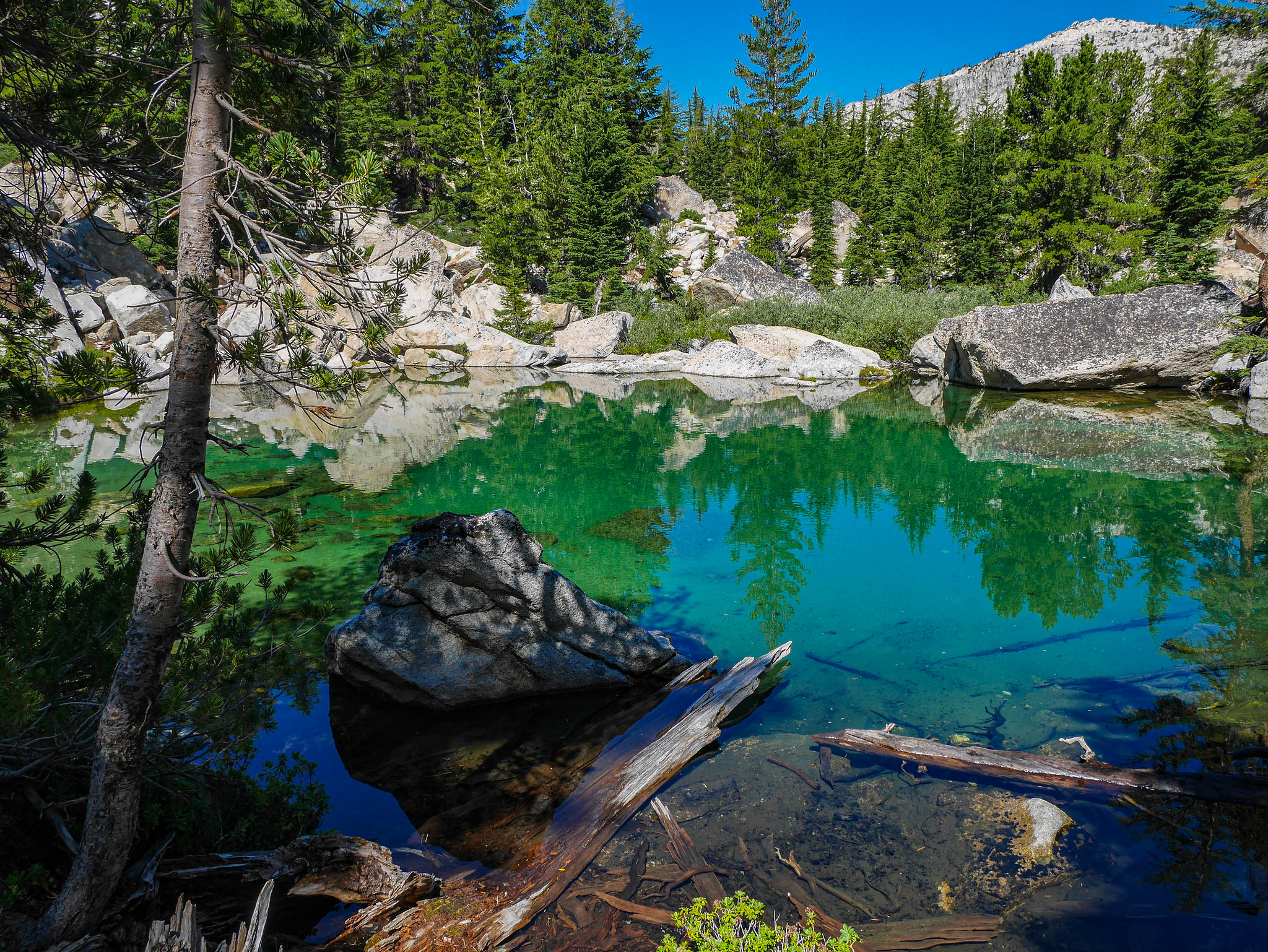
Some tarns just below the pass looked rather inviting for future camping. But I was headed off towards Mule Pass, the cleft in the ridge in the center of the photo below.

After descending for a bit, I came across the camp for the trail crew, and soon after got a good look at the infamous slide after which Slide Canyon is named.
Then it was climbing again, through forest, worrying about how the clouds and storm activity would be as I ascended above treeline to Mule Pass.
 [/url]
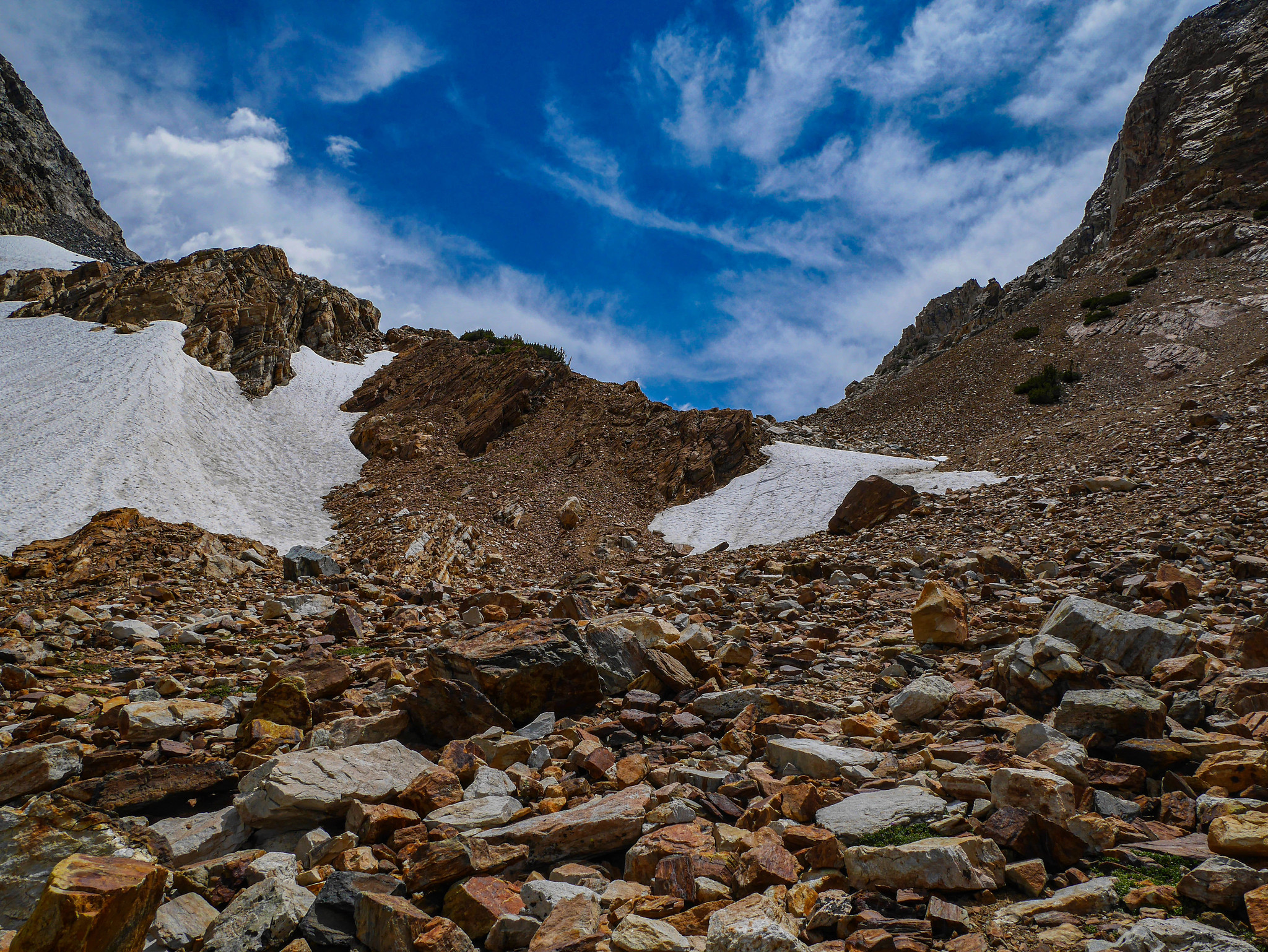
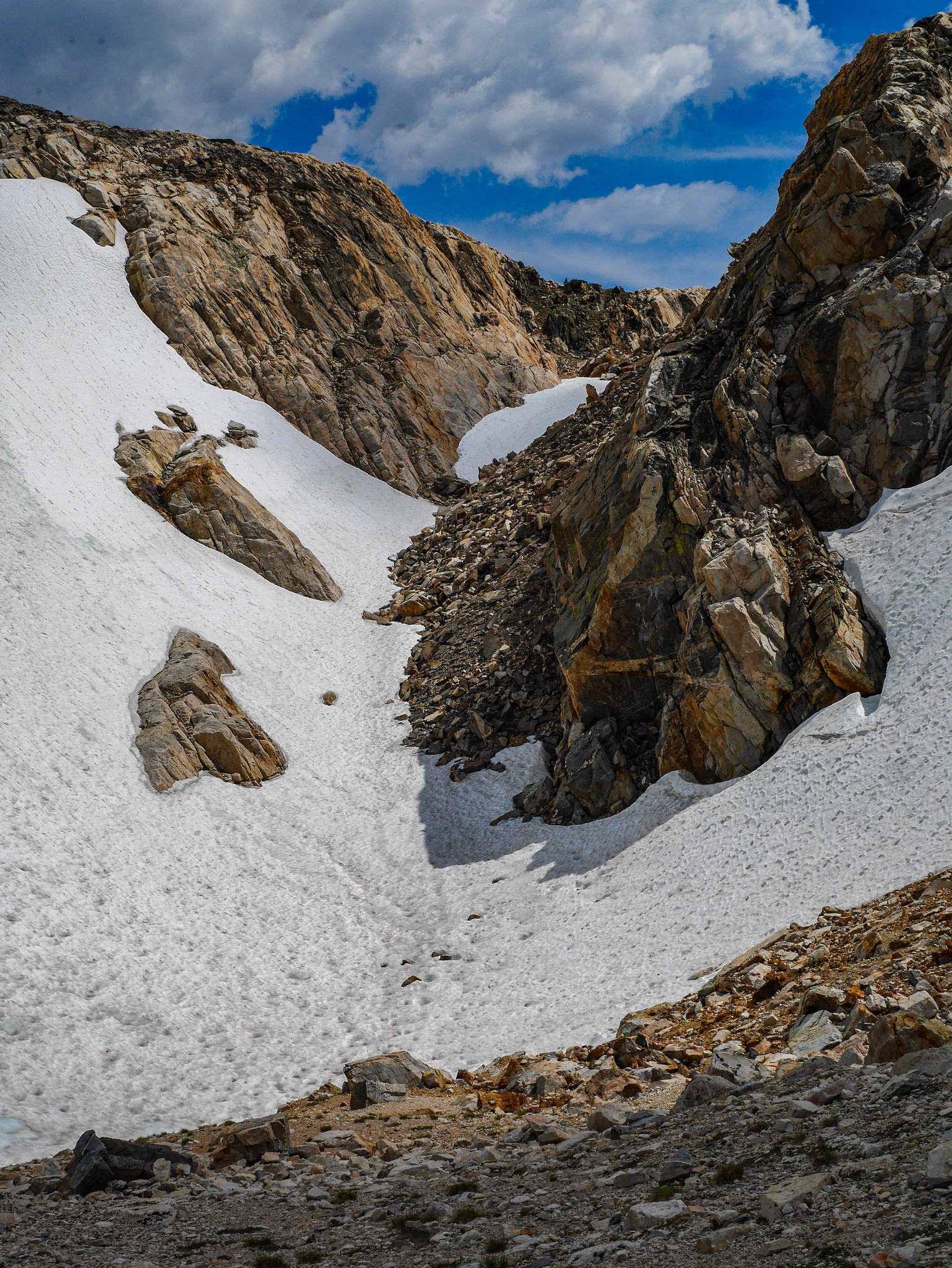
I hesitated, crouched in some shrubs, waited, then hoofed it and made my way to Mule Pass during a break in the storm. The view down Little Slide Canyon from up there was just spectacular. I definitely want to come back and explore that area.

I had a nice view south of the route I'd traveled, too, and after a short break to inhale some form of peanut butter and sugar candy (I think Reeses Pieces this time), I descended the steep west side of Mule Pass.
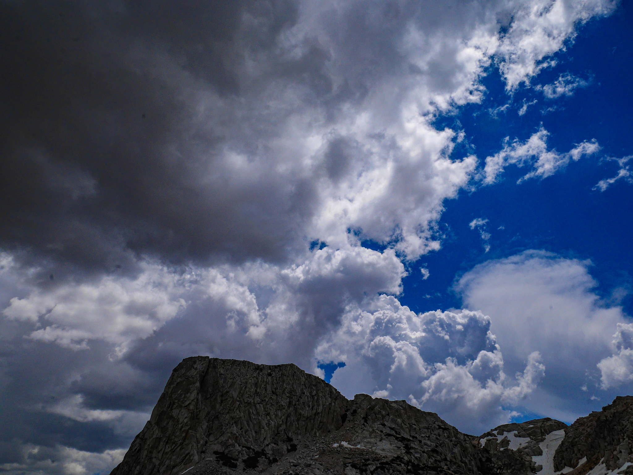
Partway down I could see the cut of the trail I was planning to take. But also the thunderstorm clouds were rolling in.
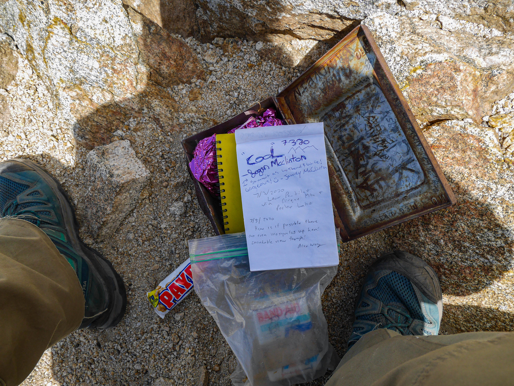
The weather turned for the worse---I saw lightning and heard very close thunder, so I quickly pitched my tent in a sheltered spot near a tarn on the west side of Mule Pass. The storm raged on Slide Mountain and the Suicide Ridge above me, and I was glad to be eating [[peanut butter sugar product probably a Payday]] in the safety of a silnylon sack, at least pitched anonymously among some low pines.
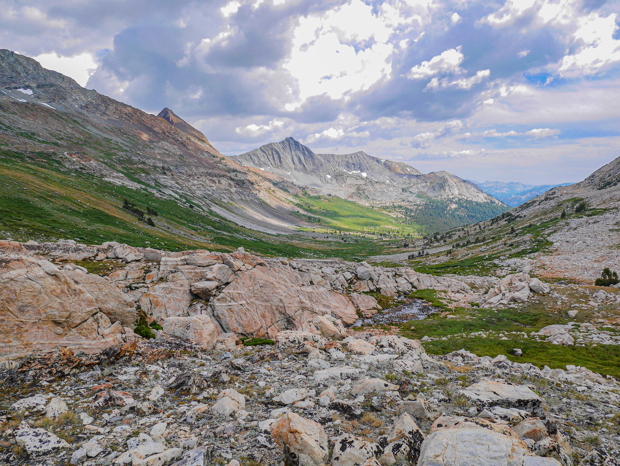
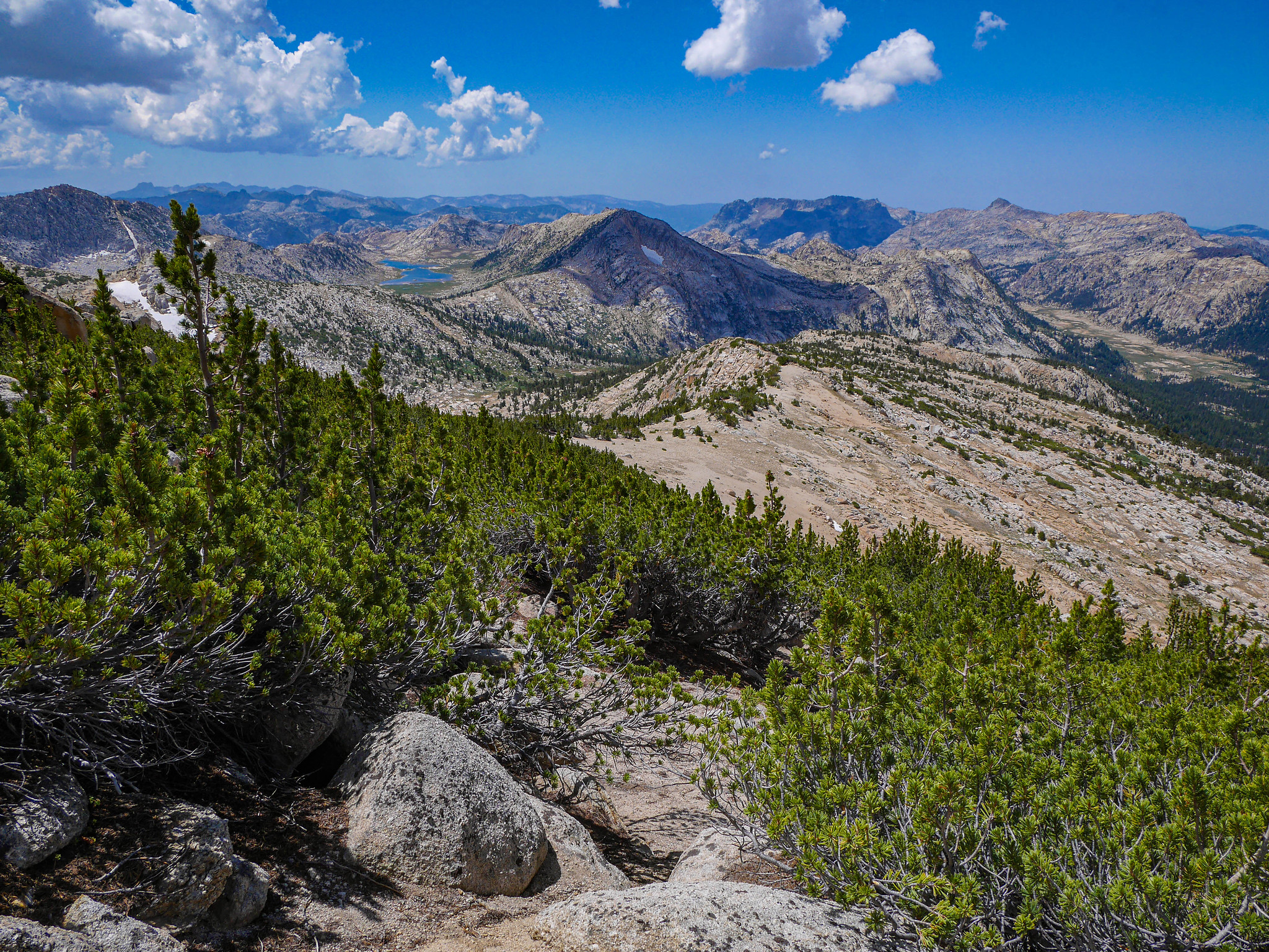
The storm blew over by around 5pm, as usual for the Sierra, and I was feeling restless, so I continued on. My plan for the day had been to make it to Rock Island Lake, but the time waiting out storms made that a no go for sure. I thought at least I could descend to the valley, and then maybe get to Snow Lake. As I climbed the trail along Snow Lake's Outlet, I got incredible views of that unnamed flat top west of Slide Mountain.


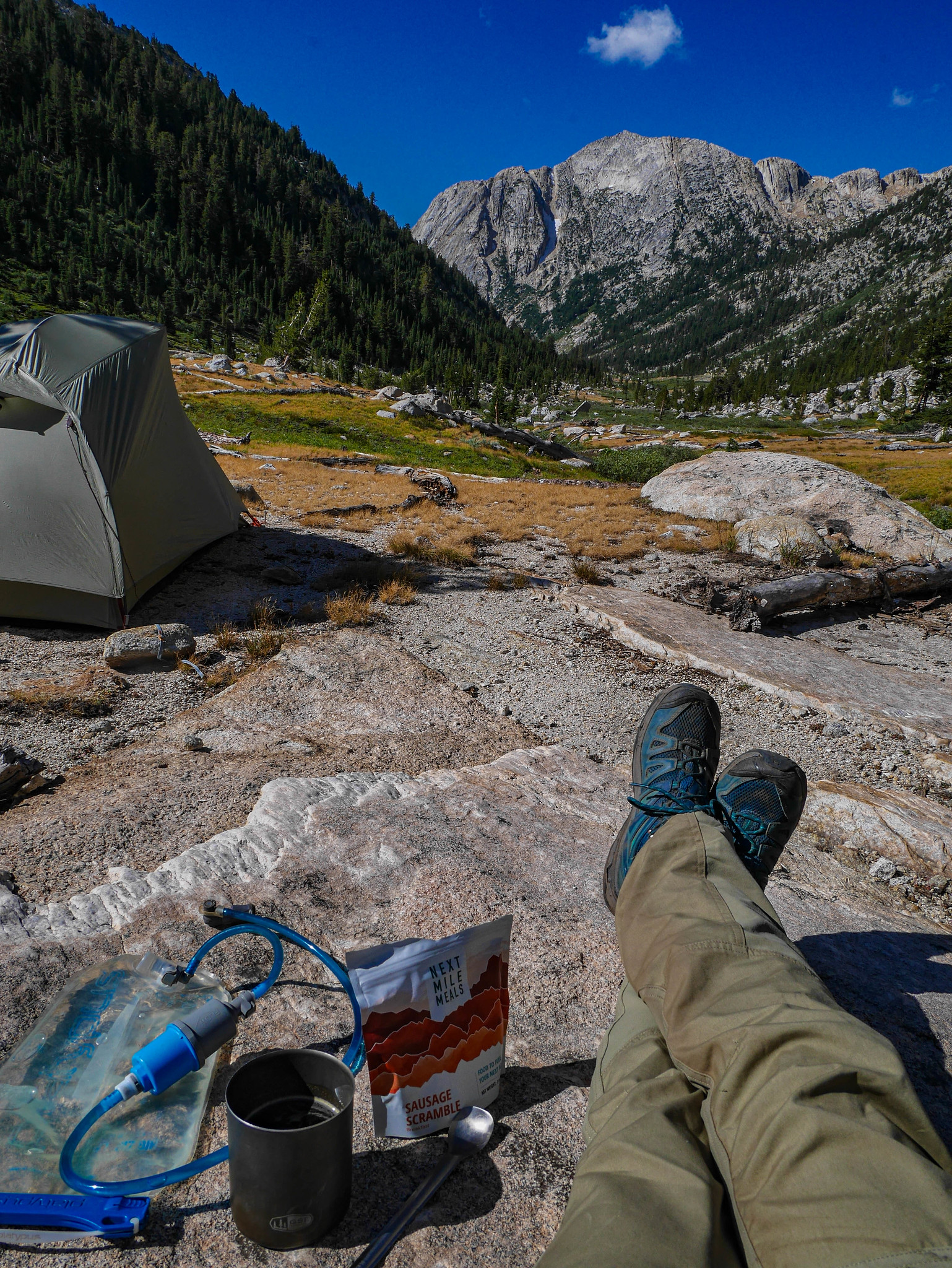
After ascending a manzanita gully full of wildflowers, I reached a flatter bench at the foot of Snow Lake. I had the feeling that there might be a good campsite with views down canyon if I headed southeast a bit, and I was right.


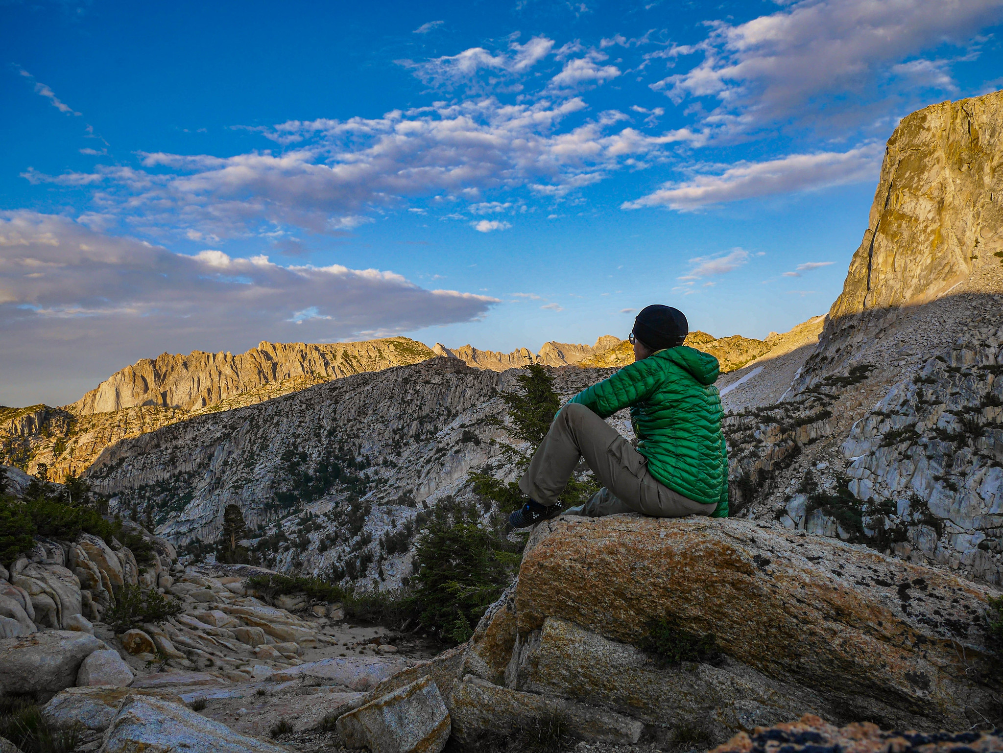
I gathered water from the stream nearby and took gratuitous timer shots of me enjoying the view. I mean, how else would you know I was there?
Glowy rocks mean bed time! Nite nite.

Day 4
Snow Lake basecamp with a summit of Crown Point
2mi +1,300ft/-1,300ft xc peak bag
I awoke in the morning to a splinter I'd somehow managed to get in my sleep. Special skills. That's me.
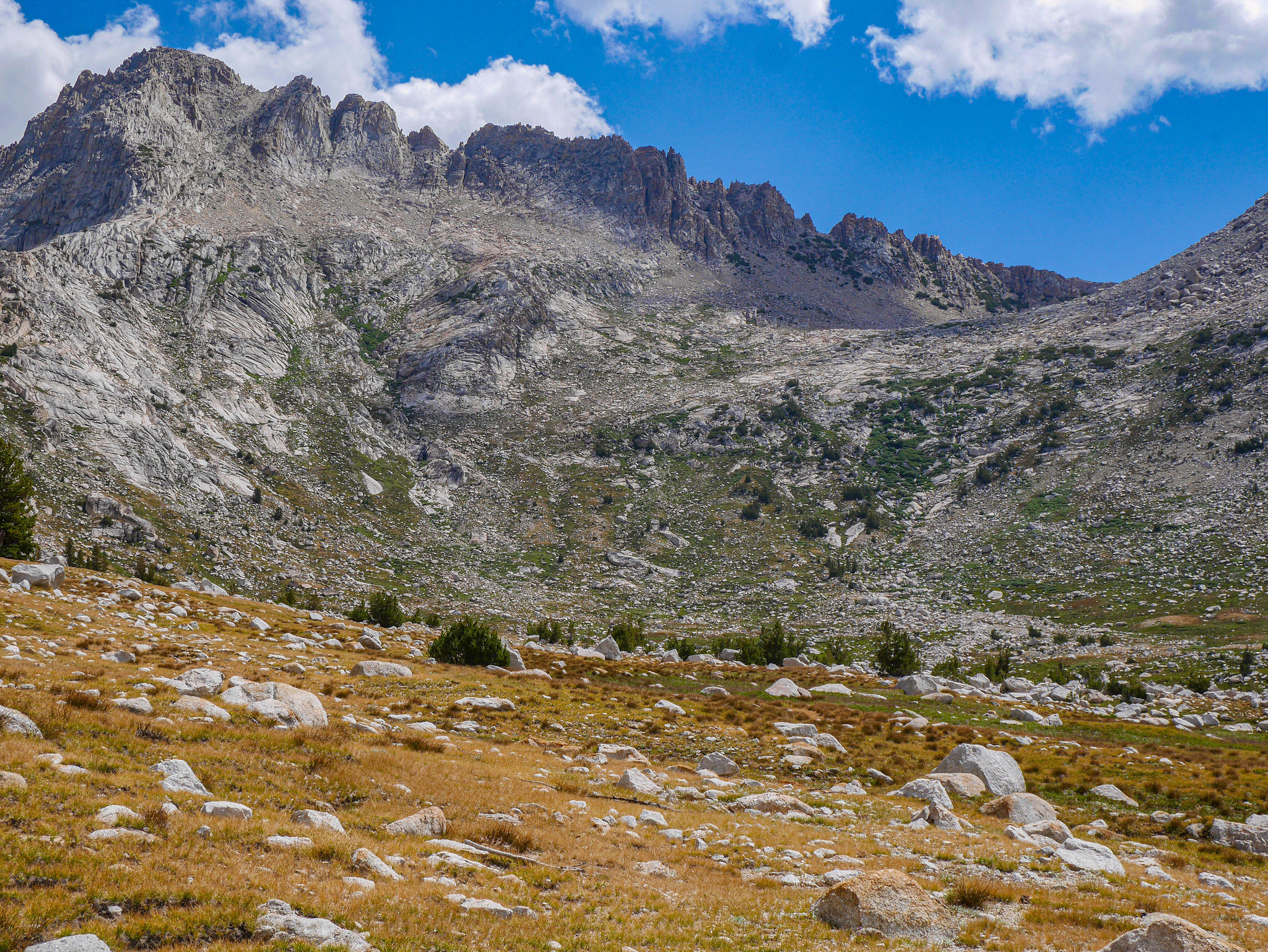
I eat pieces of wood like this for breakfast, so I pulled it out with my teeth and then contemplated what to do with my day. The weather report had said the unsettled pattern was to continue, and based on my experience the day before I knew I wanted to keep it mellow and below treeline for the afternoon. I decided to scramble up to Crown Point. First I had to hike past Snow Lake up to Rock Island Pass, where I'd turn NNW along sandy, gravely benches to gain the ridge.


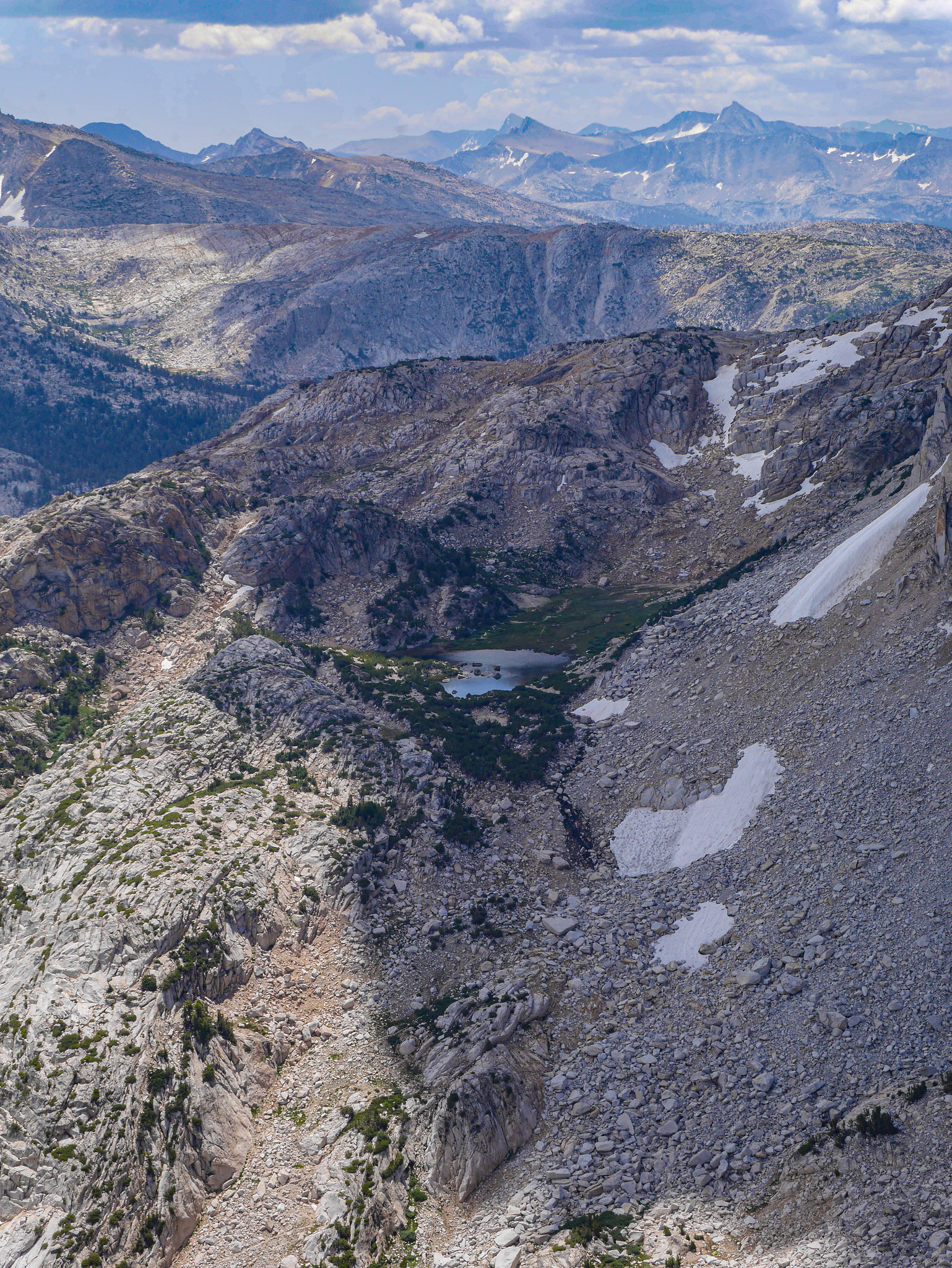
From close to the ridge I could see down and across to Rock Island Lake, where I had hoped to make it the day before (only to be thwarted by thunderstorms).

Atop the ridge, you get views to the northwest.

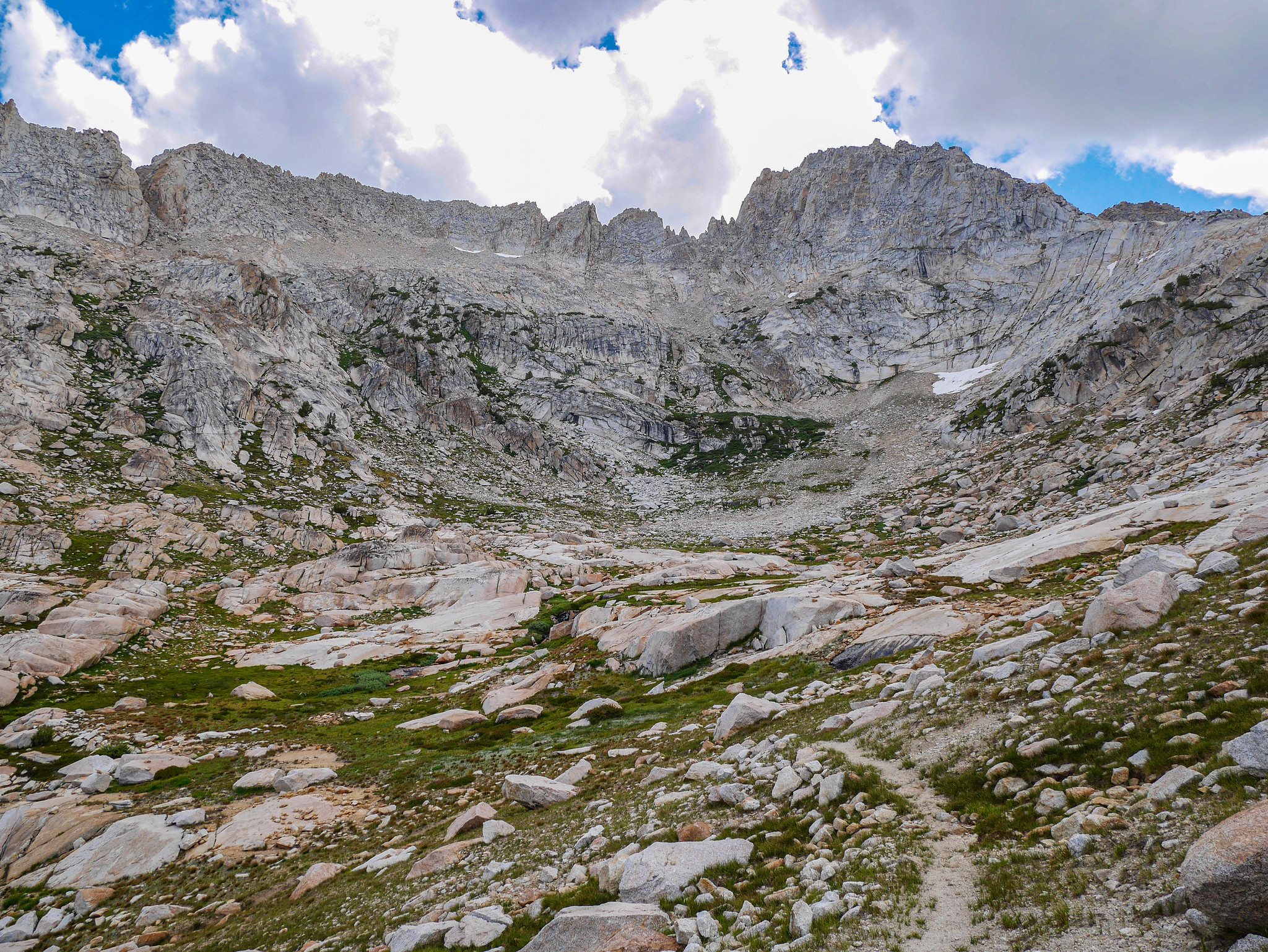
And you just follow this wide sandy bench northeast as far as you can. There's a saddle, keep just north of the ridge to avoid the worst of the rocks.

Then it's weaving in and out of altitude-dwarfed whitebark pines, picking your way. There are two ways through the (baby) crux to the summit. I went up one and down the other. I think the northern side is easier, but harder to find.

After this, I kept to the right following a use trail and wear on trees from people grabbing on. I had to do a few Class 3 moves to navigate around the south side of the summit block. It was fine but like.. just know that. I think the northern route is easier, if you can find it from below.
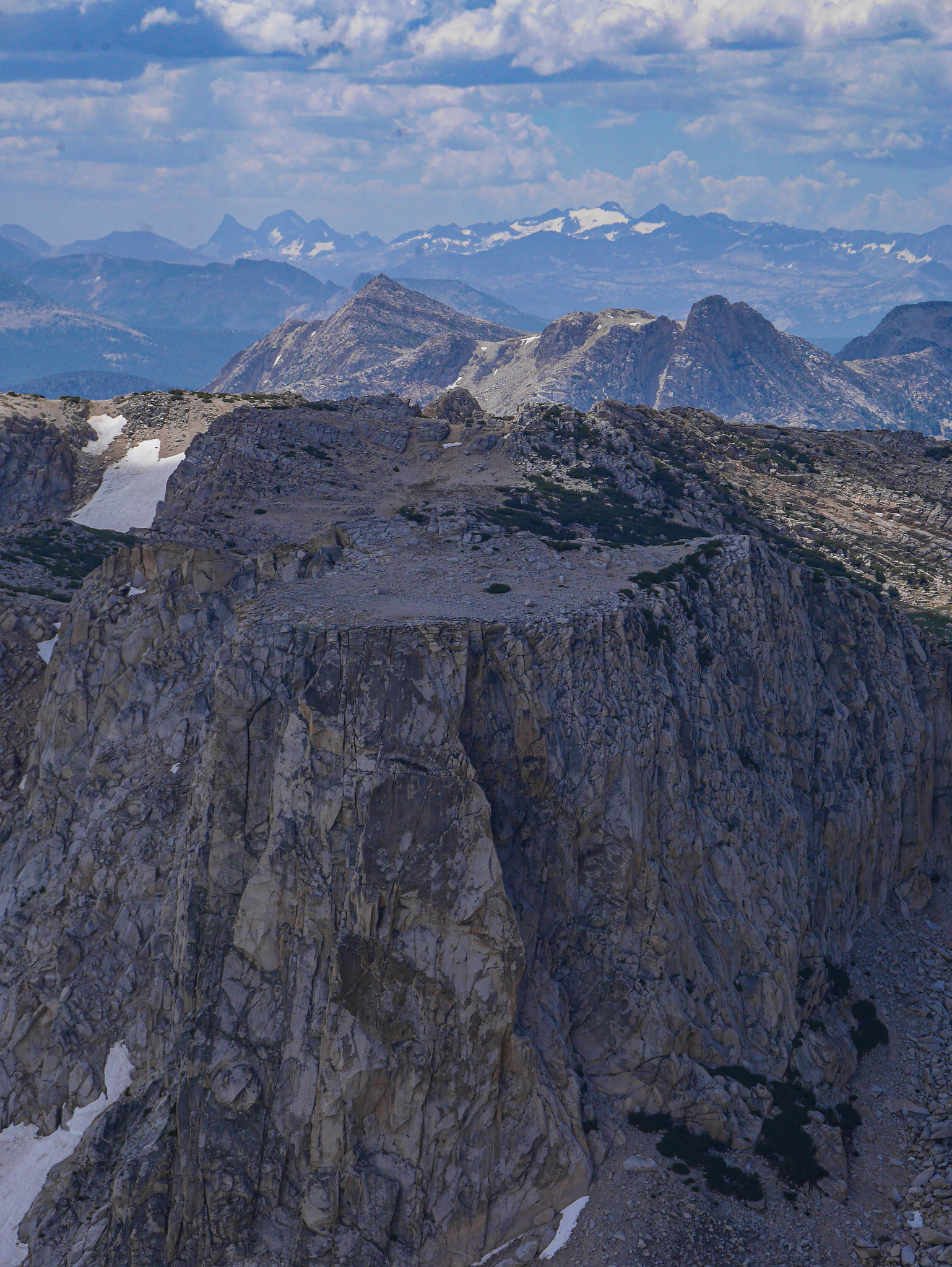
After I descended the more northern side, I could see why it was harder to find. Here's a view where you have to turn left and scramble over this little rocky bit to get to the easier route.

Back down this shrubby pine nonsense. It's easy to get off track here. Be careful to stay close to the ridgeline.
Arriving back down at Snow Lake, huge dark thunderclouds were raining down on Crown Point and points northeast. I was glad I was down and not far from camp!

I napped and snacked and read during the booming storm, only to emerge to see how the storm was progressing, and then finally have dinner and enjoy the spectacular sunset afterwards.

 [/url]

Day 5
Snow Lake to Twin Lakes
9mi, +200ft/-3,200ft
After so much time in the same spot the previous day, I was ready to get the heck out of dodge. I got my stuff packed up and ate breakfast and didn't take any photos until I got down by Crown Lake. Many campers were just waking up and packing up when I passed by. This lake was indeed rather endearing with the Sawtooths peaking out behind, and lots of granite to scramble around on.
Then there were lots of switchbacks as I made my way down towards Robinson Lake.

The outlet stream of Robinson and Lower Robinson had some rather inviting swimming holes, but I did not stop since, as we have already established, I was ready to be out of there.
It was interesting to look back up at Crown Point from this angle below, though. I was up there! Wow. Where's my cookie.

Down down down for what seems like forever in the hot morning sun. It's pretty but also it's forever. For ever ever? For EVER ever.

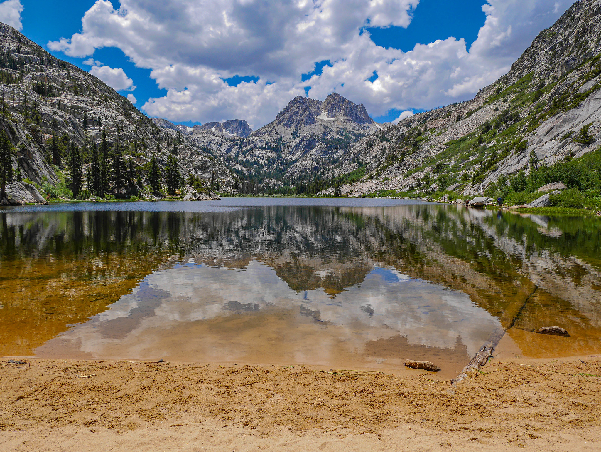
After passing umpteen boyscouts and some rather elaborate camp setups, I arrived at Barney Lake. I had to swim. I mean look at this beach. It felt so good to wash the sweat of a good morning's hoofing it off, and the water was a lovely temperature.
After a good snack and a reapplication of sunscreen it was back into the woods. Then I got a peek down to the trailhead. UGH THAT LAKE IS STILL SO FAR AWAY. IT'S SO HOT. WHY. GET ME TO THE CAR ALREADY.
Oh ok I guess you can show me some more super rad views along the way. This is looking up into Little Slide Canyon.
Here we are. Back in the land of generators and Otter Pops. It's only another half mile of this to get to my car.

Want to do this trip yourself? You'll need a permit for Horse Creek Pass in the Humboldt-Toiyabe National Forest / Hoover Wilderness. Download the Matterhorn Peak and Dunderberg Peak USGS quads. You might find the Nat Geo Yosemite NE map helpful as well.


